How to get to Rütter's D.O.G.S. by bus?
Click on the bus route to see step by step directions with maps, line arrival times and updated time schedules.
How to get to Rütter's D.O.G.S. by train?
Click on the train route to see step by step directions with maps, line arrival times and updated time schedules.
From FH 1863, Neckarstadt-Ost/Wohlgelegen
78 minFrom GRN-Klinik Schwetzingen, Schwetzingen
70 minFrom MVV Energie Ladestation, Käfertal
91 minFrom Krankenhaus GRN, Weinheim
128 minFrom Möbel Höffner, Schwetzingen
65 minFrom Bad Dürkheim Reha, Bad Dürkheim
107 minFrom Hauptfeuerwache, Berufsfeuerwehr Mannheim, Neckarau
60 minFrom Marie-Baum-Schule Heidelberg, Wieblingen
75 min
Light Rail stations near Rütter's D.O.G.S. in Ludwigshafen-Friesenheim
- Oggersheim, Zum Guten Hirten, 20 min walk,VIEW
What are the closest stations to Rütter's D.O.G.S.?
The closest stations to Rütter's D.O.G.S. are:
- Oggersheim, Zum Guten Hirten is 1522 meters away, 20 min walk.
Which bus lines stop near Rütter's D.O.G.S.?
These bus lines stop near Rütter's D.O.G.S.: 70, 71, 89, RNV 83.
Which train line stops near Rütter's D.O.G.S.?
S6 (Mainz Hbf)
What’s the nearest light rail station to Rütter's D.O.G.S. in Ludwigshafen-Friesenheim?
The nearest light rail station to Rütter's D.O.G.S. in Ludwigshafen-Friesenheim is Oggersheim, Zum Guten Hirten. It’s a 20 min walk away.
What time is the first light rail to Rütter's D.O.G.S. in Ludwigshafen-Friesenheim?
The RNV 4 is the first light rail that goes to Rütter's D.O.G.S. in Ludwigshafen-Friesenheim. It stops nearby at 4:41 AM.
What time is the last light rail to Rütter's D.O.G.S. in Ludwigshafen-Friesenheim?
The RNV 4 is the last light rail that goes to Rütter's D.O.G.S. in Ludwigshafen-Friesenheim. It stops nearby at 12:14 AM.
What time is the first bus to Rütter's D.O.G.S. in Ludwigshafen-Friesenheim?
The 90E is the first bus that goes to Rütter's D.O.G.S. in Ludwigshafen-Friesenheim. It stops nearby at 4:09 AM.
What time is the last bus to Rütter's D.O.G.S. in Ludwigshafen-Friesenheim?
The 90 is the last bus that goes to Rütter's D.O.G.S. in Ludwigshafen-Friesenheim. It stops nearby at 12:49 AM.
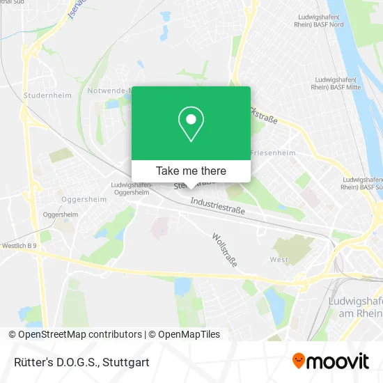
See Rütter's D.O.G.S., Ludwigshafen-Friesenheim, on the map
Public Transit to Rütter's D.O.G.S. in Ludwigshafen-Friesenheim
Wondering how to get to Rütter's D.O.G.S. in Ludwigshafen-Friesenheim? Moovit helps you find the best way to get to Rütter's D.O.G.S. with step-by-step directions from the nearest public transit station.
Moovit provides free maps and live directions to help you navigate through your city. View schedules, routes, timetables, and find out how long does it take to get to Rütter's D.O.G.S. in real time.
Looking for the nearest stop or station to Rütter's D.O.G.S.? Check out this list of stops closest to your destination: Oggersheim.
Bus: 70, 71, 89, RNV 83.Train: S6.
Want to see if there’s another route that gets you there at an earlier time? Moovit helps you find alternative routes or times. Get directions from and directions to Rütter's D.O.G.S. easily from the Moovit App or Website.
We make riding to Rütter's D.O.G.S. easy, which is why over 1.5 million users, including users in Ludwigshafen-Friesenheim, trust Moovit as the best app for public transit. You don’t need to download an individual bus app or train app, Moovit is your all-in-one transit app that helps you find the best bus time or train time available.
For information on prices of bus, train and light rail, costs and ride fares to Rütter's D.O.G.S., please check the Moovit app.
Use the app to navigate to popular places including to the airport, hospital, stadium, grocery store, mall, coffee shop, school, college, and university.
Rütter's D.O.G.S. Address: Bexbacher Straße 19 Friesenheim, 67063 Ludwigshafen am Rhein street in Ludwigshafen-Friesenheim
- Ycoa Yacht-Club Otterstadt im Angelwald,
- Suchhunde Frankenthal,
- Zentrum für Menschen mit Hund Sandra Sauer,
- Pauluskirche,
- Dietrich-Bonhoeffer-Zentrum - Prot. Pauluskirchengemeinde Ludwigshafen-Friesenheim,
- Dietrich-Bonhoeffer-Zentrum,
- Reinigung und Dekoration von Gardinen,
- Dietrich-Bonhoeffer-Zentrum Ludwigshafen / Friesenheim,
- Prot. Kita Dietrich-Bonhoeffer-Zentrum,
- Maximilian-Kolbe-Kapelle,
- Zicon,
- Segelclub Eich,
- Caritas Altenzentrum St.Franziskus,
- Öz-Bereket Megamarkt,
- Pflegedienst am Rhein,
- Pbl Pulverbeschichtung,
- Lackierbetrieb Ruth Stehle E. K.,
- EUROMASTER,
- Rettungswache Juh / Mhd Ludwigshafen,
- Johanniter Unfallhilfe E.V. Regionalverband Vorderpfalz
Places Near Rütter's D.O.G.S. (Ludwigshafen-Friesenheim)
- Porsche Museum, Zuffenhausen,
- Gasometer Pforzheim, Pforzheim,
- Waldfriedhof, Degerloch,
- Wilhelma (U-Bahn Wilhelma), Bad Cannstatt,
- Mercedes-Benz Museum (Mercedes Museum Stuttgart), Bad Cannstatt,
- Mettingen Eros-Center Puff Laufhaus, Esslingen Am Neckar,
- Im Wizemann (Halle), Bad Cannstatt,
- SI-Centrum, Möhringen,
- Marmorsaal Im Weissenburgpark, Stuttgart-Süd,
- Hanns-Martin-Schleyer-Halle, Bad Cannstatt,
- Porsche-Arena, Bad Cannstatt,
- Hauptbahnhof Stuttgart, Stuttgart-Mitte,
- Gleis 101/102 (tief), Stuttgart-Mitte,
- Schleyerhalle, Bad Cannstatt,
- Pariser Platz Stuttgart, Stuttgart-Mitte,
- FlixBus Haltestelle, Stuttgart,
- Hanns-Martin-Schleyer-Halle (Stuttgart Hans-Martin-Schleyerhalle), Bad Cannstatt,
- Geilhaus Haus 33a, Reutlingen-Betzingen,
- Mercedes-Benz Museum, Bad Cannstatt,
- Klinikum Stuttgart - Katharinenhospital, Stuttgart-Mitte
How to get to popular places in Stuttgart with public transit
Get around Ludwigshafen-Friesenheim by public transit!
Traveling around Ludwigshafen-Friesenheim has never been so easy. See step by step directions as you travel to any attraction, street or major public transit station. View bus and train schedules, arrival times, service alerts and detailed routes on a map, so you know exactly how to get to anywhere in Ludwigshafen-Friesenheim.
When traveling to any destination around Ludwigshafen-Friesenheim use Moovit's Live Directions with Get Off Notifications to know exactly where and how far to walk, how long to wait for your line, and how many stops are left. Moovit will alert you when it's time to get off — no need to constantly re-check whether yours is the next stop.
Wondering how to use public transit in Ludwigshafen-Friesenheim or how to pay for public transit in Ludwigshafen-Friesenheim? Moovit public transit app can help you navigate your way with public transit easily, and at minimum cost. It includes public transit fees, ticket prices, and costs. Looking for a map of Ludwigshafen-Friesenheim public transit lines? Moovit public transit app shows all public transit maps in Ludwigshafen-Friesenheim with all Bus, Train, Subway, Light Rail, Ferry, S-Bahn and Funicular routes and stops on an interactive map.
Stuttgart has 7 transit type(s), including: Bus, Train, Subway, Light Rail, Ferry, S-Bahn and Funicular, operated by several transit agencies, including SSB - Stadtbahn, SSB, SSB - Seilbahn / Zacke, S-Bahn Stuttgart, Rhein-Neckar-Verkehr GmbH (rnv), Karlsruher Verkehrsverbund, DB AG, DB Regiobus BW, Arverio Baden-Württemberg GmbH, DB RegioNetz Verkehrs GmbH Westfrankenbahn, DB Regio AG Baden-Württemberg, Südwestdeutsche Verkehrs-AG, DB Regio AG Mitte Region Hessen, DB and Bodensee-Oberschwaben-Bahn