How to get to R3 by bus?
Click on the bus route to see step by step directions with maps, line arrival times and updated time schedules.
How to get to R3 by train?
Click on the train route to see step by step directions with maps, line arrival times and updated time schedules.
Bus stops near R3 in Tomblaine
Light Rail stations near R3 in Tomblaine
- Essey Centre, 8 min walk,VIEW
Train stations near R3 in Tomblaine
- Jarville-La-Malgrange, 18 min walk,VIEW
Bus lines to R3 in Tomblaine
What are the closest stations to R3?
The closest stations to R3 are:
- Les Ensanges is 192 meters away, 3 min walk.
- Essey Centre is 551 meters away, 8 min walk.
- Galilée is 584 meters away, 8 min walk.
- Grande Haie is 1033 meters away, 14 min walk.
- Jarville-La-Malgrange is 1385 meters away, 18 min walk.
Which bus lines stop near R3?
These bus lines stop near R3: 11, 15.
Which train line stops near R3?
C44 (Nancy)
What’s the nearest light rail station to R3 in Tomblaine?
The nearest light rail station to R3 in Tomblaine is Essey Centre. It’s a 8 min walk away.
What’s the nearest train station to R3 in Tomblaine?
The nearest train station to R3 in Tomblaine is Jarville-La-Malgrange. It’s a 18 min walk away.
What’s the nearest bus station to R3 in Tomblaine?
The nearest bus station to R3 in Tomblaine is Les Ensanges. It’s a 3 min walk away.
What time is the first light rail to R3 in Tomblaine?
The T1 is the first light rail that goes to R3 in Tomblaine. It stops nearby at 4:40 AM.
What time is the last light rail to R3 in Tomblaine?
The T1 is the last light rail that goes to R3 in Tomblaine. It stops nearby at 12:54 AM.
What time is the first train to R3 in Tomblaine?
The C41 is the first train that goes to R3 in Tomblaine. It stops nearby at 11:25 AM.
What time is the last train to R3 in Tomblaine?
The C46+ is the last train that goes to R3 in Tomblaine. It stops nearby at 9:36 PM.
What time is the first bus to R3 in Tomblaine?
The 11 is the first bus that goes to R3 in Tomblaine. It stops nearby at 7:07 AM.
What time is the last bus to R3 in Tomblaine?
The 11 is the last bus that goes to R3 in Tomblaine. It stops nearby at 9:18 PM.
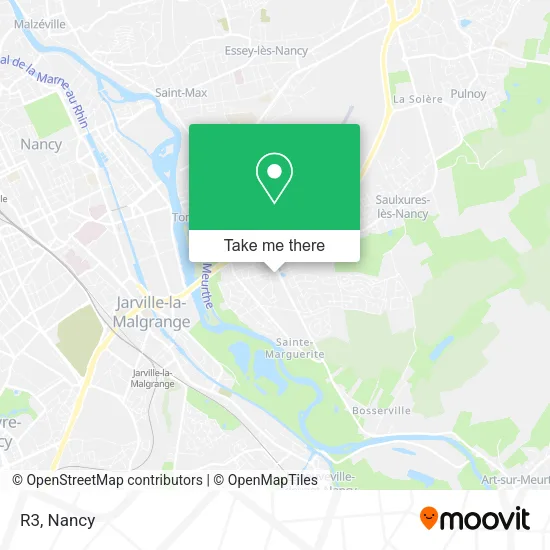
See R3, Tomblaine, on the map
Public Transit to R3 in Tomblaine
Wondering how to get to R3 in Tomblaine? Moovit helps you find the best way to get to R3 with step-by-step directions from the nearest public transit station.
Moovit provides free maps and live directions to help you navigate through your city. View schedules, routes, timetables, and find out how long does it take to get to R3 in real time.
Looking for the nearest stop or station to R3? Check out this list of stops closest to your destination: Les Ensanges; Essey Centre; Galilée; Grande Haie; Jarville-La-Malgrange.
Bus: 11, 15, 22, 60, 61, 20, 59.Train: C44, C41, C46, C46+, C42+.
Want to see if there’s another route that gets you there at an earlier time? Moovit helps you find alternative routes or times. Get directions from and directions to R3 easily from the Moovit App or Website.
We make riding to R3 easy, which is why over 1.5 million users, including users in Tomblaine, trust Moovit as the best app for public transit. You don’t need to download an individual bus app or train app, Moovit is your all-in-one transit app that helps you find the best bus time or train time available.
For information on prices of bus, train and light rail, costs and ride fares to R3, please check the Moovit app.
Use the app to navigate to popular places including to the airport, hospital, stadium, grocery store, mall, coffee shop, school, college, and university.
R3 Address: Rue Gisèle Halimi 54510 Tomblaine street in Tomblaine
- Parc Georges Brassens - La Grand-Mare Des Canards,
- Place Commerciale Michel Colucci,
- 29 Rue Léo Lagrange,
- Les Ensanges,
- Vicaire Jean Marie,
- A.D.N,
- Rond-Point Galilée,
- La Boutique du Coiffeur,
- 24 Rue Auguste Bartholdi,
- Falck Stephane,
- Complexe Sportif Leo Lagrange,
- La Piscine,
- Compagnie Sayn,
- Meyer François,
- Moret Aurélien,
- 113 Boulevard Tolstoï,
- Ajec,
- Calin Mihaita,
- Auchan Drive,
- Rue Salvador Allende
Places Near R3 (Tomblaine)
- Haut Du Lièvre, Nancy,
- E.Leclerc, VandUvre-Lès-Nancy,
- Villers-Lès-Nancy, Villers-Lès-Nancy,
- Zénith De Nancy, Maxéville,
- Clinique Majorelle, Nancy,
- Cora, Houdemont,
- Essey-Lès-Nancy, Essey-Lès-Nancy,
- Dépose-Minute, Nancy,
- Hôpital Central, Nancy,
- Piscine Nancy Thermal, Nancy,
- Polyclinique De Gentilly, Nancy,
- Rue Colette, Nancy,
- Hopital de Brabois CHU, VandUvre-Lès-Nancy,
- Villa Majorelle, Nancy,
- Tomblaine, Tomblaine,
- centre d'imagerie jacques callot, Maxéville,
- Maxéville, Maxéville,
- Clinique Pasteur, Essey-Lès-Nancy,
- Nancy Thermal, Nancy,
- Kinepolis Nancy, Nancy
How to get to popular places in Nancy with public transit
Get around Tomblaine by public transit!
Traveling around Tomblaine has never been so easy. See step by step directions as you travel to any attraction, street or major public transit station. View bus and train schedules, arrival times, service alerts and detailed routes on a map, so you know exactly how to get to anywhere in Tomblaine.
When traveling to any destination around Tomblaine use Moovit's Live Directions with Get Off Notifications to know exactly where and how far to walk, how long to wait for your line, and how many stops are left. Moovit will alert you when it's time to get off — no need to constantly re-check whether yours is the next stop.
Wondering how to use public transit in Tomblaine or how to pay for public transit in Tomblaine? Moovit public transit app can help you navigate your way with public transit easily, and at minimum cost. It includes public transit fees, ticket prices, and costs. Looking for a map of Tomblaine public transit lines? Moovit public transit app shows all public transit maps in Tomblaine with all Bus, Train and Light Rail routes and stops on an interactive map.
Nancy has 3 transit type(s), including: Bus, Train and Light Rail, operated by several transit agencies, including Réseau STAN, SNCF VOYAGEURS and OCEdefault