How to get to R4 by bus?
Click on the bus route to see step by step directions with maps, line arrival times and updated time schedules.
From Surquillo, Surquillo
44 minFrom Larcomar, Miraflores
48 minFrom Estadio Lolo Fernandez, Lima
30 minFrom Universidad Norbert Wiener, Lima
34 minFrom Parque María Reiche Miraflores, Miraflores
35 minFrom Av. Arequipa / Av. Javier Prado, San Isidro
33 minFrom Av Republica de Panama, San Isidro
41 minFrom AV REP PANAMA CON AV ANGAMOS, Surquillo
44 minFrom Av. Benavides, Miraflores
45 minFrom AV JOSE GALVEZ BARRENECHEA SAN ISIDRO, San Borja
58 min
Bus stops near R4 in San Miguel
Bus lines to R4 in San Miguel
- 1138, Carabayllo - Caquetá - Faucett - Carabayllo,VIEW
- 1163, Santa Margarita (Ventanilla) - Jockey Plaza (Surco),VIEW
- 1173, La Marina (San Miguel) - Pacasmayo (San Martin de Porres),VIEW
- 1203, Portón (San Juan De Lurigancho) - Plaza Norte (San Martin De Porres) - Portón (San Juan De Lurigancho),VIEW
- 1275, Upc (Santiago De Surco) - Oquendo (San Martín De Porres),VIEW
- 1276, Puente Benavides (Surco),VIEW
- 1286, San Diego (S.M. Porres) - Mariategui (S.J. Lurigancho),VIEW
- 1291, Ventanilla - Chorrillos,VIEW
- 1293, José Gálvez (Pachacamac) - Mi Perú (Ventanilla),VIEW
- 1300, San Juan De Lurigancho - Ventanilla,VIEW
- 1316, Pachacútec/Mi Perú (Ventanilla) - Mariátegui (San Juan de Lurigancho),VIEW
- 1435, Minka (Callao) - Torre Blanca (Carabayllo),VIEW
- 1442, Pachacútec (Ventanilla) - La Marina (San Miguel),VIEW
- 1482, Chorrillos - S.M.P.,VIEW
- 1491, Puente Benavides (Surco) - Pacasmayo (Callao),VIEW
- CR16, San Miguel - Ventanilla,VIEW
- CR34, San Miguel - Comas,VIEW
- CR35, Ventanilla - San Miguel,VIEW
- CR51, Comas - San Miguel,VIEW
- CR65, Comas - San Miguel,VIEW
What are the closest stations to R4?
The closest stations to R4 are:
- Seguro Mongrut Muñoz & Faucett is 237 meters away, 4 min walk.
- Venezuela / Faucett is 329 meters away, 5 min walk.
- Venezuela is 353 meters away, 5 min walk.
- Faucett is 354 meters away, 5 min walk.
- Incahuasi is 701 meters away, 10 min walk.
Which bus lines stop near R4?
These bus lines stop near R4: 1203, 1275, 1481, 1482, 1491, CR78, IM31.
What’s the nearest bus station to R4 in San Miguel?
The nearest bus station to R4 in San Miguel is Seguro Mongrut Muñoz & Faucett. It’s a 4 min walk away.
What time is the first bus to R4 in San Miguel?
The 1319 is the first bus that goes to R4 in San Miguel. It stops nearby at 3:00 AM.
What time is the last bus to R4 in San Miguel?
The 1319 is the last bus that goes to R4 in San Miguel. It stops nearby at 4:46 AM.
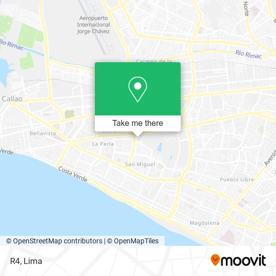
See R4, San Miguel, on the map
Public Transit to R4 in San Miguel
Wondering how to get to R4 in San Miguel? Moovit helps you find the best way to get to R4 with step-by-step directions from the nearest public transit station.
Moovit provides free maps and live directions to help you navigate through your city. View schedules, routes, timetables, and find out how long does it take to get to R4 in real time.
Looking for the nearest stop or station to R4? Check out this list of stops closest to your destination: Seguro Mongrut Muñoz & Faucett; Venezuela / Faucett; Venezuela; Faucett; Incahuasi.
Bus: 1203, 1275, 1481, 1482, 1491, CR78, IM31, CR43, CR62, 1138, 1163, 1173, 1007, 1218, 1223, 1234, 1319, 1219 SX, 1030, CR42, 1228, 1254, 1258, 1317.
Want to see if there’s another route that gets you there at an earlier time? Moovit helps you find alternative routes or times. Get directions from and directions to R4 easily from the Moovit App or Website.
We make riding to R4 easy, which is why over 1.5 million users, including users in San Miguel, trust Moovit as the best app for public transit. You don’t need to download an individual bus app or train app, Moovit is your all-in-one transit app that helps you find the best bus time or train time available.
For information on prices of bus, costs and ride fares to R4, please check the Moovit app.
Use the app to navigate to popular places including to the airport, hospital, stadium, grocery store, mall, coffee shop, school, college, and university.
R4 Address: Calle Ámsterdam 260 Callao, 15088 San Miguel street in San Miguel
- Bartra Wong Claudia Lorena,
- Dlf Fabricaciones Mecanicas E.I.R.L,
- Colegio Inmaculado Corazón de María,
- Kuates "tacos y enchiladas",
- Calle Paris San Miguel,
- mercado Pio XII,
- Western Union Metro Faucettt,
- AV Elmer faucett 558 San Miguel,
- Flight AF 483 LIM-CDG (Air France / Lima-Paris),
- Colegio American School,
- BBVA,
- Cs Beaver S.A.C,
- San Fernando,
- BANCO GNB,
- Av E Faucett 421 San Miguel Lima Perú,
- Torre Eiffel,
- ELMER FAUCETT CUADRA 6 ELMER FAUCETT CUADRA 6,
- Paradero Paris,
- Sonnenschein Nido Jardín Guardería,
- Multimarket San Fernando
Places Near R4 (San Miguel)
- Pontificia Universidad Católica del Perú - PUCP, San Miguel,
- Barranco, Barranco,
- Miraflores, Miraflores,
- Jockey Plaza, Santiago D,
- Av. Abancay, Lima,
- Centro Comercial Plaza Norte, Independen,
- Plaza San Miguel, San Miguel,
- Real Plaza Puruchuco, Ate,
- Paradero Av.Brasil,
- Aeropuerto Internacional Jorge Chávez, Ventanilla,
- Gamarra,
- Av. Salaverry, Jesus Mari,
- Parque de las Leyendas, San Miguel,
- Av. La Marina, San Miguel,
- Hospital Edgardo Rebagliati Martins, Jesus Mari,
- Mall Del Sur,
- Larcomar, Miraflores,
- av arequipa, Lima,
- Circuito Mágico Del Agua, Lima,
- Parque Kennedy, Miraflores
How to get to popular places in Lima with public transit
Get around San Miguel by public transit!
Traveling around San Miguel has never been so easy. See step by step directions as you travel to any attraction, street or major public transit station. View bus and train schedules, arrival times, service alerts and detailed routes on a map, so you know exactly how to get to anywhere in San Miguel.
When traveling to any destination around San Miguel use Moovit's Live Directions with Get Off Notifications to know exactly where and how far to walk, how long to wait for your line, and how many stops are left. Moovit will alert you when it's time to get off — no need to constantly re-check whether yours is the next stop.
Wondering how to use public transit in San Miguel or how to pay for public transit in San Miguel? Moovit public transit app can help you navigate your way with public transit easily, and at minimum cost. It includes public transit fees, ticket prices, and costs. Looking for a map of San Miguel public transit lines? Moovit public transit app shows all public transit maps in San Miguel with all Bus, Metro and Ferry routes and stops on an interactive map.
Lima has 3 transit type(s), including: Bus, Metro and Ferry, operated by several transit agencies, including Metro de Lima Línea 2 , Metro de Lima, Corredor Rojo, Metropolitano, Metropolitano - Alimentadores, Corredor Morado, Corredor Azul, Rutas Tradicionales, Transportes y Servicios La Esperanza S.A., Las Flores S.A., Virgen de la Asunción S.A., Consorcio HAM, Transportes y Service Canadá S.A., ETUL4SA and ETUCHISA