How to get to R4 Bus by bus?
Click on the bus route to see step by step directions with maps, line arrival times and updated time schedules.
From Embassy of France, Washington
81 minFrom The Fairmont Washington, D.C., Washington
74 minFrom Target, Washington
46 minFrom Fema Headquarters, Washington
72 minFrom Massachusetts Ave NW, Washington
88 minFrom Clyde's of Chevy Chase, Montgomery County
73 minFrom French Embassy, Washington
83 minFrom Joint Base Anacostia-Bolling, Washington
81 minFrom Washington Welcome Center, Washington
50 minFrom St. Albans School, Washington
64 min
How to get to R4 Bus by train?
Click on the train route to see step by step directions with maps, line arrival times and updated time schedules.
How to get to R4 Bus by metro?
Click on the metro route to see step by step directions with maps, line arrival times and updated time schedules.
From The Fairmont Washington, D.C., Washington
61 minFrom Target, Washington
28 minFrom Fema Headquarters, Washington
44 minFrom Massachusetts Ave NW, Washington
70 minFrom Clyde's of Chevy Chase, Montgomery County
56 minFrom Joint Base Anacostia-Bolling, Washington
57 minFrom Washington Welcome Center, Washington
43 minFrom St. Albans School, Washington
69 min
Bus stops near R4 Bus in Prince George's County
Train station near R4 Bus in Prince George's County
- Riverdale Marc Sb, 11 min walk,VIEW
Metro stations near R4 Bus in Prince George's County
Bus lines to R4 Bus in Prince George's County
What are the closest stations to R4 Bus?
The closest stations to R4 Bus are:
- Queens Chapel Rd+27 Av is 97 yards away, 2 min walk.
- Queens Chapel Rd+Chillum Rd is 701 yards away, 9 min walk.
- Riverdale Marc Sb is 911 yards away, 11 min walk.
- Eastern Av Ne+20 St NE is 1032 yards away, 13 min walk.
- West Hyattsville is 2110 yards away, 25 min walk.
- Fort Totten is 4384 yards away, 52 min walk.
Which bus lines stop near R4 Bus?
These bus lines stop near R4 Bus: D34, P33.
Which train line stops near R4 Bus?
MARC (Outbound - Washington)
Which metro lines stop near R4 Bus?
These metro lines stop near R4 Bus: GREEN, YELLOW.
What’s the nearest metro station to R4 Bus in Prince George's County?
The nearest metro station to R4 Bus in Prince George's County is West Hyattsville. It’s a 25 min walk away.
What’s the nearest train station to R4 Bus in Prince George's County?
The nearest train station to R4 Bus in Prince George's County is Riverdale Marc Sb. It’s a 11 min walk away.
What’s the nearest bus station to R4 Bus in Prince George's County?
The nearest bus station to R4 Bus in Prince George's County is Queens Chapel Rd+27 Av. It’s a 2 min walk away.
What time is the first metro to R4 Bus in Prince George's County?
The GREEN is the first metro that goes to R4 Bus in Prince George's County. It stops nearby at 5:08 AM.
What time is the last metro to R4 Bus in Prince George's County?
The GREEN is the last metro that goes to R4 Bus in Prince George's County. It stops nearby at 12:33 AM.
What time is the first train to R4 Bus in Prince George's County?
The MARC is the first train that goes to R4 Bus in Prince George's County. It stops nearby at 5:45 AM.
What time is the last train to R4 Bus in Prince George's County?
The MARC is the last train that goes to R4 Bus in Prince George's County. It stops nearby at 7:02 PM.
What time is the first bus to R4 Bus in Prince George's County?
The D34 is the first bus that goes to R4 Bus in Prince George's County. It stops nearby at 5:06 AM.
What time is the last bus to R4 Bus in Prince George's County?
The D34 is the last bus that goes to R4 Bus in Prince George's County. It stops nearby at 12:40 AM.
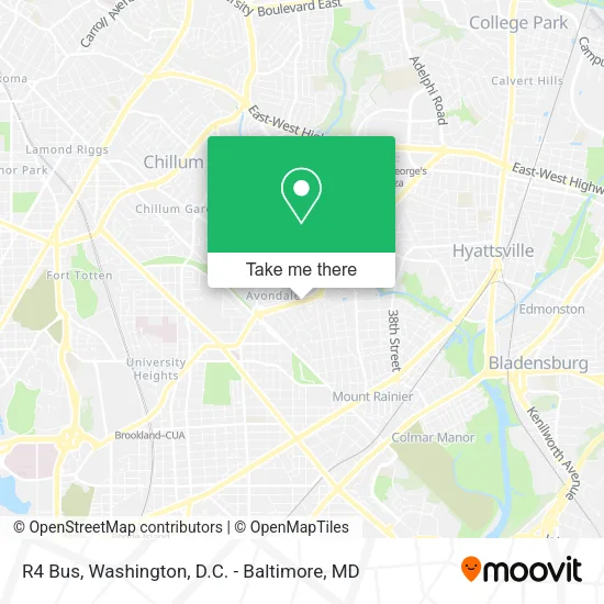
See R4 Bus, Prince George's County, on the map
Public Transit to R4 Bus in Prince George's County
Wondering how to get to R4 Bus in Prince George's County? Moovit helps you find the best way to get to R4 Bus with step-by-step directions from the nearest public transit station.
Moovit provides free maps and live directions to help you navigate through your city. View schedules, routes, timetables, and find out how long does it take to get to R4 Bus in real time.
Looking for the nearest stop or station to R4 Bus? Check out this list of stops closest to your destination: Queens Chapel Rd+27 Av; Queens Chapel Rd+Chillum Rd; Riverdale Marc Sb; Eastern Av Ne+20 St NE; West Hyattsville; Fort Totten.
Bus: D34, P33, P32, P42.Train: MARC.Metro: GREEN, YELLOW, RED.
Want to see if there’s another route that gets you there at an earlier time? Moovit helps you find alternative routes or times. Get directions from and directions to R4 Bus easily from the Moovit App or Website.
We make riding to R4 Bus easy, which is why over 1.5 million users, including users in Prince George's County, trust Moovit as the best app for public transit. You don’t need to download an individual bus app or train app, Moovit is your all-in-one transit app that helps you find the best bus time or train time available.
For information on prices of bus, metro and train, costs and ride fares to R4 Bus, please check the Moovit app.
Use the app to navigate to popular places including to the airport, hospital, stadium, grocery store, mall, coffee shop, school, college, and university.
R4 Bus Address: 2400 Queens Chapel Rd street in Prince George's County
- Avondale Overlook,
- Uhaul Metro DC,
- K&K Fast Foods,
- Colorado Electric,
- Megamart Chillum,
- Cricket Wireless Authorized Retailer,
- 31st St Arundel Rd,
- Queenstown, Maryland,
- BGC Contracting,
- Kaywood Gardens,
- Kaywood Gardens, Maryland,
- Eastern Ave NE & Varnum St NE,
- St Ann's Center for Children, Youth & Families,
- Fort Circle Park,
- Subway,
- Kaywood Gardens Apartments,
- Alpha & Omega Cleaning Services,
- Union Wesley A.M.E. Zion Church,
- Rhema Christian Center Church (Official Rhema Chrstn Ctr Ch),
- Mbiwot Foundation
Places Near R4 Bus (Prince George's County)
- Amazon Hq2, Arlington County,
- Pennsylvania Ave NW (3rd st and pennsylvania), Washington,
- PG Mall, Prince George's County,
- Sibley Memorial Hospital, Washington,
- Washington National Cathedral, Washington,
- Museum Of The Bible, Washington,
- National Museum of African American History and Culture, Washington,
- The Anthem, Washington,
- Washington DC VA Medical Center, Washington,
- Westfield Montgomery Mall, Montgomery County,
- Rock Creek Tennis Center, Washington,
- Basilica of the National Shrine, Washington,
- M&T Bank Stadium, Baltimore,
- Capital One Arena, Washington,
- Georgetown, Washington,
- National Zoo, Washington,
- Camden Yards, Baltimore,
- Warner Theatre, Washington,
- Marriott Marquis Washington, DC, Washington,
- National Mall, Washington
How to get to popular places in Washington, D.C. - Baltimore, MD with public transit
Get around Prince George's County by public transit!
Traveling around Prince George's County has never been so easy. See step by step directions as you travel to any attraction, street or major public transit station. View bus and train schedules, arrival times, service alerts and detailed routes on a map, so you know exactly how to get to anywhere in Prince George's County.
When traveling to any destination around Prince George's County use Moovit's Live Directions with Get Off Notifications to know exactly where and how far to walk, how long to wait for your line, and how many stops are left. Moovit will alert you when it's time to get off — no need to constantly re-check whether yours is the next stop.
Wondering how to use public transit in Prince George's County or how to pay for public transit in Prince George's County? Moovit public transit app can help you navigate your way with public transit easily, and at minimum cost. It includes public transit fees, ticket prices, and costs. Looking for a map of Prince George's County public transit lines? Moovit public transit app shows all public transit maps in Prince George's County with all Bus, Train, Metro, Light Rail and Ferry routes and stops on an interactive map.
Washington, D.C. - Baltimore, MD has 5 transit type(s), including: Bus, Train, Metro, Light Rail and Ferry, operated by several transit agencies, including WMATA, Montgomery County Ride On, Fairfax Connector, TheBus, PRTC, DASH - Alexandria, Arlington Transit (ART), RTA of Central Maryland, MDOT MTA, MDOT MTA Light RailLink, MDOT MTA Commuter Bus, MDOT MTA Local Bus, FXBGO!, Virginia Railway Express (VRE) and MARC