How to get to RATB Apusului by bus?
Click on the bus route to see step by step directions with maps, line arrival times and updated time schedules.
From Piața Iancului, Bucuresti
67 minFrom Bulevardul Alexandru Obregia, Bucuresti
73 minFrom Bulevardul Ion Mihalache, Bucuresti
58 minFrom Strada Mihai Eminescu, Bucuresti
60 minFrom Mega Mall, Bucuresti
85 minFrom Soseaua Oltenitei, Bucuresti
67 minFrom Vatra Luminoasă, Bucuresti
56 minFrom DRPCIV, Bucuresti
79 minFrom Bd. Expozitiei, Bucuresti
72 minFrom Biserica Sf. Elefterie, Bucuresti
37 min
How to get to RATB Apusului by metro?
Click on the metro route to see step by step directions with maps, line arrival times and updated time schedules.
From Piața Iancului, Bucuresti
52 minFrom Bulevardul Alexandru Obregia, Bucuresti
45 minFrom Bulevardul Ion Mihalache, Bucuresti
42 minFrom Strada Mihai Eminescu, Bucuresti
57 minFrom Mega Mall, Bucuresti
64 minFrom Soseaua Oltenitei, Bucuresti
44 minFrom Vatra Luminoasă, Bucuresti
53 minFrom DRPCIV, Bucuresti
53 minFrom Bd. Expozitiei, Bucuresti
72 minFrom Biserica Sf. Elefterie, Bucuresti
22 min
Trolleybus stations near RATB Apusului in Bucuresti
Metro station near RATB Apusului in Bucuresti
- Păcii, 7 min walk,VIEW
Bus stops near RATB Apusului in Bucuresti
Bus lines to RATB Apusului in Bucuresti
What are the closest stations to RATB Apusului?
The closest stations to RATB Apusului are:
- Bd. Iuliu Maniu is 219 meters away, 3 min walk.
- Apusului is 348 meters away, 5 min walk.
- Păcii is 512 meters away, 7 min walk.
- Pacii is 555 meters away, 8 min walk.
- Valea Cascadelor is 558 meters away, 8 min walk.
- Complex Apusului is 666 meters away, 9 min walk.
Which bus lines stop near RATB Apusului?
These bus lines stop near RATB Apusului: 137, 138, 178.
Which metro line stops near RATB Apusului?
M3 (Anghel Saligny)
Which Trolleybus lines stop near RATB Apusului?
These Trolleybus lines stop near RATB Apusului: 61, 62.
What’s the nearest metro station to RATB Apusului in Bucuresti?
The nearest metro station to RATB Apusului in Bucuresti is Păcii. It’s a 7 min walk away.
What’s the nearest bus station to RATB Apusului in Bucuresti?
The nearest bus stations to RATB Apusului in Bucuresti are Pacii and Valea Cascadelor. The closest one is a 8 min walk away.
What’s the nearest Trolleybus station to RATB Apusului in Bucuresti?
The nearest Trolleybus station to RATB Apusului in Bucuresti is Bd. Iuliu Maniu. It’s a 3 min walk away.
What time is the first metro to RATB Apusului in Bucuresti?
The M3 is the first metro that goes to RATB Apusului in Bucuresti. It stops nearby at 5:09 AM.
What time is the last metro to RATB Apusului in Bucuresti?
The M3 is the last metro that goes to RATB Apusului in Bucuresti. It stops nearby at 11:52 PM.
What time is the first bus to RATB Apusului in Bucuresti?
The N115 is the first bus that goes to RATB Apusului in Bucuresti. It stops nearby at 3:04 AM.
What time is the last bus to RATB Apusului in Bucuresti?
The N115 is the last bus that goes to RATB Apusului in Bucuresti. It stops nearby at 2:52 AM.
What time is the first Trolleybus to RATB Apusului in Bucuresti?
The 61 is the first Trolleybus that goes to RATB Apusului in Bucuresti. It stops nearby at 4:31 AM.
What time is the last Trolleybus to RATB Apusului in Bucuresti?
The 63 is the last Trolleybus that goes to RATB Apusului in Bucuresti. It stops nearby at 11:47 PM.
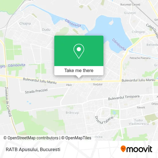
See RATB Apusului, Bucuresti, on the map
Public Transit to RATB Apusului in Bucuresti
Wondering how to get to RATB Apusului in Bucuresti? Moovit helps you find the best way to get to RATB Apusului with step-by-step directions from the nearest public transit station.
Moovit provides free maps and live directions to help you navigate through your city. View schedules, routes, timetables, and find out how long does it take to get to RATB Apusului in real time.
Looking for the nearest stop or station to RATB Apusului? Check out this list of stops closest to your destination: Bd. Iuliu Maniu; Apusului; Păcii; Pacii; Valea Cascadelor; Complex Apusului.
Bus: 137, 138, 178, 431, 432, 433, 478, 429.Metro: M3.Trolleybus: 61, 62, 106, 63, N115, 137, 138.
Want to see if there’s another route that gets you there at an earlier time? Moovit helps you find alternative routes or times. Get directions from and directions to RATB Apusului easily from the Moovit App or Website.
We make riding to RATB Apusului easy, which is why over 1.5 million users, including users in Bucuresti, trust Moovit as the best app for public transit. You don’t need to download an individual bus app or train app, Moovit is your all-in-one transit app that helps you find the best bus time or train time available.
For information on prices of bus, metro and Trolleybus, costs and ride fares to RATB Apusului, please check the Moovit app.
Use the app to navigate to popular places including to the airport, hospital, stadium, grocery store, mall, coffee shop, school, college, and university.
RATB Apusului Address: Bd. Iuliu Maniu (Str. Apusului) street in Bucuresti
- Parcare,
- Bl. 310,
- Strada Serban Bogdan Stan,
- Apop Smile Srl,
- Salon Amira,
- PIESE AUTO - Sc. Rotea Service Impex Srl,
- Mega Image Shop & Go Iuliu Maniu,
- Cmi Stomat Gen Enesc,
- Unicredit Bank - Militari,
- Florida Shaorma,
- Beu Stefania Casandra,
- ProCredit Bank,
- La Moisei,
- Strada Mărgelelor,
- Lux Adimar Boutique Sr,
- Strada Apusului & Strada Apusului,
- Cofetaria Elan,
- money gram,
- Bulevardul Iuliu Maniu 192,
- Biserica Sf. Treime
Places Near RATB Apusului (Bucuresti)
- Spitalul Fundeni, Bucuresti,
- ParkLake Shopping Center, Bucuresti,
- Cimitir Ghencea 3, Bucuresti,
- Aeroport Otopeni, Otopeni,
- Piața Presei Libere, Bucuresti,
- Spitalul Elias, Bucuresti,
- Catedrala Mântuirii Neamului Românesc, Bucuresti,
- Schitul Darvari, Bucuresti,
- Aeroport Băneasa, Bucuresti,
- AFI Cotroceni, Bucuresti,
- IKEA Pallady, Bucuresti,
- Promenada Mall, Bucuresti,
- Spitalul Universitar De Urgență Militar Central „Dr. Carol Davila”, Bucuresti,
- Nicolae Caramfil, Bucuresti,
- Arena Națională (National Arena), Bucuresti,
- Dragonul Roșu 1, Bucuresti,
- Mega Mall, Bucuresti,
- ROMEXPO, Bucuresti,
- Catedrala Mântuirii Neamului, Bucuresti,
- Gara de Nord, Bucuresti
How to get to popular places in Bucuresti with public transit
Get around Bucuresti by public transit!
Traveling around Bucuresti has never been so easy. See step by step directions as you travel to any attraction, street or major public transit station. View bus and train schedules, arrival times, service alerts and detailed routes on a map, so you know exactly how to get to anywhere in Bucuresti.
When traveling to any destination around Bucuresti use Moovit's Live Directions with Get Off Notifications to know exactly where and how far to walk, how long to wait for your line, and how many stops are left. Moovit will alert you when it's time to get off — no need to constantly re-check whether yours is the next stop.
Wondering how to use public transit in Bucuresti or how to pay for public transit in Bucuresti? Moovit public transit app can help you navigate your way with public transit easily, and at minimum cost. It includes public transit fees, ticket prices, and costs. Looking for a map of Bucuresti public transit lines? Moovit public transit app shows all public transit maps in Bucuresti with all Bus, Train, Metro, Tram and Trolleybus routes and stops on an interactive map.
Bucuresti has 5 transit type(s), including: Bus, Train, Metro, Tram and Trolleybus, operated by several transit agencies, including Metrorex, STB, TPBI | Linii Regionale, STB | Linii de Noapte, Serviciul de Transport Public Slobozia, Serviciul Transport Otopeni, Transport Județean Ialomița, Alitrans Călărași, InterRegional Călători, Linii Transport Național, Regio Călători, Transferoviar Calatori, CFR Călători, Softrans and Astra Trans Carpatic
