How to get to RATP PLR NANTERRE by bus?
Click on the bus route to see step by step directions with maps, line arrival times and updated time schedules.
From Fnac Paris Ternes, Paris
69 minFrom Aparthotel Adagio Paris XV, Paris
97 minFrom Rue Cler, Paris
79 minFrom Ambassade de Russie, Paris
72 minFrom Gennevilliers, Gennevilliers
78 minFrom Boulevard Victor Hugo, Clichy
90 minFrom Port de Grenelle, Paris
87 minFrom Rue De Courcelles, Paris
78 minFrom Rue Amélie, Paris
81 minFrom Galeries Lafayette Champs-Élysées, Paris
66 min
Bus stops near RATP PLR NANTERRE in Nanterre
RER station near RATP PLR NANTERRE in Nanterre
- Rueil-Malmaison, 4 min walk,VIEW
Bus lines to RATP PLR NANTERRE in Nanterre
What are the closest stations to RATP PLR NANTERRE?
The closest stations to RATP PLR NANTERRE are:
- D'Estienne D'Orves is 148 meters away, 2 min walk.
- Rueil-Malmaison is 298 meters away, 4 min walk.
- Parc de L'Île is 502 meters away, 7 min walk.
- Route de Chatou is 636 meters away, 9 min walk.
- Estienne D'Orves is 1117 meters away, 15 min walk.
Which RER line stops near RATP PLR NANTERRE?
A (Cergy le Haut / Poissy / Saint Germain en Laye)
Which bus lines stop near RATP PLR NANTERRE?
These bus lines stop near RATP PLR NANTERRE: 158, 159, 244.
What’s the nearest bus station to RATP PLR NANTERRE in Nanterre?
The nearest bus station to RATP PLR NANTERRE in Nanterre is D'Estienne D'Orves. It’s a 2 min walk away.
What’s the nearest RER station to RATP PLR NANTERRE in Nanterre?
The nearest RER station to RATP PLR NANTERRE in Nanterre is Rueil-Malmaison. It’s a 4 min walk away.
What time is the first bus to RATP PLR NANTERRE in Nanterre?
The 367 is the first bus that goes to RATP PLR NANTERRE in Nanterre. It stops nearby at 5:25 AM.
What time is the last bus to RATP PLR NANTERRE in Nanterre?
The 159 is the last bus that goes to RATP PLR NANTERRE in Nanterre. It stops nearby at 1:13 AM.
What time is the first RER to RATP PLR NANTERRE in Nanterre?
The A is the first RER that goes to RATP PLR NANTERRE in Nanterre. It stops nearby at 4:58 AM.
What time is the last RER to RATP PLR NANTERRE in Nanterre?
The A is the last RER that goes to RATP PLR NANTERRE in Nanterre. It stops nearby at 1:21 AM.
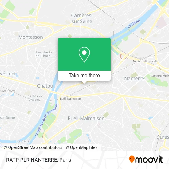
See RATP PLR NANTERRE, Nanterre, on the map
Public Transit to RATP PLR NANTERRE in Nanterre
Wondering how to get to RATP PLR NANTERRE in Nanterre? Moovit helps you find the best way to get to RATP PLR NANTERRE with step-by-step directions from the nearest public transit station.
Moovit provides free maps and live directions to help you navigate through your city. View schedules, routes, timetables, and find out how long does it take to get to RATP PLR NANTERRE in real time.
Looking for the nearest stop or station to RATP PLR NANTERRE? Check out this list of stops closest to your destination: D'Estienne D'Orves; Rueil-Malmaison; Parc de L'Île; Route de Chatou; Estienne D'Orves.
RER: A.Bus: 158, 159, 244, 367, 1, B.
Want to see if there’s another route that gets you there at an earlier time? Moovit helps you find alternative routes or times. Get directions from and directions to RATP PLR NANTERRE easily from the Moovit App or Website.
We make riding to RATP PLR NANTERRE easy, which is why over 1.5 million users, including users in Nanterre, trust Moovit as the best app for public transit. You don’t need to download an individual bus app or train app, Moovit is your all-in-one transit app that helps you find the best bus time or train time available.
For information on prices of RER, bus, metro and light rail, costs and ride fares to RATP PLR NANTERRE, please check the Moovit app.
Use the app to navigate to popular places including to the airport, hospital, stadium, grocery store, mall, coffee shop, school, college, and university.
RATP PLR NANTERRE Address: 166 D990 street in Nanterre
- ibis budget Rueil Malmaison Rueil Malmaison,
- 147 Boulevard National,
- Ibis budget Malmaison,
- Restaurant d'entreprise TOTAL Spazio,
- 562 Avenue du Parc de l'Île,
- Total - Le Spazio,
- Arval,
- Arval Rueil 3,
- Parc de l'Ile,
- Suez Consulting,
- Suez,
- Unilever,
- Salle des Marchés - Asset Management - Bnp Paribas,
- La Plateforme du Bâtiment,
- La Fabrique @ BNP Paribas Cardif,
- BNP Paribas Cardif,
- Caron Service,
- 8 Rue du Port,
- BNP Paribas Leasing Solutions - Pixel,
- ZEborne
Places Near RATP PLR NANTERRE (Nanterre)
- Hôpital Pitié Salpêtrière, Paris,
- Institut Curie, Paris,
- Hopital Lariboisière, Paris,
- Hôpital Cochin, Paris,
- Galeries Lafayette Haussmann, Paris,
- Hôpital Henri Mondor, Creteil,
- Gare Routière Flixbus, Paris,
- Galeries Lafayette, Paris,
- Hôpital Saint-Joseph, Paris,
- Centre Hospitalier des 15/20, Paris,
- Théâtre Mogador, Paris,
- Créteil Soleil, Creteil,
- Hôpital Beaujon, Clichy,
- Marché Saint-Pierre, Paris,
- Hopital Foch, Suresnes,
- Hôpital de la Pitié-Salpêtrière, Paris,
- Hôpital Necker, Paris,
- 29 Rue Manin, Paris,
- Atelier Des Lumieres, Paris,
- Fondation Louis Vuitton, Paris
How to get to popular places in Paris with public transit
Get around Nanterre by public transit!
Traveling around Nanterre has never been so easy. See step by step directions as you travel to any attraction, street or major public transit station. View bus and train schedules, arrival times, service alerts and detailed routes on a map, so you know exactly how to get to anywhere in Nanterre.
When traveling to any destination around Nanterre use Moovit's Live Directions with Get Off Notifications to know exactly where and how far to walk, how long to wait for your line, and how many stops are left. Moovit will alert you when it's time to get off — no need to constantly re-check whether yours is the next stop.
Wondering how to use public transit in Nanterre or how to pay for public transit in Nanterre? Moovit public transit app can help you navigate your way with public transit easily, and at minimum cost. It includes public transit fees, ticket prices, and costs. Looking for a map of Nanterre public transit lines? Moovit public transit app shows all public transit maps in Nanterre with all Bus, Train, Metro, Light Rail, RER, Funicular and Gondola routes and stops on an interactive map.
Paris has 7 transit type(s), including: Bus, Train, Metro, Light Rail, RER, Funicular and Gondola, operated by several transit agencies, including RATP, RER, RER Bus de remplacement, Train, Train Bus de remplacement, Tramway Bus de remplacement, TER, ADP, Magical Shuttle, Argenteuil - Boucles de Seine, Autocars Dominique, Bièvre, Brie et 2 Morin, Le Bus - C.C. du Clermontois and Cœur d’Essonne