How to get to RCM&D by bus?
Click on the bus route to see step by step directions with maps, line arrival times and updated time schedules.
From 2 Amys, Washington
40 minFrom Homewood Suites by Hilton Arlington Rosslyn Key Bridge, Arlington County
77 minFrom Tabard Inn, Washington
66 minFrom Songbyrd Music House & Record Cafe, Washington
63 minFrom Mt. Pleasant, Washington
53 minFrom The Catholic University Of America, Washington
87 minFrom Calvert St NW, Washington
42 minFrom Le Diplomate, Washington
66 minFrom Georgetown University Hospital, Washington
45 minFrom Deloitte, Arlington County
67 min
How to get to RCM&D by metro?
Click on the metro route to see step by step directions with maps, line arrival times and updated time schedules.
From 2 Amys, Washington
42 minFrom Homewood Suites by Hilton Arlington Rosslyn Key Bridge, Arlington County
50 minFrom Tabard Inn, Washington
32 minFrom Songbyrd Music House & Record Cafe, Washington
35 minFrom Mt. Pleasant, Washington
51 minFrom The Catholic University Of America, Washington
49 minFrom Le Diplomate, Washington
40 minFrom Deloitte, Arlington County
42 min
Bus stops near RCM&D in Montgomery County
Metro station near RCM&D in Montgomery County
- Tenleytown Metro Station, 35 min walk,VIEW
Bus lines to RCM&D in Montgomery County
- 29, 29-Bethesda-GlenEcho-FriendshpHghts,VIEW
- 30, 30-Bethesda-Medical Center,VIEW
- 32, 32-Bethesda-Naval Ship R&D Center,VIEW
- 34, 34-Bethesda-Wheaton,VIEW
- 47, 47-Rockville-Mont. Mall-Bethesda,VIEW
- 70, Bethesda Via Medical Center,VIEW
- M70, West To Montgomery Mall,VIEW
- 36, Bethesda Loop,VIEW
- M22, North To Olney,VIEW
What are the closest stations to RCM&D?
The closest stations to RCM&D are:
- Woodmont Ave & Old Georgetown Rd is 129 yards away, 3 min walk.
- Old Georgetown Rd & Woodmont Ave is 160 yards away, 3 min walk.
- Old Georgetown Rd & Commerce La is 232 yards away, 4 min walk.
- Bethesda Station & Bay H is 389 yards away, 5 min walk.
- Bethesda+Bay B is 453 yards away, 6 min walk.
- Tenleytown Metro Station is 2921 yards away, 35 min walk.
Which bus lines stop near RCM&D?
These bus lines stop near RCM&D: D96, M70.
Which metro line stops near RCM&D?
RED (Shady Grove)
What’s the nearest bus station to RCM&D in Montgomery County?
The nearest bus stations to RCM&D in Montgomery County are Woodmont Ave & Old Georgetown Rd and Old Georgetown Rd & Woodmont Ave. The closest one is a 3 min walk away.
What time is the first metro to RCM&D in Montgomery County?
The RED is the first metro that goes to RCM&D in Montgomery County. It stops nearby at 5:21 AM.
What time is the last metro to RCM&D in Montgomery County?
The RED is the last metro that goes to RCM&D in Montgomery County. It stops nearby at 12:19 AM.
What time is the first bus to RCM&D in Montgomery County?
The M70 is the first bus that goes to RCM&D in Montgomery County. It stops nearby at 4:55 AM.
What time is the last bus to RCM&D in Montgomery County?
The M70 is the last bus that goes to RCM&D in Montgomery County. It stops nearby at 1:59 AM.
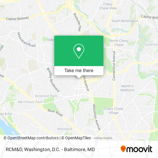
See RCM&D, Montgomery County, on the map
Public Transit to RCM&D in Montgomery County
Wondering how to get to RCM&D in Montgomery County? Moovit helps you find the best way to get to RCM&D with step-by-step directions from the nearest public transit station.
Moovit provides free maps and live directions to help you navigate through your city. View schedules, routes, timetables, and find out how long does it take to get to RCM&D in real time.
Looking for the nearest stop or station to RCM&D? Check out this list of stops closest to your destination: Woodmont Ave & Old Georgetown Rd; Old Georgetown Rd & Woodmont Ave; Old Georgetown Rd & Commerce La; Bethesda Station & Bay H; Bethesda+Bay B; Tenleytown Metro Station.
Bus: D96, M70, 29, 30, 32, 34, 47, 70, 36, M22.Metro: RED.
Want to see if there’s another route that gets you there at an earlier time? Moovit helps you find alternative routes or times. Get directions from and directions to RCM&D easily from the Moovit App or Website.
We make riding to RCM&D easy, which is why over 1.5 million users, including users in Montgomery County, trust Moovit as the best app for public transit. You don’t need to download an individual bus app or train app, Moovit is your all-in-one transit app that helps you find the best bus time or train time available.
For information on prices of metro and bus, costs and ride fares to RCM&D, please check the Moovit app.
Use the app to navigate to popular places including to the airport, hospital, stadium, grocery store, mall, coffee shop, school, college, and university.
RCM&D Address: 7507 Arlington Rd Bethesda, MD 20814 street in Montgomery County
- Alvin L Aubinoe,
- MJD Patient Communications,
- Golestaneh-Vafa,
- Art Works,
- Cheryl Leahy Home S,
- Zoominfo,
- Compass,
- Dart Homes,
- Isen Ken,
- Buchanan James DDS,
- Thomas Moriarty,
- Emergency Locksmith Service AAA,
- Masoud Hosseini-Mortgage Loan Officer,
- E&C Enterprises,
- Bethesda, Maryland,
- True Core - Rehab Strength Training and Muscle Activation,
- Grof USA MD,
- Ramos Group,
- Morrison Paul M DDS,
- Bethesda Elementary School
Places Near RCM&D (Montgomery County)
- Camden Yards, Baltimore,
- Marriott Marquis Washington, DC, Washington,
- M&T Bank Stadium, Baltimore,
- Sibley Memorial Hospital, Washington,
- Capital One Arena, Washington,
- Washington National Cathedral, Washington,
- PG Mall, Prince George's County,
- Amazon Hq2, Arlington County,
- Basilica of the National Shrine, Washington,
- The Anthem, Washington,
- Westfield Montgomery Mall, Montgomery County,
- National Museum of African American History and Culture, Washington,
- National Zoo, Washington,
- Museum Of The Bible, Washington,
- Pennsylvania Ave NW (3rd st and pennsylvania), Washington,
- Washington DC VA Medical Center, Washington,
- Georgetown, Washington,
- National Theatre, Washington,
- Warner Theatre, Washington,
- Rock Creek Tennis Center, Washington
How to get to popular places in Washington, D.C. - Baltimore, MD with public transit
Get around Montgomery County by public transit!
Traveling around Montgomery County has never been so easy. See step by step directions as you travel to any attraction, street or major public transit station. View bus and train schedules, arrival times, service alerts and detailed routes on a map, so you know exactly how to get to anywhere in Montgomery County.
When traveling to any destination around Montgomery County use Moovit's Live Directions with Get Off Notifications to know exactly where and how far to walk, how long to wait for your line, and how many stops are left. Moovit will alert you when it's time to get off — no need to constantly re-check whether yours is the next stop.
Wondering how to use public transit in Montgomery County or how to pay for public transit in Montgomery County? Moovit public transit app can help you navigate your way with public transit easily, and at minimum cost. It includes public transit fees, ticket prices, and costs. Looking for a map of Montgomery County public transit lines? Moovit public transit app shows all public transit maps in Montgomery County with all Bus, Train, Metro, Light Rail and Ferry routes and stops on an interactive map.
Washington, D.C. - Baltimore, MD has 5 transit type(s), including: Bus, Train, Metro, Light Rail and Ferry, operated by several transit agencies, including WMATA, Montgomery County Ride On, Fairfax Connector, TheBus, PRTC, DASH - Alexandria, Arlington Transit (ART), RTA of Central Maryland, MDOT MTA, MDOT MTA Light RailLink, MDOT MTA Commuter Bus, MDOT MTA Local Bus, FXBGO!, Virginia Railway Express (VRE) and MARC