How to get to RENAULT THILLOIS by bus?
Click on the bus route to see step by step directions with maps, line arrival times and updated time schedules.
From Vitibot, Reims
78 minFrom Z.I. de Saint-Léonard, Reims
80 minFrom Chemin De Léonard, Reims
81 minFrom Le Saint Nicaise, Reims
38 minFrom Maison Commune Du Chemin Vert, Reims
37 minFrom Reims, Reims
81 minFrom Jacquart, Reims
36 minFrom Adecco Bezannes Tertiaire, Bezannes
42 minFrom Saint-Léonard, Reims
81 minFrom Job Michaël, Reims
35 min
Light Rail stations near RENAULT THILLOIS in Thillois
- Courlancy, 29 min walk,VIEW
Bus lines to RENAULT THILLOIS in Thillois
What are the closest stations to RENAULT THILLOIS?
The closest stations to RENAULT THILLOIS are:
- P+R Thillois is 104 meters away, 2 min walk.
- Millesime is 238 meters away, 4 min walk.
- Courlancy is 2195 meters away, 29 min walk.
Which bus lines stop near RENAULT THILLOIS?
These bus lines stop near RENAULT THILLOIS: U1, U8.
What’s the nearest light rail station to RENAULT THILLOIS in Thillois?
The nearest light rail station to RENAULT THILLOIS in Thillois is Courlancy. It’s a 29 min walk away.
What’s the nearest bus station to RENAULT THILLOIS in Thillois?
The nearest bus station to RENAULT THILLOIS in Thillois is P+R Thillois. It’s a 2 min walk away.
What time is the first light rail to RENAULT THILLOIS in Thillois?
The TRAM is the first light rail that goes to RENAULT THILLOIS in Thillois. It stops nearby at 5:14 AM.
What time is the last light rail to RENAULT THILLOIS in Thillois?
The TRAM is the last light rail that goes to RENAULT THILLOIS in Thillois. It stops nearby at 12:57 AM.
What time is the first bus to RENAULT THILLOIS in Thillois?
The U1 is the first bus that goes to RENAULT THILLOIS in Thillois. It stops nearby at 5:22 AM.
What time is the last bus to RENAULT THILLOIS in Thillois?
The U1 is the last bus that goes to RENAULT THILLOIS in Thillois. It stops nearby at 12:26 AM.
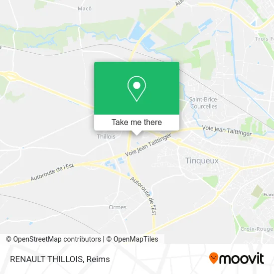
See RENAULT THILLOIS, Thillois, on the map
Public Transit to RENAULT THILLOIS in Thillois
Wondering how to get to RENAULT THILLOIS in Thillois? Moovit helps you find the best way to get to RENAULT THILLOIS with step-by-step directions from the nearest public transit station.
Moovit provides free maps and live directions to help you navigate through your city. View schedules, routes, timetables, and find out how long does it take to get to RENAULT THILLOIS in real time.
Looking for the nearest stop or station to RENAULT THILLOIS? Check out this list of stops closest to your destination: P+R Thillois; Millesime; Courlancy.
Bus: U1, U8, E6, E7.
Want to see if there’s another route that gets you there at an earlier time? Moovit helps you find alternative routes or times. Get directions from and directions to RENAULT THILLOIS easily from the Moovit App or Website.
We make riding to RENAULT THILLOIS easy, which is why over 1.5 million users, including users in Thillois, trust Moovit as the best app for public transit. You don’t need to download an individual bus app or train app, Moovit is your all-in-one transit app that helps you find the best bus time or train time available.
For information on prices of bus and light rail, costs and ride fares to RENAULT THILLOIS, please check the Moovit app.
Use the app to navigate to popular places including to the airport, hospital, stadium, grocery store, mall, coffee shop, school, college, and university.
RENAULT THILLOIS Address: Parc Millésime 51370 Thillois street in Thillois
- Autobernard Deals Thillois,
- ETOILE AUTOBERNARD THILLOIS,
- Hippopotamus,
- Collard et Fils Jardin 2000 Reims,
- Plaza Bowling Reims Thillois,
- Z.A.C. de Thillois,
- Shengda,
- ZEborne,
- Citroen Thillois-Autobernard,
- Etap Hôtel Reims Thillois,
- Gaumont Millésime,
- Burger King,
- Restobooling,
- Sherlock Pub,
- Bowling,
- Bodegon,
- Cinéma Gaumont - Parking 2,
- Grill Comptoir,
- Hôtel ibis Budget,
- Carrefour
Places Near RENAULT THILLOIS (Thillois)
- Hôpital Debré, Reims,
- Ikea, Thillois,
- Polyclinique Reims Bezannes, Bezannes,
- Parc de Champagne, Reims,
- Moulin De La Housse, Reims,
- St Remi, Reims,
- Leclerc, Saint-Brice-Courcelles,
- Carrefour, Tinqueux,
- La Neuvillette, Reims,
- Bétheny, Bétheny,
- Croix Blandin, Reims,
- Tinqueux, Tinqueux,
- Cormontreuil, Reims,
- Parc Des Expositions, Reims,
- Hôpital Maison Blanche, Reims,
- CHU, Reims,
- Bezannes, Bezannes,
- Campus Croix Rouge, Reims,
- Gare Tgv, Bezannes,
- E. Leclerc Champfleury, Champfleury
How to get to popular places in Reims with public transit
Get around Thillois by public transit!
Traveling around Thillois has never been so easy. See step by step directions as you travel to any attraction, street or major public transit station. View bus and train schedules, arrival times, service alerts and detailed routes on a map, so you know exactly how to get to anywhere in Thillois.
When traveling to any destination around Thillois use Moovit's Live Directions with Get Off Notifications to know exactly where and how far to walk, how long to wait for your line, and how many stops are left. Moovit will alert you when it's time to get off — no need to constantly re-check whether yours is the next stop.
Wondering how to use public transit in Thillois or how to pay for public transit in Thillois? Moovit public transit app can help you navigate your way with public transit easily, and at minimum cost. It includes public transit fees, ticket prices, and costs. Looking for a map of Thillois public transit lines? Moovit public transit app shows all public transit maps in Thillois with all Bus and Light Rail routes and stops on an interactive map.
Reims has 2 transit type(s), including: Bus and Light Rail, operated by several transit agencies, including Transdev Reims