Directions to REPSOL (Carabayllo) with public transportation
The following transit lines have routes that pass near REPSOL
 Bus: 1023.
How to get to REPSOL by bus?
Click on the bus route to see step by step directions with maps, line arrival times and updated time schedules.
From Salaverry, Comas
56 minFrom Las Lomas de Carabayllo, Carabayllo
71 minFrom Ovalo de Puente Piedra, Puente Pie
92 minFrom km 22 1/2 Tupac Amaru, Carabayllo
21 minFrom Las Divas Club Nocturno, Puente Pie
79 minFrom Puente Piedra, Puente Pie
93 minFrom Carabayllo, Carabayllo
51 minFrom Municipalidad de Carabayllo, Carabayllo
40 minFrom El Tumi, Carabayllo
50 minFrom URB SANTO DOMINGO CARABAYLLO, Carabayllo
46 min
Bus stop near REPSOL in Carabayllo
- El Bunker, 3 min walk,VIEW
Bus lines to REPSOL in Carabayllo
- 1023, Centro Poblado Rio Seco (Carabayllo) - Colonial (Callao) ,VIEW
What are the closest stations to REPSOL?
The closest stations to REPSOL are:
- El Bunker is 196 meters away, 3 min walk.
Which bus line stops near REPSOL?
1023 (Colonial (Callao) - Centro Poblado de Rio Seco (Carabayllo))
What’s the nearest bus station to REPSOL in Carabayllo?
The nearest bus station to REPSOL in Carabayllo is El Bunker. It’s a 3 min walk away.
What time is the first bus to REPSOL in Carabayllo?
The 1023 is the first bus that goes to REPSOL in Carabayllo. It stops nearby at 6:11 AM.
What time is the last bus to REPSOL in Carabayllo?
The 1023 is the last bus that goes to REPSOL in Carabayllo. It stops nearby at 8:33 PM.
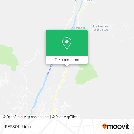
See REPSOL, Carabayllo, on the map
Public Transit to REPSOL in Carabayllo
Wondering how to get to REPSOL in Carabayllo? Moovit helps you find the best way to get to REPSOL with step-by-step directions from the nearest public transit station.
Moovit provides free maps and live directions to help you navigate through your city. View schedules, routes, timetables, and find out how long does it take to get to REPSOL in real time.
Looking for the nearest stop or station to REPSOL? Check out this list of stops closest to your destination: El Bunker.
Bus: 1023.
Want to see if there’s another route that gets you there at an earlier time? Moovit helps you find alternative routes or times. Get directions from and directions to REPSOL easily from the Moovit App or Website.
We make riding to REPSOL easy, which is why over 1.5 million users, including users in Carabayllo, trust Moovit as the best app for public transit. You don’t need to download an individual bus app or train app, Moovit is your all-in-one transit app that helps you find the best bus time or train time available.
For information on prices of bus, costs and ride fares to REPSOL, please check the Moovit app.
Use the app to navigate to popular places including to the airport, hospital, stadium, grocery store, mall, coffee shop, school, college, and university.
REPSOL Address: 20A 15320 Carabayllo street in Carabayllo
- Kilometro 28 de la Avenida Tupac Amaru,
- Camino a Canta,
- Av Tupac Amaru Km 26,
- Consorcio Agua Azul,
- Chicharroneria La Gatita,
- Puente OSOYNIK,
- Puesto De Salud Punchauca,
- Museo Regional Colli,
- Institución Educativa Inicial 8163 Santiago Apostol De Punchauca,
- Casa Hacienda Punchauca,
- Carretera a Canta Km 25.5,
- Carretera a Canta,
- Museo Regional De Arqueología,
- Hacienda Punchauca,
- Iglesia Nuestra Señora de Guadalupe,
- Punchauca,
- Establo,
- Establo Punchauca,
- Transporte Lucas C.C,
- Casa Huerta Virgen del Carmen Ampl.
Places Near REPSOL (Carabayllo)
- Real Plaza Puruchuco, Ate,
- Aeropuerto Internacional Jorge Chávez, Ventanilla,
- Av. La Marina, San Miguel,
- Centro Comercial Plaza Norte, Independen,
- Pontificia Universidad Católica del Perú - PUCP, San Miguel,
- Parque de las Leyendas, San Miguel,
- Gamarra,
- Mall Del Sur,
- Paradero Av.Brasil,
- Parque Kennedy, Miraflores,
- Larcomar, Miraflores,
- Barranco, Barranco,
- Plaza San Miguel, San Miguel,
- av arequipa, Lima,
- Hospital Edgardo Rebagliati Martins, Jesus Mari,
- Circuito Mágico Del Agua, Lima,
- Av. Salaverry, Jesus Mari,
- Miraflores, Miraflores,
- Jockey Plaza, Santiago D,
- Av. Abancay, Lima
How to get to popular places in Lima with public transit
Get around Carabayllo by public transit!
Traveling around Carabayllo has never been so easy. See step by step directions as you travel to any attraction, street or major public transit station. View bus and train schedules, arrival times, service alerts and detailed routes on a map, so you know exactly how to get to anywhere in Carabayllo.
When traveling to any destination around Carabayllo use Moovit's Live Directions with Get Off Notifications to know exactly where and how far to walk, how long to wait for your line, and how many stops are left. Moovit will alert you when it's time to get off — no need to constantly re-check whether yours is the next stop.
Wondering how to use public transit in Carabayllo or how to pay for public transit in Carabayllo? Moovit public transit app can help you navigate your way with public transit easily, and at minimum cost. It includes public transit fees, ticket prices, and costs. Looking for a map of Carabayllo public transit lines? Moovit public transit app shows all public transit maps in Carabayllo with all Bus, Metro and Ferry routes and stops on an interactive map.
Lima has 3 transit type(s), including: Bus, Metro and Ferry, operated by several transit agencies, including Metro de Lima Línea 2 , Metro de Lima, Corredor Rojo, Metropolitano, Metropolitano - Alimentadores, Corredor Morado, Corredor Azul, Rutas Tradicionales, Transportes y Servicios La Esperanza S.A., Las Flores S.A., Virgen de la Asunción S.A., Consorcio HAM, Transportes y Service Canadá S.A., ETUL4SA and ETUCHISA