How to get to RFK Stadium Open Air Farmers' Market by bus?
Click on the bus route to see step by step directions with maps, line arrival times and updated time schedules.
From Hyatt Regency Crystal City at Reagan National Airport, Arlington County
94 minFrom Embassy Of Pakistan, Washington
75 minFrom Joint Base Myer – Henderson Hall (JBMHH) | Fort Myer area, Arlington County
74 minFrom Headquarters - U.S. Coast Guard, Washington
72 minFrom Arlington, VA, Arlington County
73 minFrom National Museum of Women in the Arts, Washington
31 minFrom College Park Marriott Hotel & Conference Center, Prince George's County
89 minFrom Treasury Building, Washington
37 minFrom Fairmont Hotel-Washington, Washington
49 minFrom Days Inn Connecticut Ave, Washington
67 min
How to get to RFK Stadium Open Air Farmers' Market by train?
Click on the train route to see step by step directions with maps, line arrival times and updated time schedules.
How to get to RFK Stadium Open Air Farmers' Market by metro?
Click on the metro route to see step by step directions with maps, line arrival times and updated time schedules.
From Hyatt Regency Crystal City at Reagan National Airport, Arlington County
57 minFrom Embassy Of Pakistan, Washington
60 minFrom Arlington, VA, Arlington County
48 minFrom National Museum of Women in the Arts, Washington
38 minFrom Treasury Building, Washington
43 minFrom Fairmont Hotel-Washington, Washington
47 minFrom Days Inn Connecticut Ave, Washington
52 min
Bus stops near RFK Stadium Open Air Farmers' Market in Washington
Metro station near RFK Stadium Open Air Farmers' Market in Washington
- Potomac Ave, 30 min walk,VIEW
Bus lines to RFK Stadium Open Air Farmers' Market in Washington
What are the closest stations to RFK Stadium Open Air Farmers' Market?
The closest stations to RFK Stadium Open Air Farmers' Market are:
- Benning Rd Ne+26 St NE is 314 yards away, 5 min walk.
- Clay St Ne+33 St NE is 472 yards away, 6 min walk.
- Benning Rd Ne+19 St NE is 906 yards away, 11 min walk.
- 22 St Ne+E Capitol St NE is 1203 yards away, 15 min walk.
- Maryland Av Ne+21 St NE is 1385 yards away, 17 min walk.
- Potomac Ave is 2554 yards away, 30 min walk.
Which bus line stops near RFK Stadium Open Air Farmers' Market?
D20 (East To Minnesota Av)
Which train line stops near RFK Stadium Open Air Farmers' Market?
NORTHEAST REGIONAL (Boston)
Which metro lines stop near RFK Stadium Open Air Farmers' Market?
These metro lines stop near RFK Stadium Open Air Farmers' Market: BLUE, ORANGE, SILVER.
What’s the nearest metro station to RFK Stadium Open Air Farmers' Market in Washington?
The nearest metro station to RFK Stadium Open Air Farmers' Market in Washington is Potomac Ave. It’s a 30 min walk away.
What’s the nearest bus station to RFK Stadium Open Air Farmers' Market in Washington?
The nearest bus station to RFK Stadium Open Air Farmers' Market in Washington is Benning Rd Ne+26 St NE. It’s a 5 min walk away.
What time is the first metro to RFK Stadium Open Air Farmers' Market in Washington?
The BLUE is the first metro that goes to RFK Stadium Open Air Farmers' Market in Washington. It stops nearby at 5:04 AM.
What time is the last metro to RFK Stadium Open Air Farmers' Market in Washington?
The ORANGE is the last metro that goes to RFK Stadium Open Air Farmers' Market in Washington. It stops nearby at 12:26 AM.
What time is the first bus to RFK Stadium Open Air Farmers' Market in Washington?
The D20 is the first bus that goes to RFK Stadium Open Air Farmers' Market in Washington. It stops nearby at 3:03 AM.
What time is the last bus to RFK Stadium Open Air Farmers' Market in Washington?
The D20 is the last bus that goes to RFK Stadium Open Air Farmers' Market in Washington. It stops nearby at 3:09 AM.
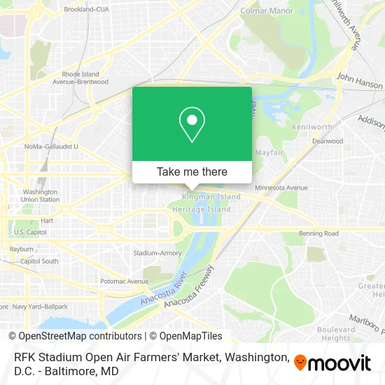
See RFK Stadium Open Air Farmers' Market, Washington, on the map
Public Transit to RFK Stadium Open Air Farmers' Market in Washington
Wondering how to get to RFK Stadium Open Air Farmers' Market in Washington? Moovit helps you find the best way to get to RFK Stadium Open Air Farmers' Market with step-by-step directions from the nearest public transit station.
Moovit provides free maps and live directions to help you navigate through your city. View schedules, routes, timetables, and find out how long does it take to get to RFK Stadium Open Air Farmers' Market in real time.
Looking for the nearest stop or station to RFK Stadium Open Air Farmers' Market? Check out this list of stops closest to your destination: Benning Rd Ne+26 St NE; Clay St Ne+33 St NE; Benning Rd Ne+19 St NE; 22 St Ne+E Capitol St NE; Maryland Av Ne+21 St NE; Potomac Ave.
Bus: D20, C57, C33, D2X, D24, C43.Train: NORTHEAST REGIONAL.Metro: BLUE, ORANGE, SILVER.
Want to see if there’s another route that gets you there at an earlier time? Moovit helps you find alternative routes or times. Get directions from and directions to RFK Stadium Open Air Farmers' Market easily from the Moovit App or Website.
We make riding to RFK Stadium Open Air Farmers' Market easy, which is why over 1.5 million users, including users in Washington, trust Moovit as the best app for public transit. You don’t need to download an individual bus app or train app, Moovit is your all-in-one transit app that helps you find the best bus time or train time available.
For information on prices of bus, metro and train, costs and ride fares to RFK Stadium Open Air Farmers' Market, please check the Moovit app.
Use the app to navigate to popular places including to the airport, hospital, stadium, grocery store, mall, coffee shop, school, college, and university.
RFK Stadium Open Air Farmers' Market Address: 2615 Benning Rd NE street in Washington
- Benning Rd NE & Oklahoma Ave NE,
- Benning Road & Oklahoma Avenue Northeast,
- Langston Golf Course,
- 2512 E St NE ,
- Spingarn High School,
- Kingman Island,
- Spingarn High School Track,
- Fields at RFK Campus,
- Two Rivers Public Charter School,
- J.W. King Senior Center,
- Anacostia River,
- Phelps High School,
- Benning Road & 19th Street Northeast,
- River Terrace Park,
- RFK Memorial Stadium,
- Anacostia Ave NE (clay anacostia),
- RFK Stadium (Run or Dye RFK),
- Rfk Stadium,
- Festival Grounds at RFK Campus,
- RFK Stadium Parking Lot 8
Places Near RFK Stadium Open Air Farmers' Market (Washington)
- PG Mall, Prince George's County,
- Amazon Hq2, Arlington County,
- Pennsylvania Ave NW (3rd st and pennsylvania), Washington,
- The Anthem, Washington,
- Museum Of The Bible, Washington,
- Washington National Cathedral, Washington,
- Basilica of the National Shrine, Washington,
- Rock Creek Tennis Center, Washington,
- Warner Theatre, Washington,
- M&T Bank Stadium, Baltimore,
- Sibley Memorial Hospital, Washington,
- National Mall, Washington,
- Washington DC VA Medical Center, Washington,
- National Zoo, Washington,
- Westfield Montgomery Mall, Montgomery County,
- Georgetown, Washington,
- National Museum of African American History and Culture, Washington,
- Camden Yards, Baltimore,
- Marriott Marquis Washington, DC, Washington,
- Capital One Arena, Washington
How to get to popular places in Washington, D.C. - Baltimore, MD with public transit
Get around Washington by public transit!
Traveling around Washington has never been so easy. See step by step directions as you travel to any attraction, street or major public transit station. View bus and train schedules, arrival times, service alerts and detailed routes on a map, so you know exactly how to get to anywhere in Washington.
When traveling to any destination around Washington use Moovit's Live Directions with Get Off Notifications to know exactly where and how far to walk, how long to wait for your line, and how many stops are left. Moovit will alert you when it's time to get off — no need to constantly re-check whether yours is the next stop.
Wondering how to use public transit in Washington or how to pay for public transit in Washington? Moovit public transit app can help you navigate your way with public transit easily, and at minimum cost. It includes public transit fees, ticket prices, and costs. Looking for a map of Washington public transit lines? Moovit public transit app shows all public transit maps in Washington with all Bus, Train, Metro, Light Rail and Ferry routes and stops on an interactive map.
Washington, D.C. - Baltimore, MD has 5 transit type(s), including: Bus, Train, Metro, Light Rail and Ferry, operated by several transit agencies, including WMATA, Montgomery County Ride On, Fairfax Connector, TheBus, PRTC, DASH - Alexandria, Arlington Transit (ART), RTA of Central Maryland, MDOT MTA, MDOT MTA Light RailLink, MDOT MTA Commuter Bus, MDOT MTA Local Bus, FXBGO!, Virginia Railway Express (VRE) and MARC