How to get to RJC by bus?
Click on the bus route to see step by step directions with maps, line arrival times and updated time schedules.
From Piper High School, Plantation
54 minFrom Galleria at Fort Lauderdale (Galleria Mall At Fort Lauderdale), Fort Lauderdale
60 minFrom Tamarac, Coral Springs-Margate
41 minFrom Florida Turnpike Sunrise Blvd. Toll Plaza, Plantation
49 minFrom Galleria Mall, Fort Lauderdale
62 minFrom South Plantation High School, Plantation
58 minFrom Cardinal Gibbons High School, Fort Lauderdale
38 minFrom Sawgrass Recreation Park, Fort Lauderdale
65 minFrom Amazon Fulfillment Center-DMF3, Pompano Beach
52 minFrom 595 Express, Davie
85 min
Bus stop near RJC in Fort Lauderdale
- Commercial Boulevard & US 441, 3 min walk,VIEW
Bus lines to RJC in Fort Lauderdale
What are the closest stations to RJC?
The closest stations to RJC are:
- Commercial Boulevard & US 441 is 199 yards away, 3 min walk.
Which bus lines stop near RJC?
These bus lines stop near RJC: 19, 441, 55.
What’s the nearest bus station to RJC in Fort Lauderdale?
The nearest bus station to RJC in Fort Lauderdale is Commercial Boulevard & US 441. It’s a 3 min walk away.
What time is the first bus to RJC in Fort Lauderdale?
The 19 is the first bus that goes to RJC in Fort Lauderdale. It stops nearby at 4:46 AM.
What time is the last bus to RJC in Fort Lauderdale?
The 19 is the last bus that goes to RJC in Fort Lauderdale. It stops nearby at 1:02 AM.
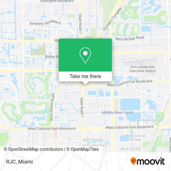
See RJC, Fort Lauderdale, on the map
Public Transit to RJC in Fort Lauderdale
Wondering how to get to RJC in Fort Lauderdale? Moovit helps you find the best way to get to RJC with step-by-step directions from the nearest public transit station.
Moovit provides free maps and live directions to help you navigate through your city. View schedules, routes, timetables, and find out how long does it take to get to RJC in real time.
Looking for the nearest stop or station to RJC? Check out this list of stops closest to your destination: Commercial Boulevard & US 441.
Bus: 19, 441, 55, 11.
Want to see if there’s another route that gets you there at an earlier time? Moovit helps you find alternative routes or times. Get directions from and directions to RJC easily from the Moovit App or Website.
We make riding to RJC easy, which is why over 1.5 million users, including users in Fort Lauderdale, trust Moovit as the best app for public transit. You don’t need to download an individual bus app or train app, Moovit is your all-in-one transit app that helps you find the best bus time or train time available.
For information on prices of bus, costs and ride fares to RJC, please check the Moovit app.
Use the app to navigate to popular places including to the airport, hospital, stadium, grocery store, mall, coffee shop, school, college, and university.
RJC Address: 3890 W Commercial Blvd Fort Lauderdale, FL 33309 street in Fort Lauderdale
- Traditional Medicine Center,
- Coles,
- Miriams Training Site,
- Sage Spa FTL,
- Legal Credit Repair,
- Zoe Life Christian Center,
- Chriscay,
- La Granja Service,
- Primary Medical Physicians,
- Cell Touch SFL,
- Towmaxx,
- Video Outlet (Adult Videos),
- DUNKIN',
- W Commercial Blvd & 441 (SR 7),
- W Commercial Blvd / N State Road 7,
- Born on Purpose Project,
- La Quinta by Wyndham Fort Lauderdale Tamarac,
- LA QUINTA by Wyndham-Tamarac,
- LA QUINTA by Wyndham-Tamarac,
- Amazon Locker-Roadshow
Places Near RJC (Fort Lauderdale)
- Wynwood, Miami,
- Brickell City Centre, Miami,
- Aventura Mall, Miami,
- Sawgrass mall ( FL ), Miami Beach,
- Miami Design District, Miami,
- Aventura Mall, Miami Beach,
- Dolphin Mall, Miami,
- Richard E. Gerstein Justice Building, Miami,
- Bayside Marketplace, Miami,
- Port of Miami Cruise Terminal, Miami,
- Hard Rock Stadium, Miami Gardens,
- Zoo Miami, Miami,
- Sawgrass Mall, Miami,
- Miami-Dade County Courthouse, Miami,
- Dolphin Mall Bus, Miami,
- Marlins Park, Miami,
- 1351 NW 12th St, Miami,
- Keiser University Flagship Campus, West Palm Beach,
- Little Havana, Miami,
- Miami Freedom Park, Miami
How to get to popular places in Miami with public transit
Get around Fort Lauderdale by public transit!
Traveling around Fort Lauderdale has never been so easy. See step by step directions as you travel to any attraction, street or major public transit station. View bus and train schedules, arrival times, service alerts and detailed routes on a map, so you know exactly how to get to anywhere in Fort Lauderdale.
When traveling to any destination around Fort Lauderdale use Moovit's Live Directions with Get Off Notifications to know exactly where and how far to walk, how long to wait for your line, and how many stops are left. Moovit will alert you when it's time to get off — no need to constantly re-check whether yours is the next stop.
Wondering how to use public transit in Fort Lauderdale or how to pay for public transit in Fort Lauderdale? Moovit public transit app can help you navigate your way with public transit easily, and at minimum cost. It includes public transit fees, ticket prices, and costs. Looking for a map of Fort Lauderdale public transit lines? Moovit public transit app shows all public transit maps in Fort Lauderdale with all Bus, Train, Light Rail and Ferry routes and stops on an interactive map.
Miami has 4 transit type(s), including: Bus, Train, Light Rail and Ferry, operated by several transit agencies, including Broward County Transit, Miami-Dade Transit, Metrorail, Palm Tran, Tri-Rail, Brightline, MARTY, City of Homestead Trolley, Key West Transit, Treasure Coast Connector, GoLine IRT, Amtrak, Greyhound-us, FlixBus-us and Aventura Express Shuttle Bus