How to get to RK Xintiandi by bus?
Click on the bus route to see step by step directions with maps, line arrival times and updated time schedules.
From Tiangang Xiyue Hotel, Jiangdong District
31 minFrom Ningbo Dongqian Lake Xiaoputo Scenic Area Management Co., Ltd., Yinzhou District
42 minFrom Sanjiang Shopping (Global City Branch), Yinzhou District
41 minFrom Le Zhu Breakfast, Jiangbei District
51 minFrom Jiang Village Committee (Jinda South Road), Yinzhou District
52 minFrom Ningbo University - East Gate Dormitory, Jiangbei District
37 minFrom Global Yintai City (Entrance/Exit), Yinzhou District
46 minFrom Yijia Business Hotel, Zhenhai District
24 minFrom Ningbo 9th Hospital - Emergency, Jiangbei District
38 minFrom Youth Road, Yinzhou District
38 min
How to get to RK Xintiandi by metro?
Click on the metro route to see step by step directions with maps, line arrival times and updated time schedules.
Bus stops near RK Xintiandi in Jiangbei District
Metro station near RK Xintiandi in Jiangbei District
- Drum Tower, 17 min walk,VIEW
Bus lines to RK Xintiandi in Jiangbei District
- Route 8, East Bus Station,VIEW
- 360, Yinzhou Bus Terminal,VIEW
- Route 380, Ningbo Railway,VIEW
- 501, Ningbo University,VIEW
- 516, Jiangbei Investment & Business Center Zone B,VIEW
- Route 6, Qinghe Bus Station,VIEW
- Route 363, Yinzhou Higher Education Park,VIEW
- Route 812, Chenglang Community,VIEW
- Route 350, Malachite Road,VIEW
- Route 352, Ningbo University Affiliated Hospital,VIEW
- Route 303, Qingfeng Bridge Station - Jiangbei Innovation Zone C,VIEW
- Route 337, Qingfeng Bridge Bus Station - Sanqi Market,VIEW
- Route 339, Cihu Middle School - Qingfeng Bridge Bus Station,VIEW
- Route 816, Qingfeng Bridge Bus Station - Duantang Dingjia,VIEW
- Route 378, Jiang'an Road,VIEW
- 541 Express, Ningbo Railway Station - Zhaobao Mountain,VIEW
- 1, Ningbo Railway Station - Zhuangshi Bus Station,VIEW
- Route 4, Zhuangqiao Shangshao Station - Dongmenkou,VIEW
- Route 13, Qingfeng Bridge Station - Guangsha Yiting,VIEW
- Route 19, Nanyuan New Village - Transit Qingfeng Bridge Station,VIEW
What are the closest stations to RK Xintiandi?
The closest stations to RK Xintiandi are:
- Shengbao Road is 86 meters away, 2 min walk.
- Daqing South Road is 335 meters away, 5 min walk.
- Xinma Road People's Road Junction is 358 meters away, 5 min walk.
- Ningbo University Affiliated Hospital is 449 meters away, 6 min walk.
- Sanjiang Middle School is 493 meters away, 7 min walk.
- Taoyuan Residential Area is 711 meters away, 10 min walk.
- Drum Tower is 1313 meters away, 17 min walk.
Which bus lines stop near RK Xintiandi?
These bus lines stop near RK Xintiandi: Route 303, Route 352, 360, Route 378, 501, 516.
Which metro line stops near RK Xintiandi?
Line 2 (Lishie International Airport)
What’s the nearest metro station to RK Xintiandi in Jiangbei District?
The nearest metro station to RK Xintiandi in Jiangbei District is Drum Tower. It’s a 17 min walk away.
What’s the nearest bus station to RK Xintiandi in Jiangbei District?
The nearest bus station to RK Xintiandi in Jiangbei District is Shengbao Road. It’s a 2 min walk away.
What time is the first metro to RK Xintiandi in Jiangbei District?
The Line 1 is the first metro that goes to RK Xintiandi in Jiangbei District. It stops nearby at 6:17 AM.
What time is the last metro to RK Xintiandi in Jiangbei District?
The Line 1 is the last metro that goes to RK Xintiandi in Jiangbei District. It stops nearby at 10:50 PM.
What time is the first bus to RK Xintiandi in Jiangbei District?
The Route 202 Night Line is the first bus that goes to RK Xintiandi in Jiangbei District. It stops nearby at 3:02 AM.
What time is the last bus to RK Xintiandi in Jiangbei District?
The Route 202 Night Line is the last bus that goes to RK Xintiandi in Jiangbei District. It stops nearby at 3:02 AM.
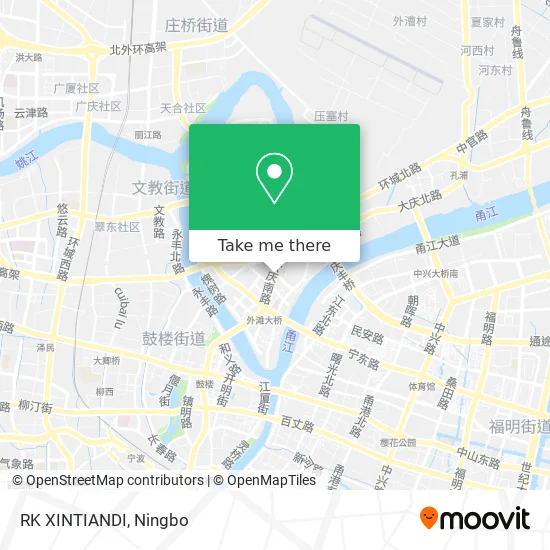
See RK Xintiandi, Jiangbei District, on the map
Public Transit to RK Xintiandi in Jiangbei District
Wondering how to get to RK Xintiandi in Jiangbei District? Moovit helps you find the best way to get to RK Xintiandi with step-by-step directions from the nearest public transit station.
Moovit provides free maps and live directions to help you navigate through your city. View schedules, routes, timetables, and find out how long does it take to get to RK Xintiandi in real time.
Looking for the nearest stop or station to RK Xintiandi? Check out this list of stops closest to your destination: Shengbao Road; Daqing South Road; Xinma Road People's Road Junction; Ningbo University Affiliated Hospital; Sanjiang Middle School; Taoyuan Residential Area; Drum Tower.
Bus: Route 303, Route 352, 360, Route 378, 501, 516, Route 8, 360, Route 380, 501, 516, Route 6, Route 363, Route 812, Route 350, Route 352, Route 303, Route 337, Route 339, Route 816.Metro: Line 2, Line 1, Line 2.
Want to see if there’s another route that gets you there at an earlier time? Moovit helps you find alternative routes or times. Get directions from and directions to RK Xintiandi easily from the Moovit App or Website.
We make riding to RK Xintiandi easy, which is why over 1.5 million users, including users in Jiangbei District, trust Moovit as the best app for public transit. You don’t need to download an individual bus app or train app, Moovit is your all-in-one transit app that helps you find the best bus time or train time available.
For information on prices of bus and metro, costs and ride fares to RK Xintiandi, please check the Moovit app.
Use the app to navigate to popular places including to the airport, hospital, stadium, grocery store, mall, coffee shop, school, college, and university.
RK Xintiandi Address: 大庆南路382号附近 street in Jiangbei District
- Lujing New World Plaza,
- Caoma Second Village North District,
- Baisha Market Parking Lot - Entrance / Exit,
- Baisha Market - Parking Lot,
- Baisha Market Guangming Wine Shop,
- Pudong Bank 24-Hour Self-Service Bank,
- Ningbo Milk Group Yong You Milk Bar 0574-003,
- Fuji Chess and Card Room,
- Cai Lao Bao (Ningbo Baisha Market Branch),
- Ningbo Jiangbei District People's Court Parking Lot - Entrance / Exit,
- Baisha Market - North Gate,
- Fat Child Ice Cream Shop,
- Baisha Market - South Gate 2,
- China Welfare Lottery (Jiangbei Central Station),
- Daqing New Village - South Gate,
- Xiao Dong Electric Vehicle Shop,
- Shengbao Road / Daqing South Road (Intersection),
- 2nd Room,
- Zhengda Community Maritime Bureau Residential Area,
- Zhengda Community
Places Near RK Xintiandi (Jiangbei District)
- Ningbo Second Hospital-Emergency, Haishu District,
- Wanxiang City (Under Construction), Jiangbei District,
- City Hero (New City Wuyue Plaza), Zhenhai District,
- Ningbo Medical Center Li Huili Hospital East Hospital - Outpatient, Yinzhou District,
- Ningbo Traditional Chinese Medicine Hospital, Haishu District,
- Ningbo Medical Center Li Huili Eastern Hospital, Yinzhou District,
- Ningbo Foreigner Beach, Jiangbei District,
- Li Huili Eastern Hospital, Yinzhou District,
- Zhongle Dance Hall, Jiangbei District,
- Ningbo Jintian Copper (Group) Co., Ltd., Jiangbei District,
- Sam's Club (Qinghe Road), Jiangbei District,
- Ningbo Cultural Creative Port, Jiangbei District,
- Ayuwang Temple, Yinzhou District,
- Gas Station, Yinzhou District,
- Ningbo No. 6 Hospital, Jiangdong District,
- Ningbo Lishe International Airport, Yinzhou District,
- Wanxiang City, Jiangbei District,
- Nantang Old Street, Haishu District,
- Ningbo First Hospital - Inpatient Department, Haishu District,
- France · Woodpecker
How to get to popular places in Ningbo with public transit
Get around Jiangbei District by public transit!
Traveling around Jiangbei District has never been so easy. See step by step directions as you travel to any attraction, street or major public transit station. View bus and train schedules, arrival times, service alerts and detailed routes on a map, so you know exactly how to get to anywhere in Jiangbei District.
When traveling to any destination around Jiangbei District use Moovit's Live Directions with Get Off Notifications to know exactly where and how far to walk, how long to wait for your line, and how many stops are left. Moovit will alert you when it's time to get off — no need to constantly re-check whether yours is the next stop.
Wondering how to use public transit in Jiangbei District or how to pay for public transit in Jiangbei District? Moovit public transit app can help you navigate your way with public transit easily, and at minimum cost. It includes public transit fees, ticket prices, and costs. Looking for a map of Jiangbei District public transit lines? Moovit public transit app shows all public transit maps in Jiangbei District with all Bus and Metro routes and stops on an interactive map.
Ningbo has 2 transit type(s), including: Bus and Metro, operated by several transit agencies, including Ningbo Metro, Ningbo Bus and Yuyao Bus