Directions to RMH Atrium (Harrisonburg) with public transportation
The following transit lines have routes that pass near RMH Atrium
 Bus: BRCC NORTH, 4, 4-B, EXT 4, YELLOW.
Bus stops near RMH Atrium in Harrisonburg
Bus lines to RMH Atrium in Harrisonburg
- 4, Route 4,VIEW
- 4-B, Route 4-B,VIEW
- EXT 4, Extended Route 4,VIEW
- YELLOW, JMU Yellow (Weekdays),VIEW
- YELLOW, JMU Yellow Night (Weekdays),VIEW
- YELLOW, JMU Yellow (Saturdays),VIEW
- BLACK, JMU Black Line,VIEW
- GREEN, JMU Green Line,VIEW
- JMU SUMMER SILVER, JMU Summer Silver,VIEW
- SILVER, JMU Silver (Saturday),VIEW
- SILVER, JMU Silver (Weekday),VIEW
- Jennifer M. Bryant, Acnp-BC,
- Rockingham Memorial Hospital,
- RMH Rehab Services,
- Rehab Services,
- Jmu Soccer / Lacrosse / Track and Field Complex,
- George's Foods,
- Gilmer Industries,
- Village Juice and Kitchen Closed,
- 330 Stone Spring Rd,
- Prompt,
- ATM,
- Dept Solid Waste & Recycling,
- Harrisonburg Public Works,
- Intercept Youth Services,
- Harrisonburg Recycling Center,
- Allied Concrete Company,
- Valley Building Supply,
- Concrete Pipe & Precast,
- Americast,
- Cargill Company Store
Places Near RMH Atrium (Harrisonburg)
- Sibley Memorial Hospital, Washington,
- Westfield Montgomery Mall, Montgomery County,
- Museum Of The Bible, Washington,
- National Zoo, Washington,
- Washington National Cathedral, Washington,
- Washington DC VA Medical Center, Washington,
- Camden Yards, Baltimore,
- Amazon Hq2, Arlington County,
- Marriott Marquis Washington, DC, Washington,
- Georgetown, Washington,
- M&T Bank Stadium, Baltimore,
- Warner Theatre, Washington,
- Basilica of the National Shrine, Washington,
- The Anthem, Washington,
- Capital One Arena, Washington,
- National Mall, Washington,
- National Museum of African American History and Culture, Washington,
- PG Mall, Prince George's County,
- Rock Creek Tennis Center, Washington,
- Pennsylvania Ave NW (3rd st and pennsylvania), Washington
How to get to popular places in Washington, D.C. - Baltimore, MD with public transit
What are the closest stations to RMH Atrium?
The closest stations to RMH Atrium are:
- Rmh Wellness Center is 447 yards away, 6 min walk.
- Pheasant Run (Shelter) is 915 yards away, 12 min walk.
- Devon Ln. @ 1420 Foxhill / Squire Hill is 3338 yards away, 40 min walk.
Which bus line stops near RMH Atrium?
BRCC NORTH (Brcc)
What’s the nearest bus station to RMH Atrium in Harrisonburg?
The nearest bus station to RMH Atrium in Harrisonburg is Rmh Wellness Center. It’s a 6 min walk away.
What time is the first bus to RMH Atrium in Harrisonburg?
The 4 is the first bus that goes to RMH Atrium in Harrisonburg. It stops nearby at 6:38 AM.
What time is the last bus to RMH Atrium in Harrisonburg?
The 4-B is the last bus that goes to RMH Atrium in Harrisonburg. It stops nearby at 10:28 PM.
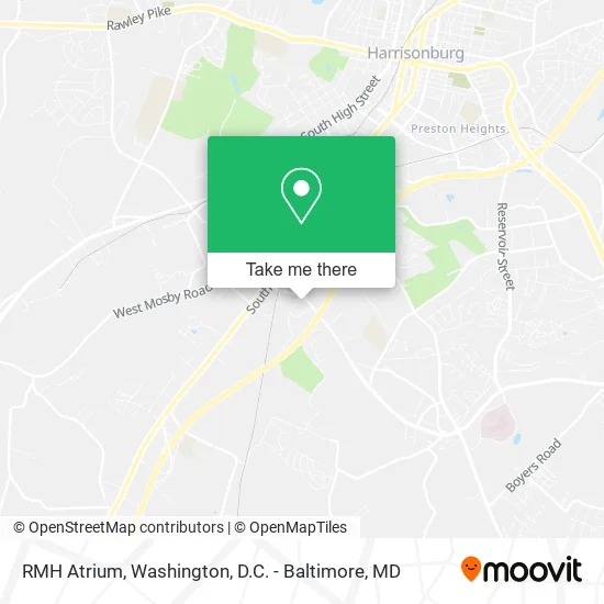
See RMH Atrium, Harrisonburg, on the map
Public Transit to RMH Atrium in Harrisonburg
Wondering how to get to RMH Atrium in Harrisonburg? Moovit helps you find the best way to get to RMH Atrium with step-by-step directions from the nearest public transit station.
Moovit provides free maps and live directions to help you navigate through your city. View schedules, routes, timetables, and find out how long does it take to get to RMH Atrium in real time.
Looking for the nearest stop or station to RMH Atrium? Check out this list of stops closest to your destination: Rmh Wellness Center; Pheasant Run (Shelter); Devon Ln. @ 1420 Foxhill / Squire Hill.
Bus: BRCC NORTH, 4, 4-B, EXT 4, YELLOW, YELLOW, YELLOW, BLACK, GREEN, JMU SUMMER SILVER, SILVER, SILVER.
Want to see if there’s another route that gets you there at an earlier time? Moovit helps you find alternative routes or times. Get directions from and directions to RMH Atrium easily from the Moovit App or Website.
We make riding to RMH Atrium easy, which is why over 1.5 million users, including users in Harrisonburg, trust Moovit as the best app for public transit. You don’t need to download an individual bus app or train app, Moovit is your all-in-one transit app that helps you find the best bus time or train time available.
For information on prices of train and bus, costs and ride fares to RMH Atrium, please check the Moovit app.
Use the app to navigate to popular places including to the airport, hospital, stadium, grocery store, mall, coffee shop, school, college, and university.
RMH Atrium Address: 2000 Beery Rd Harrisonburg, VA 22801 street in Harrisonburg
Get around Harrisonburg by public transit!
Traveling around Harrisonburg has never been so easy. See step by step directions as you travel to any attraction, street or major public transit station. View bus and train schedules, arrival times, service alerts and detailed routes on a map, so you know exactly how to get to anywhere in Harrisonburg.
When traveling to any destination around Harrisonburg use Moovit's Live Directions with Get Off Notifications to know exactly where and how far to walk, how long to wait for your line, and how many stops are left. Moovit will alert you when it's time to get off — no need to constantly re-check whether yours is the next stop.
Wondering how to use public transit in Harrisonburg or how to pay for public transit in Harrisonburg? Moovit public transit app can help you navigate your way with public transit easily, and at minimum cost. It includes public transit fees, ticket prices, and costs. Looking for a map of Harrisonburg public transit lines? Moovit public transit app shows all public transit maps in Harrisonburg with all Bus, Train, Metro, Light Rail and Ferry routes and stops on an interactive map.
Washington, D.C. - Baltimore, MD has 5 transit type(s), including: Bus, Train, Metro, Light Rail and Ferry, operated by several transit agencies, including WMATA, Montgomery County Ride On, Fairfax Connector, TheBus, PRTC, DASH - Alexandria, Arlington Transit (ART), RTA of Central Maryland, MDOT MTA, MDOT MTA Light RailLink, MDOT MTA Commuter Bus, MDOT MTA Local Bus, FXBGO!, Virginia Railway Express (VRE) and MARC