Directions to RMS Fitness (Baltimore County) with public transportation
The following transit lines have routes that pass near RMS Fitness
 Bus: 115.
How to get to RMS Fitness by bus?
Click on the bus route to see step by step directions with maps, line arrival times and updated time schedules.
From Towson Town Center, Baltimore County
66 minFrom Towson, MD, Baltimore County
103 minFrom I-695 Exit 29 (Loch Raven Blvd (MD 542)/Cromwell Bridge Rd), Baltimore County
103 minFrom I-695 @ Exit 27 (Dulaney Valley Road/MD 146), Baltimore County
115 minFrom Good Samaritan Hospital, Baltimore
53 minFrom Morgan State University, Baltimore
69 minFrom Medstar Franklin Square Medical Center, Baltimore County
44 minFrom Middle River, Maryland, Baltimore County
169 minFrom I-695 @ Exit 26 (York Rd/MD 45), Baltimore County
111 minFrom Franklin Square Dr (franklin hospital), Baltimore County
48 min
Bus stop near RMS Fitness in Baltimore County
- Chapel Rd & Chapeltown Cir Ns Wb, 9 min walk,VIEW
Bus lines to RMS Fitness in Baltimore County
- 115, Downtown,VIEW
What are the closest stations to RMS Fitness?
The closest stations to RMS Fitness are:
- Chapel Rd & Chapeltown Cir Ns Wb is 713 yards away, 9 min walk.
Which bus line stops near RMS Fitness?
115 (Perry Hall)
What’s the nearest bus station to RMS Fitness in Baltimore County?
The nearest bus station to RMS Fitness in Baltimore County is Chapel Rd & Chapeltown Cir Ns Wb. It’s a 9 min walk away.
What time is the first bus to RMS Fitness in Baltimore County?
The 115 is the first bus that goes to RMS Fitness in Baltimore County. It stops nearby at 5:53 AM.
What time is the last bus to RMS Fitness in Baltimore County?
The 115 is the last bus that goes to RMS Fitness in Baltimore County. It stops nearby at 6:33 PM.
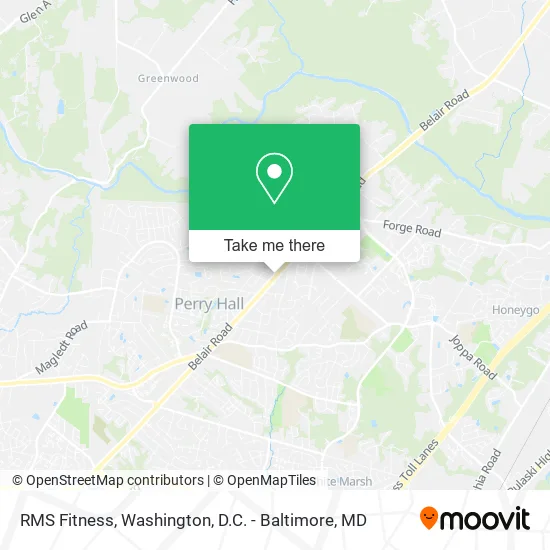
See RMS Fitness, Baltimore County, on the map
Public Transit to RMS Fitness in Baltimore County
Wondering how to get to RMS Fitness in Baltimore County? Moovit helps you find the best way to get to RMS Fitness with step-by-step directions from the nearest public transit station.
Moovit provides free maps and live directions to help you navigate through your city. View schedules, routes, timetables, and find out how long does it take to get to RMS Fitness in real time.
Looking for the nearest stop or station to RMS Fitness? Check out this list of stops closest to your destination: Chapel Rd & Chapeltown Cir Ns Wb.
Bus: 115.
Want to see if there’s another route that gets you there at an earlier time? Moovit helps you find alternative routes or times. Get directions from and directions to RMS Fitness easily from the Moovit App or Website.
We make riding to RMS Fitness easy, which is why over 1.5 million users, including users in Baltimore County, trust Moovit as the best app for public transit. You don’t need to download an individual bus app or train app, Moovit is your all-in-one transit app that helps you find the best bus time or train time available.
For information on prices of bus, costs and ride fares to RMS Fitness, please check the Moovit app.
Use the app to navigate to popular places including to the airport, hospital, stadium, grocery store, mall, coffee shop, school, college, and university.
RMS Fitness Address: 9512 Belair Rd Nottingham, MD 21236 street in Baltimore County
- Bills Refrigeration & Air-Conditioning,
- AT&T,
- The Company Government Services Division,
- Rustic Inn,
- Baltimore Construction Accounting,
- Empanadas by Abuela,
- Carpet Cleaning Perry Hall MD,
- Musalla Village Condominiums,
- BK Artistry by Becky Karatzas,
- Musalla Manor Apartments,
- Chapel Rd Belair Rd,
- WESTERN UNION,
- Mubs' Pub,
- Youni Wellness Spa,
- Sugaring NYC - Perry Hall,
- EZ-HQL Firearms Training Center,
- P.E. Sales, Inc.,
- 82 Birchbrook Ct,
- Joppa Rd & Belair Rd,
- E Joppa Rd and Belair
Places Near RMS Fitness (Baltimore County)
- Marriott Marquis Washington, DC, Washington,
- Museum Of The Bible, Washington,
- Georgetown, Washington,
- The Anthem, Washington,
- Warner Theatre, Washington,
- Rock Creek Tennis Center, Washington,
- Washington National Cathedral, Washington,
- Washington DC VA Medical Center, Washington,
- Camden Yards, Baltimore,
- National Mall, Washington,
- Westfield Montgomery Mall, Montgomery County,
- Capital One Arena, Washington,
- National Museum of African American History and Culture, Washington,
- National Zoo, Washington,
- Sibley Memorial Hospital, Washington,
- Amazon Hq2, Arlington County,
- M&T Bank Stadium, Baltimore,
- PG Mall, Prince George's County,
- Pennsylvania Ave NW (3rd st and pennsylvania), Washington,
- Basilica of the National Shrine, Washington
How to get to popular places in Washington, D.C. - Baltimore, MD with public transit
Get around Baltimore County by public transit!
Traveling around Baltimore County has never been so easy. See step by step directions as you travel to any attraction, street or major public transit station. View bus and train schedules, arrival times, service alerts and detailed routes on a map, so you know exactly how to get to anywhere in Baltimore County.
When traveling to any destination around Baltimore County use Moovit's Live Directions with Get Off Notifications to know exactly where and how far to walk, how long to wait for your line, and how many stops are left. Moovit will alert you when it's time to get off — no need to constantly re-check whether yours is the next stop.
Wondering how to use public transit in Baltimore County or how to pay for public transit in Baltimore County? Moovit public transit app can help you navigate your way with public transit easily, and at minimum cost. It includes public transit fees, ticket prices, and costs. Looking for a map of Baltimore County public transit lines? Moovit public transit app shows all public transit maps in Baltimore County with all Bus, Train, Metro, Light Rail and Ferry routes and stops on an interactive map.
Washington, D.C. - Baltimore, MD has 5 transit type(s), including: Bus, Train, Metro, Light Rail and Ferry, operated by several transit agencies, including WMATA, Montgomery County Ride On, Fairfax Connector, TheBus, PRTC, DASH - Alexandria, Arlington Transit (ART), RTA of Central Maryland, MDOT MTA, MDOT MTA Light RailLink, MDOT MTA Commuter Bus, MDOT MTA Local Bus, FXBGO!, Virginia Railway Express (VRE) and MARC