How to get to ROSSMANN by bus?
Click on the bus route to see step by step directions with maps, line arrival times and updated time schedules.
How to get to ROSSMANN by train?
Click on the train route to see step by step directions with maps, line arrival times and updated time schedules.
Bus stops near ROSSMANN in Warsaw
Train station near ROSSMANN in Warsaw
- Skawina, 11 min walk,VIEW
Bus lines to ROSSMANN in Warsaw
- 203, Czerwone Maki P+R - Skawina,VIEW
- 223, Czerwone Maki P+R - Brzeźnica Dworzec,VIEW
- 243, Borek Fałęcki - Skawina SCK,VIEW
- 253, Czerwone Maki P+R - Wola Radziszowska Pętla,VIEW
- 283, Czerwone Maki P+R - Skawina,VIEW
- 293, Borek Fałęcki - Kopanka Pętla,VIEW
- 903, Linia nocna | Czerwone Maki P+R - Skawina,VIEW
- A53, Skawina SCK - Zawoja Policzne,VIEW
- 233, Czerwone Maki P+R - Skawina,VIEW
- 235, Borek Fałęcki - Ochodza Odwiśle,VIEW
- 273, Skawina SCK - Polanka Hallera Centrum,VIEW
- 295, Skawina SCK - Grabie Pętla,VIEW
- A43, Skawina - Rzozów - Gołuchowice - Polanka Hallera - Grabie - Przytkowice - Zebrzydowice - Kalwaria Zebrzydowska,VIEW
- 245, Borek Fałęcki,VIEW
What are the closest stations to ROSSMANN?
The closest stations to ROSSMANN are:
- Skawina Popiełuszki is 148 meters away, 2 min walk.
- Skawina Cmentarz is 265 meters away, 4 min walk.
- Skawina is 636 meters away, 9 min walk.
Which bus line stops near ROSSMANN?
253 (Wola Radziszowska Pętla)
Which train lines stop near ROSSMANN?
These train lines stop near ROSSMANN: KMŁ, REG.
What’s the nearest train station to ROSSMANN in Warsaw?
The nearest train station to ROSSMANN in Warsaw is Skawina. It’s a 11 min walk away.
What’s the nearest bus station to ROSSMANN in Warsaw?
The nearest bus station to ROSSMANN in Warsaw is Skawina Popiełuszki. It’s a 2 min walk away.
What time is the first train to ROSSMANN in Warsaw?
The REG is the first train that goes to ROSSMANN in Warsaw. It stops nearby at 4:19 AM.
What time is the last train to ROSSMANN in Warsaw?
The KMŁ is the last train that goes to ROSSMANN in Warsaw. It stops nearby at 12:16 AM.
What time is the first bus to ROSSMANN in Warsaw?
The 295 is the first bus that goes to ROSSMANN in Warsaw. It stops nearby at 3:50 AM.
What time is the last bus to ROSSMANN in Warsaw?
The 235 is the last bus that goes to ROSSMANN in Warsaw. It stops nearby at 12:09 AM.
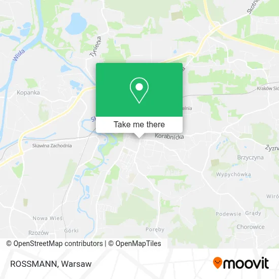
See ROSSMANN, Warsaw, on the map
Public Transit to ROSSMANN in Warsaw
Wondering how to get to ROSSMANN in Warsaw? Moovit helps you find the best way to get to ROSSMANN with step-by-step directions from the nearest public transit station.
Moovit provides free maps and live directions to help you navigate through your city. View schedules, routes, timetables, and find out how long does it take to get to ROSSMANN in real time.
Looking for the nearest stop or station to ROSSMANN? Check out this list of stops closest to your destination: Skawina Popiełuszki; Skawina Cmentarz; Skawina.
Bus: 253, 203, 223, 243, 283, 233, 235, 273, 295, A43, 245.Train: KMŁ, REG.
Want to see if there’s another route that gets you there at an earlier time? Moovit helps you find alternative routes or times. Get directions from and directions to ROSSMANN easily from the Moovit App or Website.
We make riding to ROSSMANN easy, which is why over 1.5 million users, including users in Warsaw, trust Moovit as the best app for public transit. You don’t need to download an individual bus app or train app, Moovit is your all-in-one transit app that helps you find the best bus time or train time available.
For information on prices of train and bus, costs and ride fares to ROSSMANN, please check the Moovit app.
Use the app to navigate to popular places including to the airport, hospital, stadium, grocery store, mall, coffee shop, school, college, and university.
ROSSMANN Address: ulica 29 Listopada 13, 32-050 Skawina street in Warsaw
- Doris Studio Fryzur,
- Centrum Weterynaryjne Animus Przychodnia Weterynaryjna Anna,
- Mesh Magdalena Baran,
- Optometria Gorzen Spólka Jawna,
- Centrum Korekcji Wzroku - Optometrium,
- Agi Agnieszka Odziomek,
- Plnb0692,
- Analizy,
- Magic Style,
- Anna Maj Butik u Ani,
- Elżbieta Jakubek,
- Electric-Control,
- Stowarzyszenie Budujemy Nadzieję,
- Stomatolog Dentysta Dziecięcy Leczenie Kanałowe Ortodoncja Skawina - Centrum Stomatologiczne Fullde,
- Geers Dobry Słuch,
- Prowi. Usługi Elektroinstalacyjne, Kubas M.,
- Geers,
- Gregory Dreux Md International,
- Fulldent sp. z o.o.,
- Fillo
Places Near ROSSMANN (Warsaw)
- Szpital Bielański, Warsaw,
- Wołoska-Szpital 01, Warsaw,
- Centralny Szpital Kliniczny MSWiA ul. Wołoska, Warsaw,
- Wołoska, Warsaw,
- PGE Narodowy, Warsaw,
- Banacha - Szpital Kliniczny, Warsaw,
- Szpital Spartanska, Warsaw,
- Szpital Orłowskiego, Warsaw,
- Postępu, Warsaw,
- Domaniewska, Warsaw,
- Galeria Mokotów, Warsaw,
- Cmentarz Bródnowski, Warsaw,
- Torwar, Warsaw,
- Galeria Północna, Warsaw,
- Sejm Rp, Warsaw,
- CH Arkadia, Warsaw,
- Szaserów - Szpital, Warsaw,
- Stare Miasto, Warsaw,
- Szpital Czerniakowski, Warsaw,
- Instytut Kardiologii w Aninie, Warsaw
How to get to popular places in Warsaw with public transit
Get around Warsaw by public transit!
Traveling around Warsaw has never been so easy. See step by step directions as you travel to any attraction, street or major public transit station. View bus and train schedules, arrival times, service alerts and detailed routes on a map, so you know exactly how to get to anywhere in Warsaw.
When traveling to any destination around Warsaw use Moovit's Live Directions with Get Off Notifications to know exactly where and how far to walk, how long to wait for your line, and how many stops are left. Moovit will alert you when it's time to get off — no need to constantly re-check whether yours is the next stop.
Wondering how to use public transit in Warsaw or how to pay for public transit in Warsaw? Moovit public transit app can help you navigate your way with public transit easily, and at minimum cost. It includes public transit fees, ticket prices, and costs. Looking for a map of Warsaw public transit lines? Moovit public transit app shows all public transit maps in Warsaw with all Bus, Train, Metro, Light Rail, Ferry and Cable Car routes and stops on an interactive map.
Warsaw has 6 transit type(s), including: Bus, Train, Metro, Light Rail, Ferry and Cable Car, operated by several transit agencies, including Warszawski Transport Publiczny, Warszawska Kolej Dojazdowa, Koleje Mazowieckie, ZTP Kraków, Miasto Piastów, Miasto Ząbki, Koleje Małopolskie, Komunikacja Miejska Łomianki, Gmina Pruszków, MPK Wrocław, MZDiK Radom, UM w Grodzisku Mazowieckim, UM w Nowym Dworze Mazowieckim, UM Płońsk and Koleje Dolnośląskie