Directions to RPM (Richmond) with public transportation
The following transit lines have routes that pass near RPM
 Bus: 18, BRT, 50, 91, 19.
- Train: CAROLINIAN, FLORIDIAN, NORTHEAST REGIONAL, PALMETTO, SILVER METEOR.
How to get to RPM by bus?
Click on the bus route to see step by step directions with maps, line arrival times and updated time schedules.
From Lorton, VA - Amtrak Auto Train Station (LOR), Fairfax County
232 minFrom Potomac Mills Mall, Prince William County
217 minFrom Lorton, VA, Fairfax County
226 minFrom Busch Gardens Williamsburg (Employee Parking Lot), James City County
158 minFrom Rose Gaming Resort, Prince William County
242 minFrom UVA Hospital Medical Center, Charlottesville
306 minFrom Amazon Fulfillment Center-Ric3, Richmond
71 minFrom Woodbridge, VA, Prince William County
161 min
Bus stops near RPM in Richmond
Train station near RPM in Richmond
- Richmond Staples Mill Road Amtrak Station, 61 min walk,VIEW
Bus lines to RPM in Richmond
What are the closest stations to RPM?
The closest stations to RPM are:
- Staples Mill Eastbound Station is 39 yards away, 1 min walk.
- Broad + Chantilly is 145 yards away, 2 min walk.
- Maywill at Vital Records And Health Statistics is 454 yards away, 6 min walk.
- Staples Mill & Radford is 478 yards away, 6 min walk.
- Richmond Staples Mill Road Amtrak Station is 5167 yards away, 61 min walk.
Which bus lines stop near RPM?
These bus lines stop near RPM: 18, BRT.
What’s the nearest bus station to RPM in Richmond?
The nearest bus station to RPM in Richmond is Staples Mill Eastbound Station. It’s a 1 min walk away.
What time is the first train to RPM in Richmond?
The SILVER METEOR is the first train that goes to RPM in Richmond. It stops nearby at 3:52 AM.
What time is the last train to RPM in Richmond?
The SILVER METEOR is the last train that goes to RPM in Richmond. It stops nearby at 3:52 AM.
What time is the first bus to RPM in Richmond?
The BRT is the first bus that goes to RPM in Richmond. It stops nearby at 5:02 AM.
What time is the last bus to RPM in Richmond?
The BRT is the last bus that goes to RPM in Richmond. It stops nearby at 1:33 AM.
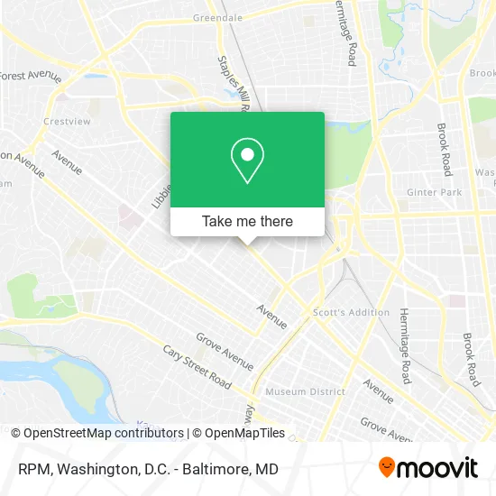
See RPM, Richmond, on the map
Public Transit to RPM in Richmond
Wondering how to get to RPM in Richmond? Moovit helps you find the best way to get to RPM with step-by-step directions from the nearest public transit station.
Moovit provides free maps and live directions to help you navigate through your city. View schedules, routes, timetables, and find out how long does it take to get to RPM in real time.
Looking for the nearest stop or station to RPM? Check out this list of stops closest to your destination: Staples Mill Eastbound Station; Broad + Chantilly; Maywill at Vital Records And Health Statistics; Staples Mill & Radford; Richmond Staples Mill Road Amtrak Station.
Bus: 18, BRT, 50, 91, 19, 76, 79.Train: CAROLINIAN, FLORIDIAN, NORTHEAST REGIONAL, PALMETTO, SILVER METEOR.
Want to see if there’s another route that gets you there at an earlier time? Moovit helps you find alternative routes or times. Get directions from and directions to RPM easily from the Moovit App or Website.
We make riding to RPM easy, which is why over 1.5 million users, including users in Richmond, trust Moovit as the best app for public transit. You don’t need to download an individual bus app or train app, Moovit is your all-in-one transit app that helps you find the best bus time or train time available.
For information on prices of bus and train, costs and ride fares to RPM, please check the Moovit app.
Use the app to navigate to popular places including to the airport, hospital, stadium, grocery store, mall, coffee shop, school, college, and university.
RPM Address: 4705 W Broad St Richmond, VA 23230 street in Richmond
- Cameo Models International,
- R.P.M.,
- Fields of Car Audio Vehicle Security Custom Wheels,
- Advanced Window Tint Co.,
- R.P.M. Superstore,
- Music & Arts,
- Sunrise Caribbean Cuisine,
- Johanas Colombian Grill,
- On A Roll Italian Subs,
- Outré Southern Fusion,
- NYC Vegan,
- Chefsuite,
- Titlemax Title Loans,
- Pro Printing,
- Enterprise,
- Gca Services Group,
- DTW Driving School,
- Drive To Work,
- SK Bedding,
- Burger King
Places Near RPM (Richmond)
- M&T Bank Stadium, Baltimore,
- Museum Of The Bible, Washington,
- National Museum of African American History and Culture, Washington,
- Washington National Cathedral, Washington,
- Amazon Hq2, Arlington County,
- Basilica of the National Shrine, Washington,
- Sibley Memorial Hospital, Washington,
- The Anthem, Washington,
- Warner Theatre, Washington,
- Georgetown, Washington,
- Rock Creek Tennis Center, Washington,
- Westfield Montgomery Mall, Montgomery County,
- Capital One Arena, Washington,
- Marriott Marquis Washington, DC, Washington,
- PG Mall, Prince George's County,
- National Zoo, Washington,
- National Theatre, Washington,
- Camden Yards, Baltimore,
- Washington DC VA Medical Center, Washington,
- Pennsylvania Ave NW (3rd st and pennsylvania), Washington
How to get to popular places in Washington, D.C. - Baltimore, MD with public transit
Get around Richmond by public transit!
Traveling around Richmond has never been so easy. See step by step directions as you travel to any attraction, street or major public transit station. View bus and train schedules, arrival times, service alerts and detailed routes on a map, so you know exactly how to get to anywhere in Richmond.
When traveling to any destination around Richmond use Moovit's Live Directions with Get Off Notifications to know exactly where and how far to walk, how long to wait for your line, and how many stops are left. Moovit will alert you when it's time to get off — no need to constantly re-check whether yours is the next stop.
Wondering how to use public transit in Richmond or how to pay for public transit in Richmond? Moovit public transit app can help you navigate your way with public transit easily, and at minimum cost. It includes public transit fees, ticket prices, and costs. Looking for a map of Richmond public transit lines? Moovit public transit app shows all public transit maps in Richmond with all Bus, Train, Metro, Light Rail and Ferry routes and stops on an interactive map.
Washington, D.C. - Baltimore, MD has 5 transit type(s), including: Bus, Train, Metro, Light Rail and Ferry, operated by several transit agencies, including WMATA, Montgomery County Ride On, Fairfax Connector, TheBus, PRTC, DASH - Alexandria, Arlington Transit (ART), RTA of Central Maryland, MDOT MTA, MDOT MTA Light RailLink, MDOT MTA Commuter Bus, MDOT MTA Local Bus, FXBGO!, Virginia Railway Express (VRE) and MARC