How to get to RSC Trucking by bus?
Click on the bus route to see step by step directions with maps, line arrival times and updated time schedules.
From National Pony of the Americas Club, Beech Grove
79 minFrom Wheeler Mission Center For Women & Children, Indianapolis City (Balance)
35 minFrom N Franklin Rd / E 56th St, Lawrence
60 minFrom Roadside Assistance Indianapolis, Indianapolis City (Balance)
30 minFrom TSA Indianapolis Str 3, Indianapolis City (Balance)
34 minFrom Uptons Famous Pet Training Center, Indianapolis City (Balance)
67 minFrom Salon700, Beech Grove
75 minFrom S Keystone Ave / E Pleasant Run Parkway South Dr, Indianapolis City (Balance)
47 minFrom Community Clinic at Walgreens - Beech Grove, Beech Grove
74 min
Bus stops near RSC Trucking in Indianapolis City (Balance)
Bus lines to RSC Trucking in Indianapolis City (Balance)
What are the closest stations to RSC Trucking?
The closest stations to RSC Trucking are:
- 10th St & Bazil Ave is 67 yards away, 1 min walk.
- Post Rd & 10th St is 243 yards away, 4 min walk.
Which bus line stops near RSC Trucking?
10 (Meijer E. Wash)
What’s the nearest bus station to RSC Trucking in Indianapolis City (Balance)?
The nearest bus station to RSC Trucking in Indianapolis City (Balance) is 10th St & Bazil Ave. It’s a 1 min walk away.
What time is the first bus to RSC Trucking in Indianapolis City (Balance)?
The 87 is the first bus that goes to RSC Trucking in Indianapolis City (Balance). It stops nearby at 4:29 AM.
What time is the last bus to RSC Trucking in Indianapolis City (Balance)?
The 10 is the last bus that goes to RSC Trucking in Indianapolis City (Balance). It stops nearby at 10:37 PM.
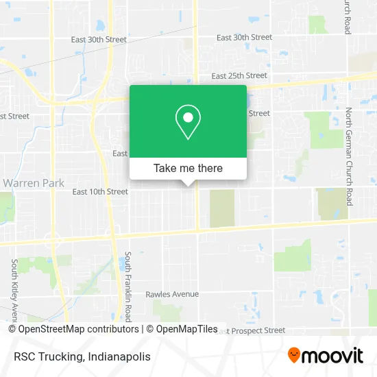
See RSC Trucking, Indianapolis City (Balance), on the map
Public Transit to RSC Trucking in Indianapolis City (Balance)
Wondering how to get to RSC Trucking in Indianapolis City (Balance)? Moovit helps you find the best way to get to RSC Trucking with step-by-step directions from the nearest public transit station.
Moovit provides free maps and live directions to help you navigate through your city. View schedules, routes, timetables, and find out how long does it take to get to RSC Trucking in real time.
Looking for the nearest stop or station to RSC Trucking? Check out this list of stops closest to your destination: 10th St & Bazil Ave; Post Rd & 10th St.
Bus: 10, 87.
Want to see if there’s another route that gets you there at an earlier time? Moovit helps you find alternative routes or times. Get directions from and directions to RSC Trucking easily from the Moovit App or Website.
We make riding to RSC Trucking easy, which is why over 1.5 million users, including users in Indianapolis City (Balance), trust Moovit as the best app for public transit. You don’t need to download an individual bus app or train app, Moovit is your all-in-one transit app that helps you find the best bus time or train time available.
For information on prices of bus, costs and ride fares to RSC Trucking, please check the Moovit app.
Use the app to navigate to popular places including to the airport, hospital, stadium, grocery store, mall, coffee shop, school, college, and university.
RSC Trucking Address: 8930 E 10th St Indianapolis, IN 46219 street in Indianapolis City (Balance)
- Print & Copy Shop,
- Dr. J.R. Lindeman, Dds,
- Tasty Tays Bbq Llc,
- Burn One Smoke One Llc,
- Remnant Ministries Indy,
- Lindeman J R Dds,
- Don't Eat the Bone BBQ,
- 10th and Post Smoke Shop,
- Custom Auto,
- A 01 Locksmith,
- King Sharks Fish and Chicken,
- God's Embrace Coffee Shop,
- Mj's Backyard Bbq & Catering,
- Blue Rhino Propane Exchange,
- Marathon Gas,
- Amoco,
- Bitcoin Depot - Bitcoin Atm,
- Prcc Kidstreet,
- Sparkle Touch Ministry,
- Hunt Brothers Pizza
Places Near RSC Trucking (Indianapolis City (Balance))
- Plainfield, IN, Plainfield,
- Castleton Square Mall, Indianapolis,
- Indiana Convention Center, Indianapolis City (Balance),
- St. Vincent Hospital - Indianapolis, Indianapolis City (Balance),
- Indiana, Indianapolis City (Balance),
- 119 W 19th St Parking, Indianapolis City (Balance),
- Methodist Hospital of Indianapolis, Indianapolis City (Balance),
- Lilly Corporate Center (Eli Lilly & Co), Indianapolis City (Balance),
- Cotter's Massage Parlor With Happy Endings, Indianapolis City (Balance),
- I-465 / I-65 Interchange, Indianapolis City (Balance),
- THE BALT, Indianapolis City (Balance),
- Indianapolis Motor Speedway, Speedway,
- Gainbridge Fieldhouse, Indianapolis City (Balance),
- St. Vincent entrance #1, Indianapolis City (Balance),
- Train Ride At Castleton Mall, Indianapolis City (Balance),
- Eskenazi Hospital, Indianapolis City (Balance),
- Indianapolis Airport Zone 2, Indianapolis City (Balance),
- Lucas Oil Stadium, Indianapolis City (Balance),
- Jersey Barn, Indianapolis City (Balance),
- I U Health Methodist Hospital, Indianapolis City (Balance)
How to get to popular places in Indianapolis with public transit
Get around Indianapolis City (Balance) by public transit!
Traveling around Indianapolis City (Balance) has never been so easy. See step by step directions as you travel to any attraction, street or major public transit station. View bus and train schedules, arrival times, service alerts and detailed routes on a map, so you know exactly how to get to anywhere in Indianapolis City (Balance).
When traveling to any destination around Indianapolis City (Balance) use Moovit's Live Directions with Get Off Notifications to know exactly where and how far to walk, how long to wait for your line, and how many stops are left. Moovit will alert you when it's time to get off — no need to constantly re-check whether yours is the next stop.
Wondering how to use public transit in Indianapolis City (Balance) or how to pay for public transit in Indianapolis City (Balance)? Moovit public transit app can help you navigate your way with public transit easily, and at minimum cost. It includes public transit fees, ticket prices, and costs. Looking for a map of Indianapolis City (Balance) public transit lines? Moovit public transit app shows all public transit maps in Indianapolis City (Balance) with all bus routes and stops on an interactive map.
Indianapolis has 1 transit type(s), including: bus, operated by several transit agencies, including IndyGo, FlixBus-us and Greyhound-us