Directions to RUTA P 53 ENTRE RUTAP 6 Y CALLE 427 (La Plata) with public transportation
The following transit lines have routes that pass near RUTA P 53 ENTRE RUTAP 6 Y CALLE 427
 Colectivo: 273.
How to get to RUTA P 53 ENTRE RUTAP 6 Y CALLE 427 by Colectivo?
Click on the Colectivo route to see step by step directions with maps, line arrival times and updated time schedules.
From Quilmes, La Plata
98 minFrom Ciudad de los Niños, La Plata
40 minFrom Av. 7 Y 520, La Plata
73 minFrom Constitución, La Plata
37 minFrom Hospital San Roque de Gonnet, La Plata
39 minFrom Supermercado Mayorista Nini, La Plata
68 minFrom Abasto, La Plata
98 minFrom Estadio Único Ciudad de La Plata, La Plata
77 minFrom 7 y 520, La Plata
73 minFrom City Bell, La Plata
46 min
Colectivo stop near RUTA P 53 ENTRE RUTAP 6 Y CALLE 427 in La Plata
- Calle 135 4040, 4 min walk,VIEW
Colectivo lines to RUTA P 53 ENTRE RUTAP 6 Y CALLE 427 in La Plata
- 273, RONDIN Rincon - V. Elisa,VIEW
What are the closest stations to RUTA P 53 ENTRE RUTAP 6 Y CALLE 427?
The closest stations to RUTA P 53 ENTRE RUTAP 6 Y CALLE 427 are:
- Calle 135 4040 is 239 meters away, 4 min walk.
Which Colectivo line stops near RUTA P 53 ENTRE RUTAP 6 Y CALLE 427?
273 (G : Arturo Seguí x Belgrano x 19)
What’s the nearest Colectivo station to RUTA P 53 ENTRE RUTAP 6 Y CALLE 427 in La Plata?
The nearest Colectivo station to RUTA P 53 ENTRE RUTAP 6 Y CALLE 427 in La Plata is Calle 135 4040. It’s a 4 min walk away.
What time is the first Colectivo to RUTA P 53 ENTRE RUTAP 6 Y CALLE 427 in La Plata?
The 273 is the first Colectivo that goes to RUTA P 53 ENTRE RUTAP 6 Y CALLE 427 in La Plata. It stops nearby at 4:00 AM.
What time is the last Colectivo to RUTA P 53 ENTRE RUTAP 6 Y CALLE 427 in La Plata?
The 273 is the last Colectivo that goes to RUTA P 53 ENTRE RUTAP 6 Y CALLE 427 in La Plata. It stops nearby at 11:46 PM.
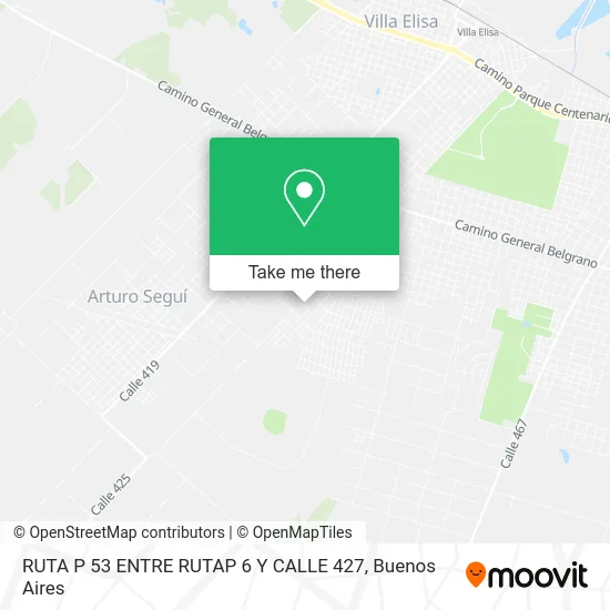
See RUTA P 53 ENTRE RUTAP 6 Y CALLE 427, La Plata, on the map
Public Transit to RUTA P 53 ENTRE RUTAP 6 Y CALLE 427 in La Plata
Wondering how to get to RUTA P 53 ENTRE RUTAP 6 Y CALLE 427 in La Plata? Moovit helps you find the best way to get to RUTA P 53 ENTRE RUTAP 6 Y CALLE 427 with step-by-step directions from the nearest public transit station.
Moovit provides free maps and live directions to help you navigate through your city. View schedules, routes, timetables, and find out how long does it take to get to RUTA P 53 ENTRE RUTAP 6 Y CALLE 427 in real time.
Looking for the nearest stop or station to RUTA P 53 ENTRE RUTAP 6 Y CALLE 427? Check out this list of stops closest to your destination: Calle 135 4040.
Colectivo: 273.
Want to see if there’s another route that gets you there at an earlier time? Moovit helps you find alternative routes or times. Get directions from and directions to RUTA P 53 ENTRE RUTAP 6 Y CALLE 427 easily from the Moovit App or Website.
We make riding to RUTA P 53 ENTRE RUTAP 6 Y CALLE 427 easy, which is why over 1.5 million users, including users in La Plata, trust Moovit as the best app for public transit. You don’t need to download an individual bus app or train app, Moovit is your all-in-one transit app that helps you find the best bus time or train time available.
For information on prices of Colectivo, costs and ride fares to RUTA P 53 ENTRE RUTAP 6 Y CALLE 427, please check the Moovit app.
Use the app to navigate to popular places including to the airport, hospital, stadium, grocery store, mall, coffee shop, school, college, and university.
Location: La Plata, Buenos Aires
- Calle 136,
- Calle 137 66,
- Calle 430,
- Calle 427,
- 435 e 136 y 137,
- 428 entre 133 y 134,
- 438 e 134 y 135,
- Calle 133 / Diagonal 430,
- Calle 427 3756,
- Calle 139 / Calle 433,
- Calle 137 610,
- 136 esquina 440 10,
- La Alicia Cenas Privadas,
- Calle 434 entre 139 y 140,
- Calle 434 / Calle 140,
- Calle 133 618,
- * 439 e 138 y 139,
- 132 421 y 423,
- Calle 440 / Calle 138,
- Calle 141 66
Places Near RUTA P 53 ENTRE RUTAP 6 Y CALLE 427 (La Plata)
- Avellaneda, Avellaneda,
- Jardín Japonés, Distrito Federal,
- Dot Baires Shopping, Vicente López,
- Tecnópolis, Vicente López,
- La Plata, La Plata,
- Aeroparque Jorge Newbery,
- Estadio Monumental (River Plate), Distrito Federal,
- CABA, Distrito Federal,
- Hospital Santa Lucia, Distrito Federal,
- Buenos Aires, Distrito Federal,
- Barrio Chino, Distrito Federal,
- Once, Distrito Federal,
- Parque de la Ciudad, Distrito Federal,
- Facultad de Odontología (UBA), Distrito Federal,
- Movistar Arena, Distrito Federal,
- Abasto Shopping, Distrito Federal,
- Aeropuerto Ezeiza, Distrito Federal,
- Flores, Distrito Federal,
- La Plata, La Plata,
- Unicenter Shopping, San Isidro
How to get to popular places in Buenos Aires with public transit
Get around La Plata by public transit!
Traveling around La Plata has never been so easy. See step by step directions as you travel to any attraction, street or major public transit station. View bus and train schedules, arrival times, service alerts and detailed routes on a map, so you know exactly how to get to anywhere in La Plata.
When traveling to any destination around La Plata use Moovit's Live Directions with Get Off Notifications to know exactly where and how far to walk, how long to wait for your line, and how many stops are left. Moovit will alert you when it's time to get off — no need to constantly re-check whether yours is the next stop.
Wondering how to use public transit in La Plata or how to pay for public transit in La Plata? Moovit public transit app can help you navigate your way with public transit easily, and at minimum cost. It includes public transit fees, ticket prices, and costs. Looking for a map of La Plata public transit lines? Moovit public transit app shows all public transit maps in La Plata with all Colectivo, Train, Subte, Light Rail and Ferry routes and stops on an interactive map.
Buenos Aires has 5 transit type(s), including: Colectivo, Train, Subte, Light Rail and Ferry, operated by several transit agencies, including Municipalidad Carmen de Areco, Trenes Argentinos, Ferrovías, Metrovías, Subte de Buenos Aires, Doscientos Ocho Transporte Automotor S.A., Empresa del Oeste, Empresa de Transportes Tratado del PIlar S.R.L., Transportes Veintidos de Septiembre, Sargento Cabral, Transportes Sesenta y Ocho, Transportes Quirno Costa, Transportes Santa Fe, Transportes Automotores Riachuelo and Transportes Atlantida