How to get to RVZ by bus?
Click on the bus route to see step by step directions with maps, line arrival times and updated time schedules.
From Hippodrome de Longchamp, Paris
66 minFrom Solidays, Paris
68 minFrom Havas Village, Puteaux
61 minFrom Bois-Colombes, Bois-Colombes
71 minFrom S.P.A, Gennevilliers
72 minFrom Primark, Creteil
84 minFrom Hôtel Novotel Paris 17, Paris
47 minFrom Cimetière Parisien de Thiais, Thiais
76 minFrom Avenue de Wagram, Paris
51 minFrom Musée de l'Homme, Paris
31 min
How to get to RVZ by metro?
Click on the metro route to see step by step directions with maps, line arrival times and updated time schedules.
Bus stops near RVZ in Paris
Bus lines to RVZ in Paris
What are the closest stations to RVZ?
The closest stations to RVZ are:
- Bastille - Faubourg Saint-Antoine is 31 meters away, 1 min walk.
- Bastille is 84 meters away, 2 min walk.
- Bastille - Roquette is 113 meters away, 2 min walk.
- Bastille - Beaumarchais is 283 meters away, 4 min walk.
- Sully - Morland is 848 meters away, 11 min walk.
Which metro lines stop near RVZ?
These metro lines stop near RVZ: 1, 8.
Which bus lines stop near RVZ?
These bus lines stop near RVZ: 56, 86, 87.
What’s the nearest metro station to RVZ in Paris?
The nearest metro station to RVZ in Paris is Bastille. It’s a 2 min walk away.
What’s the nearest bus station to RVZ in Paris?
The nearest bus station to RVZ in Paris is Bastille - Faubourg Saint-Antoine. It’s a 1 min walk away.
What time is the first metro to RVZ in Paris?
The 1 is the first metro that goes to RVZ in Paris. It stops nearby at 5:32 AM.
What time is the last metro to RVZ in Paris?
The 5 is the last metro that goes to RVZ in Paris. It stops nearby at 1:07 AM.
What time is the first bus to RVZ in Paris?
The N01 is the first bus that goes to RVZ in Paris. It stops nearby at 3:00 AM.
What time is the last bus to RVZ in Paris?
The N16 is the last bus that goes to RVZ in Paris. It stops nearby at 3:25 AM.
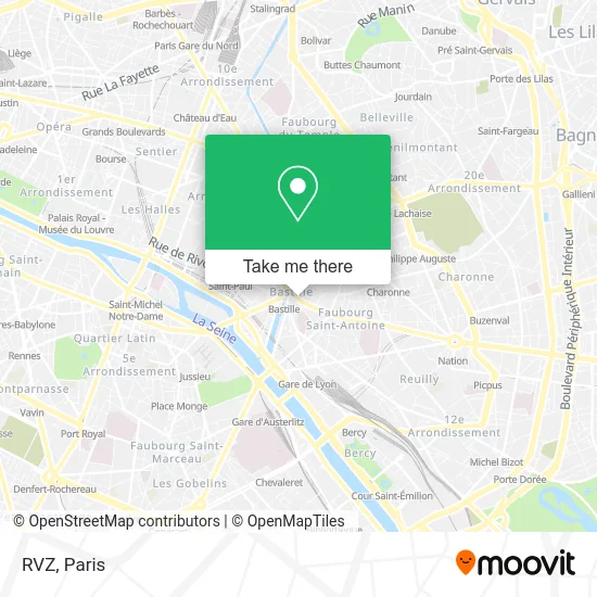
See RVZ, Paris, on the map
Public Transit to RVZ in Paris
Wondering how to get to RVZ in Paris? Moovit helps you find the best way to get to RVZ with step-by-step directions from the nearest public transit station.
Moovit provides free maps and live directions to help you navigate through your city. View schedules, routes, timetables, and find out how long does it take to get to RVZ in real time.
Looking for the nearest stop or station to RVZ? Check out this list of stops closest to your destination: Bastille - Faubourg Saint-Antoine; Bastille; Bastille - Roquette; Bastille - Beaumarchais; Sully - Morland.
Metro: 1, 8, 5, 7.Bus: 56, 86, 87, 76, 69, 29, 91, N02, N11, N01.
Want to see if there’s another route that gets you there at an earlier time? Moovit helps you find alternative routes or times. Get directions from and directions to RVZ easily from the Moovit App or Website.
We make riding to RVZ easy, which is why over 1.5 million users, including users in Paris, trust Moovit as the best app for public transit. You don’t need to download an individual bus app or train app, Moovit is your all-in-one transit app that helps you find the best bus time or train time available.
For information on prices of metro, bus, light rail, train and RER, costs and ride fares to RVZ, please check the Moovit app.
Use the app to navigate to popular places including to the airport, hospital, stadium, grocery store, mall, coffee shop, school, college, and university.
RVZ Address: 21 rue du Faubourg Saint-Antoine street in Paris
- Jordan Bastille,
- Jordan,
- G-Star RAW Store,
- Vans,
- M6 Boutique,
- Hub,
- Africa n°1,
- MK2 Bastille (Côté Saint-Antoine),
- 28 Bis Faubourg Saint-Antoine,
- Micromania,
- Sephora,
- André,
- Rue du Faubourg Saint-Antoine (Hopital Des Quinze-Vingts),
- Jean-paul Gaultier Sa,
- 120 Rue de Lyon,
- Amorino,
- Gare de la Bastille,
- Chevignon,
- Bastille Opera,
- Les Grandes Marches
Places Near RVZ (Paris)
- 29 Rue Manin, Paris,
- Théâtre Mogador, Paris,
- Hôpital Saint-Joseph, Paris,
- Hôpital de la Pitié-Salpêtrière, Paris,
- Centre Hospitalier des 15/20, Paris,
- Beaugrenelle, Paris,
- Galeries Lafayette, Paris,
- Hôpital Henri Mondor, Creteil,
- Fondation Louis Vuitton, Paris,
- Hôpital Necker, Paris,
- Hopital Lariboisière, Paris,
- Hopital Foch, Suresnes,
- Hôpital Beaujon, Clichy,
- Atelier Des Lumieres, Paris,
- Gare Routière Flixbus, Paris,
- Hôpital Cochin, Paris,
- Marché Saint-Pierre, Paris,
- Galeries Lafayette Haussmann, Paris,
- Créteil Soleil, Creteil,
- Hôpital Pitié Salpêtrière, Paris
How to get to popular places in Paris with public transit
Get around Paris by public transit!
Traveling around Paris has never been so easy. See step by step directions as you travel to any attraction, street or major public transit station. View bus and train schedules, arrival times, service alerts and detailed routes on a map, so you know exactly how to get to anywhere in Paris.
When traveling to any destination around Paris use Moovit's Live Directions with Get Off Notifications to know exactly where and how far to walk, how long to wait for your line, and how many stops are left. Moovit will alert you when it's time to get off — no need to constantly re-check whether yours is the next stop.
Wondering how to use public transit in Paris or how to pay for public transit in Paris? Moovit public transit app can help you navigate your way with public transit easily, and at minimum cost. It includes public transit fees, ticket prices, and costs. Looking for a map of Paris public transit lines? Moovit public transit app shows all public transit maps in Paris with all Bus, Train, Metro, Light Rail, RER, Funicular and Gondola routes and stops on an interactive map.
Paris has 7 transit type(s), including: Bus, Train, Metro, Light Rail, RER, Funicular and Gondola, operated by several transit agencies, including RATP, RER, RER Bus de remplacement, Train, Train Bus de remplacement, Tramway Bus de remplacement, TER, ADP, Magical Shuttle, Argenteuil - Boucles de Seine, Autocars Dominique, Bièvre, Brie et 2 Morin, Le Bus - C.C. du Clermontois and Cœur d’Essonne