How to get to RX for Imaging by bus?
Click on the bus route to see step by step directions with maps, line arrival times and updated time schedules.
From Del Prado & Hancock Bridge, Cape Coral
36 minFrom Maya Travel Maya Express, Cape Coral
31 minFrom Cat Cay Lake, Cape Coral
44 minFrom U.S.-41 / Colonial Blvd. Intersection, Fort Myers
36 minFrom Nolan Family Insurance, Fort Myers
55 minFrom Mary Neilson, Cape Coral
36 minFrom Edison Mall, Fort Myers
38 minFrom Journeys Kidz, Fort Myers
37 minFrom Cynthia's Hair Palace, Fort Myers
55 min
Bus stops near RX for Imaging in Cape Coral
Bus lines to RX for Imaging in Cape Coral
What are the closest stations to RX for Imaging?
The closest stations to RX for Imaging are:
- 47 Ter @ SE 6th Ave-Eb is 159 yards away, 2 min walk.
- Cc Pwky @ Palm Tree Dr is 262 yards away, 4 min walk.
Which bus lines stop near RX for Imaging?
These bus lines stop near RX for Imaging: 120, 30, 40, 70.
What’s the nearest bus station to RX for Imaging in Cape Coral?
The nearest bus station to RX for Imaging in Cape Coral is 47 Ter @ SE 6th Ave-Eb. It’s a 2 min walk away.
What time is the first bus to RX for Imaging in Cape Coral?
The 40 is the first bus that goes to RX for Imaging in Cape Coral. It stops nearby at 5:45 AM.
What time is the last bus to RX for Imaging in Cape Coral?
The 30 is the last bus that goes to RX for Imaging in Cape Coral. It stops nearby at 9:12 PM.
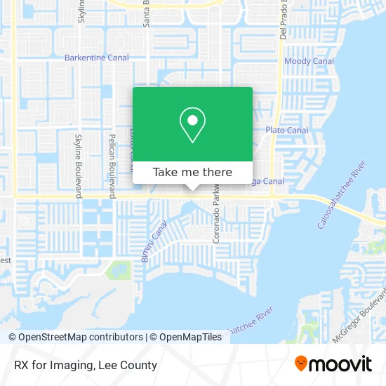
See RX for Imaging, Cape Coral, on the map
Public Transit to RX for Imaging in Cape Coral
Wondering how to get to RX for Imaging in Cape Coral? Moovit helps you find the best way to get to RX for Imaging with step-by-step directions from the nearest public transit station.
Moovit provides free maps and live directions to help you navigate through your city. View schedules, routes, timetables, and find out how long does it take to get to RX for Imaging in real time.
Looking for the nearest stop or station to RX for Imaging? Check out this list of stops closest to your destination: 47 Ter @ SE 6th Ave-Eb; Cc Pwky @ Palm Tree Dr.
Bus: 120, 30, 40, 70.
Want to see if there’s another route that gets you there at an earlier time? Moovit helps you find alternative routes or times. Get directions from and directions to RX for Imaging easily from the Moovit App or Website.
We make riding to RX for Imaging easy, which is why over 1.5 million users, including users in Cape Coral, trust Moovit as the best app for public transit. You don’t need to download an individual bus app or train app, Moovit is your all-in-one transit app that helps you find the best bus time or train time available.
For information on prices of bus, costs and ride fares to RX for Imaging, please check the Moovit app.
Use the app to navigate to popular places including to the airport, hospital, stadium, grocery store, mall, coffee shop, school, college, and university.
RX for Imaging Address: 506 SE 47th Ter Cape Coral, FL 33904 street in Cape Coral
- Amanda M Bradbury Pa - Lee Physician Group,
- First Horizon Bank,
- Safeway Water of Southwest Florida,
- Four Freedoms Park,
- Windsor Properties Co of Florida,
- Artisan Bread Two,
- 319 Cape Coral Parkway East,
- Rolando Ruz,
- ATM Home Improvement / Elite Home Improvement,
- Beverly Mesch Acupuncture Physician,
- Russ Whitney Real Estate,
- Domenico Laviano,
- Acmaxtech,
- Liquor Store,
- Cape Coral Fire Station 1,
- One Way Roofing and Remodeling,
- Pizza Parma,
- Christopher Alan Homes,
- Raabery Ink Society,
- Uplay Kids
Places Near RX for Imaging (Cape Coral)
- Pelican Landing Beach Shuttle, Bonita Springs,
- Lee County Tax Collector, Cape Coral,
- Bonita Springs, FL, Bonita Springs,
- All About U Naples Escorts, Pine Ridge,
- Bonita Beach, Bonita Springs,
- Ft Myers Airport RSW,
- US-41, Fort Myers,
- Lehigh Acres, FL, Lehigh Acres,
- Rosa Parks Transportation Center, Fort Myers,
- Miromar Outlets, Estero,
- I-75 & MLK (Exit 138), Fort Myers,
- Seminole Casino Hotel Immokalee,
- Amazon Warehouse Rsw5,
- Edison Mall, Fort Myers,
- Matlacha Nude Beach, Matlacha Isles-Matlacha Shores,
- U.S.-41 / Colonial Blvd. Intersection, Fort Myers,
- I-75 & Colonial (Exit 136), Fort Myers,
- Walmart Supercenter, Fort Myers,
- Flixbus, Fort Myers,
- Bonita Bay Private Beach Club, Bonita Springs
How to get to popular places in Lee County with public transit
Get around Cape Coral by public transit!
Traveling around Cape Coral has never been so easy. See step by step directions as you travel to any attraction, street or major public transit station. View bus and train schedules, arrival times, service alerts and detailed routes on a map, so you know exactly how to get to anywhere in Cape Coral.
When traveling to any destination around Cape Coral use Moovit's Live Directions with Get Off Notifications to know exactly where and how far to walk, how long to wait for your line, and how many stops are left. Moovit will alert you when it's time to get off — no need to constantly re-check whether yours is the next stop.
Wondering how to use public transit in Cape Coral or how to pay for public transit in Cape Coral? Moovit public transit app can help you navigate your way with public transit easily, and at minimum cost. It includes public transit fees, ticket prices, and costs. Looking for a map of Cape Coral public transit lines? Moovit public transit app shows all public transit maps in Cape Coral with all bus routes and stops on an interactive map.
Lee County has 1 transit type(s), including: bus, operated by several transit agencies, including LeeTran, CAT and FlixBus-us