How to get to R.A.D Fabrication by bus?
Click on the bus route to see step by step directions with maps, line arrival times and updated time schedules.
From Imilestones, Indianapolis City (Balance)
39 minFrom Elegance Salon de Eventos & Decoracion, Indianapolis City (Balance)
41 minFrom I 70 East, Indianapolis City (Balance)
45 minFrom Irvington Halloween Festival, Indianapolis City (Balance)
23 minFrom Speedway High School, Speedway
55 minFrom College Avenue & 54th Street, Indianapolis City (Balance)
47 minFrom Old Bethel Preschool, Indianapolis City (Balance)
53 minFrom S Arlington Ave / Brookville Rd, Indianapolis City (Balance)
50 minFrom West Michigan Street veterinary clinic, Indianapolis City (Balance)
43 min
Bus stops near R.A.D Fabrication in Indianapolis City (Balance)
Bus lines to R.A.D Fabrication in Indianapolis City (Balance)
What are the closest stations to R.A.D Fabrication?
The closest stations to R.A.D Fabrication are:
- Massachusetts Ave & East St is 31 yards away, 1 min walk.
- New York St & College Ave is 51 yards away, 1 min walk.
Which bus lines stop near R.A.D Fabrication?
These bus lines stop near R.A.D Fabrication: 21, 25, 3, 8.
What’s the nearest bus station to R.A.D Fabrication in Indianapolis City (Balance)?
The nearest bus stations to R.A.D Fabrication in Indianapolis City (Balance) are Massachusetts Ave & East St and New York St & College Ave. The closest one is a 1 min walk away.
What time is the first bus to R.A.D Fabrication in Indianapolis City (Balance)?
The 21 is the first bus that goes to R.A.D Fabrication in Indianapolis City (Balance). It stops nearby at 5:26 AM.
What time is the last bus to R.A.D Fabrication in Indianapolis City (Balance)?
The 21 is the last bus that goes to R.A.D Fabrication in Indianapolis City (Balance). It stops nearby at 9:36 PM.
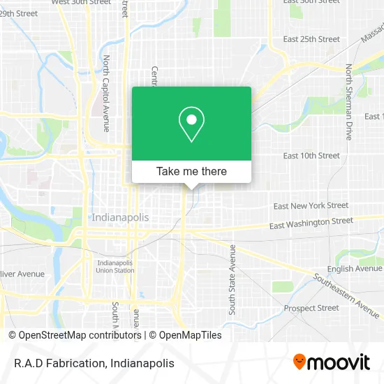
See R.A.D Fabrication, Indianapolis City (Balance), on the map
Public Transit to R.A.D Fabrication in Indianapolis City (Balance)
Wondering how to get to R.A.D Fabrication in Indianapolis City (Balance)? Moovit helps you find the best way to get to R.A.D Fabrication with step-by-step directions from the nearest public transit station.
Moovit provides free maps and live directions to help you navigate through your city. View schedules, routes, timetables, and find out how long does it take to get to R.A.D Fabrication in real time.
Looking for the nearest stop or station to R.A.D Fabrication? Check out this list of stops closest to your destination: Massachusetts Ave & East St; New York St & College Ave.
Bus: 21, 25, 3, 8.
Want to see if there’s another route that gets you there at an earlier time? Moovit helps you find alternative routes or times. Get directions from and directions to R.A.D Fabrication easily from the Moovit App or Website.
We make riding to R.A.D Fabrication easy, which is why over 1.5 million users, including users in Indianapolis City (Balance), trust Moovit as the best app for public transit. You don’t need to download an individual bus app or train app, Moovit is your all-in-one transit app that helps you find the best bus time or train time available.
For information on prices of bus, costs and ride fares to R.A.D Fabrication, please check the Moovit app.
Use the app to navigate to popular places including to the airport, hospital, stadium, grocery store, mall, coffee shop, school, college, and university.
R.A.D Fabrication Address: 940 E Michigan St street in Indianapolis City (Balance)
- Homeless & Reentry Helpers,
- Helpers Helping Others Outreach Team,
- Reclaimed Vintage Industrial,
- Timewarp Pop,
- Jimenez MR.Discount,
- Popeye's Indianapolis,
- Corinthian Baptist Church,
- Bike People,
- First Rate Electric,
- USPS Collection Box - Blue Box,
- Luxcity Realty,
- Auto-Medic,
- Hair by Kellyn,
- Therefinerymedspaindy,
- Hair by Chelsea Spack,
- Smoking Goose Meatery,
- Inner Sol Esthetics,
- Lauren.Burnside,
- Keo Siêu Dính - Ngọc Linh 73,
- Foundry
Places Near R.A.D Fabrication (Indianapolis City (Balance))
- St. Vincent entrance #1, Indianapolis City (Balance),
- Lilly Corporate Center (Eli Lilly & Co), Indianapolis City (Balance),
- Eskenazi Hospital, Indianapolis City (Balance),
- Indiana Convention Center, Indianapolis City (Balance),
- Cotter's Massage Parlor With Happy Endings, Indianapolis City (Balance),
- Lucas Oil Stadium, Indianapolis City (Balance),
- St. Vincent Hospital - Indianapolis, Indianapolis City (Balance),
- I-465 / I-65 Interchange, Indianapolis City (Balance),
- Jersey Barn, Indianapolis City (Balance),
- Indiana, Indianapolis City (Balance),
- 119 W 19th St Parking, Indianapolis City (Balance),
- Methodist Hospital of Indianapolis, Indianapolis City (Balance),
- Indianapolis Motor Speedway, Speedway,
- Castleton Square Mall, Indianapolis,
- Train Ride At Castleton Mall, Indianapolis City (Balance),
- THE BALT, Indianapolis City (Balance),
- Plainfield, IN, Plainfield,
- I U Health Methodist Hospital, Indianapolis City (Balance),
- Indianapolis Airport Zone 2, Indianapolis City (Balance),
- Gainbridge Fieldhouse, Indianapolis City (Balance)
How to get to popular places in Indianapolis with public transit
Get around Indianapolis City (Balance) by public transit!
Traveling around Indianapolis City (Balance) has never been so easy. See step by step directions as you travel to any attraction, street or major public transit station. View bus and train schedules, arrival times, service alerts and detailed routes on a map, so you know exactly how to get to anywhere in Indianapolis City (Balance).
When traveling to any destination around Indianapolis City (Balance) use Moovit's Live Directions with Get Off Notifications to know exactly where and how far to walk, how long to wait for your line, and how many stops are left. Moovit will alert you when it's time to get off — no need to constantly re-check whether yours is the next stop.
Wondering how to use public transit in Indianapolis City (Balance) or how to pay for public transit in Indianapolis City (Balance)? Moovit public transit app can help you navigate your way with public transit easily, and at minimum cost. It includes public transit fees, ticket prices, and costs. Looking for a map of Indianapolis City (Balance) public transit lines? Moovit public transit app shows all public transit maps in Indianapolis City (Balance) with all bus routes and stops on an interactive map.
Indianapolis has 1 transit type(s), including: bus, operated by several transit agencies, including IndyGo, FlixBus-us and Greyhound-us