Directions to R.A.P (Botafogo) with public transportation
The following transit lines have routes that pass near R.A.P
 Bus: 2740D (EXECUTIVO), 455, 457, 483, 740D.
- Metro: L1, L4, L2.
- Gondola: BONDINHO (LINHA TURÍSTICA).
How to get to R.A.P by bus?
Click on the bus route to see step by step directions with maps, line arrival times and updated time schedules.
From Av. Pres. Vargas 1997, Centro
25 minFrom Consulado Americano no Rio de Janeiro, Centro
16 minFrom Benfica, Benfica
34 minFrom Santa Rosa, Niterói
68 minFrom Hospital Estadual Anchieta, Caju
34 minFrom Central do Brasil, Centro
27 minFrom niterói x itaipuaçu Viação Nossa Senhora Do Amparo, Niterói
45 minFrom Setor Leste, Maracanã
32 minFrom SENAC Riachuelo, Sampaio
43 min
How to get to R.A.P by metro?
Click on the metro route to see step by step directions with maps, line arrival times and updated time schedules.
Bus stops near R.A.P in Botafogo
- Shopping Riosul, 3 min walk,VIEW
- Casa & Gourmet Shopping | Shopping Riosul, 4 min walk,VIEW
- BRS 3 I - Avenida Lauro Sodre | Shopping Rio Sul, 4 min walk,VIEW
- UFRJ - Praia Vermelha (Linhas Via Botafogo), 4 min walk,VIEW
- UFRJ - Praia Vermelha, 5 min walk,VIEW
- Rio Sul - Free Bus, 6 min walk,VIEW
- Escola Eleva - Botafogo, 9 min walk,VIEW
Metro station near R.A.P in Botafogo
- Botafogo, 18 min walk,VIEW
Gondola station near R.A.P in Botafogo
- Praia Vermelha, 17 min walk,VIEW
Bus lines to R.A.P in Botafogo
- 513, Metrô Botafogo,VIEW
- 169, Terminal Gentileza - General Osório (BRS 1 - via Aterro),VIEW
- 415, Usina - Leblon (Brs 2 - Via Aterro / Lagoa),VIEW
- SN 415, Usina - Leblon (BRS 2 - via Lapa / Praia do Flamengo),VIEW
- 455, Méier - Copacabana (Brs 3 - Via Central / Rio Sul),VIEW
- SV 474, Jacaré - Copacabana (Brs 2 - Via Túnel Marcello Alencar),VIEW
- 483, Penha - Ipanema (Brs 3 - Via Bonsucesso / Expressa / Aterro),VIEW
- SN 483, Penha - Ipanema (Brs 3 - Via Central / Praia do Flamengo),VIEW
- SPA 483, Fiocruz - Ipanema (Brs 3 - Via Expressa / Aterro),VIEW
- SPB 483, Ramos - Ipanema (Brs 3 - Via Expressa / Aterro),VIEW
- 484, Olaria - Ipanema (Brs 3 - Via Av. Brasil / Central / Aterro),VIEW
- 492, Bancários - Prado Junior (Via Linha Vermelha),VIEW
- 536, LECD138 - São Conrado - Leme (via Rocinha / Metrô Botafogo),VIEW
- 100 - TRO1, Troncal 1 - Central - General Osório (Brs 1 - Via Copacabana),VIEW
- 2334, Campo Grande - Castelo (Brs 3 - Via Recreio / Copacabana),VIEW
- 2335, Santa Cruz - Castelo (Brs 3 - Via Pedra / Barra),VIEW
- 2337, Santa Cruz - Castelo (Brs 3 - Via Sepetiba / Barra),VIEW
- 2338, Campo Grande - Castelo (Brs 3 - Via Recreio / Copacabana),VIEW
- 456, Norte Shopping,VIEW
- 457, Copacabana,VIEW
What are the closest stations to R.A.P?
The closest stations to R.A.P are:
- Shopping Riosul is 131 meters away, 3 min walk.
- Casa & Gourmet Shopping | Shopping Riosul is 180 meters away, 4 min walk.
- BRS 3 I - Avenida Lauro Sodre | Shopping Rio Sul is 189 meters away, 4 min walk.
- UFRJ - Praia Vermelha (Linhas Via Botafogo) is 241 meters away, 4 min walk.
- UFRJ - Praia Vermelha is 258 meters away, 5 min walk.
- Rio Sul - Free Bus is 332 meters away, 6 min walk.
- Escola Eleva - Botafogo is 583 meters away, 9 min walk.
- Botafogo is 1257 meters away, 18 min walk.
- Praia Vermelha is 1259 meters away, 17 min walk.
Which bus lines stop near R.A.P?
These bus lines stop near R.A.P: 2740D (EXECUTIVO), 455, 457, 483, 740D, SPB 483.
Which metro lines stop near R.A.P?
These metro lines stop near R.A.P: L1, L4, L2.
What’s the nearest metro station to R.A.P in Botafogo?
The nearest metro station to R.A.P in Botafogo is Botafogo. It’s a 18 min walk away.
What’s the nearest bus station to R.A.P in Botafogo?
The nearest bus station to R.A.P in Botafogo is Shopping Riosul. It’s a 3 min walk away.
What’s the nearest gondola station to R.A.P in Botafogo?
The nearest gondola station to R.A.P in Botafogo is Praia Vermelha. It’s a 17 min walk away.
What time is the first metro to R.A.P in Botafogo?
The L2 is the first metro that goes to R.A.P in Botafogo. It stops nearby at 5:00 AM.
What time is the last metro to R.A.P in Botafogo?
The L2 is the last metro that goes to R.A.P in Botafogo. It stops nearby at 12:51 AM.
What time is the first bus to R.A.P in Botafogo?
The SN 538 is the first bus that goes to R.A.P in Botafogo. It stops nearby at 3:00 AM.
What time is the last bus to R.A.P in Botafogo?
The SN 554 is the last bus that goes to R.A.P in Botafogo. It stops nearby at 3:54 AM.
What time is the first gondola to R.A.P in Botafogo?
The BONDINHO (LINHA TURÍSTICA) is the first gondola that goes to R.A.P in Botafogo. It stops nearby at 8:20 AM.
What time is the last gondola to R.A.P in Botafogo?
The BONDINHO (LINHA TURÍSTICA) is the last gondola that goes to R.A.P in Botafogo. It stops nearby at 9:01 PM.
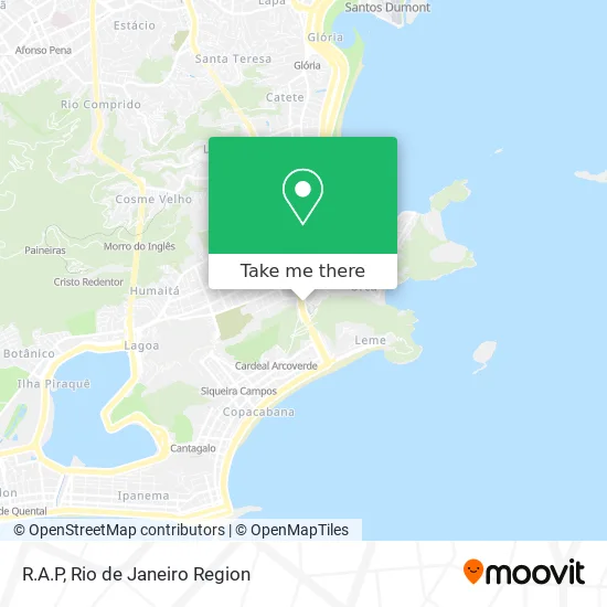
See R.A.P, Botafogo, on the map
Public Transit to R.A.P in Botafogo
Wondering how to get to R.A.P in Botafogo? Moovit helps you find the best way to get to R.A.P with step-by-step directions from the nearest public transit station.
Moovit provides free maps and live directions to help you navigate through your city. View schedules, routes, timetables, and find out how long does it take to get to R.A.P in real time.
Looking for the nearest stop or station to R.A.P? Check out this list of stops closest to your destination: Shopping Riosul; Casa & Gourmet Shopping | Shopping Riosul; BRS 3 I - Avenida Lauro Sodre | Shopping Rio Sul; UFRJ - Praia Vermelha (Linhas Via Botafogo); UFRJ - Praia Vermelha; Rio Sul - Free Bus; Escola Eleva - Botafogo; Botafogo; Praia Vermelha.
Bus: 2740D (EXECUTIVO), 455, 457, 483, 740D, SPB 483, 513, 169, 415, SN 415, SV 474, 456, SN 457, SV 483, 485, 104, 167, 426, 472, 474.Metro: L1, L4, L2.Gondola: BONDINHO (LINHA TURÍSTICA).
Want to see if there’s another route that gets you there at an earlier time? Moovit helps you find alternative routes or times. Get directions from and directions to R.A.P easily from the Moovit App or Website.
We make riding to R.A.P easy, which is why over 1.5 million users, including users in Botafogo, trust Moovit as the best app for public transit. You don’t need to download an individual bus app or train app, Moovit is your all-in-one transit app that helps you find the best bus time or train time available.
For information on prices of bus and metro, costs and ride fares to R.A.P, please check the Moovit app.
Use the app to navigate to popular places including to the airport, hospital, stadium, grocery store, mall, coffee shop, school, college, and university.
R.A.P Address: Avenida Lauro Sodré, 445 Botafogo Rio de Janeiro-RJ 22290-070 street in Botafogo
- Vitagel - Farmacia De Manipulacao,
- Funbuffet Restaurante,
- Linha 472 - Triagem / Leme,
- Brs 3, I - Avenida Lauro Sodre,
- Lauro Muller,
- Avenida Lauro Sodré / Rua Lauro Müller,
- Brs 2 - Avenida Venceslau Braz Próximo ao 119,
- Primeira Classe Rock in Rio - Avenida Lauro Sodré. em frente à entrada do Shopping Rio Sul,
- Rua Lauro Müller 116,
- Ponto de Taxi AMAST,
- Shopping Rio Sul (Loja Ellus Shopping Rio Sul),
- Shopping Rio Sul (Fom Rio Sul),
- Avenida Lauro Sodré 445,
- Avenida Carlos Peixoto,
- UFRJ,
- Avenida Venceslau Braz 65,
- Casa & Video,
- Rua General Góis Monteiro / Passagem Paulo Barreto Lopes Lima,
- Botafogo in Urca,
- Tutto Bianco
Places Near R.A.P (Botafogo)
- Rio De Janeiro,
- Hospital Federal Do Andaraí, Andaraí,
- Avenida Rio Branco, Centro,
- Hospital Pedro Ernesto, Vila Isabel,
- Hospital Federal Cardoso Fontes, Jacarepaguá,
- Hospital Municipal Ronaldo Gazolla, Acari,
- Rodoviária Novo Rio (Rodoviária do Rio de Janeiro), Santo Cristo,
- Feira Livre da Gloria, Glória,
- Feirão De Malhas, Duque De Caxias,
- Niterói, Niterói,
- Praia do Arpoador, Ipanema,
- Rua Ulysses Guimarães 16, Cidade Nova,
- Avenida Venezuela 134, Saúde,
- Rua Licínio Cardoso, São Francisco Xavier,
- Norte Shopping, Cachambi,
- Museu Do Amanhã, Centro,
- Shopping Rio Sul, Botafogo,
- Shopping Nova América, Del Castilho,
- Shopping RioSul, Botafogo,
- Shopping Downtown, Barra Da Tijuca
How to get to popular places in Rio de Janeiro Region with public transit
Get around Botafogo by public transit!
Traveling around Botafogo has never been so easy. See step by step directions as you travel to any attraction, street or major public transit station. View bus and train schedules, arrival times, service alerts and detailed routes on a map, so you know exactly how to get to anywhere in Botafogo.
When traveling to any destination around Botafogo use Moovit's Live Directions with Get Off Notifications to know exactly where and how far to walk, how long to wait for your line, and how many stops are left. Moovit will alert you when it's time to get off — no need to constantly re-check whether yours is the next stop.
Wondering how to use public transit in Botafogo or how to pay for public transit in Botafogo? Moovit public transit app can help you navigate your way with public transit easily, and at minimum cost. It includes public transit fees, ticket prices, and costs. Looking for a map of Botafogo public transit lines? Moovit public transit app shows all public transit maps in Botafogo with all Bus, Train, Metro, Light Rail, Ferry, Cable Car, Gondola and Funicular routes and stops on an interactive map.
Rio de Janeiro Region has 8 transit type(s), including: Bus, Train, Metro, Light Rail, Ferry, Cable Car, Gondola and Funicular, operated by several transit agencies, including TrensRJ, Metrô Rio, VLT Carioca, Barcas Rio, BRT MOBI-Rio, Auto Viação Alpha, Auto Viação Tijuca, Gire Transportes, Transurb, Viação Nossa Senhora das Graças, Consórcio INTERSUL, Braso Lisboa (Municipal), Caprichosa Auto Ônibus, Auto Viação Três Amigos and Rodoviária Âncora Matias
Public transit lines with stations closest to R.A.P in Botafogo
Metro lines with stations closest to R.A.P in Botafogo
Bus lines with stations closest to R.A.P in Botafogo
BRS 3 I - Avenida Lauro Sodre | Shopping Rio Sul
- 456LECD132 - Norte Shopping - Copacabana (Brs 3 - via Vila Isabel / Estácio / Santa Bárbara)
- 457Abolição - Copacabana (Brs 3 - Via Túnel Santa Bárbara)
- SN 457Abolição - Copacabana (Brs 3 - Via Central/Lapa/Laranjeiras)
- SV 483Penha - Ipanema (Brs 3 - Via Aterro / Via Expressa / Parque União)
- 485Fundão - Ipanema (Brs 3 - Via Linha Vermelha)
UFRJ - Praia Vermelha (Linhas Via Botafogo)
- 104Terminal Gentileza - São Conrado (Brs 1 - Via Copacabana / Niemeyer)
- 167Terminal Gentileza - Urca (Circular - Via Praia do Flamengo)
- 426Usina - Jardim de Alah (Brs 2 - Via Rio Comprido / Túnel Santa Bárbara)
- 472Triagem - Leme (Brs 2 - Via Central / Rio Sul)
- 474Jacaré - Copacabana (Brs 2 - Via Túnel Santa Bárbara)