R. Abraham Lincoln, 216 stop - Wednesday schedule
| Line | Direction | Time |
|---|---|---|
| 958P-10 | Vl. Olímpia | 5:12 AM |
| 8062-10 | Lapa | 5:22 AM |
| 958P-10 | Vl. Olímpia | 5:38 AM |
| 8002-10 | Term. Pirituba | 5:55 AM |
| 958P-10 | Vl. Olímpia | 5:58 AM |
| 958P-10 | Vl. Olímpia | 6:18 AM |
| 8062-10 | Lapa | 6:22 AM |
| 8002-10 | Term. Pirituba | 6:25 AM |
| 958P-10 | Vl. Olímpia | 6:38 AM |
| 8002-10 | Term. Pirituba | 6:55 AM |
| 958P-10 | Vl. Olímpia | 6:58 AM |
| 958P-10 | Vl. Olímpia | 7:30 AM |
| 8002-10 | Term. Pirituba | 7:32 AM |
| 8062-10 | Lapa | 7:49 AM |
| 8002-10 | Term. Pirituba | 7:57 AM |
| 958P-10 | Vl. Olímpia | 7:59 AM |
| 8002-10 | Term. Pirituba | 8:32 AM |
| 958P-10 | Vl. Olímpia | 8:39 AM |
| 8002-10 | Term. Pirituba | 9:02 AM |
| 8062-10 | Lapa | 9:29 AM |
| 8002-10 | Term. Pirituba | 9:32 AM |
| 958P-10 | Vl. Olímpia | 9:34 AM |
| 8002-10 | Term. Pirituba | 10:06 AM |
| 958P-10 | Vl. Olímpia | 10:28 AM |
| 8002-10 | Term. Pirituba | 10:47 AM |
Directions to R. Abraham Lincoln, 216 stop (São Domingos) with public transit
The following transit lines have routes that pass near R. Abraham Lincoln, 216
 Bus: 053, 399, 8002-10, 8055-10, 958P-10.
- Train: LINHA 8, LINHA 7.
How to get to R. Abraham Lincoln, 216 stop by bus?
Click on the bus route to see step by step directions with maps, line arrival times and updated time schedules.
How to get to R. Abraham Lincoln, 216 stop by train?
Click on the train route to see step by step directions with maps, line arrival times and updated time schedules.
Bus stops near R. Abraham Lincoln, 216 stop in São Domingos
- Rua Abraham Lincoln, 317, 1 min walk,
- R. Abraham Lincoln, 116, 3 min walk,
- Rua Inácio Luís da Costa, 6 min walk,
- R. Inácio Luís da Costa, 1888 - Parque Sao Domingos, São Paulo, 7 min walk,
- Avenida Alexandre Colares, 15 min walk,
Train stations near R. Abraham Lincoln, 216 station in São Domingos
- Pirituba, 38 min walk,
- Imperatriz Leopoldina, 54 min walk,
Bus lines to R. Abraham Lincoln, 216 stop in São Domingos
- 958P-10, Vl. Olímpia,
- 8002-10, Term. Pirituba,
- 8062-10, Lapa,
- 119L-10, Vila Sulina - Terminal Lapa,
- N136-11, Terminal Lapa - Morro Doce (Circular),
- 8004-10, Habitacional Turística - Terminal Lapa,
- 8013-10, Terminal Jardim Britania - Lapa,
- 8040-10, Sol Nascente - Terminal Lapa,
- 8047-10, Jaraguá - Lapa,
- 8050-10, Parque Morro Doce - Lapa,
- 8050-31, Parque Morro Doce - Lapa,
- 8055-51, Perus - Metrô Barra Funda,
- 8686-21, Terminal Lapa - Mangalot,
- 053, Sao Paulo (Lapa) - Barueri (Parque Imperial),
- 054, Cajamar (Jordanesia) - Sao Paulo (Lapa),
- 055, Cajamar (Cte - Vila Nova) - Sao Paulo (Lapa),
- 113, Osasco (Jardim Santa Fe) - Sao Paulo (Lapa),
- 198, Caieiras (Laranjeiras) - Sao Paulo (Lapa),
- 229, Osasco (Jardim Acucara) - Sao Paulo (Lapa),
- 231, Osasco (Jardim Elvira) - Sao Paulo (Metro Armenia),
What are the closest stations to R. Abraham Lincoln, 216?
The closest stations to R. Abraham Lincoln, 216 are:
- Rua Abraham Lincoln, 317 stop is 28 meters away, 1 min walk.
- R. Abraham Lincoln, 116 stop is 179 meters away, 3 min walk.
- Rua Inácio Luís da Costa stop is 465 meters away, 6 min walk.
- R. Inácio Luís da Costa, 1888 - Parque Sao Domingos, São Paulo stop is 507 meters away, 7 min walk.
- Avenida Alexandre Colares stop is 1125 meters away, 15 min walk.
- Pirituba station is 2922 meters away, 38 min walk.
- Imperatriz Leopoldina station is 4238 meters away, 54 min walk.
Which bus lines stop near R. Abraham Lincoln, 216?
These bus lines stop near R. Abraham Lincoln, 216: 053, 399, 8002-10, 8055-10, 958P-10.
Which train line stops near R. Abraham Lincoln, 216?
LINHA 8 (Itapevi)
What’s the nearest bus station to R. Abraham Lincoln, 216 in São Domingos?
The nearest bus station to R. Abraham Lincoln, 216 in São Domingos is Rua Abraham Lincoln, 317. It’s a 1 min walk away.
What time is the first train to R. Abraham Lincoln, 216 in São Domingos?
The LINHA 8 is the first train that goes to R. Abraham Lincoln, 216 in São Domingos. It stops nearby at 4:09 AM.
What time is the last train to R. Abraham Lincoln, 216 in São Domingos?
The LINHA 7 is the last train that goes to R. Abraham Lincoln, 216 in São Domingos. It stops nearby at 12:53 AM.
What time is the first bus to R. Abraham Lincoln, 216 in São Domingos?
The N136-11 is the first bus that goes to R. Abraham Lincoln, 216 in São Domingos. It stops nearby at 4:06 AM.
What time is the last bus to R. Abraham Lincoln, 216 in São Domingos?
The N136-11 is the last bus that goes to R. Abraham Lincoln, 216 in São Domingos. It stops nearby at 4:06 AM.
R. Abraham Lincoln, 216 station
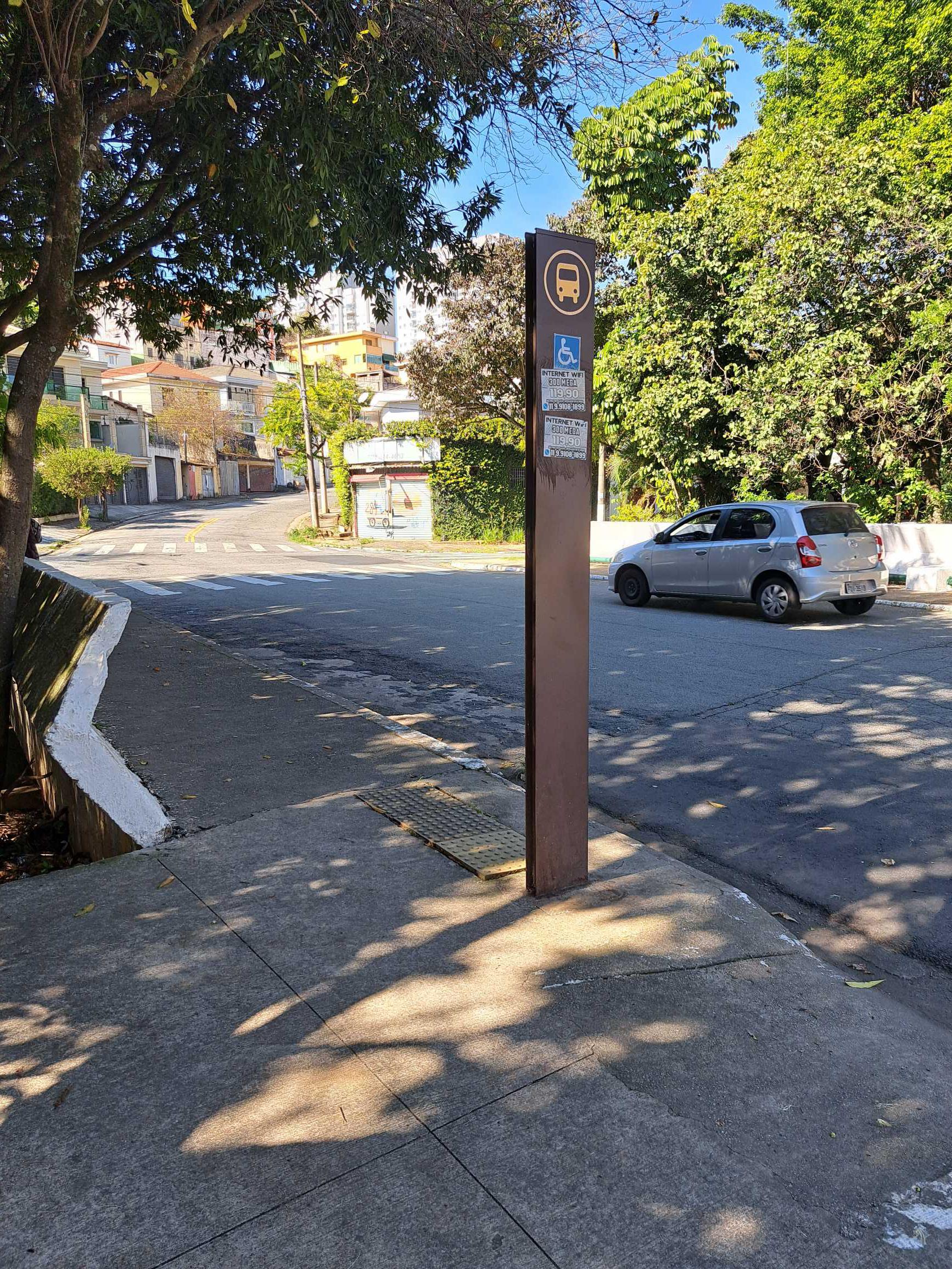 Taken by Fernando S.
See R. Abraham Lincoln, 216 stop, São Domingos, on the map
Public transit to R. Abraham Lincoln, 216 stop in São Domingos
Looking for directions to R. Abraham Lincoln, 216 in São Domingos, Brazil?
Download the Moovit App to find the current schedule and step-by-step directions for Bus or Train routes that pass through R. Abraham Lincoln, 216.
Looking for the nearest stops closest to R. Abraham Lincoln, 216 ? Check out this list of closest stops to your destination: Rua Abraham Lincoln; R. Abraham Lincoln; Rua Inácio Luís da Costa; R. Inácio Luís da Costa; Avenida Alexandre Colares; Pirituba; Imperatriz Leopoldina.
Bus: 053, 399, 8002-10, 8055-10, 958P-10, 8062-10, 119L-10, N136-11, 8004-10, 8013-10, 8040-10, 8043-10, 8622-10, 8677-10, 8686-10.Train: LINHA 8, LINHA 7.
We make riding on public transit to R. Abraham Lincoln, 216 easy, which is why over 1.7 billion users, including users in São Domingos trust Moovit as the best app for public transit.
Use the app to navigate to popular places including to the airport, hospital, stadium, grocery store, mall, coffee shop, school, college, and university.
The first line to this stop is 958P-10, at 5:12 AM, and the last line is 8002-10 at 1:34 AM.
Rua General Charles de Gaulle, São Paulo, Brazil
This stop serves SPTrans’s lines
- Rua Abraham Lincoln, 317,
- R. Abraham Lincoln, 116,
- Rua Inácio Luís da Costa,
- R. Inácio Luís da Costa, 1888 - Parque Sao Domingos, São Paulo,
- Avenida Alexandre Colares
Bus stops near R. Abraham Lincoln, 216 stop
- Pirituba,
- Imperatriz Leopoldina
Train stations near R. Abraham Lincoln, 216 station
- Avenida Hilário Pereira De Souza, 492,
- Av. Sumaré, 73,
- Avenida Nordestina, 4704,
- Rua Ibitirama 197,
- Avenida General Pedro Pinho 1540,
- Rua Brigadeiro Gavião Peixoto 213,
- Av. dos Nacionalistas, 920,
- Av. Coca,
- Rua Brigadeiro Tobias, 780,
- Estrada Marechal Tomoki Hiramoto (Sitio Tirulim),
- Av. Aguiar da Beira, 917,
- Br-116 Rod. Régis Bittencourt, Km 294 Norte,
- Av. Interlagos, 3501,
- Paraíso,
- Avenida dos Autonomistas 3752,
- Rod. Raposo Tavares - Km 31,
- Av. Eliseu de Almeida, 3150,
- Ponto Final Cidade São Pedro (Linha 850,860),
- Parada Terminal Grande Alvarenga,
- R. Clodomiro Amazonas, 1291
Popular public transit stations in São Domingos
Get around São Domingos by public transit!
Traveling around São Domingos has never been so easy. See step by step directions as you travel to any attraction, street or major public transit station. View bus and train schedules, arrival times, service alerts and detailed routes on a map, so you know exactly how to get to anywhere in São Domingos.
When traveling to any destination around São Domingos use Moovit's Live Directions with Get Off Notifications to know exactly where and how far to walk, how long to wait for your line, and how many stops are left. Moovit will alert you when it's time to get off — no need to constantly re-check whether yours is the next stop.
Wondering how to use public transit in São Domingos or how to pay for public transit in São Domingos? Moovit public transit app can help you navigate your way with public transit easily, and at minimum cost. It includes public transit fees, ticket prices, and costs. Looking for a map of São Domingos public transit lines? Moovit public transit app shows all public transit maps in São Domingos with all Bus, Train, Metro, Light Rail, Ferry, Gondola, Cable Car and Funicular routes and stops on an interactive map.
Sao Paulo Region has 8 transit type(s), including: Bus, Train, Metro, Light Rail, Ferry, Gondola, Cable Car and Funicular, operated by several transit agencies, including SPTrans, CPTM, ViaMobilidade, Aquático SP, SPTRANS, EMTU, ViaQuatro, Auto Ônibus Moratense, GRU Airport (Aeroporto de Guarulhos), Auto Viação Urubupungá (Cajamar), Viação Cometa, Auto Viação Urubupungá (Osasco), Viação Ultra / Rápido Brasil, Auto Viação Urubupungá (Santana de Parnaíba) and Expresso Luxo