How to get to R Adams Roofing Inc by bus?
Click on the bus route to see step by step directions with maps, line arrival times and updated time schedules.
From Marian University, Indianapolis City (Balance)
56 minFrom Butler High Ropes Course, Indianapolis City (Balance)
70 minFrom Garfield Regional Park, Indianapolis City (Balance)
71 minFrom FedEx, Indianapolis City (Balance)
64 minFrom N Franklin Rd / E 56th St, Lawrence
61 minFrom My Indy Dental Center, Indianapolis City (Balance)
53 minFrom No 7 Salon & Spa Studio, Indianapolis City (Balance)
58 minFrom Arely Romero, Indianapolis City (Balance)
45 minFrom IUPUI University Tower Ballroom, Indianapolis City (Balance)
52 minFrom East Ridge Elementary School, Indianapolis City (Balance)
91 min
Bus stops near R Adams Roofing Inc in Indianapolis City (Balance)
Bus lines to R Adams Roofing Inc in Indianapolis City (Balance)
What are the closest stations to R Adams Roofing Inc?
The closest stations to R Adams Roofing Inc are:
- 34th St & Dequincy St is 881 yards away, 11 min walk.
- 30th St & Kristen Dr E is 923 yards away, 11 min walk.
Which bus line stops near R Adams Roofing Inc?
30 (Sunnyside Rd)
What’s the nearest bus station to R Adams Roofing Inc in Indianapolis City (Balance)?
The nearest bus stations to R Adams Roofing Inc in Indianapolis City (Balance) are 34th St & Dequincy St and 30th St & Kristen Dr E. The closest one is a 11 min walk away.
What time is the first bus to R Adams Roofing Inc in Indianapolis City (Balance)?
The 30 is the first bus that goes to R Adams Roofing Inc in Indianapolis City (Balance). It stops nearby at 4:33 AM.
What time is the last bus to R Adams Roofing Inc in Indianapolis City (Balance)?
The 30 is the last bus that goes to R Adams Roofing Inc in Indianapolis City (Balance). It stops nearby at 11:46 PM.
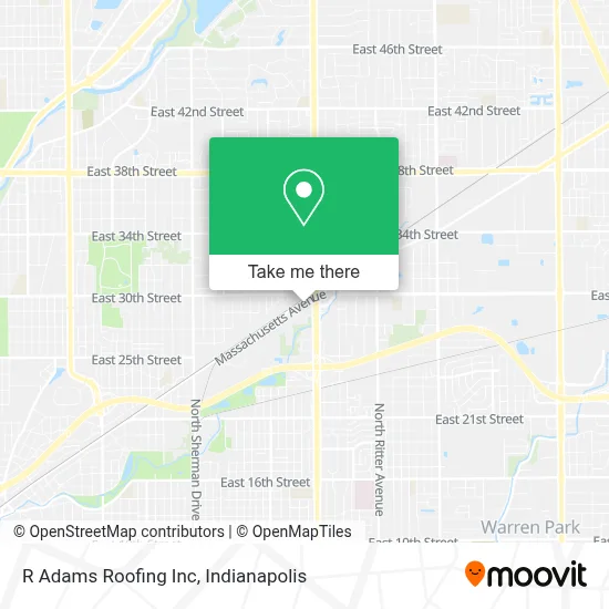
See R Adams Roofing Inc, Indianapolis City (Balance), on the map
Public Transit to R Adams Roofing Inc in Indianapolis City (Balance)
Wondering how to get to R Adams Roofing Inc in Indianapolis City (Balance)? Moovit helps you find the best way to get to R Adams Roofing Inc with step-by-step directions from the nearest public transit station.
Moovit provides free maps and live directions to help you navigate through your city. View schedules, routes, timetables, and find out how long does it take to get to R Adams Roofing Inc in real time.
Looking for the nearest stop or station to R Adams Roofing Inc? Check out this list of stops closest to your destination: 34th St & Dequincy St; 30th St & Kristen Dr E.
Bus: 30, 2.
Want to see if there’s another route that gets you there at an earlier time? Moovit helps you find alternative routes or times. Get directions from and directions to R Adams Roofing Inc easily from the Moovit App or Website.
We make riding to R Adams Roofing Inc easy, which is why over 1.5 million users, including users in Indianapolis City (Balance), trust Moovit as the best app for public transit. You don’t need to download an individual bus app or train app, Moovit is your all-in-one transit app that helps you find the best bus time or train time available.
For information on prices of bus, costs and ride fares to R Adams Roofing Inc, please check the Moovit app.
Use the app to navigate to popular places including to the airport, hospital, stadium, grocery store, mall, coffee shop, school, college, and university.
R Adams Roofing Inc Address: 4990 E Massachusetts Ave street in Indianapolis City (Balance)
- E 30th St / N Emerson Ave,
- Gt Motors Collision Llc,
- Aztec Wfr Inc,
- Safeway Logistics,
- Darryl Webster's Boot Camp Connect,
- Sisters4sisters Embc,
- Viper Construction,
- Southern Baptist Convention,
- College Movers & Junk Hauling,
- Emmanuel Missionary Baptist Church,
- Aci Asphalt & Concrete,
- Mi Tech Tungsten Metals,
- Mac Corporation,
- Auto Sales & Service, Inc,
- Complete Window & Door,
- Nanas Childcare and Preschool,
- Western Union,
- Libertyx Bitcoin Atm,
- Ift Indianapolis,
- Imagineering Solutions
Places Near R Adams Roofing Inc (Indianapolis City (Balance))
- THE BALT, Indianapolis City (Balance),
- Indiana Convention Center, Indianapolis City (Balance),
- Jersey Barn, Indianapolis City (Balance),
- Plainfield, IN, Plainfield,
- Indiana, Indianapolis City (Balance),
- I-465 / I-65 Interchange, Indianapolis City (Balance),
- Eskenazi Hospital, Indianapolis City (Balance),
- Lucas Oil Stadium, Indianapolis City (Balance),
- Lilly Corporate Center (Eli Lilly & Co), Indianapolis City (Balance),
- Indianapolis Motor Speedway, Speedway,
- St. Vincent Hospital - Indianapolis, Indianapolis City (Balance),
- St. Vincent entrance #1, Indianapolis City (Balance),
- I U Health Methodist Hospital, Indianapolis City (Balance),
- 119 W 19th St Parking, Indianapolis City (Balance),
- Castleton Square Mall, Indianapolis,
- Train Ride At Castleton Mall, Indianapolis City (Balance),
- Cotter's Massage Parlor With Happy Endings, Indianapolis City (Balance),
- Indianapolis Airport Zone 2, Indianapolis City (Balance),
- Methodist Hospital of Indianapolis, Indianapolis City (Balance),
- Gainbridge Fieldhouse, Indianapolis City (Balance)
How to get to popular places in Indianapolis with public transit
Get around Indianapolis City (Balance) by public transit!
Traveling around Indianapolis City (Balance) has never been so easy. See step by step directions as you travel to any attraction, street or major public transit station. View bus and train schedules, arrival times, service alerts and detailed routes on a map, so you know exactly how to get to anywhere in Indianapolis City (Balance).
When traveling to any destination around Indianapolis City (Balance) use Moovit's Live Directions with Get Off Notifications to know exactly where and how far to walk, how long to wait for your line, and how many stops are left. Moovit will alert you when it's time to get off — no need to constantly re-check whether yours is the next stop.
Wondering how to use public transit in Indianapolis City (Balance) or how to pay for public transit in Indianapolis City (Balance)? Moovit public transit app can help you navigate your way with public transit easily, and at minimum cost. It includes public transit fees, ticket prices, and costs. Looking for a map of Indianapolis City (Balance) public transit lines? Moovit public transit app shows all public transit maps in Indianapolis City (Balance) with all bus routes and stops on an interactive map.
Indianapolis has 1 transit type(s), including: bus, operated by several transit agencies, including IndyGo, FlixBus-us and Greyhound-us