R. Casemiro de Abreu, 40 stop - Wednesday schedule
| Line | Direction | Time |
|---|---|---|
| C11 JARDIM HOLANDÊS | Jardim Holandês → Terminal Pinhais | 5:13 AM |
| C12 VILA NOVA | Vila Nova → Terminal Pinhais | 5:28 AM |
| C13 ÁGUA CLARA | Água Clara (Roseira) → Terminal Pinhais | 5:30 AM |
| C11 JARDIM HOLANDÊS | Jardim Holandês → Terminal Pinhais | 5:38 AM |
| C12 VILA NOVA | Vila Nova → Terminal Pinhais | 5:48 AM |
| C13 ÁGUA CLARA | Água Clara → Terminal Pinhais | 5:49 AM |
| C11 JARDIM HOLANDÊS | Jardim Holandês → Terminal Pinhais | 5:50 AM |
| I20 MARACANÃ / AFONSO PENA | Terminal Afonso Pena → Terminal Maracanã | 5:54 AM |
| C12 VILA NOVA | Vila Nova → Terminal Pinhais | 6:00 AM |
| C11 JARDIM HOLANDÊS | Jardim Holandês → Terminal Pinhais | 6:03 AM |
| C12 VILA NOVA | Vila Nova → Terminal Pinhais | 6:09 AM |
| I20 MARACANÃ / AFONSO PENA | Terminal Afonso Pena → Terminal Maracanã | 6:12 AM |
| C13 ÁGUA CLARA | Água Clara → Terminal Pinhais | 6:14 AM |
| C11 JARDIM HOLANDÊS | Jardim Holandês → Terminal Pinhais | 6:15 AM |
| C12 VILA NOVA | Vila Nova → Terminal Pinhais | 6:18 AM |
| C13 ÁGUA CLARA | Água Clara (Roseira) → Terminal Pinhais | 6:25 AM |
| C12 VILA NOVA | Vila Nova → Terminal Pinhais | 6:26 AM |
| C11 JARDIM HOLANDÊS | Jardim Holandês → Terminal Pinhais | 6:26 AM |
| I20 MARACANÃ / AFONSO PENA | Terminal Afonso Pena → Terminal Maracanã | 6:29 AM |
| C12 VILA NOVA | Vila Nova → Terminal Pinhais | 6:34 AM |
| C11 JARDIM HOLANDÊS | Jardim Holandês → Terminal Pinhais | 6:35 AM |
| C12 VILA NOVA | Vila Nova → Terminal Pinhais | 6:40 AM |
| C11 JARDIM HOLANDÊS | Jardim Holandês → Terminal Pinhais | 6:43 AM |
| C13 ÁGUA CLARA | Água Clara → Terminal Pinhais | 6:44 AM |
| I20 MARACANÃ / AFONSO PENA | Terminal Afonso Pena → Terminal Maracanã | 6:46 AM |
Directions to R. Casemiro de Abreu, 40 stop (Pinhais) with public transit
The following transit lines have routes that pass near R. Casemiro de Abreu, 40
 Bus: C11 JARDIM HOLANDÊS, C12 VILA NOVA, C13 ÁGUA CLARA, I20 MARACANÃ / AFONSO PENA, C15 WEISSÓPOLIS.
How to get to R. Casemiro de Abreu, 40 stop by bus?
Click on the bus route to see step by step directions with maps, line arrival times and updated time schedules.
Bus stops near R. Casemiro de Abreu, 40 stop in Pinhais
- Av. Iraí, 1015, 1 min walk,
- R. Rio Solimões, 44, 3 min walk,
- Av. Iraí, 1299, 5 min walk,
- R. Manoel Bandeira, 49, 6 min walk,
- Rua Euclides Da Cunha, 712, 8 min walk,
Bus lines to R. Casemiro de Abreu, 40 stop in Pinhais
- C11 JARDIM HOLANDÊS, Terminal Pinhais → Jardim Holandês,
- C12 VILA NOVA, Vila Nova → Terminal Pinhais,
- C13 ÁGUA CLARA, Terminal Pinhais → Água Clara (Roseira),
- C15 WEISSÓPOLIS, Sentido Horário (após 09:00),
- C39 WEISSÓPOLIS / VILA MARIA ANTONIETA, Terminal Pinhais ↺ Weissópolis (Circular Anti-Horário),
- I14 T. SÃO ROQUE / T. PINHAIS (VIA GUARITUBA), Terminal Pinhais → Terminal São Roque,
- I20 MARACANÃ / AFONSO PENA, Terminal Maracanã → Terminal Afonso Pena,
- C17 VILA MARIA ANTONIETA, Terminal Pinhais ↻ Vila Maria Antonieta / Jardim Tropical (Circular),
- C18 JARDIM TROPICAL (VIA VARGEM GRANDE), Jardim Tropical → Terminal Pinhais,
- C38 PINHAIS / CENTENÁRIO (JARDIM TROPICAL VIA VARGEM GRANDE), Jardim Tropical → Terminal Centenário,
What are the closest stations to R. Casemiro de Abreu, 40?
The closest stations to R. Casemiro de Abreu, 40 are:
- Av. Iraí, 1015 stop is 9 meters away, 1 min walk.
- R. Rio Solimões, 44 stop is 223 meters away, 3 min walk.
- Av. Iraí, 1299 stop is 364 meters away, 5 min walk.
- R. Manoel Bandeira, 49 stop is 399 meters away, 6 min walk.
- Rua Euclides Da Cunha, 712 stop is 605 meters away, 8 min walk.
Which bus lines stop near R. Casemiro de Abreu, 40?
These bus lines stop near R. Casemiro de Abreu, 40: C11 JARDIM HOLANDÊS, C12 VILA NOVA, C13 ÁGUA CLARA, I20 MARACANÃ / AFONSO PENA.
What’s the nearest bus station to R. Casemiro de Abreu, 40 in Pinhais?
The nearest bus station to R. Casemiro de Abreu, 40 in Pinhais is Av. Iraí, 1015. It’s a 1 min walk away.
What time is the first bus to R. Casemiro de Abreu, 40 in Pinhais?
The C15 WEISSÓPOLIS is the first bus that goes to R. Casemiro de Abreu, 40 in Pinhais. It stops nearby at 4:55 AM.
What time is the last bus to R. Casemiro de Abreu, 40 in Pinhais?
The C15 WEISSÓPOLIS is the last bus that goes to R. Casemiro de Abreu, 40 in Pinhais. It stops nearby at 12:38 AM.
R. Casemiro de Abreu, 40 station
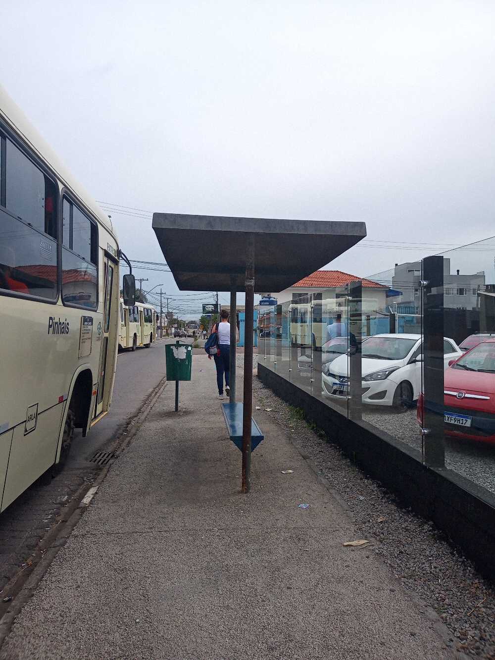 Taken by Anonymous
See R. Casemiro de Abreu, 40 stop, Pinhais, on the map
Public transit to R. Casemiro de Abreu, 40 stop (ID: 420821) in Pinhais
Looking for directions to R. Casemiro de Abreu, 40 in Pinhais, Brazil?
Download the Moovit App to find the current schedule and step-by-step directions for Bus routes that pass through R. Casemiro de Abreu, 40.
Looking for the nearest stops closest to R. Casemiro de Abreu, 40 ? Check out this list of closest stops to your destination: Av. Iraí; R. Rio Solimões; Av. Iraí; R. Manoel Bandeira; Rua Euclides Da Cunha.
Bus: C11 JARDIM HOLANDÊS, C12 VILA NOVA, C13 ÁGUA CLARA, I20 MARACANÃ / AFONSO PENA, C15 WEISSÓPOLIS, C39 WEISSÓPOLIS / VILA MARIA ANTONIETA, I14 T. SÃO ROQUE / T. PINHAIS (VIA GUARITUBA), C17 VILA MARIA ANTONIETA, C18 JARDIM TROPICAL (VIA VARGEM GRANDE), C38 PINHAIS / CENTENÁRIO (JARDIM TROPICAL VIA VARGEM GRANDE).
We make riding on public transit to R. Casemiro de Abreu, 40 easy, which is why over 1.7 billion users, including users in Pinhais trust Moovit as the best app for public transit.
Use the app to navigate to popular places including to the airport, hospital, stadium, grocery store, mall, coffee shop, school, college, and university.
R. Casemiro de Abreu, 40 stop’s code is 420821
The first line to this stop is C11 JARDIM HOLANDÊS, at 5:13 AM, and the last line is C12 VILA NOVA at 12:24 AM.
This stop serves AMEP (Cartões bancários / Cartão MetroCard / Dinheiro)’s lines
- Av. Iraí, 1015,
- R. Rio Solimões, 44,
- Av. Iraí, 1299,
- R. Manoel Bandeira, 49,
- Rua Euclides Da Cunha, 712
Bus stops near R. Casemiro de Abreu, 40 stop
- R. Desembargador Antônio Leopoldo Dos Santos, 5,
- Av. Presidente Kennedy, 300,
- Rodovia Br 476 (Do Xisto) - Trevo Antônio Olinto,
- Rua Pedro Kramar,
- Rua Carlos Poulhman, 620,
- Av. Visconde de Guarapuava, 3900 (Shopping Curitiba),
- Av. Silva Jardim, 1627 (Hospital Pequeno Príncipe),
- Rod. Curitiba Ponta Grossa BR-277 / R. Alcides Valentino Zanella,
- Travessa Moreira Garcez (275),
- R. Fagundes Varela, 101,
- R. José Bajerski, 1683,
- R. João Dembinski, 1301,
- Estr. da Ribeira BR-476, 1480,
- Estr. da Ribeira BR-476 / R. Carlos Francisco Prochaska,
- Rodovia Br 476 (Estrada Da Ribeira) -Eco Pousada Vale Do Ribeira,
- Mercado Municipal de Curitiba,
- Av. Independência - Igreja São Sebastião / Faxinal Do Tanque,
- R. Amauri Lange Silvério, 270,
- Hospital Erasto Gaertner (R. Doutor Ovande do Amaral, 201),
- R. Izaac Ferreira Da Cruz, 4387 - Subestação Copel
Popular public transit stations in Pinhais
Get around Pinhais by public transit!
Traveling around Pinhais has never been so easy. See step by step directions as you travel to any attraction, street or major public transit station. View bus and train schedules, arrival times, service alerts and detailed routes on a map, so you know exactly how to get to anywhere in Pinhais.
When traveling to any destination around Pinhais use Moovit's Live Directions with Get Off Notifications to know exactly where and how far to walk, how long to wait for your line, and how many stops are left. Moovit will alert you when it's time to get off — no need to constantly re-check whether yours is the next stop.
Wondering how to use public transit in Pinhais or how to pay for public transit in Pinhais? Moovit public transit app can help you navigate your way with public transit easily, and at minimum cost. It includes public transit fees, ticket prices, and costs. Looking for a map of Pinhais public transit lines? Moovit public transit app shows all public transit maps in Pinhais with all Bus and Cable Car routes and stops on an interactive map.
Curitiba Region has 2 transit type(s), including: Bus and Cable Car, operated by several transit agencies, including Sistema Integrado de Mobilidade (URBS), Sistema Integrado de Mobilidade (AMEP), URBS (Cartões bancários e Dinheiro), URBS (Cartões bancários / Cartão URBS), AMEP (Cartões bancários / Cartão MetroCard), AMEP (Cartões bancários / Cartão MetroCard / Dinheiro), Viação Colombo (Dinheiro), TRIAR (Cartão TRIAR / Dinheiro), Empresa Curitiba Cerro Azul (Dinheiro), Expresso Penha (Dinheiro), Empresa Campo Alto Tijucas (Dinheiro), Auto Viação São José (Cartão VEM / Dinheiro), BRT S/A (Cartão VEM / Dinheiro), TransPiedade (Cartão Cidadão / Dinheiro) and Oceânica Sul (Cartão Transporte / Dinheiro)