R. Castro Alves, 748 stop - Friday schedule
| Line | Direction | Time |
|---|---|---|
| H01 ARAUCÁRIA / GUADALUPE | Terminal Guadalupe → Terminal Araucária | 5:09 AM |
| H97 ANGÉLICA / GUADALUPE | Terminal Guadalupe → Terminal Angélica | 5:39 AM |
| H01 ARAUCÁRIA / GUADALUPE | Terminal Guadalupe → Terminal Araucária | 5:54 AM |
| 761 VILA IZABEL | Praça Rui Barbosa → Vila Izabel | 6:05 AM |
| 673 FORMOSA | Praça Rui Barbosa → Formosa | 6:07 AM |
| F71 FAZENDA / GUADALUPE | Terminal Guadalupe → Terminal Fazenda | 6:08 AM |
| H01 ARAUCÁRIA / GUADALUPE | Terminal Guadalupe → Terminal Araucária | 6:09 AM |
| 671 PORTÃO | Praça Rui Barbosa → Portão | 6:14 AM |
| 674 NOSSA SENHORA DA LUZ | Praça Rui Barbosa → Nossa Senhora da Luz | 6:18 AM |
| G72 AREIA BRANCA / GUADALUPE | Terminal Guadalupe → Areia Branca | 6:28 AM |
| F71 FAZENDA / GUADALUPE | Terminal Guadalupe → Terminal Fazenda | 6:28 AM |
| H97 ANGÉLICA / GUADALUPE | Terminal Guadalupe → Terminal Angélica | 6:34 AM |
| 761 VILA IZABEL | Praça Rui Barbosa → Vila Izabel | 6:35 AM |
| 762 VILA ROSINHA | Praça Rui Barbosa → Vila Rosinha | 6:38 AM |
| 670 SÃO JORGE | Praça Rui Barbosa → São Jorge | 6:38 AM |
| 673 FORMOSA | Praça Rui Barbosa → Formosa | 6:39 AM |
| H01 ARAUCÁRIA / GUADALUPE | Terminal Guadalupe → Terminal Araucária | 6:39 AM |
| 674 NOSSA SENHORA DA LUZ | Praça Rui Barbosa → Nossa Senhora da Luz | 6:45 AM |
| F71 FAZENDA / GUADALUPE | Terminal Guadalupe → Terminal Fazenda | 6:48 AM |
| H01 ARAUCÁRIA / GUADALUPE | Terminal Guadalupe → Terminal Araucária | 6:49 AM |
| H01 ARAUCÁRIA / GUADALUPE | Terminal Guadalupe → Terminal Araucária | 6:59 AM |
| 761 VILA IZABEL | Praça Rui Barbosa → Vila Izabel | 7:10 AM |
| 673 FORMOSA | Praça Rui Barbosa → Formosa | 7:11 AM |
| 762 VILA ROSINHA | Praça Rui Barbosa → Vila Rosinha | 7:11 AM |
| 674 NOSSA SENHORA DA LUZ | Praça Rui Barbosa → Nossa Senhora da Luz | 7:12 AM |
Directions to R. Castro Alves, 748 stop (Água Verde) with public transit
The following transit lines have routes that pass near R. Castro Alves, 748
 Bus: 203 SANTA CÂNDIDA / CAPÃO RASO, 507 SÍTIO CERCADO (HORÁRIO), 761 VILA IZABEL, 701 FAZENDINHA, 703 CAIUÁ.
How to get to R. Castro Alves, 748 stop by bus?
Click on the bus route to see step by step directions with maps, line arrival times and updated time schedules.
Bus stops near R. Castro Alves, 748 stop in Água Verde
- Av. Iguaçu, 3000, 2 min walk,
- R. Guararapes, 1004, 4 min walk,
- Av. República Argentina, 1155, 5 min walk,
- R. Guaianazes, 119, 6 min walk,
- Av. Presidente Getúlio Vargas, 3000, 6 min walk,
- Praça Abibe Isfer (Secretaria Estadual da Educação), 7 min walk,
- Petit Carneiro, 7 min walk,
Bus lines to R. Castro Alves, 748 stop in Água Verde
- 701 FAZENDINHA, FAZENDINHA,
- 703 CAIUÁ, CAIUÁ,
- 706 CAIUÁ - FAZENDINHA / CENTRO, CAIUÁ - FAZENDINHA / CENTRO,
- 760 SANTA QUITÉRIA, SANTA QUITÉRIA,
- 777 VILA VELHA, VILA VELHA,
- 778 COTOLENGO, COTOLENGO,
- 788 MAD. VILA VELHA, MAD. VILA VELHA,
- 789 MAD. CAIUÁ, MAD. CAIUÁ,
- H01 ARAUCÁRIA / GUADALUPE, Terminal Guadalupe → Terminal Araucária,
- F71 FAZENDA / GUADALUPE, Terminal Guadalupe → Terminal Fazenda,
- G72 AREIA BRANCA / GUADALUPE, Terminal Guadalupe → Areia Branca,
- G72 QUITANDINHA / GUADALUPE, Terminal Guadalupe → Quitandinha,
- H97 ANGÉLICA / GUADALUPE, Terminal Guadalupe → Terminal Angélica,
- 671 PORTÃO, Praça Rui Barbosa → Portão,
- 673 FORMOSA, Praça Rui Barbosa → Formosa,
- 674 NOSSA SENHORA DA LUZ, Praça Rui Barbosa → Nossa Senhora da Luz,
- 209 MAD. SANTA CÂNDIDA / CAPÃO RASO, Terminal Santa Cândida → Terminal Capão Raso,
- 609 MAD. CIC, Praça Rui Barbosa → Terminal CIC,
- 761 VILA IZABEL, Praça Rui Barbosa → Vila Izabel,
- 762 VILA ROSINHA, Vila Rosinha → Praça Rui Barbosa,
What are the closest stations to R. Castro Alves, 748?
The closest stations to R. Castro Alves, 748 are:
- Av. Iguaçu, 3000 stop is 124 meters away, 2 min walk.
- R. Guararapes, 1004 stop is 270 meters away, 4 min walk.
- Av. República Argentina, 1155 stop is 391 meters away, 5 min walk.
- R. Guaianazes, 119 stop is 425 meters away, 6 min walk.
- Av. Presidente Getúlio Vargas, 3000 stop is 447 meters away, 6 min walk.
- Praça Abibe Isfer (Secretaria Estadual da Educação) stop is 476 meters away, 7 min walk.
- Petit Carneiro stop is 493 meters away, 7 min walk.
Which bus lines stop near R. Castro Alves, 748?
These bus lines stop near R. Castro Alves, 748: 203 SANTA CÂNDIDA / CAPÃO RASO, 507 SÍTIO CERCADO (HORÁRIO), 761 VILA IZABEL.
What’s the nearest bus station to R. Castro Alves, 748 in Água Verde?
The nearest bus station to R. Castro Alves, 748 in Água Verde is Av. Iguaçu, 3000. It’s a 2 min walk away.
What time is the first bus to R. Castro Alves, 748 in Água Verde?
The 209 MAD. SANTA CÂNDIDA / CAPÃO RASO is the first bus that goes to R. Castro Alves, 748 in Água Verde. It stops nearby at 3:02 AM.
What time is the last bus to R. Castro Alves, 748 in Água Verde?
The 609 MAD. CIC is the last bus that goes to R. Castro Alves, 748 in Água Verde. It stops nearby at 3:25 AM.
R. Castro Alves, 748 station
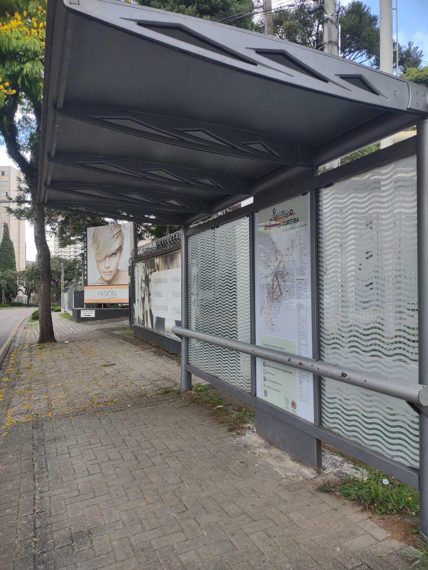 Taken by Luis C.
See R. Castro Alves, 748 stop, Água Verde, on the map
Public transit to R. Castro Alves, 748 stop (ID: 180533) in Água Verde
Looking for directions to R. Castro Alves, 748 in Água Verde, Brazil?
Download the Moovit App to find the current schedule and step-by-step directions for Bus routes that pass through R. Castro Alves, 748.
Looking for the nearest stops closest to R. Castro Alves, 748 ? Check out this list of closest stops to your destination: Av. Iguaçu; R. Guararapes; Av. República Argentina; R. Guaianazes; Av. Presidente Getúlio Vargas; Praça Abibe Isfer (Secretaria Estadual da Educação); Petit Carneiro.
Bus: 203 SANTA CÂNDIDA / CAPÃO RASO, 507 SÍTIO CERCADO (HORÁRIO), 761 VILA IZABEL, 701 FAZENDINHA, 703 CAIUÁ, 706 CAIUÁ - FAZENDINHA / CENTRO, 760 SANTA QUITÉRIA, 777 VILA VELHA, H01 ARAUCÁRIA / GUADALUPE, F71 FAZENDA / GUADALUPE, G72 AREIA BRANCA / GUADALUPE, G72 QUITANDINHA / GUADALUPE, H97 ANGÉLICA / GUADALUPE, 209 MAD. SANTA CÂNDIDA / CAPÃO RASO, 609 MAD. CIC, 762 VILA ROSINHA, 670 SÃO JORGE.
We make riding on public transit to R. Castro Alves, 748 easy, which is why over 1.7 billion users, including users in Água Verde trust Moovit as the best app for public transit.
Use the app to navigate to popular places including to the airport, hospital, stadium, grocery store, mall, coffee shop, school, college, and university.
R. Castro Alves, 748 stop’s code is 180533
The first line to this stop is H01 ARAUCÁRIA / GUADALUPE, at 5:09 AM, and the last line is H01 ARAUCÁRIA / GUADALUPE at 12:34 AM.
820 Rua Castro Alves, Curitiba, Brazil
This stop serves URBS (Cartões bancários / Cartão URBS) and AMEP (Cartões bancários / Cartão MetroCard / Dinheiro)’s lines
Popular routes from R. Castro Alves, 748 stop, Água Verde
- Av. Iguaçu, 3000,
- R. Guararapes, 1004,
- Av. República Argentina, 1155,
- R. Guaianazes, 119,
- Av. Presidente Getúlio Vargas, 3000,
- Praça Abibe Isfer (Secretaria Estadual da Educação),
- Petit Carneiro
Bus stops near R. Castro Alves, 748 stop
- R. Rui Barbosa, 10,
- R. Odir Gomes da Rocha, 1248,
- Rua Aílton Luís Nodari, 121,
- Rodovia Br 116 (Régis Bittencourt),
- Av. 25 de Janeiro, 2460,
- R. Emiliano Perneta, 190,
- R. Ângelo Gai, 2820 - Trav. Nsa. Aparecida,
- R. Estrada Da Graciosa, 366,
- Universidade Positivo (Bloco Marrom),
- Av. Presidente Arthur da Silva Bernardes, 1000,
- Av. Silva Jardim, 3600,
- Rua Olívia Gonçalves Freitas, 586-616,
- Av. Munhoz da Rocha, 1067,
- PUC (Linha Verde),
- R. João Bettega, 5800,
- Rua Carlos Poulhman, 620,
- R. Henrique Mehl, 271,
- Av. do Batel, 1898 (Shopping Pátio Batel),
- Av. das Américas, 231,
- Rua Helena Blitzkow Stonoga 2764
Popular public transit stations in Água Verde
Get around Água Verde by public transit!
Traveling around Água Verde has never been so easy. See step by step directions as you travel to any attraction, street or major public transit station. View bus and train schedules, arrival times, service alerts and detailed routes on a map, so you know exactly how to get to anywhere in Água Verde.
When traveling to any destination around Água Verde use Moovit's Live Directions with Get Off Notifications to know exactly where and how far to walk, how long to wait for your line, and how many stops are left. Moovit will alert you when it's time to get off — no need to constantly re-check whether yours is the next stop.
Wondering how to use public transit in Água Verde or how to pay for public transit in Água Verde? Moovit public transit app can help you navigate your way with public transit easily, and at minimum cost. It includes public transit fees, ticket prices, and costs. Looking for a map of Água Verde public transit lines? Moovit public transit app shows all public transit maps in Água Verde with all Bus and Cable Car routes and stops on an interactive map.
Curitiba Region has 2 transit type(s), including: Bus and Cable Car, operated by several transit agencies, including Sistema Integrado de Mobilidade (URBS), Sistema Integrado de Mobilidade (AMEP), URBS (Cartões bancários e Dinheiro), URBS (Cartões bancários / Cartão URBS), AMEP (Cartões bancários / Cartão MetroCard), AMEP (Cartões bancários / Cartão MetroCard / Dinheiro), Viação Colombo (Dinheiro), TRIAR (Cartão TRIAR / Dinheiro), Empresa Curitiba Cerro Azul (Dinheiro), Expresso Penha (Dinheiro), Empresa Campo Alto Tijucas (Dinheiro), Auto Viação São José (Cartão VEM / Dinheiro), BRT S/A (Cartão VEM / Dinheiro), TransPiedade (Cartão Cidadão / Dinheiro) and Oceânica Sul (Cartão Transporte / Dinheiro)