R. Cerro Batiui, 4 stop - Wednesday schedule
| Line | Direction | Time |
|---|---|---|
| N143-11 | Morro Grande | 3:44 AM |
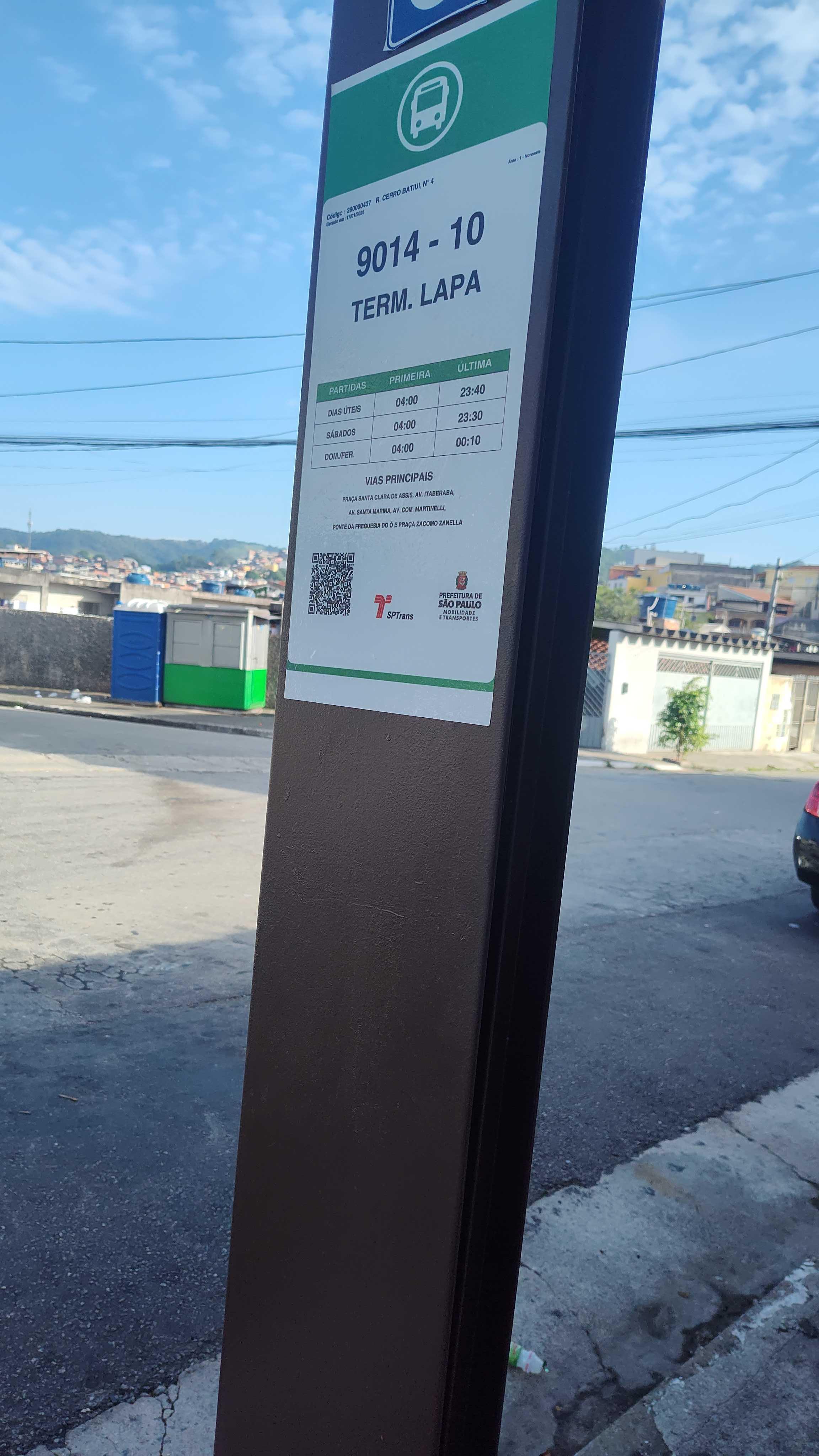
| 9014-10 | Term. Lapa | 4:00 AM |
| 9014-10 | Term. Lapa | 4:30 AM |
| N143-11 | Morro Grande | 4:44 AM |
| 9014-10 | Term. Lapa | 4:50 AM |
| 9014-10 | Morro Grande | 5:01 AM |
| 9014-10 | Term. Lapa | 5:08 AM |
| 9014-10 | Term. Lapa | 5:26 AM |
| 9014-10 | Morro Grande | 5:34 AM |
| 9014-10 | Term. Lapa | 5:43 AM |
| 9014-10 | Morro Grande | 5:56 AM |
| 9014-10 | Term. Lapa | 6:00 AM |
| 9014-10 | Term. Lapa | 6:16 AM |
| 9014-10 | Morro Grande | 6:16 AM |
| 9014-10 | Term. Lapa | 6:30 AM |
| 9014-10 | Morro Grande | 6:37 AM |
| 9014-10 | Term. Lapa | 6:42 AM |
| 9014-10 | Term. Lapa | 6:54 AM |
| 9014-10 | Morro Grande | 6:57 AM |
| 9014-10 | Term. Lapa | 7:05 AM |
| 9014-10 | Term. Lapa | 7:16 AM |
| 9014-10 | Morro Grande | 7:23 AM |
| 9014-10 | Term. Lapa | 7:27 AM |
| 9014-10 | Term. Lapa | 7:38 AM |
| 9014-10 | Morro Grande | 7:44 AM |
Directions to R. Cerro Batiui, 4 stop (Freguesia Do Ó) with public transit
The following transit lines have routes that pass near R. Cerro Batiui, 4
 Bus: 8538-10, 9014-10, N143-11, 1026-10, 1034-10.
- Train: LINHA 7.
How to get to R. Cerro Batiui, 4 stop by bus?
Click on the bus route to see step by step directions with maps, line arrival times and updated time schedules.
How to get to R. Cerro Batiui, 4 stop by train?
Click on the train route to see step by step directions with maps, line arrival times and updated time schedules.
Bus stops near R. Cerro Batiui, 4 stop in Freguesia Do Ó
- R. Francisco Nunes Siqueira, 213, 2 min walk,
- R. S. Urbano, 58, 4 min walk,
- Av. Brasilina Vieira Simões, 254, 5 min walk,
- R. Valencio Augusto de B. Filho, 823, 8 min walk,
- R. Raimundo da Cunha Matos, 8 min walk,
- R. Porto de Palos, 31, 8 min walk,
Train stations near R. Cerro Batiui, 4 station in Freguesia Do Ó
- Pirituba, 30 min walk,
Bus lines to R. Cerro Batiui, 4 stop in Freguesia Do Ó
- N143-11, Morro Grande,
- 9014-10, Term. Lapa,
- 1026-10, Vl. Iara,
- 1034-10, Conexão Vl. Iório,
- 8538-10, Pça. do Correio,
- 917M-10, Metrô Ana Rosa,
- 917M-31, Morro Grande,
- 9015-31, Vl. Zatt,
What are the closest stations to R. Cerro Batiui, 4?
The closest stations to R. Cerro Batiui, 4 are:
- R. Francisco Nunes Siqueira, 213 stop is 135 meters away, 2 min walk.
- R. S. Urbano, 58 stop is 292 meters away, 4 min walk.
- Av. Brasilina Vieira Simões, 254 stop is 344 meters away, 5 min walk.
- R. Valencio Augusto de B. Filho, 823 stop is 553 meters away, 8 min walk.
- R. Raimundo da Cunha Matos stop is 574 meters away, 8 min walk.
- R. Porto de Palos, 31 stop is 581 meters away, 8 min walk.
- Pirituba station is 2294 meters away, 30 min walk.
Which bus lines stop near R. Cerro Batiui, 4?
These bus lines stop near R. Cerro Batiui, 4: 8538-10, 9014-10.
Which train line stops near R. Cerro Batiui, 4?
LINHA 7 (Jundiaí)
What’s the nearest train station to R. Cerro Batiui, 4 in Freguesia Do Ó?
The nearest train station to R. Cerro Batiui, 4 in Freguesia Do Ó is Pirituba. It’s a 30 min walk away.
What’s the nearest bus station to R. Cerro Batiui, 4 in Freguesia Do Ó?
The nearest bus station to R. Cerro Batiui, 4 in Freguesia Do Ó is R. Francisco Nunes Siqueira, 213. It’s a 2 min walk away.
What time is the first train to R. Cerro Batiui, 4 in Freguesia Do Ó?
The LINHA 7 is the first train that goes to R. Cerro Batiui, 4 in Freguesia Do Ó. It stops nearby at 4:10 AM.
What time is the last train to R. Cerro Batiui, 4 in Freguesia Do Ó?
The LINHA 7 is the last train that goes to R. Cerro Batiui, 4 in Freguesia Do Ó. It stops nearby at 12:53 AM.
What time is the first bus to R. Cerro Batiui, 4 in Freguesia Do Ó?
The N143-11 is the first bus that goes to R. Cerro Batiui, 4 in Freguesia Do Ó. It stops nearby at 3:41 AM.
What time is the last bus to R. Cerro Batiui, 4 in Freguesia Do Ó?
The N143-11 is the last bus that goes to R. Cerro Batiui, 4 in Freguesia Do Ó. It stops nearby at 2:46 AM.
R. Cerro Batiui, 4 station
 Taken by Anonymous
See R. Cerro Batiui, 4 stop, Freguesia Do Ó, on the map
Public transit to R. Cerro Batiui, 4 stop in Freguesia Do Ó
Looking for directions to R. Cerro Batiui, 4 in Freguesia Do Ó, Brazil?
Download the Moovit App to find the current schedule and step-by-step directions for Bus or Train routes that pass through R. Cerro Batiui, 4.
Looking for the nearest stops closest to R. Cerro Batiui, 4 ? Check out this list of closest stops to your destination: R. Francisco Nunes Siqueira; R. S. Urbano; Av. Brasilina Vieira Simões; R. Valencio Augusto de B. Filho; R. Raimundo da Cunha Matos; R. Porto de Palos; Pirituba.
Bus: 8538-10, 9014-10, N143-11, 1026-10, 1034-10, 917M-10, 917M-31.Train: LINHA 7.
We make riding on public transit to R. Cerro Batiui, 4 easy, which is why over 1.7 billion users, including users in Freguesia Do Ó trust Moovit as the best app for public transit.
Use the app to navigate to popular places including to the airport, hospital, stadium, grocery store, mall, coffee shop, school, college, and university.
The first line to this stop is N143-11, at 3:44 AM, and the last line is N143-11 at 2:44 AM.
15 Rua Cerro Batui, São Paulo, Brazil
This stop serves SPTrans’s lines
- R. Francisco Nunes Siqueira, 213,
- R. S. Urbano, 58,
- Av. Brasilina Vieira Simões, 254,
- R. Valencio Augusto de B. Filho, 823,
- R. Raimundo da Cunha Matos,
- R. Porto de Palos, 31
Bus stops near R. Cerro Batiui, 4 stop
- Pirituba
Train station near R. Cerro Batiui, 4 station
- Av. Escola Politécnica - Av. Torres de Oliveira,
- Avenida Yervant Kissajikian 1615,
- Av. Olavo Fontoura, 1209,
- Rua Brigadeiro Tobias, 780,
- Parada Thermas da Mata,
- Rua Barão do Rio Branco 255,
- Terminal Metro Belém Norte,
- Borba Gato,
- R. Frederico Grotte, 322,
- Terminal Água Espraiada,
- Terminal Paço- São Bernardo,
- Engenheiro Manoel Feio,
- Av. Jacu-Pêssego/Nova Trabalhadores, 35,
- Terminal Ferraz,
- Quitaúna,
- Guapituba,
- R. Miguel Yunes, 485,
- R. Alcântara, 113,
- Rua Costa Barros, 544 - Vila Alpina, São Paulo,
- Av. dos Metalúrgicos, 2100
Popular public transit stations in Freguesia Do Ó
Get around Freguesia Do Ó by public transit!
Traveling around Freguesia Do Ó has never been so easy. See step by step directions as you travel to any attraction, street or major public transit station. View bus and train schedules, arrival times, service alerts and detailed routes on a map, so you know exactly how to get to anywhere in Freguesia Do Ó.
When traveling to any destination around Freguesia Do Ó use Moovit's Live Directions with Get Off Notifications to know exactly where and how far to walk, how long to wait for your line, and how many stops are left. Moovit will alert you when it's time to get off — no need to constantly re-check whether yours is the next stop.
Wondering how to use public transit in Freguesia Do Ó or how to pay for public transit in Freguesia Do Ó? Moovit public transit app can help you navigate your way with public transit easily, and at minimum cost. It includes public transit fees, ticket prices, and costs. Looking for a map of Freguesia Do Ó public transit lines? Moovit public transit app shows all public transit maps in Freguesia Do Ó with all Bus, Train, Metro, Light Rail, Ferry, Gondola, Cable Car and Funicular routes and stops on an interactive map.
Sao Paulo Region has 8 transit type(s), including: Bus, Train, Metro, Light Rail, Ferry, Gondola, Cable Car and Funicular, operated by several transit agencies, including SPTrans, CPTM, ViaMobilidade, Aquático SP, SPTRANS, EMTU, ViaQuatro, Auto Ônibus Moratense, GRU Airport (Aeroporto de Guarulhos), Auto Viação Urubupungá (Cajamar), Viação Cometa, Auto Viação Urubupungá (Osasco), Viação Ultra / Rápido Brasil, Auto Viação Urubupungá (Santana de Parnaíba) and Expresso Luxo