R. Fermin Alvarez, 56 stop - Wednesday schedule
| Line | Direction | Time |
|---|---|---|
| 3754-10 | Metrô Itaquera | 3:32 AM |
| 3754-10 | Metrô Itaquera | 3:42 AM |
| 3026-10 | CPTM Guaianases | 3:45 AM |
| N437-11 | Term. Cid. Tiradentes | 3:45 AM |
| 3754-10 | Metrô Itaquera | 3:52 AM |
| 3026-10 | CPTM Guaianases | 3:55 AM |
| 3754-10 | Metrô Itaquera | 4:02 AM |
| 3026-10 | CPTM Guaianases | 4:05 AM |
| 3754-10 | Metrô Itaquera | 4:10 AM |
| 3026-10 | CPTM Guaianases | 4:15 AM |
| 3754-10 | Metrô Itaquera | 4:18 AM |
| 3026-10 | CPTM Guaianases | 4:20 AM |
| 3026-10 | CPTM Guaianases | 4:25 AM |
| 3754-10 | Metrô Itaquera | 4:26 AM |
| 3026-10 | CPTM Guaianases | 4:30 AM |
| 3754-10 | Metrô Itaquera | 4:34 AM |
| 3026-10 | CPTM Guaianases | 4:35 AM |
| 3026-10 | CPTM Guaianases | 4:40 AM |
| 3754-10 | Metrô Itaquera | 4:42 AM |
| 3026-10 | CPTM Guaianases | 4:45 AM |
| N437-11 | Term. Cid. Tiradentes | 4:45 AM |
| 3754-10 | Metrô Itaquera | 4:50 AM |
| 3026-10 | CPTM Guaianases | 4:50 AM |
| 3026-10 | CPTM Guaianases | 4:55 AM |
| 3754-10 | Metrô Itaquera | 4:56 AM |
Directions to R. Fermin Alvarez, 56 stop (Cidade Tiradentes) with public transit
The following transit lines have routes that pass near R. Fermin Alvarez, 56
 Bus: 3026-10, 312N-10, 3756-10, 3768-10, N437-11.
- Train: LINHA 11.
How to get to R. Fermin Alvarez, 56 stop by bus?
Click on the bus route to see step by step directions with maps, line arrival times and updated time schedules.
How to get to R. Fermin Alvarez, 56 stop by train?
Click on the train route to see step by step directions with maps, line arrival times and updated time schedules.
Bus stops near R. Fermin Alvarez, 56 stop in Cidade Tiradentes
- R. Fermin Alvarez, 118, 1 min walk,
- R. Inácio Monteiro, 2039, 2 min walk,
- R. Inácio Monteiro, 2220, 3 min walk,
- Rua Engenheiro Mário Savell, 66, 12 min walk,
Train stations near R. Fermin Alvarez, 56 station in Cidade Tiradentes
- Antonio Gianetti Neto, 29 min walk,
Bus lines to R. Fermin Alvarez, 56 stop in Cidade Tiradentes
- N437-11, Term. Cid. Tiradentes,
- 3026-10, CPTM Guaianases,
- 3754-10, Metrô Itaquera,
- N441-11, Vl. Yolanda,
- 3025-10, CPTM Guaianases,
- 3756-10, Barro Branco,
- 3768-10, CPTM José Bonifácio,
- 312N-10, São Miguel Paulista,
- 4003-10, E.T. Itaquera,
- 4314-10, Term. Pq. D. Pedro II,
- 4314-21, Term. Vl. Carrão,
- 342N-10, CPTM Guaianases,
- 3738-10, COHAB Juscelino,
What are the closest stations to R. Fermin Alvarez, 56?
The closest stations to R. Fermin Alvarez, 56 are:
- R. Fermin Alvarez, 118 stop is 36 meters away, 1 min walk.
- R. Inácio Monteiro, 2039 stop is 112 meters away, 2 min walk.
- R. Inácio Monteiro, 2220 stop is 198 meters away, 3 min walk.
- Rua Engenheiro Mário Savell, 66 stop is 899 meters away, 12 min walk.
- Antonio Gianetti Neto station is 2247 meters away, 29 min walk.
Which bus lines stop near R. Fermin Alvarez, 56?
These bus lines stop near R. Fermin Alvarez, 56: 3026-10, 312N-10, 3756-10, 3768-10.
Which train line stops near R. Fermin Alvarez, 56?
LINHA 11 (Estudantes)
What’s the nearest train station to R. Fermin Alvarez, 56 in Cidade Tiradentes?
The nearest train station to R. Fermin Alvarez, 56 in Cidade Tiradentes is Antonio Gianetti Neto. It’s a 29 min walk away.
What’s the nearest bus station to R. Fermin Alvarez, 56 in Cidade Tiradentes?
The nearest bus station to R. Fermin Alvarez, 56 in Cidade Tiradentes is R. Fermin Alvarez, 118. It’s a 1 min walk away.
What time is the first train to R. Fermin Alvarez, 56 in Cidade Tiradentes?
The LINHA 11 is the first train that goes to R. Fermin Alvarez, 56 in Cidade Tiradentes. It stops nearby at 4:00 AM.
What time is the last train to R. Fermin Alvarez, 56 in Cidade Tiradentes?
The LINHA 11 is the last train that goes to R. Fermin Alvarez, 56 in Cidade Tiradentes. It stops nearby at 12:39 AM.
What time is the first bus to R. Fermin Alvarez, 56 in Cidade Tiradentes?
The N441-11 is the first bus that goes to R. Fermin Alvarez, 56 in Cidade Tiradentes. It stops nearby at 3:18 AM.
What time is the last bus to R. Fermin Alvarez, 56 in Cidade Tiradentes?
The N437-11 is the last bus that goes to R. Fermin Alvarez, 56 in Cidade Tiradentes. It stops nearby at 2:51 AM.
R. Fermin Alvarez, 56 station
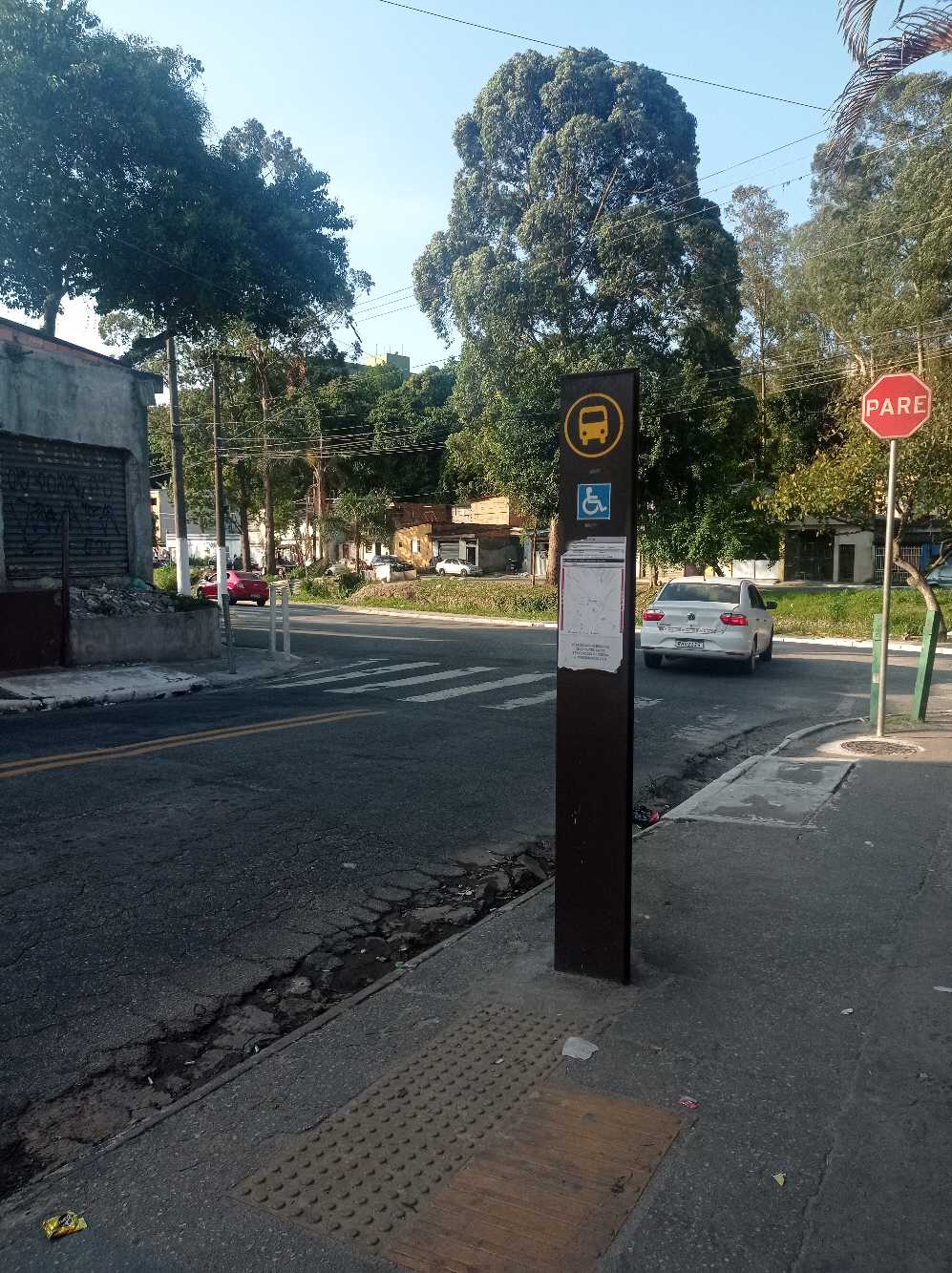 Taken by Anonymous
See R. Fermin Alvarez, 56 stop, Cidade Tiradentes, on the map
Public transit to R. Fermin Alvarez, 56 stop in Cidade Tiradentes
Looking for directions to R. Fermin Alvarez, 56 in Cidade Tiradentes, Brazil?
Download the Moovit App to find the current schedule and step-by-step directions for Bus or Train routes that pass through R. Fermin Alvarez, 56.
Looking for the nearest stops closest to R. Fermin Alvarez, 56 ? Check out this list of closest stops to your destination: R. Fermin Alvarez; R. Inácio Monteiro; R. Inácio Monteiro; Rua Engenheiro Mário Savell; Antonio Gianetti Neto.
Bus: 3026-10, 312N-10, 3756-10, 3768-10, N437-11, 3754-10, N441-11, 3025-10, 4003-10, 4314-10, 4314-21, 342N-10, 3738-10.Train: LINHA 11.
We make riding on public transit to R. Fermin Alvarez, 56 easy, which is why over 1.7 billion users, including users in Cidade Tiradentes trust Moovit as the best app for public transit.
Use the app to navigate to popular places including to the airport, hospital, stadium, grocery store, mall, coffee shop, school, college, and university.
The first line to this stop is 3754-10, at 3:32 AM, and the last line is N437-11 at 2:45 AM.
SN Rua Fermin Alvares, São Paulo, Brazil
This stop serves SPTrans’s lines
- R. Fermin Alvarez, 118,
- R. Inácio Monteiro, 2039,
- R. Inácio Monteiro, 2220,
- Rua Engenheiro Mário Savell, 66
Bus stops near R. Fermin Alvarez, 56 stop
- Antonio Gianetti Neto
Train station near R. Fermin Alvarez, 56 station
- R. Miguel Yunes, 500,
- Autódromo,
- Avenida Prefeito Carlos Ferreira Lopes (Extra),
- Rua Pedra Azul, 314,
- Av. Amadeu da Silva Samelo, 423,
- Av. Pres. Juscelino Kubitschek, 180,
- R. Voluntários da Pátria, 3744,
- Av. Gerônimo Barbosa da Silva, 1383,
- Av. Ibirapuera, 901,
- Av. Mazzei, 1655,
- Br-116 Rod. Régis Bittencourt, Km 332,2 Norte - dos Rosas, Juquitiba,
- Caieiras,
- Ponto Final COHAB V,
- Pista Central,
- Av. Sumaré,
- Vila Matilde,
- Av. das Nações Unidas, 17955,
- Domingos De Moraes,
- Alto do Ipiranga,
- R. Card. Arcoverde, 950
Popular public transit stations in Cidade Tiradentes
Get around Cidade Tiradentes by public transit!
Traveling around Cidade Tiradentes has never been so easy. See step by step directions as you travel to any attraction, street or major public transit station. View bus and train schedules, arrival times, service alerts and detailed routes on a map, so you know exactly how to get to anywhere in Cidade Tiradentes.
When traveling to any destination around Cidade Tiradentes use Moovit's Live Directions with Get Off Notifications to know exactly where and how far to walk, how long to wait for your line, and how many stops are left. Moovit will alert you when it's time to get off — no need to constantly re-check whether yours is the next stop.
Wondering how to use public transit in Cidade Tiradentes or how to pay for public transit in Cidade Tiradentes? Moovit public transit app can help you navigate your way with public transit easily, and at minimum cost. It includes public transit fees, ticket prices, and costs. Looking for a map of Cidade Tiradentes public transit lines? Moovit public transit app shows all public transit maps in Cidade Tiradentes with all Bus, Train, Metro, Light Rail, Ferry, Gondola, Cable Car and Funicular routes and stops on an interactive map.
Sao Paulo Region has 8 transit type(s), including: Bus, Train, Metro, Light Rail, Ferry, Gondola, Cable Car and Funicular, operated by several transit agencies, including SPTrans, CPTM, ViaMobilidade, Aquático SP, SPTRANS, EMTU, ViaQuatro, Auto Ônibus Moratense, GRU Airport (Aeroporto de Guarulhos), Auto Viação Urubupungá (Cajamar), Viação Cometa, Auto Viação Urubupungá (Osasco), Viação Ultra / Rápido Brasil, Auto Viação Urubupungá (Santana de Parnaíba) and Expresso Luxo