How to get to R H F by bus?
Click on the bus route to see step by step directions with maps, line arrival times and updated time schedules.
From Embassy Of Sweden, Washington
44 minFrom Childrens Hospital, Washington
104 minFrom Eastern Market, Washington
85 minFrom Cannon House Office Building, Washington
76 minFrom Capital Turnaround, Washington
94 minFrom Miracle Theatre, Washington
86 minFrom Anacostia Park, Washington
102 minFrom Renwick Gallery, Washington
51 minFrom Scott Circle, Washington
62 minFrom U.S. Botanic Garden, Washington
76 min
How to get to R H F by metro?
Click on the metro route to see step by step directions with maps, line arrival times and updated time schedules.
From Embassy Of Sweden, Washington
35 minFrom Childrens Hospital, Washington
69 minFrom Eastern Market, Washington
40 minFrom Cannon House Office Building, Washington
37 minFrom Capital Turnaround, Washington
47 minFrom Miracle Theatre, Washington
40 minFrom Anacostia Park, Washington
56 minFrom Renwick Gallery, Washington
30 minFrom Scott Circle, Washington
38 minFrom U.S. Botanic Garden, Washington
40 min
Bus stops near R H F in Arlington County
Metro station near R H F in Arlington County
- Clarendon, 29 min walk,VIEW
Bus lines to R H F in Arlington County
What are the closest stations to R H F?
The closest stations to R H F are:
- Carlin Springs Rd+N Thomas St is 177 yards away, 3 min walk.
- N Randolph St+Wilson Bl is 448 yards away, 6 min walk.
- N Glebe Rd & N Henderson Rd is 471 yards away, 6 min walk.
- Wilson Blvd & Taylor St is 486 yards away, 6 min walk.
- Clarendon is 2443 yards away, 29 min walk.
Which bus lines stop near R H F?
These bus lines stop near R H F: 41, A58.
Which metro lines stop near R H F?
These metro lines stop near R H F: ORANGE, SILVER.
What’s the nearest metro station to R H F in Arlington County?
The nearest metro station to R H F in Arlington County is Clarendon. It’s a 29 min walk away.
What’s the nearest bus station to R H F in Arlington County?
The nearest bus station to R H F in Arlington County is Carlin Springs Rd+N Thomas St. It’s a 3 min walk away.
What time is the first metro to R H F in Arlington County?
The ORANGE is the first metro that goes to R H F in Arlington County. It stops nearby at 5:10 AM.
What time is the last metro to R H F in Arlington County?
The SILVER is the last metro that goes to R H F in Arlington County. It stops nearby at 12:31 AM.
What time is the first bus to R H F in Arlington County?
The A70 is the first bus that goes to R H F in Arlington County. It stops nearby at 5:39 AM.
What time is the last bus to R H F in Arlington County?
The A58 is the last bus that goes to R H F in Arlington County. It stops nearby at 2:00 AM.
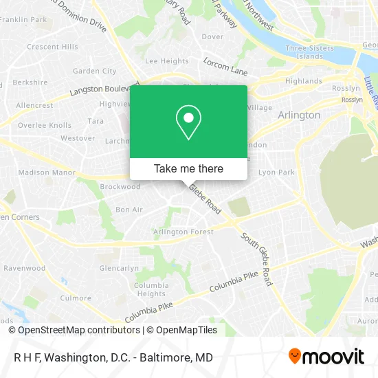
See R H F, Arlington County, on the map
Public Transit to R H F in Arlington County
Wondering how to get to R H F in Arlington County? Moovit helps you find the best way to get to R H F with step-by-step directions from the nearest public transit station.
Moovit provides free maps and live directions to help you navigate through your city. View schedules, routes, timetables, and find out how long does it take to get to R H F in real time.
Looking for the nearest stop or station to R H F? Check out this list of stops closest to your destination: Carlin Springs Rd+N Thomas St; N Randolph St+Wilson Bl; N Glebe Rd & N Henderson Rd; Wilson Blvd & Taylor St; Clarendon.
Bus: 41, A58, A76, A12, A70, A71, 72, F50, F60, F61.Metro: ORANGE, SILVER.
Want to see if there’s another route that gets you there at an earlier time? Moovit helps you find alternative routes or times. Get directions from and directions to R H F easily from the Moovit App or Website.
We make riding to R H F easy, which is why over 1.5 million users, including users in Arlington County, trust Moovit as the best app for public transit. You don’t need to download an individual bus app or train app, Moovit is your all-in-one transit app that helps you find the best bus time or train time available.
For information on prices of metro and bus, costs and ride fares to R H F, please check the Moovit app.
Use the app to navigate to popular places including to the airport, hospital, stadium, grocery store, mall, coffee shop, school, college, and university.
R H F Address: 4300 N Carlin Springs Rd Arlington, VA 22203 street in Arlington County
- Idog,
- Steven Desomer Associates,
- Same Day Appliance Service & Repair Appliance,
- Urba,
- STARBUCKS,
- Harris Teeter,
- MNB Technical Service,
- Coinstar - Bitcoin ATM,
- The Science Advisory Board Bioinformatics,
- Bernstein Companies,
- E*Trade Financial Corporation,
- Aveda Arts & Sciences Institute-Arlington,
- 5 Wits,
- Kettler Capitals Iceplex,
- Ballston Quarter,
- Jagkumar,
- Ballston Common Mall,
- Onelife Fitness,
- Immersive Gamebox - Arlington,
- Jerry Ruley MD
Places Near R H F (Arlington County)
- Westfield Montgomery Mall, Montgomery County,
- Marriott Marquis Washington, DC, Washington,
- Georgetown, Washington,
- Washington National Cathedral, Washington,
- PG Mall, Prince George's County,
- Camden Yards, Baltimore,
- Warner Theatre, Washington,
- Pennsylvania Ave NW (3rd st and pennsylvania), Washington,
- The Anthem, Washington,
- Sibley Memorial Hospital, Washington,
- Capital One Arena, Washington,
- Washington DC VA Medical Center, Washington,
- National Museum of African American History and Culture, Washington,
- Museum Of The Bible, Washington,
- Rock Creek Tennis Center, Washington,
- Amazon Hq2, Arlington County,
- M&T Bank Stadium, Baltimore,
- National Mall, Washington,
- National Zoo, Washington,
- Basilica of the National Shrine, Washington
How to get to popular places in Washington, D.C. - Baltimore, MD with public transit
Get around Arlington County by public transit!
Traveling around Arlington County has never been so easy. See step by step directions as you travel to any attraction, street or major public transit station. View bus and train schedules, arrival times, service alerts and detailed routes on a map, so you know exactly how to get to anywhere in Arlington County.
When traveling to any destination around Arlington County use Moovit's Live Directions with Get Off Notifications to know exactly where and how far to walk, how long to wait for your line, and how many stops are left. Moovit will alert you when it's time to get off — no need to constantly re-check whether yours is the next stop.
Wondering how to use public transit in Arlington County or how to pay for public transit in Arlington County? Moovit public transit app can help you navigate your way with public transit easily, and at minimum cost. It includes public transit fees, ticket prices, and costs. Looking for a map of Arlington County public transit lines? Moovit public transit app shows all public transit maps in Arlington County with all Bus, Train, Metro, Light Rail and Ferry routes and stops on an interactive map.
Washington, D.C. - Baltimore, MD has 5 transit type(s), including: Bus, Train, Metro, Light Rail and Ferry, operated by several transit agencies, including WMATA, Montgomery County Ride On, Fairfax Connector, TheBus, PRTC, DASH - Alexandria, Arlington Transit (ART), RTA of Central Maryland, MDOT MTA, MDOT MTA Light RailLink, MDOT MTA Commuter Bus, MDOT MTA Local Bus, FXBGO!, Virginia Railway Express (VRE) and MARC