How to get to R. Lobato & Associates by bus?
Click on the bus route to see step by step directions with maps, line arrival times and updated time schedules.
From ProCare Medical Group, Enterprise
59 minFrom Shopping Mall in Las Vegas, NV, Las Vegas
53 minFrom S Durango Dr / W Warm Springs Rd, Spring Valley
61 minFrom RIO All-Suite Hotel & Casino, Paradise
55 minFrom Embroidery Amazing, Paradise
68 minFrom Las Vegas Hair Clinic, Las Vegas
51 minFrom Penn & Teller Theater, Paradise
59 minFrom Rio All Suite Hotel And Casino Employee Parking Lot, Paradise
62 minFrom Bettye Wilson Soccer Complex, Las Vegas
47 minFrom T.J. Maxx, Las Vegas
30 min
Bus stops near R. Lobato & Associates in Las Vegas
Bus lines to R. Lobato & Associates in Las Vegas
What are the closest stations to R. Lobato & Associates?
The closest stations to R. Lobato & Associates are:
- Eb Sahara Before Crystal Water is 253 yards away, 4 min walk.
- Nb Fort Apache After Red Hills is 1036 yards away, 13 min walk.
Which bus lines stop near R. Lobato & Associates?
These bus lines stop near R. Lobato & Associates: 120, SX.
What’s the nearest bus station to R. Lobato & Associates in Las Vegas?
The nearest bus station to R. Lobato & Associates in Las Vegas is Eb Sahara Before Crystal Water. It’s a 4 min walk away.
What time is the first bus to R. Lobato & Associates in Las Vegas?
The SX is the first bus that goes to R. Lobato & Associates in Las Vegas. It stops nearby at 3:30 AM.
What time is the last bus to R. Lobato & Associates in Las Vegas?
The SX is the last bus that goes to R. Lobato & Associates in Las Vegas. It stops nearby at 3:32 AM.
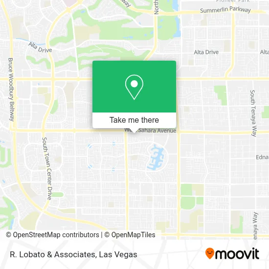
See R. Lobato & Associates, Las Vegas, on the map
Public Transit to R. Lobato & Associates in Las Vegas
Wondering how to get to R. Lobato & Associates in Las Vegas? Moovit helps you find the best way to get to R. Lobato & Associates with step-by-step directions from the nearest public transit station.
Moovit provides free maps and live directions to help you navigate through your city. View schedules, routes, timetables, and find out how long does it take to get to R. Lobato & Associates in real time.
Looking for the nearest stop or station to R. Lobato & Associates? Check out this list of stops closest to your destination: Eb Sahara Before Crystal Water; Nb Fort Apache After Red Hills.
Bus: 120, SX.
Want to see if there’s another route that gets you there at an earlier time? Moovit helps you find alternative routes or times. Get directions from and directions to R. Lobato & Associates easily from the Moovit App or Website.
We make riding to R. Lobato & Associates easy, which is why over 1.7 million users, including users in Las Vegas, trust Moovit as the best app for public transit. You don’t need to download an individual bus app or train app, Moovit is your all-in-one transit app that helps you find the best bus time or train time available.
For information on prices of bus, costs and ride fares to R. Lobato & Associates, please check the Moovit app.
Use the app to navigate to popular places including to the airport, hospital, stadium, grocery store, mall, coffee shop, school, college, and university.
R. Lobato & Associates Address: 9061 W Sahara Ave Ste 101 street in Las Vegas
- Dollar Tree,
- Coinstar,
- Biolife Plasma Services,
- City of Hope,
- Anthem,
- Sahara Ave & Fort Apache Rd,
- Clark County Library District,
- Lake Tahoe,
- Antelope Canyon Pro,
- Lake Sahara (North Side Park),
- Appliance Repair Las Vegas,
- Saxxy's BBQ Sauce,
- Korman Overhead Doors,
- S Durango Dr / W Sahara Ave,
- Road from Vegas to Pahrump,
- Peccole Ranch Trail,
- S Fort Apache Rd / W Charleston Blvd,
- S Rampart Blvd / W Charleston Blvd,
- Black Roze Hair Design by Jessica Peters,
- Matthew S Barton, MD
Places Near R. Lobato & Associates (Las Vegas)
- Walmart Supercenter, Las Vegas,
- Omega Mart, Las Vegas,
- Lee Canyon, Las Vegas,
- The Palms Casino Resort, Paradise,
- The Neon Museum, Las Vegas,
- Las Vegas Premium Outlets-North, Enterprise,
- Town Square, Enterprise,
- Las Vegas South Premium Outlets, Enterprise,
- Koolsville Tattoos, Las Vegas,
- Las Vegas North Premium Outlets, Las Vegas,
- Arte Museum Las Vegas, Paradise,
- Gold & Silver Pawn Shop, Las Vegas,
- Meow Wolf - Las Vegas (Meow Wolf's Omega Mart), Las Vegas,
- Welcome To Fabulous Las Vegas Sign, Paradise,
- Area15, Las Vegas,
- The Deuce Bus Stop at Fremont St, Las Vegas,
- Trump International Hotel Las Vegas, Paradise,
- Allegiant Stadium, Paradise,
- Zak Bagans Haunted Museum, Las Vegas,
- Walmart, Las Vegas
How to get to popular places in Las Vegas with public transit
Get around Las Vegas by public transit!
Traveling around Las Vegas has never been so easy. See step by step directions as you travel to any attraction, street or major public transit station. View bus and train schedules, arrival times, service alerts and detailed routes on a map, so you know exactly how to get to anywhere in Las Vegas.
When traveling to any destination around Las Vegas use Moovit's Live Directions with Get Off Notifications to know exactly where and how far to walk, how long to wait for your line, and how many stops are left. Moovit will alert you when it's time to get off — no need to constantly re-check whether yours is the next stop.
Wondering how to use public transit in Las Vegas or how to pay for public transit in Las Vegas? Moovit public transit app can help you navigate your way with public transit easily, and at minimum cost. It includes public transit fees, ticket prices, and costs. Looking for a map of Las Vegas public transit lines? Moovit public transit app shows all public transit maps in Las Vegas with all Bus and Monorail routes and stops on an interactive map.
Las Vegas has 2 transit type(s), including: Bus and Monorail, operated by several transit agencies, including RTCSNV, City of Las Vegas, Alvand Transportation, Vegas Airporter, Las Vegas Monorail, FlixBus-us and Greyhound-us