Directions to R.M Systems Development (Xaxim) with public transportation
The following transit lines have routes that pass near R.M Systems Development
How to get to R.M Systems Development by bus?
Click on the bus route to see step by step directions with maps, line arrival times and updated time schedules.
From Rua Marechal Hermes, Centro Cívico
65 minFrom Universidade Tuiuti do Paraná (UTP), Santo Inácio
71 minFrom Rua Barão do Rio Branco 122, Centro
48 minFrom Cemiterio Pedro Fuss, São José Dos Pinhais
95 minFrom Av João Gualberto, Juvevê
60 minFrom Praça Nossa Senhora de Salette, Centro Cívico
60 minFrom Rua João Negrão, Centro
33 minFrom Hospital Oswaldo Cruz, Centro
51 minFrom Rua Mateus Leme, São Francisco
54 minFrom Universidade Tuiuti, Santo Inácio
71 min
Bus stops near R.M Systems Development in Xaxim
Bus lines to R.M Systems Development in Xaxim
- 525 HAUER / CAPÃO RASO, Terminal Capão Raso → Terminal Hauer,VIEW
- 689 MAD. SÃO PEDRO / RIO NEGRO, Praça Rui Barbosa ↺ São Pedro / Rio Negro (Circular),VIEW
- 526 ITAMARATI / VILA SÃO PEDRO, Terminal Hauer → Terminal Capão Raso ,VIEW
- 030 INTERBAIRROS III, Terminal Santa Cândida → Terminal Capão Raso,VIEW
- 625 GRAMADOS, Terminal Sítio Cercado → Terminal Capão Raso,VIEW
What are the closest stations to R.M Systems Development?
The closest stations to R.M Systems Development are:
- Rua Coronel Rivadávia Pereira de Morães 35 is 374 meters away, 5 min walk.
- Rua Professor Lauro Zak 70 is 589 meters away, 8 min walk.
- R. Constantino José De Almeida, 125 is 863 meters away, 12 min walk.
- R. Omar Raymundo Picheth, 645 is 994 meters away, 13 min walk.
Which bus line stops near R.M Systems Development?
525 HAUER / CAPÃO RASO (Terminal Hauer → Terminal Capão Raso)
What’s the nearest bus station to R.M Systems Development in Xaxim?
The nearest bus station to R.M Systems Development in Xaxim is Rua Coronel Rivadávia Pereira de Morães 35. It’s a 5 min walk away.
What time is the first bus to R.M Systems Development in Xaxim?
The 689 MAD. SÃO PEDRO / RIO NEGRO is the first bus that goes to R.M Systems Development in Xaxim. It stops nearby at 3:18 AM.
What time is the last bus to R.M Systems Development in Xaxim?
The 689 MAD. SÃO PEDRO / RIO NEGRO is the last bus that goes to R.M Systems Development in Xaxim. It stops nearby at 3:20 AM.
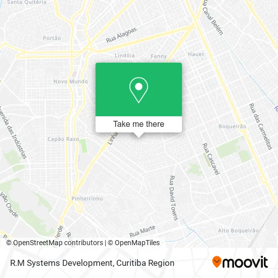
See R.M Systems Development, Xaxim, on the map
Public Transit to R.M Systems Development in Xaxim
Wondering how to get to R.M Systems Development in Xaxim? Moovit helps you find the best way to get to R.M Systems Development with step-by-step directions from the nearest public transit station.
Moovit provides free maps and live directions to help you navigate through your city. View schedules, routes, timetables, and find out how long does it take to get to R.M Systems Development in real time.
Looking for the nearest stop or station to R.M Systems Development? Check out this list of stops closest to your destination: Rua Coronel Rivadávia Pereira de Morães 35; Rua Professor Lauro Zak 70; R. Constantino José De Almeida; R. Omar Raymundo Picheth.
Bus: 525 HAUER / CAPÃO RASO, 689 MAD. SÃO PEDRO / RIO NEGRO, 526 ITAMARATI / VILA SÃO PEDRO, 030 INTERBAIRROS III, 625 GRAMADOS.
Want to see if there’s another route that gets you there at an earlier time? Moovit helps you find alternative routes or times. Get directions from and directions to R.M Systems Development easily from the Moovit App or Website.
We make riding to R.M Systems Development easy, which is why over 1.5 million users, including users in Xaxim, trust Moovit as the best app for public transit. You don’t need to download an individual bus app or train app, Moovit is your all-in-one transit app that helps you find the best bus time or train time available.
For information on prices of bus, costs and ride fares to R.M Systems Development, please check the Moovit app.
Use the app to navigate to popular places including to the airport, hospital, stadium, grocery store, mall, coffee shop, school, college, and university.
R.M Systems Development Address: Rua Eurico Fonseca dos Santos, 892 Xaxim Curitiba-PR 81810-490 street in Xaxim
- Rua Euríco Fonseca dos Santos 914,
- Comunidade N. Sra. Perpétuo Socorro,
- Edneia de Fatima Breginsque Manozzo,
- Amanozzo,
- Comunidade Do Jardim Esmeralda,
- Msm Design - Comercio de Quadro de Formatura,
- Carolisas,
- Visual Cabelo e Estetica,
- Geamani Tech,
- Reviver Igreja Em Células,
- Fliperama Curitiba,
- Jm Pinturas,
- Cad's Cabeleireiros,
- Referencia Mudancas Premium,
- Ag Mobilia,
- Shekinah Artesanato,
- Kelrygourmet,
- Mica Lauz,
- Gb Refrigeracao,
- Auqemia
Places Near R.M Systems Development (Xaxim)
- Shopping Palladium, Portão,
- Hhhhh, Fazendinha,
- Hospital Nossa Senhora Das Graças, Mercês,
- Jardim Botânico de Curitiba PR, Centro,
- Hospital Da Cruz Vermelha, Batel,
- Rua General Mário Tourinho, Campina Do Siqueira,
- Park Shopping Barigüi, Mossunguê,
- Shopping Estação, Rebouças,
- Campo Largo, Campo,
- Parque Barigui, Mercês,
- Jockey Plaza Shopping Center, Tarumã,
- Hospital de Clínicas (HC - UFPR), Centro,
- Hospital Erasto Gaertner, Jardim Das Américas,
- Hospital Universitário Evangélico de Curitiba, Bigorrilho,
- Arena Da Baixada - Curitiba,
- Hospital Angelina Caron, Campina Grande Do Sul,
- Rua Martim Afonso 558, Mercês,
- Hospital Madalena Sofia, Bairro Alto,
- Hospital do Rocio, Campo,
- Pontifícia Universidade Católica do Paraná (PUCPR), Prado Velho
How to get to popular places in Curitiba Region with public transit
Get around Xaxim by public transit!
Traveling around Xaxim has never been so easy. See step by step directions as you travel to any attraction, street or major public transit station. View bus and train schedules, arrival times, service alerts and detailed routes on a map, so you know exactly how to get to anywhere in Xaxim.
When traveling to any destination around Xaxim use Moovit's Live Directions with Get Off Notifications to know exactly where and how far to walk, how long to wait for your line, and how many stops are left. Moovit will alert you when it's time to get off — no need to constantly re-check whether yours is the next stop.
Wondering how to use public transit in Xaxim or how to pay for public transit in Xaxim? Moovit public transit app can help you navigate your way with public transit easily, and at minimum cost. It includes public transit fees, ticket prices, and costs. Looking for a map of Xaxim public transit lines? Moovit public transit app shows all public transit maps in Xaxim with all Bus and Cable Car routes and stops on an interactive map.
Curitiba Region has 2 transit type(s), including: Bus and Cable Car, operated by several transit agencies, including Sistema Integrado de Mobilidade (URBS), Sistema Integrado de Mobilidade (AMEP), URBS (Cartões bancários e Dinheiro), URBS (Cartões bancários / Cartão URBS), AMEP (Cartões bancários / Cartão MetroCard), AMEP (Cartões bancários / Cartão MetroCard / Dinheiro), Viação Colombo (Dinheiro), TRIAR (Cartão TRIAR / Dinheiro), Empresa Curitiba Cerro Azul (Dinheiro), Expresso Nossa Senhora da Penha (Dinheiro), Empresa Campo Alto Tijucas (Dinheiro), Auto Viação São José (Cartão VEM / Dinheiro), BRT S/A (Cartão VEM / Dinheiro), TransPiedade (Cartão Cidadão / Dinheiro) and Oceânica Sul (Cartão Transporte / Dinheiro)