R. Melo Freire stop - Tuesday schedule
| Line | Direction | Time |
|---|---|---|
| N308-11 | Term. Pq. D. Pedro II | 3:04 AM |
| N308-11 | Term. Pq. D. Pedro II | 3:34 AM |
| N308-11 | Term. Pq. D. Pedro II | 4:04 AM |
| 4310-10 | Term. Pq. D. Pedro II | 4:26 AM |
| N308-11 | Term. Pq. D. Pedro II | 4:34 AM |
| 4310-10 | Term. Pq. D. Pedro II | 4:36 AM |
| 4313-10 | Term. Pq. D. Pedro II | 4:41 AM |
| 4310-10 | Term. Pq. D. Pedro II | 4:41 AM |
| 4314-10 | Term. Pq. D. Pedro II | 4:44 AM |
| 4312-10 | Term. Pq. D. Pedro II | 4:46 AM |
| 4310-10 | Term. Pq. D. Pedro II | 4:46 AM |
| 3414-10 | Term. Pq. D. Pedro II | 4:49 AM |
| 4310-10 | Term. Pq. D. Pedro II | 4:51 AM |
| 407I-10 | Metrô Bresser | 4:54 AM |
| 4313-10 | Term. Pq. D. Pedro II | 4:56 AM |
| 3459-21 | Term. Pq. D. Pedro II | 4:56 AM |
| 4310-10 | Term. Pq. D. Pedro II | 4:56 AM |
| 4312-10 | Term. Pq. D. Pedro II | 4:58 AM |
| 3773-10 | Metrô Carrão | 4:59 AM |
| 4311-10 | Term. Pq. D. Pedro II | 5:01 AM |
| 4310-10 | Term. Pq. D. Pedro II | 5:01 AM |
| 407G-10 | Metrô Carrão | 5:02 AM |
| 407E-10 | Metrô Carrão | 5:03 AM |
| 4314-10 | Term. Pq. D. Pedro II | 5:04 AM |
| 4310-10 | Term. Pq. D. Pedro II | 5:06 AM |
Directions to R. Melo Freire stop (Tatuapé) with public transit
The following transit lines have routes that pass near R. Melo Freire
 Bus: 414P-10, 4310-10, 4311-10, 4313-10, 584.
- Metro: LINHA 3.
- Train: LINHA 11, LINHA 12.
How to get to R. Melo Freire stop by bus?
Click on the bus route to see step by step directions with maps, line arrival times and updated time schedules.
How to get to R. Melo Freire stop by train?
Click on the train route to see step by step directions with maps, line arrival times and updated time schedules.
How to get to R. Melo Freire stop by metro?
Click on the metro route to see step by step directions with maps, line arrival times and updated time schedules.
Bus stops near R. Melo Freire stop in Tatuapé
- Metrô Carrão - Parada 2, 2 min walk,
- Terminal Metrô Carrão (Lado Sul) Plat. C, 3 min walk,
- Rua Doutor Ângelo Vita 375, 5 min walk,
- Rua Doutor Ângelo Vita, 303, 5 min walk,
- R. Vilela, 663, 5 min walk,
- Terminal Metrô Carrão Sul, 9 min walk,
- Av. Celso Garcia, 4722 - Tatuapé, São Paulo, 10 min walk,
- Parada 1/3 - Hosp. Munic. do Tatuapé, 10 min walk,
- Metrô Carrão - Parada 1, 12 min walk,
Metro stations near R. Melo Freire station in Tatuapé
- Belém, 21 min walk,
Train stations near R. Melo Freire station in Tatuapé
- Tatuapé, 51 min walk,
Bus lines to R. Melo Freire stop in Tatuapé
- 407I-10, Conj. Manoel da Nóbrega,
- 407I-21, Metrô Tatuapé,
- 3029-10, Jd. das Rosas,
- 4311-10, Term. São Mateus,
- 4313-10, Term. Cid. Tiradentes,
- 4314-10, Inácio Monteiro,
- 4315-10, Term. Vl. Carrão,
- 3773-10, Metrô Carrão,
- 172X-10, Pq. Novo Mundo,
- 414P-10, Term. Norte Metrô Carrão,
- 242, Itaquaquecetuba (Jardim Pinheirinho) - Sao Paulo (Metro Carrao),
- 252, Guarulhos (Jardim Cumbica) - Sao Paulo (Metro Carrao),
- 573, Sao Paulo (Metro Carrao) - Guarulhos (Parque Continental II),
- 584, Guarulhos (Parque Primavera) - Sao Paulo (Metro Carrao),
- 242BI1, Itaquaquecetuba (Pequeno Coracao) - Sao Paulo (Metro Carrao),
- 407W-10, Jardim Iv Centenário - Metrô Carrão,
- 507T-10, Terminal Sapopemba - Metrô Carrão,
- 573T-10, Terminal Sapopemba - Metrô Carrão,
- 573T-31, Terminal Sapopemba - Metrô Carrão,
- 3729-10, Shopping Aricanduva - Metrô Carrão,
What are the closest stations to R. Melo Freire?
The closest stations to R. Melo Freire are:
- Metrô Carrão - Parada 2 stop is 124 meters away, 2 min walk.
- Terminal Metrô Carrão (Lado Sul) Plat. C is 167 meters away, 3 min walk.
- Rua Doutor Ângelo Vita 375 stop is 346 meters away, 5 min walk.
- Rua Doutor Ângelo Vita, 303 stop is 349 meters away, 5 min walk.
- R. Vilela, 663 stop is 380 meters away, 5 min walk.
- Terminal Metrô Carrão Sul is 648 meters away, 9 min walk.
- Av. Celso Garcia, 4722 - Tatuapé, São Paulo stop is 730 meters away, 10 min walk.
- Parada 1/3 - Hosp. Munic. do Tatuapé stop is 738 meters away, 10 min walk.
- Metrô Carrão - Parada 1 stop is 886 meters away, 12 min walk.
- Belém station is 1650 meters away, 21 min walk.
- Tatuapé station is 3961 meters away, 51 min walk.
Which bus lines stop near R. Melo Freire?
These bus lines stop near R. Melo Freire: 414P-10, 4310-10, 4311-10, 4313-10, 584.
Which metro line stops near R. Melo Freire?
LINHA 3 (Corinthians-Itaquera)
Which train line stops near R. Melo Freire?
LINHA 11 (Estudantes)
What’s the nearest metro station to R. Melo Freire in Tatuapé?
The nearest metro station to R. Melo Freire in Tatuapé is Belém. It’s a 21 min walk away.
What’s the nearest bus station to R. Melo Freire in Tatuapé?
The nearest bus station to R. Melo Freire in Tatuapé is Metrô Carrão - Parada 2. It’s a 2 min walk away.
What time is the first metro to R. Melo Freire in Tatuapé?
The LINHA 3 is the first metro that goes to R. Melo Freire in Tatuapé. It stops nearby at 4:58 AM.
What time is the last metro to R. Melo Freire in Tatuapé?
The LINHA 3 is the last metro that goes to R. Melo Freire in Tatuapé. It stops nearby at 12:32 AM.
What time is the first train to R. Melo Freire in Tatuapé?
The LINHA 12 is the first train that goes to R. Melo Freire in Tatuapé. It stops nearby at 4:04 AM.
What time is the last train to R. Melo Freire in Tatuapé?
The LINHA 11 is the last train that goes to R. Melo Freire in Tatuapé. It stops nearby at 12:54 AM.
What time is the first bus to R. Melo Freire in Tatuapé?
The 507T-10 is the first bus that goes to R. Melo Freire in Tatuapé. It stops nearby at 4:20 AM.
What time is the last bus to R. Melo Freire in Tatuapé?
The 407K-10 is the last bus that goes to R. Melo Freire in Tatuapé. It stops nearby at 2:18 AM.
R. Melo Freire station
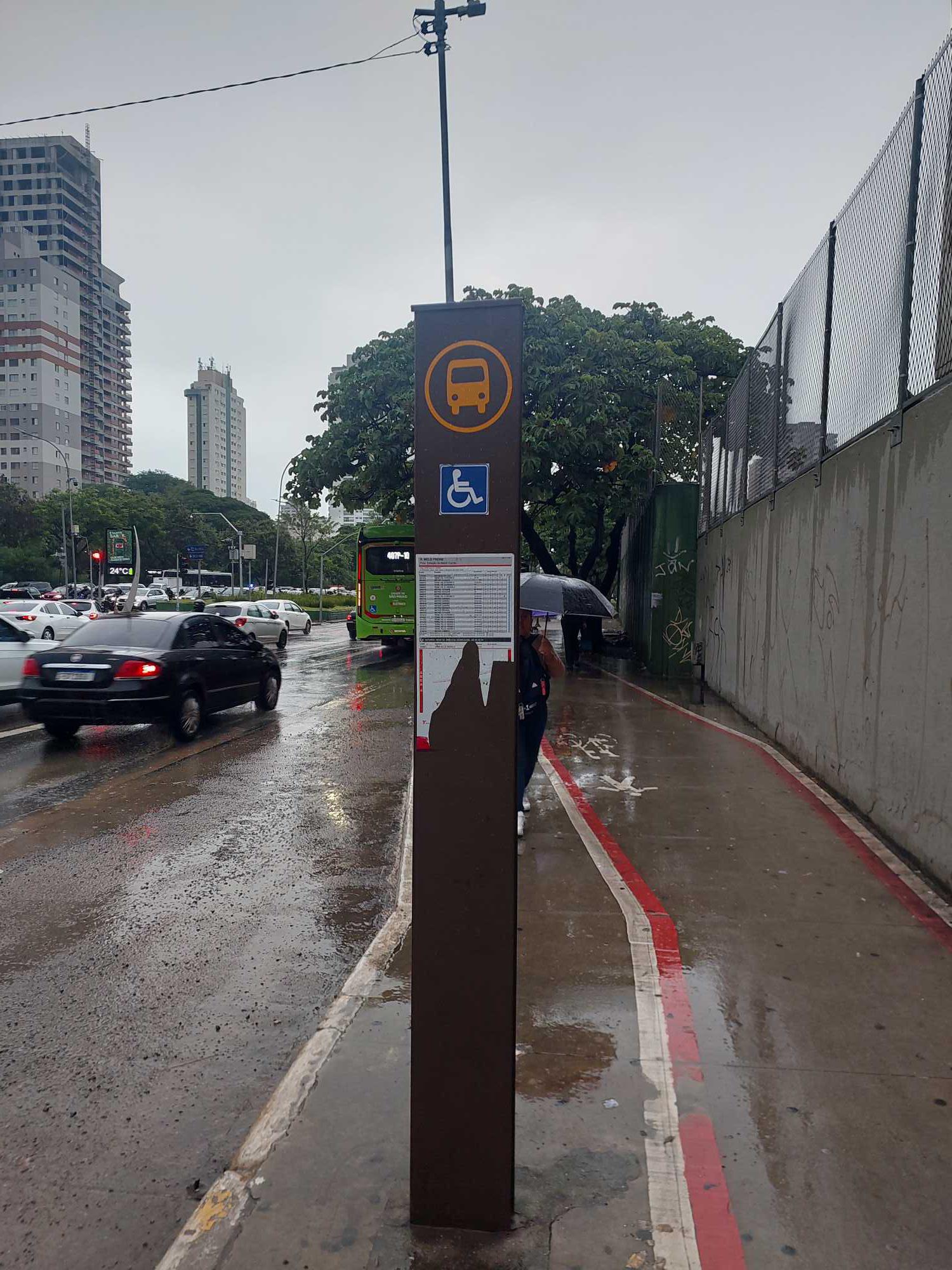 Taken by Thiago K.
See R. Melo Freire stop, Tatuapé, on the map
Public transit to R. Melo Freire stop in Tatuapé
Looking for directions to R. Melo Freire in Tatuapé, Brazil?
Download the Moovit App to find the current schedule and step-by-step directions for Metro, Bus or Train routes that pass through R. Melo Freire.
Looking for the nearest stops closest to R. Melo Freire ? Check out this list of closest stops to your destination: Metrô Carrão - Parada 2; Terminal Metrô Carrão (Lado Sul) Plat. C; Rua Doutor Ângelo Vita 375; Rua Doutor Ângelo Vita; R. Vilela; Terminal Metrô Carrão Sul; Av. Celso Garcia; Parada 1/3 - Hosp. Munic. do Tatuapé; Metrô Carrão - Parada 1; Belém; Tatuapé.
Bus: 414P-10, 4310-10, 4311-10, 4313-10, 584, 407I-10, 407I-21, 3029-10, 3773-10, 172X-10, 242, 252, 573, 242BI1.Metro: LINHA 3.Train: LINHA 11, LINHA 12.
We make riding on public transit to R. Melo Freire easy, which is why over 1.7 billion users, including users in Tatuapé trust Moovit as the best app for public transit.
Use the app to navigate to popular places including to the airport, hospital, stadium, grocery store, mall, coffee shop, school, college, and university.
The first line to this stop is N308-11, at 3:04 AM, and the last line is N308-11 at 2:34 AM.
This stop serves SPTrans’s lines
- Metrô Carrão - Parada 2,
- Terminal Metrô Carrão (Lado Sul) Plat. C,
- Rua Doutor Ângelo Vita 375,
- Rua Doutor Ângelo Vita, 303,
- R. Vilela, 663,
- Terminal Metrô Carrão Sul,
- Av. Celso Garcia, 4722 - Tatuapé, São Paulo,
- Parada 1/3 - Hosp. Munic. do Tatuapé,
- Metrô Carrão - Parada 1
Bus stops near R. Melo Freire stop
- Belém
Metro station near R. Melo Freire station
- Tatuapé
Train station near R. Melo Freire station
- Avenida Doutor Dante Pazzanese 500,
- Parada I.N.S.S.(C/B),
- Rua Serra da Bocaina, 126,
- R. Joaquim Machado, 108,
- Av. Jacu-Pêssego/Nova Trabalhadores, 3778,
- Av. Inconfidência Mineira, 1467,
- Av. República do Líbano, 990,
- Avenida Pedro Álvares Cabral, 443 - Auditório Ibirapuera,
- Avenida 23 De Maio 412,
- Avenida Arnolfo Azevedo, 231,
- Parada Anchieta (Piraporinha),
- R. Serra de Botucatu, 1195,
- Avenida Doutor Guilherme Dumont Vilares 1030,
- Avenida Vinte e Três de Maio (C/B),
- Av. José Maria Whitaker, 81,
- Av. Eng. Caetano Alvares, 3054,
- Av. Pe. Antônio José dos Santos, 1667,
- Av. Mário de Andrade, 1350,
- Parada Matriz (São Bernardo),
- Avenida Marginal do Ribeirão
Popular public transit stations in Tatuapé
Get around Tatuapé by public transit!
Traveling around Tatuapé has never been so easy. See step by step directions as you travel to any attraction, street or major public transit station. View bus and train schedules, arrival times, service alerts and detailed routes on a map, so you know exactly how to get to anywhere in Tatuapé.
When traveling to any destination around Tatuapé use Moovit's Live Directions with Get Off Notifications to know exactly where and how far to walk, how long to wait for your line, and how many stops are left. Moovit will alert you when it's time to get off — no need to constantly re-check whether yours is the next stop.
Wondering how to use public transit in Tatuapé or how to pay for public transit in Tatuapé? Moovit public transit app can help you navigate your way with public transit easily, and at minimum cost. It includes public transit fees, ticket prices, and costs. Looking for a map of Tatuapé public transit lines? Moovit public transit app shows all public transit maps in Tatuapé with all Bus, Train, Metro, Light Rail, Ferry, Gondola, Cable Car and Funicular routes and stops on an interactive map.
Sao Paulo Region has 8 transit type(s), including: Bus, Train, Metro, Light Rail, Ferry, Gondola, Cable Car and Funicular, operated by several transit agencies, including SPTrans, CPTM, ViaMobilidade, Aquático SP, SPTRANS, EMTU, ViaQuatro, Auto Ônibus Moratense, GRU Airport (Aeroporto de Guarulhos), Auto Viação Urubupungá (Cajamar), Viação Cometa, Auto Viação Urubupungá (Osasco), Viação Ultra / Rápido Brasil, Auto Viação Urubupungá (Santana de Parnaíba) and Expresso Luxo