R. Min. Ferreira Alves, 672 stop - Wednesday schedule
| Line | Direction | Time |
|---|---|---|
| 478P-10 | Vl. Romana | 5:31 AM |
| 478P-10 | Vl. Romana | 6:04 AM |
| 478P-10 | Vl. Romana | 6:36 AM |
| 478P-10 | Vl. Romana | 6:56 AM |
| 478P-10 | Vl. Romana | 7:21 AM |
| 478P-10 | Vl. Romana | 7:47 AM |
| 478P-10 | Vl. Romana | 8:13 AM |
| 478P-10 | Vl. Romana | 8:39 AM |
| 478P-10 | Vl. Romana | 9:10 AM |
| 478P-10 | Vl. Romana | 9:45 AM |
| 478P-10 | Vl. Romana | 10:30 AM |
| 478P-10 | Vl. Romana | 11:15 AM |
| 478P-10 | Vl. Romana | 11:54 AM |
| 478P-10 | Vl. Romana | 12:24 PM |
| 478P-10 | Vl. Romana | 12:54 PM |
| 478P-10 | Vl. Romana | 1:19 PM |
| 478P-10 | Vl. Romana | 1:44 PM |
| 478P-10 | Vl. Romana | 2:09 PM |
| 478P-10 | Vl. Romana | 2:34 PM |
| 478P-10 | Vl. Romana | 3:05 PM |
| 478P-10 | Vl. Romana | 3:47 PM |
| 478P-10 | Vl. Romana | 4:41 PM |
| 478P-10 | Vl. Romana | 5:15 PM |
| 478P-10 | Vl. Romana | 5:45 PM |
| 478P-10 | Vl. Romana | 6:10 PM |
Directions to R. Min. Ferreira Alves, 672 stop (Perdizes) with public transit
The following transit lines have routes that pass near R. Min. Ferreira Alves, 672
 Bus: 478P-10, 7272-10, 809U-10, 809U-21, 856R-10.
- Metro: LINHA 2, LINHA 3.
- Train: LINHA 7, LINHA 8, LINHA 10, LINHA 11, 13 - JADE.
How to get to R. Min. Ferreira Alves, 672 stop by bus?
Click on the bus route to see step by step directions with maps, line arrival times and updated time schedules.
How to get to R. Min. Ferreira Alves, 672 stop by train?
Click on the train route to see step by step directions with maps, line arrival times and updated time schedules.
How to get to R. Min. Ferreira Alves, 672 stop by metro?
Click on the metro route to see step by step directions with maps, line arrival times and updated time schedules.
Bus stops near R. Min. Ferreira Alves, 672 stop in Perdizes
- Avenida Pompéia 1015, 2 min walk,
- R. Des. do Vale, 539, 3 min walk,
- R. Min. Ferreira Alves, 829, 4 min walk,
- R. Dr. Augusto de Miranda, 292, 5 min walk,
- R. Des. do Vale, 1043, 7 min walk,
Metro stations near R. Min. Ferreira Alves, 672 station in Perdizes
- Vila Madalena, 16 min walk,
- Palmeiras-Barra Funda, 26 min walk,
Train stations near R. Min. Ferreira Alves, 672 station in Perdizes
- Água Branca, 36 min walk,
- Lapa, 47 min walk,
- Palmeiras-Barra Funda, 56 min walk,
Bus lines to R. Min. Ferreira Alves, 672 stop in Perdizes
- N206-11, Metrô Vl. Madalena,
- 809U-10, Cid. Universitária,
- 809U-21, Metrô Vila Madalena,
- 856R-10, Socorro,
- 8252-10, Lapa,
- 478P-10, Vl. Romana,
- 7272-10, Pça. Ramos de Azevedo,
- 938P-10, Jardim Tereza - Metrô Barra Funda,
- 938V-10, Jardim Vista Alegre - Metrô Barra Funda,
- 978T-10, Jardim Guarani - Metrô Barra Funda,
- 199D-10, Term. Pinheiros,
What are the closest stations to R. Min. Ferreira Alves, 672?
The closest stations to R. Min. Ferreira Alves, 672 are:
- Avenida Pompéia 1015 stop is 134 meters away, 2 min walk.
- R. Des. do Vale, 539 stop is 152 meters away, 3 min walk.
- R. Min. Ferreira Alves, 829 stop is 235 meters away, 4 min walk.
- R. Dr. Augusto de Miranda, 292 stop is 317 meters away, 5 min walk.
- R. Des. do Vale, 1043 stop is 542 meters away, 7 min walk.
- Vila Madalena station is 1213 meters away, 16 min walk.
- Palmeiras-Barra Funda station is 2004 meters away, 26 min walk.
- Água Branca station is 2808 meters away, 36 min walk.
- Lapa station is 3617 meters away, 47 min walk.
Which bus lines stop near R. Min. Ferreira Alves, 672?
These bus lines stop near R. Min. Ferreira Alves, 672: 478P-10, 7272-10, 809U-10, 809U-21, 856R-10.
Which metro lines stop near R. Min. Ferreira Alves, 672?
These metro lines stop near R. Min. Ferreira Alves, 672: LINHA 2, LINHA 3.
Which train line stops near R. Min. Ferreira Alves, 672?
LINHA 7 (Jundiaí)
What’s the nearest metro station to R. Min. Ferreira Alves, 672 in Perdizes?
The nearest metro station to R. Min. Ferreira Alves, 672 in Perdizes is Vila Madalena. It’s a 16 min walk away.
What’s the nearest bus station to R. Min. Ferreira Alves, 672 in Perdizes?
The nearest bus station to R. Min. Ferreira Alves, 672 in Perdizes is Avenida Pompéia 1015. It’s a 2 min walk away.
What time is the first metro to R. Min. Ferreira Alves, 672 in Perdizes?
The LINHA 3 is the first metro that goes to R. Min. Ferreira Alves, 672 in Perdizes. It stops nearby at 4:40 AM.
What time is the last metro to R. Min. Ferreira Alves, 672 in Perdizes?
The LINHA 3 is the last metro that goes to R. Min. Ferreira Alves, 672 in Perdizes. It stops nearby at 12:51 AM.
What time is the first train to R. Min. Ferreira Alves, 672 in Perdizes?
The LINHA 7 is the first train that goes to R. Min. Ferreira Alves, 672 in Perdizes. It stops nearby at 4:00 AM.
What time is the last train to R. Min. Ferreira Alves, 672 in Perdizes?
The LINHA 11 is the last train that goes to R. Min. Ferreira Alves, 672 in Perdizes. It stops nearby at 1:05 AM.
What time is the first bus to R. Min. Ferreira Alves, 672 in Perdizes?
The N206-11 is the first bus that goes to R. Min. Ferreira Alves, 672 in Perdizes. It stops nearby at 3:07 AM.
What time is the last bus to R. Min. Ferreira Alves, 672 in Perdizes?
The N206-11 is the last bus that goes to R. Min. Ferreira Alves, 672 in Perdizes. It stops nearby at 3:16 AM.
R. Min. Ferreira Alves, 672 station
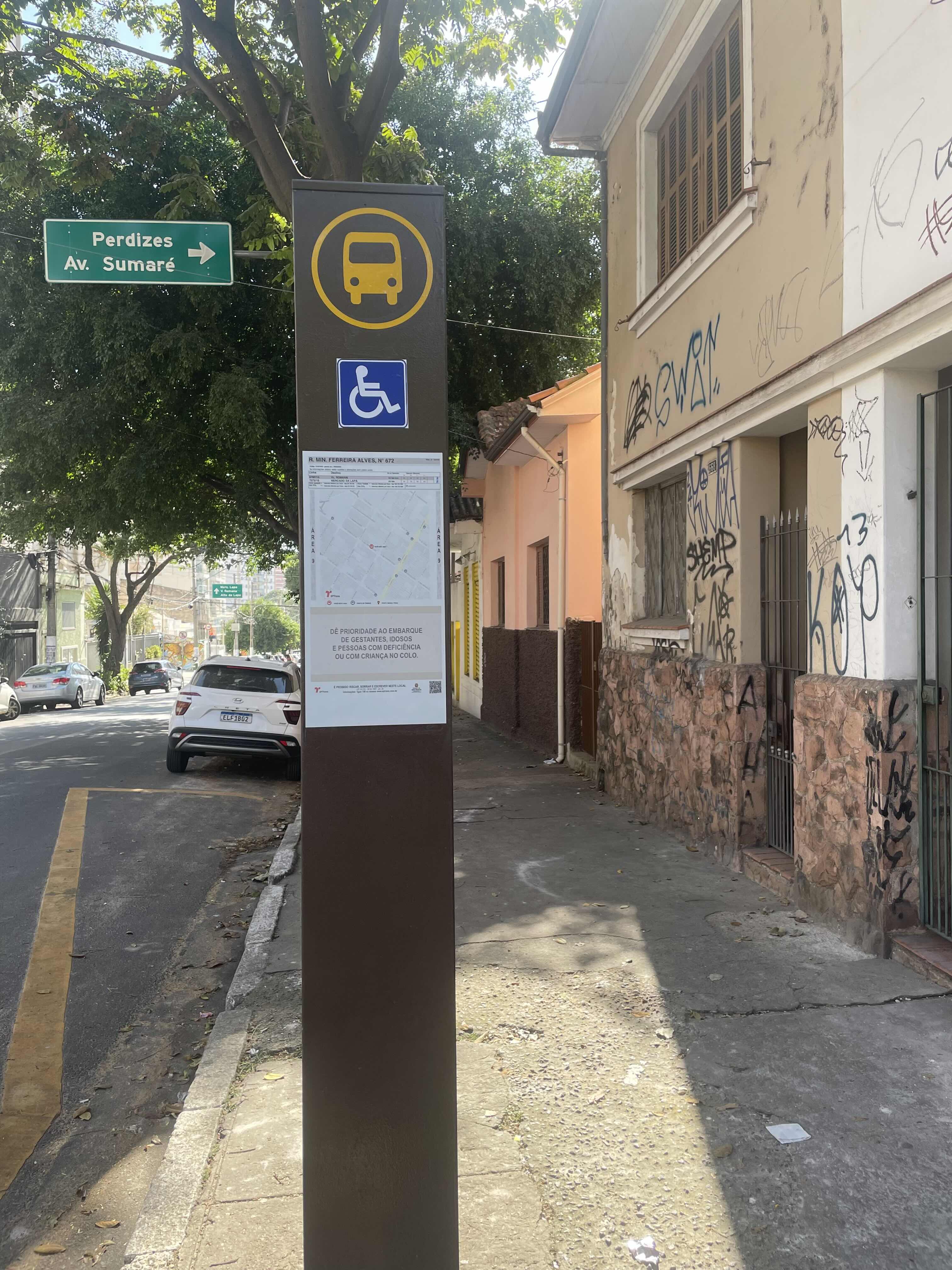 Taken by Anonymous
See R. Min. Ferreira Alves, 672 stop, Perdizes, on the map
Public transit to R. Min. Ferreira Alves, 672 stop in Perdizes
Looking for directions to R. Min. Ferreira Alves, 672 in Perdizes, Brazil?
Download the Moovit App to find the current schedule and step-by-step directions for Bus, Metro or Train routes that pass through R. Min. Ferreira Alves, 672.
Looking for the nearest stops closest to R. Min. Ferreira Alves, 672 ? Check out this list of closest stops to your destination: Avenida Pompéia 1015; R. Des. do Vale; R. Min. Ferreira Alves; R. Dr. Augusto de Miranda; R. Des. do Vale; Vila Madalena; Palmeiras-Barra Funda; Água Branca; Lapa.
Bus: 478P-10, 7272-10, 809U-10, 809U-21, 856R-10, N206-11, 8252-10.Metro: LINHA 2, LINHA 3.Train: LINHA 7, LINHA 8, LINHA 10, LINHA 11, 13 - JADE.
We make riding on public transit to R. Min. Ferreira Alves, 672 easy, which is why over 1.7 billion users, including users in Perdizes trust Moovit as the best app for public transit.
Use the app to navigate to popular places including to the airport, hospital, stadium, grocery store, mall, coffee shop, school, college, and university.
The first line to this stop is 478P-10, at 5:31 AM, and the last line is 478P-10 at 1:24 AM.
638 Rua Ministro Ferreira Alves, São Paulo, Brazil
This stop serves SPTrans’s lines
- Avenida Pompéia 1015,
- R. Des. do Vale, 539,
- R. Min. Ferreira Alves, 829,
- R. Dr. Augusto de Miranda, 292,
- R. Des. do Vale, 1043
Bus stops near R. Min. Ferreira Alves, 672 stop
- Vila Madalena,
- Palmeiras-Barra Funda
Metro stations near R. Min. Ferreira Alves, 672 station
- Água Branca,
- Lapa,
- Palmeiras-Barra Funda
Train stations near R. Min. Ferreira Alves, 672 station
- Av. José Maria Whitaker, 81,
- Av. dos Metalúrgicos, 1797,
- Estrada Mogi-Bertioga (Km 75),
- Parada Upa City Jaraguá,
- Avenida Brigadeiro Luís Antônio , 4008,
- Corinthians-Itaquera,
- Estação Metrô Pedro II,
- Av. Angélica, 634,
- Av. Souza Ramos, 245,
- Parada Castelo Branco,
- Rodovia Presidente Castelo Branco, 360-374,
- Estrada Municipal Santo Angelo (Bar Do Cosme),
- Rua Siqueira Campos, 483,
- Hospital Leonor Mendes de Barros,
- Av. Diógenes Ribeiro de Lima, 2200,
- Avenida Charles Goodyear, 65,
- Parada Bandeira Paulista 446,
- Av. Hebe Camargo - Antônio F. de Castilho 8,
- Av. Raimundo Pereira de Magalhães, 1881,
- Avenida Florêncio De Paiva 566
Popular public transit stations in Perdizes
Get around Perdizes by public transit!
Traveling around Perdizes has never been so easy. See step by step directions as you travel to any attraction, street or major public transit station. View bus and train schedules, arrival times, service alerts and detailed routes on a map, so you know exactly how to get to anywhere in Perdizes.
When traveling to any destination around Perdizes use Moovit's Live Directions with Get Off Notifications to know exactly where and how far to walk, how long to wait for your line, and how many stops are left. Moovit will alert you when it's time to get off — no need to constantly re-check whether yours is the next stop.
Wondering how to use public transit in Perdizes or how to pay for public transit in Perdizes? Moovit public transit app can help you navigate your way with public transit easily, and at minimum cost. It includes public transit fees, ticket prices, and costs. Looking for a map of Perdizes public transit lines? Moovit public transit app shows all public transit maps in Perdizes with all Bus, Train, Metro, Light Rail, Ferry, Gondola, Cable Car and Funicular routes and stops on an interactive map.
Sao Paulo Region has 8 transit type(s), including: Bus, Train, Metro, Light Rail, Ferry, Gondola, Cable Car and Funicular, operated by several transit agencies, including SPTrans, CPTM, ViaMobilidade, Aquático SP, SPTRANS, EMTU, ViaQuatro, Auto Ônibus Moratense, GRU Airport (Aeroporto de Guarulhos), Auto Viação Urubupungá (Cajamar), Viação Cometa, Auto Viação Urubupungá (Osasco), Viação Ultra / Rápido Brasil, Auto Viação Urubupungá (Santana de Parnaíba) and Expresso Luxo