Directions to R.P Cavalcante Servicos (Colombo) with public transportation
The following transit lines have routes that pass near R.P Cavalcante Servicos
How to get to R.P Cavalcante Servicos by bus?
Click on the bus route to see step by step directions with maps, line arrival times and updated time schedules.
From cemitério vaticano, Almirante Tamandaré
89 minFrom Terminal Cachoeira, Almirante Tamandaré
62 minFrom Ginásio do Tarumã, Tarumã
47 minFrom Rua Thereza Lopes Skroski, Santa Cândida
55 minFrom Quatro Barras, Quatro Barras
61 minFrom Emiliano Perneta, Pinhais
44 minFrom Rua Fernandes de Barros, Hugo Lange
47 minFrom Jardim Paulista, Campina Grande Do Sul
40 minFrom Jockey Club do Paraná, Tarumã
50 minFrom Avenida Victor Ferreira do Amaral, Tarumã
48 min
Bus stops near R.P Cavalcante Servicos in Colombo
Bus lines to R.P Cavalcante Servicos in Colombo
- S11 ROÇA GRANDE / GUARAITUBA, Terminal Roça Grande → Terminal Guaraituba,VIEW
- B13 JARDIM DAS GRAÇAS, Jardim Das Graças → Terminal Maracanã,VIEW
- B03 GUARAITUBA / ALTO DA XV (VIA MARACANÃ), Terminal Guaraituba ↺ Jardim Social / Alto da Rua XV (Circular),VIEW
- B06 GUARAITUBA / RUI BARBOSA (VIA MARACANÃ / SEMIDIRETO), Marechal Dedoro / Rui Barbosa → Terminal Guaraituba ,VIEW
- B20 GUARAITUBA / CABRAL (VIA MARACANÃ), Terminal Guaraituba → Terminal Cabral,VIEW
- B69 MAD. CURITIBA / SÃO DIMAS, São Dimas → Terminal Guadalupe,VIEW
- B89 GUARAITUBA / RUI BARBOSA (VIA MARACANÃ / CABRAL), Terminal Guaraituba → Praça Rui Barbosa,VIEW
- Y99 TUNAS DO PARANÁ / GUADALUPE, Terminal Guadalupe → Tunas do Paraná,VIEW
- U11 ITAJACURU / SANTA GEMA (IMBUIAL), Terminal Sede Colombo ↺ Itajacuru / Santa Gema (Circular),VIEW
- 0950-500 CURITIBA / ADRIANÓPOLIS (VIA TUNAS DO PARANÁ), Curitiba → Adrianópolis,VIEW
What are the closest stations to R.P Cavalcante Servicos?
The closest stations to R.P Cavalcante Servicos are:
- Rua Hélio Dalprá, 33 is 9 meters away, 1 min walk.
- Rodovia Br 476 (Estrada Da Ribeira) - Paróquia Santa Teresinha is 197 meters away, 3 min walk.
- Rodovia Br 476 (Estrada Da Ribeira) - Klauzer is 316 meters away, 5 min walk.
Which bus lines stop near R.P Cavalcante Servicos?
These bus lines stop near R.P Cavalcante Servicos: B06 GUARAITUBA / RUI BARBOSA (VIA MARACANÃ / SEMIDIRETO), B20 GUARAITUBA / CABRAL (VIA MARACANÃ), I33 JARDIM PAULISTA / GUARAITUBA.
What’s the nearest bus station to R.P Cavalcante Servicos in Colombo?
The nearest bus station to R.P Cavalcante Servicos in Colombo is Rua Hélio Dalprá, 33. It’s a 1 min walk away.
What time is the first bus to R.P Cavalcante Servicos in Colombo?
The B69 MAD. CURITIBA / SÃO DIMAS is the first bus that goes to R.P Cavalcante Servicos in Colombo. It stops nearby at 4:02 AM.
What time is the last bus to R.P Cavalcante Servicos in Colombo?
The B69 MAD. CURITIBA / SÃO DIMAS is the last bus that goes to R.P Cavalcante Servicos in Colombo. It stops nearby at 2:05 AM.
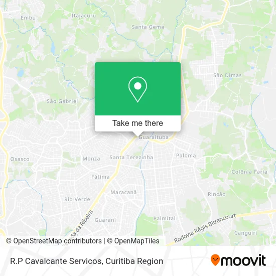
See R.P Cavalcante Servicos, Colombo, on the map
Public Transit to R.P Cavalcante Servicos in Colombo
Wondering how to get to R.P Cavalcante Servicos in Colombo? Moovit helps you find the best way to get to R.P Cavalcante Servicos with step-by-step directions from the nearest public transit station.
Moovit provides free maps and live directions to help you navigate through your city. View schedules, routes, timetables, and find out how long does it take to get to R.P Cavalcante Servicos in real time.
Looking for the nearest stop or station to R.P Cavalcante Servicos? Check out this list of stops closest to your destination: Rua Hélio Dalprá; Rodovia Br 476 (Estrada Da Ribeira) - Paróquia Santa Teresinha; Rodovia Br 476 (Estrada Da Ribeira) - Klauzer.
Bus: B06 GUARAITUBA / RUI BARBOSA (VIA MARACANÃ / SEMIDIRETO), B20 GUARAITUBA / CABRAL (VIA MARACANÃ), I33 JARDIM PAULISTA / GUARAITUBA, S11 ROÇA GRANDE / GUARAITUBA, B13 JARDIM DAS GRAÇAS, B03 GUARAITUBA / ALTO DA XV (VIA MARACANÃ), B69 MAD. CURITIBA / SÃO DIMAS, B89 GUARAITUBA / RUI BARBOSA (VIA MARACANÃ / CABRAL), U11 ITAJACURU / SANTA GEMA (IMBUIAL), 0950-500 CURITIBA / ADRIANÓPOLIS (VIA TUNAS DO PARANÁ).
Want to see if there’s another route that gets you there at an earlier time? Moovit helps you find alternative routes or times. Get directions from and directions to R.P Cavalcante Servicos easily from the Moovit App or Website.
We make riding to R.P Cavalcante Servicos easy, which is why over 1.5 million users, including users in Colombo, trust Moovit as the best app for public transit. You don’t need to download an individual bus app or train app, Moovit is your all-in-one transit app that helps you find the best bus time or train time available.
For information on prices of bus, costs and ride fares to R.P Cavalcante Servicos, please check the Moovit app.
Use the app to navigate to popular places including to the airport, hospital, stadium, grocery store, mall, coffee shop, school, college, and university.
R.P Cavalcante Servicos Address: Rua Maiorca, 56 Santa Terezinha Colombo-PR 83408-630 street in Colombo
- Promessa Music Gravadora e Corretora,
- Abrotto Transportes,
- Betinardi Holding,
- Jedaias Silva Sociedade Individual de Advocacia,
- Residencial Maiorca VI,
- Brasil Parafusos,
- Alternativa Manutencao de Ferramentas,
- Lcr Negocios,
- Wilson José Maschio Sociedade Individual de Advocacia,
- C M G Imóveis,
- Gilberto Carlos Marczak da Silva,
- Azul Piscinas,
- Consultório Veterinário Domitila Moreira,
- Material de Construção e Madereira Carvalho,
- Auto Center Modelo,
- Dalpra Auto Center,
- Ecritório do Vovô Ademir Goulart,
- Moveislider,
- Perlin Neves E Cia,
- Banco 24horas
Places Near R.P Cavalcante Servicos (Colombo)
- Hospital Erasto Gaertner, Jardim Das Américas,
- Hospital do Rocio, Campo,
- Hospital Da Cruz Vermelha, Batel,
- Parque Barigui, Mercês,
- Hospital Nossa Senhora Das Graças, Mercês,
- Campo Largo, Campo,
- Jardim Botânico de Curitiba PR, Centro,
- Arena Da Baixada - Curitiba,
- Pontifícia Universidade Católica do Paraná (PUCPR), Prado Velho,
- Rua General Mário Tourinho, Campina Do Siqueira,
- Shopping Palladium, Portão,
- Hospital Madalena Sofia, Bairro Alto,
- Park Shopping Barigüi, Mossunguê,
- Hospital de Clínicas (HC - UFPR), Centro,
- Rua Martim Afonso 558, Mercês,
- Hospital Angelina Caron, Campina Grande Do Sul,
- Jockey Plaza Shopping Center, Tarumã,
- Shopping Estação, Rebouças,
- Hospital Universitário Evangélico de Curitiba, Bigorrilho,
- Hhhhh, Fazendinha
How to get to popular places in Curitiba Region with public transit
Get around Colombo by public transit!
Traveling around Colombo has never been so easy. See step by step directions as you travel to any attraction, street or major public transit station. View bus and train schedules, arrival times, service alerts and detailed routes on a map, so you know exactly how to get to anywhere in Colombo.
When traveling to any destination around Colombo use Moovit's Live Directions with Get Off Notifications to know exactly where and how far to walk, how long to wait for your line, and how many stops are left. Moovit will alert you when it's time to get off — no need to constantly re-check whether yours is the next stop.
Wondering how to use public transit in Colombo or how to pay for public transit in Colombo? Moovit public transit app can help you navigate your way with public transit easily, and at minimum cost. It includes public transit fees, ticket prices, and costs. Looking for a map of Colombo public transit lines? Moovit public transit app shows all public transit maps in Colombo with all Bus and Cable Car routes and stops on an interactive map.
Curitiba Region has 2 transit type(s), including: Bus and Cable Car, operated by several transit agencies, including Sistema Integrado de Mobilidade (URBS), Sistema Integrado de Mobilidade (AMEP), URBS (Cartões bancários e Dinheiro), URBS (Cartões bancários / Cartão URBS), AMEP (Cartões bancários / Cartão MetroCard), AMEP (Cartões bancários / Cartão MetroCard / Dinheiro), Viação Colombo (Dinheiro), TRIAR (Cartão TRIAR / Dinheiro), Empresa Curitiba Cerro Azul (Dinheiro), Expresso Nossa Senhora da Penha (Dinheiro), Empresa Campo Alto Tijucas (Dinheiro), Auto Viação São José (Cartão VEM / Dinheiro), BRT S/A (Cartão VEM / Dinheiro), TransPiedade (Cartão Cidadão / Dinheiro) and Oceânica Sul (Cartão Transporte / Dinheiro)
Public transit lines with stations closest to R.P Cavalcante Servicos in Colombo
Bus lines with stations closest to R.P Cavalcante Servicos in Colombo
Rodovia Br 476 (Estrada Da Ribeira) - Paróquia Santa Teresinha
 B03 GUARAITUBA / ALTO DA XV (VIA MARACANÃ)GUARAITUBA / ALTO DA XV (via MARACANÃ)
- B06 GUARAITUBA / RUI BARBOSA (VIA MARACANÃ / SEMIDIRETO)GUARAITUBA / RUI BARBOSA (via MARACANÃ / SEMIDIRETO)
- B20 GUARAITUBA / CABRAL (VIA MARACANÃ)GUARAITUBA / CABRAL (via MARACANÃ)
- B69 MAD. CURITIBA / SÃO DIMASMAD. CURITIBA / SÃO DIMAS
- B89 GUARAITUBA / RUI BARBOSA (VIA MARACANÃ / CABRAL)GUARAITUBA / RUI BARBOSA (via MARACANÃ / CABRAL)