How to get to R.P. Installations by bus?
Click on the bus route to see step by step directions with maps, line arrival times and updated time schedules.
From Canada Post Distribution Center (LCD2), Edmonton
86 minFrom Walmart-Meadowlark, Edmonton
41 minFrom Edmonton AISH Office, Edmonton
50 minFrom A L Technical Services, Edmonton
70 minFrom Ross Sheppard High School, Edmonton
60 minFrom YEG Tex, Edmonton
77 minFrom Mayfield Common, Edmonton
68 minFrom Ambleside, Edmonton
94 minFrom Kaye Edmonton Clinic Outpatient Referrals, Edmonton
48 minFrom Kaye Edmonton Clinic, Edmonton
48 min
Bus stops near R.P. Installations in Edmonton
Bus lines to R.P. Installations in Edmonton
What are the closest stations to R.P. Installations?
The closest stations to R.P. Installations are:
- Lewis Estates Boulevard & Suder Greens Drive is 522 meters away, 7 min walk.
- Guardian Road & Whitemud Drive is 1093 meters away, 15 min walk.
- 215 Street & Rosenthal Boulevard is 1393 meters away, 18 min walk.
Which bus lines stop near R.P. Installations?
These bus lines stop near R.P. Installations: 916, 917.
What’s the nearest bus station to R.P. Installations in Edmonton?
The nearest bus station to R.P. Installations in Edmonton is Lewis Estates Boulevard & Suder Greens Drive. It’s a 7 min walk away.
What time is the first bus to R.P. Installations in Edmonton?
The 917 is the first bus that goes to R.P. Installations in Edmonton. It stops nearby at 5:48 AM.
What time is the last bus to R.P. Installations in Edmonton?
The 916 is the last bus that goes to R.P. Installations in Edmonton. It stops nearby at 12:11 AM.
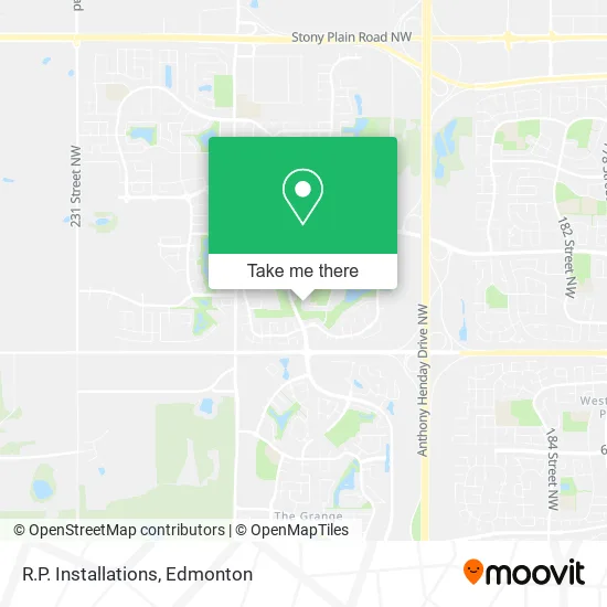
See R.P. Installations, Edmonton, on the map
Public Transit to R.P. Installations in Edmonton
Wondering how to get to R.P. Installations in Edmonton? Moovit helps you find the best way to get to R.P. Installations with step-by-step directions from the nearest public transit station.
Moovit provides free maps and live directions to help you navigate through your city. View schedules, routes, timetables, and find out how long does it take to get to R.P. Installations in real time.
Looking for the nearest stop or station to R.P. Installations? Check out this list of stops closest to your destination: Lewis Estates Boulevard & Suder Greens Drive; Guardian Road & Whitemud Drive; 215 Street & Rosenthal Boulevard.
Bus: 916, 917, 678, 926, 930X, 922.
Want to see if there’s another route that gets you there at an earlier time? Moovit helps you find alternative routes or times. Get directions from and directions to R.P. Installations easily from the Moovit App or Website.
We make riding to R.P. Installations easy, which is why over 1.5 million users, including users in Edmonton, trust Moovit as the best app for public transit. You don’t need to download an individual bus app or train app, Moovit is your all-in-one transit app that helps you find the best bus time or train time available.
For information on prices of bus, costs and ride fares to R.P. Installations, please check the Moovit app.
Use the app to navigate to popular places including to the airport, hospital, stadium, grocery store, mall, coffee shop, school, college, and university.
R.P. Installations Address: 837 Proctor Wynd NW Edmonton, AB T5T 6J3 street in Edmonton
- Lewis Estate Potter Green Park,
- Potter Greens Park Playground (West),
- Neat A Clean,
- Evolution Massage Care Clinic,
- Trady's Construction & Painting,
- Breckenridge Lane & Breckenridge Drive,
- Circle-D Drywall,
- Rainbow,
- Radiance by Chloe,
- Edo of Japan,
- Good Buddy Granville,
- Pizza Hut,
- Ace Liquor the Grange,
- Soulfire Music,
- M & M Food Market,
- GDP Inc. ,
- Mon Amour Hair Extension,
- Suder's Green Park,
- Bayline Travel Corp,
- Urban Rebel
Places Near R.P. Installations (Edmonton)
- Grey Nuns Community Hospital, Edmonton,
- Canada Place Service Canada Centre, Edmonton,
- Edmonton Commonwealth Stadium, Edmonton,
- MacEwan University, Edmonton,
- University of Alberta, Edmonton,
- Alberta Legislature Building, Edmonton,
- Fort Edmonton Park, Edmonton,
- Edmonton VIA Rail Station, Edmonton,
- Rogers Place, Edmonton,
- Royal Alexandra Hospital, Edmonton,
- Edmonton Valley Zoo, Edmonton,
- Cross Cancer Institute, Edmonton,
- Whyte Avenue, Edmonton,
- Edmonton EXPO Centre, Edmonton,
- West Edmonton Mall, Edmonton,
- Londonderry Mall, Edmonton,
- Borden Park, Edmonton,
- Northgate Centre, Edmonton,
- Kingsway Mall, Edmonton,
- Kaye Edmonton Clinic, Edmonton
How to get to popular places in Edmonton with public transit
Get around Edmonton by public transit!
Traveling around Edmonton has never been so easy. See step by step directions as you travel to any attraction, street or major public transit station. View bus and train schedules, arrival times, service alerts and detailed routes on a map, so you know exactly how to get to anywhere in Edmonton.
When traveling to any destination around Edmonton use Moovit's Live Directions with Get Off Notifications to know exactly where and how far to walk, how long to wait for your line, and how many stops are left. Moovit will alert you when it's time to get off — no need to constantly re-check whether yours is the next stop.
Wondering how to use public transit in Edmonton or how to pay for public transit in Edmonton? Moovit public transit app can help you navigate your way with public transit easily, and at minimum cost. It includes public transit fees, ticket prices, and costs. Looking for a map of Edmonton public transit lines? Moovit public transit app shows all public transit maps in Edmonton with all Bus and Light Rail routes and stops on an interactive map.
Edmonton has 2 transit type(s), including: Bus and Light Rail, operated by several transit agencies, including ETS LRT, ETS, Strathcona County Transit, St. Albert Transit, Spruce Grove Transit, Fort Saskatchewan Transit, Beaumont Transit and Leduc Transit