R. Parapuã, 336 stop - Wednesday schedule
| Line | Direction | Time |
|---|---|---|
| N141-11 | Jd. Carombé | 3:14 AM |
| N141-11 | Jd. Carombé | 4:14 AM |
| 9047-10 | Jd. Paulistano | 5:26 AM |
| 978T-10 | Jd. Guarani | 5:27 AM |
| 9789-10 | Jd. Paulistano | 5:38 AM |
| 9047-10 | Jd. Paulistano | 5:41 AM |
| 978T-10 | Jd. Guarani | 5:41 AM |
| 9789-10 | Jd. Paulistano | 5:48 AM |
| 978T-10 | Jd. Guarani | 5:49 AM |
| 9047-10 | Jd. Paulistano | 5:51 AM |
| 978T-10 | Jd. Guarani | 5:57 AM |
| 9789-10 | Jd. Paulistano | 6:01 AM |
| 9047-10 | Jd. Paulistano | 6:01 AM |
| 978T-10 | Jd. Guarani | 6:05 AM |
| 9789-10 | Jd. Paulistano | 6:13 AM |
| 9047-10 | Jd. Paulistano | 6:13 AM |
| 978T-10 | Jd. Guarani | 6:13 AM |
| 978T-10 | Jd. Guarani | 6:22 AM |
| 9789-10 | Jd. Paulistano | 6:23 AM |
| 9047-10 | Jd. Paulistano | 6:23 AM |
| 978T-10 | Jd. Guarani | 6:30 AM |
| 9047-10 | Jd. Paulistano | 6:32 AM |
| 9789-10 | Jd. Paulistano | 6:34 AM |
| 978T-10 | Jd. Guarani | 6:38 AM |
| 9047-10 | Jd. Paulistano | 6:40 AM |
Directions to R. Parapuã, 336 stop (Freguesia Do Ó) with public transit
The following transit lines have routes that pass near R. Parapuã, 336
 Bus: 8215-10, 847P-42, 8528-10, 9047-10, 9789-10.
- Train: LINHA 7.
How to get to R. Parapuã, 336 stop by bus?
Click on the bus route to see step by step directions with maps, line arrival times and updated time schedules.
Bus stops near R. Parapuã, 336 stop in Freguesia Do Ó
- R. Parapuã, 299, 1 min walk,
- R. Teixeira de Macedo, 33, 2 min walk,
- Avenida Itaberaba, 2001, 6 min walk,
- Avenida Itaberaba 2220, 7 min walk,
- Av. Min. Petrônio Portela, 2255, 7 min walk,
- Avenida Ministro Petrônio Portela 967 2035, 7 min walk,
Train stations near R. Parapuã, 336 station in Freguesia Do Ó
- Lapa, 32 min walk,
Bus lines to R. Parapuã, 336 stop in Freguesia Do Ó
- N141-11, Terminal Cachoeirinha - Jardim Carombé (Circular),
- N142-11, Terminal Pirituba - Terminal Casa Verde (Circular),
- 847P-42, Brasilândia - Vila Olímpia,
- 978T-10, Jardim Guarani - Metrô Barra Funda,
- 8215-10, Jardim Paulistano - Praça Do Correio,
- 8528-10, Jardim Guarani - Praça Do Correio,
- 9012-10, Itaberaba - Terminal Lapa,
- 9047-10, Jardim Paulistano - Lapa,
- 9789-10, Jardim Paulistano - Metrô Barra Funda,
- 975A-10, Metrô Ana Rosa,
- 957T-10, COHAB Taipas,
- 938V-10, Jd. Vista Alegre,
- 8199-10, Cem. Vl. Nova Cachoeirinha,
- 8545-10, Penteado,
- 9014-42, Term. Lapa,
- N144-11, Hospital Brasilândia,
- 917M-31, Morro Grande,
- 1024-10, Conexão Petrônio Portela,
- 1025-10, Conexão Petrônio Portela,
- 1026-10, Vl. Iara,
What are the closest stations to R. Parapuã, 336?
The closest stations to R. Parapuã, 336 are:
- R. Parapuã, 299 stop is 39 meters away, 1 min walk.
- R. Teixeira de Macedo, 33 stop is 72 meters away, 2 min walk.
- Avenida Itaberaba, 2001 stop is 427 meters away, 6 min walk.
- Avenida Itaberaba 2220 stop is 468 meters away, 7 min walk.
- Av. Min. Petrônio Portela, 2255 stop is 516 meters away, 7 min walk.
- Avenida Ministro Petrônio Portela 967 2035 stop is 521 meters away, 7 min walk.
- Lapa station is 2480 meters away, 32 min walk.
Which bus lines stop near R. Parapuã, 336?
These bus lines stop near R. Parapuã, 336: 8215-10, 847P-42, 8528-10, 9047-10, 9789-10, 978T-10.
What’s the nearest bus station to R. Parapuã, 336 in Freguesia Do Ó?
The nearest bus station to R. Parapuã, 336 in Freguesia Do Ó is R. Parapuã, 299. It’s a 1 min walk away.
What time is the first train to R. Parapuã, 336 in Freguesia Do Ó?
The LINHA 7 is the first train that goes to R. Parapuã, 336 in Freguesia Do Ó. It stops nearby at 4:06 AM.
What time is the last train to R. Parapuã, 336 in Freguesia Do Ó?
The LINHA 7 is the last train that goes to R. Parapuã, 336 in Freguesia Do Ó. It stops nearby at 12:57 AM.
What time is the first bus to R. Parapuã, 336 in Freguesia Do Ó?
The N144-11 is the first bus that goes to R. Parapuã, 336 in Freguesia Do Ó. It stops nearby at 3:00 AM.
What time is the last bus to R. Parapuã, 336 in Freguesia Do Ó?
The N142-11 is the last bus that goes to R. Parapuã, 336 in Freguesia Do Ó. It stops nearby at 3:17 AM.
R. Parapuã, 336 station
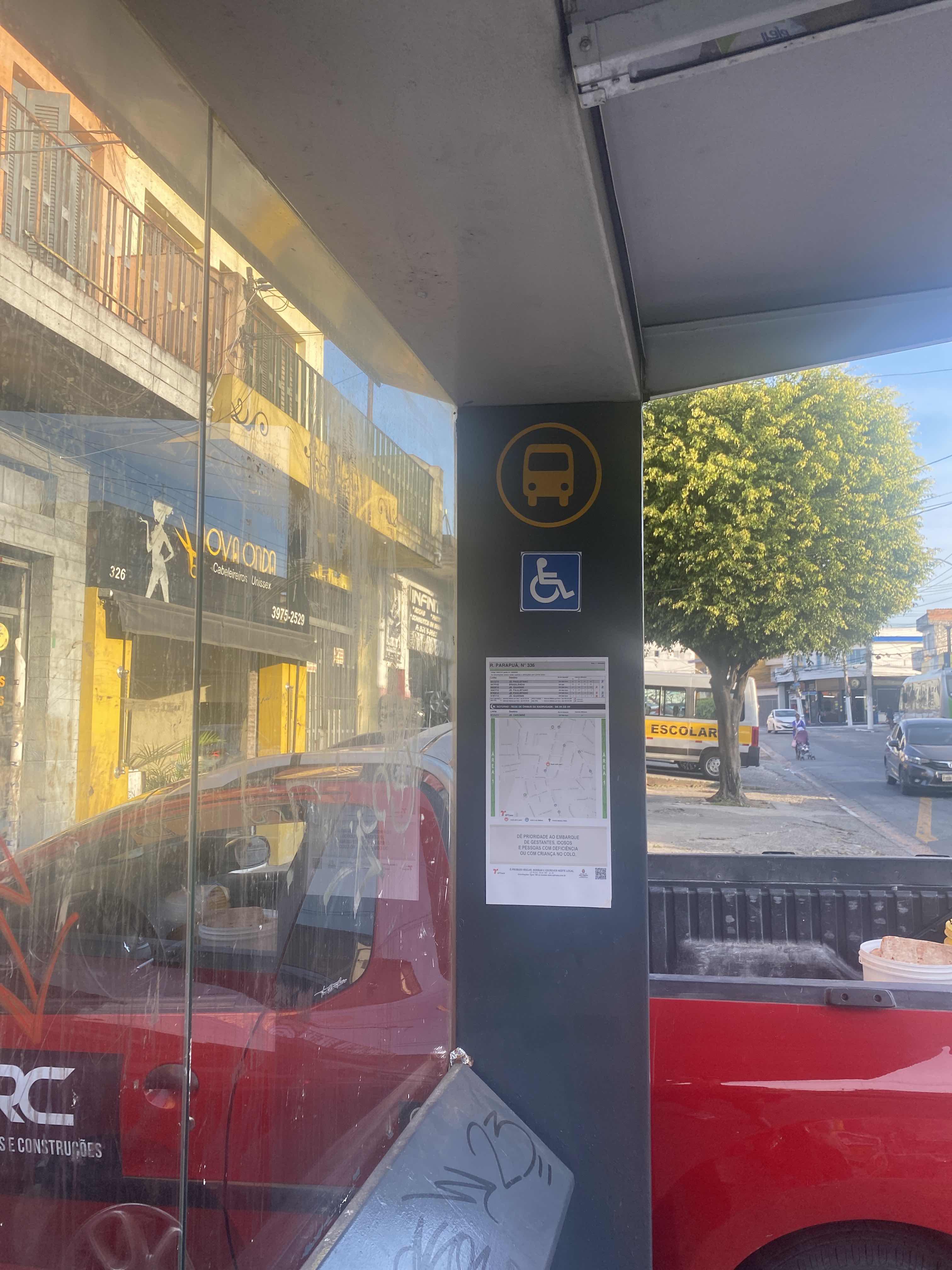 Taken by Anonymous
See R. Parapuã, 336 stop, Freguesia Do Ó, on the map
Public transit to R. Parapuã, 336 stop in Freguesia Do Ó
Looking for directions to R. Parapuã, 336 in Freguesia Do Ó, Brazil?
Download the Moovit App to find the current schedule and step-by-step directions for Bus, Metro or Train routes that pass through R. Parapuã, 336.
Looking for the nearest stops closest to R. Parapuã, 336 ? Check out this list of closest stops to your destination: R. Parapuã; R. Teixeira de Macedo; Avenida Itaberaba; Avenida Itaberaba 2220; Av. Min. Petrônio Portela; Avenida Ministro Petrônio Portela 967 2035; Lapa.
Bus: 8215-10, 847P-42, 8528-10, 9047-10, 9789-10, 978T-10, N141-11, N142-11, 975A-10, 957T-10, 938V-10, 8199-10, 8545-10, 9014-42.Train: LINHA 7.
We make riding on public transit to R. Parapuã, 336 easy, which is why over 1.7 billion users, including users in Freguesia Do Ó trust Moovit as the best app for public transit.
Use the app to navigate to popular places including to the airport, hospital, stadium, grocery store, mall, coffee shop, school, college, and university.
The first line to this stop is N141-11, at 3:14 AM, and the last line is N141-11 at 2:14 AM.
297 Rua Parapua, São Paulo, Brazil
This stop serves SPTrans’s lines
- R. Parapuã, 299,
- R. Teixeira de Macedo, 33,
- Avenida Itaberaba, 2001,
- Avenida Itaberaba 2220,
- Av. Min. Petrônio Portela, 2255,
- Avenida Ministro Petrônio Portela 967 2035
Bus stops near R. Parapuã, 336 stop
- Lapa
Train station near R. Parapuã, 336 station
- Osasco,
- Av. Moreira Guimarães, 510,
- Terminal Lapa,
- Rua Boa Vista, 364,
- Biritiba Ussu (Esquina Mogi-Bertioga),
- Avenida Professor Ascendino Reis, 830 • Metrô Aacd-Servidor,
- Botujuru,
- Imperatriz Leopoldina,
- Av. Bráz Leme, 1000,
- Jardim Silveira,
- Av. Brasil, 2200,
- Av. Pacaembu, 820,
- Av. dos Nacionalistas, 920,
- Av. Wilhelm Friedrich Ladwig,
- Rua Brigadeiro Gavião Peixoto 213,
- Parada Periperi (C/B),
- Av. Yervant Kissajikian, 2248,
- Parada 3 - Metrô Tatuapé,
- Av. Prestes Maia- 811,
- R. Gen. Mendes, 45
Popular public transit stations in Freguesia Do Ó
Get around Freguesia Do Ó by public transit!
Traveling around Freguesia Do Ó has never been so easy. See step by step directions as you travel to any attraction, street or major public transit station. View bus and train schedules, arrival times, service alerts and detailed routes on a map, so you know exactly how to get to anywhere in Freguesia Do Ó.
When traveling to any destination around Freguesia Do Ó use Moovit's Live Directions with Get Off Notifications to know exactly where and how far to walk, how long to wait for your line, and how many stops are left. Moovit will alert you when it's time to get off — no need to constantly re-check whether yours is the next stop.
Wondering how to use public transit in Freguesia Do Ó or how to pay for public transit in Freguesia Do Ó? Moovit public transit app can help you navigate your way with public transit easily, and at minimum cost. It includes public transit fees, ticket prices, and costs. Looking for a map of Freguesia Do Ó public transit lines? Moovit public transit app shows all public transit maps in Freguesia Do Ó with all Bus, Train, Metro, Light Rail, Ferry, Gondola, Cable Car and Funicular routes and stops on an interactive map.
Sao Paulo Region has 8 transit type(s), including: Bus, Train, Metro, Light Rail, Ferry, Gondola, Cable Car and Funicular, operated by several transit agencies, including SPTrans, CPTM, ViaMobilidade, Aquático SP, SPTRANS, EMTU, ViaQuatro, Auto Ônibus Moratense, GRU Airport (Aeroporto de Guarulhos), Auto Viação Urubupungá (Cajamar), Viação Cometa, Auto Viação Urubupungá (Osasco), Viação Ultra / Rápido Brasil, Auto Viação Urubupungá (Santana de Parnaíba) and Expresso Luxo