Directions to R&R Extreme Wings (Indianapolis City (Balance)) with public transportation
The following transit lines have routes that pass near R&R Extreme Wings
 Bus: 16.
How to get to R&R Extreme Wings by bus?
Click on the bus route to see step by step directions with maps, line arrival times and updated time schedules.
From I-465 / I-65 Interchange, Indianapolis City (Balance)
41 minFrom Churchman Hill Plaza Shopping Center, Beech Grove
57 minFrom US 31 and Thompson Rd, Indianapolis City (Balance)
57 minFrom Christel House Academy, Indianapolis City (Balance)
43 minFrom S Arlington Ave / E Raymond St, Indianapolis City (Balance)
81 minFrom E Thompson Rd / S Shelby St, Indianapolis City (Balance)
89 minFrom Chiropractor, Indianapolis City (Balance)
38 minFrom ALDI, Indianapolis City (Balance)
39 min
Bus stop near R&R Extreme Wings in Indianapolis City (Balance)
- Emerson Ave & Ehler Dr, 7 min walk,VIEW
Bus lines to R&R Extreme Wings in Indianapolis City (Balance)
- 16, County Line Rd,VIEW
What are the closest stations to R&R Extreme Wings?
The closest stations to R&R Extreme Wings are:
- Emerson Ave & Ehler Dr is 585 yards away, 7 min walk.
Which bus line stops near R&R Extreme Wings?
16 (County Line Rd)
What’s the nearest bus station to R&R Extreme Wings in Indianapolis City (Balance)?
The nearest bus station to R&R Extreme Wings in Indianapolis City (Balance) is Emerson Ave & Ehler Dr. It’s a 7 min walk away.
What time is the first bus to R&R Extreme Wings in Indianapolis City (Balance)?
The 16 is the first bus that goes to R&R Extreme Wings in Indianapolis City (Balance). It stops nearby at 4:51 AM.
What time is the last bus to R&R Extreme Wings in Indianapolis City (Balance)?
The 16 is the last bus that goes to R&R Extreme Wings in Indianapolis City (Balance). It stops nearby at 10:15 PM.
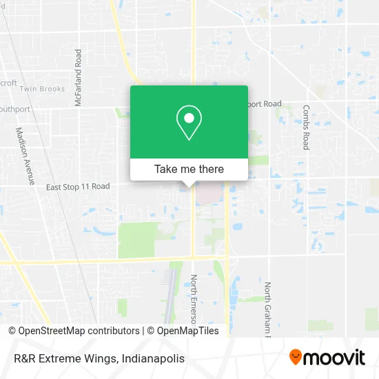
See R&R Extreme Wings, Indianapolis City (Balance), on the map
Public Transit to R&R Extreme Wings in Indianapolis City (Balance)
Wondering how to get to R&R Extreme Wings in Indianapolis City (Balance)? Moovit helps you find the best way to get to R&R Extreme Wings with step-by-step directions from the nearest public transit station.
Moovit provides free maps and live directions to help you navigate through your city. View schedules, routes, timetables, and find out how long does it take to get to R&R Extreme Wings in real time.
Looking for the nearest stop or station to R&R Extreme Wings? Check out this list of stops closest to your destination: Emerson Ave & Ehler Dr.
Bus: 16.
Want to see if there’s another route that gets you there at an earlier time? Moovit helps you find alternative routes or times. Get directions from and directions to R&R Extreme Wings easily from the Moovit App or Website.
We make riding to R&R Extreme Wings easy, which is why over 1.5 million users, including users in Indianapolis City (Balance), trust Moovit as the best app for public transit. You don’t need to download an individual bus app or train app, Moovit is your all-in-one transit app that helps you find the best bus time or train time available.
For information on prices of bus, costs and ride fares to R&R Extreme Wings, please check the Moovit app.
Use the app to navigate to popular places including to the airport, hospital, stadium, grocery store, mall, coffee shop, school, college, and university.
R&R Extreme Wings Address: 8028 S Emerson Ave Indianapolis, IN 46237 street in Indianapolis City (Balance)
- State Farm Insurance,
- KUMON,
- Enails,
- Felly Collections,
- Back To Health Chiropractic,
- Nationwide PRP Doctor Locator,
- Chickaboom,
- Chai & Kathi Roll Lounge,
- Gorall Insurance Agency,
- Franciscan Health Breast Center,
- St Francis Hospital Breast Center,
- St Francis Outpatient Lab,
- Brawley, Donna, Pt,
- JWM Neurology,
- Jamie Fletcher DVM,
- At Home Health Equipment,
- Tactic Marketing,
- Midwestern Roofing,
- Empire Beauty School,
- Indy South Foot and Ankle
Places Near R&R Extreme Wings (Indianapolis City (Balance))
- Gainbridge Fieldhouse, Indianapolis City (Balance),
- THE BALT, Indianapolis City (Balance),
- Methodist Hospital of Indianapolis, Indianapolis City (Balance),
- 119 W 19th St Parking, Indianapolis City (Balance),
- Indianapolis Motor Speedway, Speedway,
- Castleton Square Mall, Indianapolis,
- I-465 / I-65 Interchange, Indianapolis City (Balance),
- St. Vincent entrance #1, Indianapolis City (Balance),
- I U Health Methodist Hospital, Indianapolis City (Balance),
- Plainfield, IN, Plainfield,
- Lucas Oil Stadium, Indianapolis City (Balance),
- Train Ride At Castleton Mall, Indianapolis City (Balance),
- Cotter's Massage Parlor With Happy Endings, Indianapolis City (Balance),
- Eskenazi Hospital, Indianapolis City (Balance),
- Indianapolis Airport Zone 2, Indianapolis City (Balance),
- Lilly Corporate Center (Eli Lilly & Co), Indianapolis City (Balance),
- St. Vincent Hospital - Indianapolis, Indianapolis City (Balance),
- Indiana Convention Center, Indianapolis City (Balance),
- Indiana, Indianapolis City (Balance),
- Jersey Barn, Indianapolis City (Balance)
How to get to popular places in Indianapolis with public transit
Get around Indianapolis City (Balance) by public transit!
Traveling around Indianapolis City (Balance) has never been so easy. See step by step directions as you travel to any attraction, street or major public transit station. View bus and train schedules, arrival times, service alerts and detailed routes on a map, so you know exactly how to get to anywhere in Indianapolis City (Balance).
When traveling to any destination around Indianapolis City (Balance) use Moovit's Live Directions with Get Off Notifications to know exactly where and how far to walk, how long to wait for your line, and how many stops are left. Moovit will alert you when it's time to get off — no need to constantly re-check whether yours is the next stop.
Wondering how to use public transit in Indianapolis City (Balance) or how to pay for public transit in Indianapolis City (Balance)? Moovit public transit app can help you navigate your way with public transit easily, and at minimum cost. It includes public transit fees, ticket prices, and costs. Looking for a map of Indianapolis City (Balance) public transit lines? Moovit public transit app shows all public transit maps in Indianapolis City (Balance) with all bus routes and stops on an interactive map.
Indianapolis has 1 transit type(s), including: bus, operated by several transit agencies, including IndyGo, FlixBus-us and Greyhound-us