How to get to R & R House by bus?
Click on the bus route to see step by step directions with maps, line arrival times and updated time schedules.
From Waldorf Astoria Las Vegas, Paradise
34 minFrom E Sunset Rd / S Maryland Pkwy, Paradise
69 minFrom Craig And Martin Luther King/Camino El Norte, North Las Vegas
46 minFrom Post Road & Decatur, Las Vegas, Paradise
66 minFrom W Craig Rd / N Martin Luther King Blvd, North Las Vegas
46 minFrom Harry Reid Airport Rent-A-Car Center, Enterprise
49 minFrom McCarran Rent-A-Car Center, Enterprise
49 minFrom Penthouse Mandalay Bay 62nd Floor, Paradise
41 minFrom Deja Vu Adult Emporium (Deja Vu Presents the Dark Side: A Fetish Store), Paradise
55 minFrom W Craig Rd / N Commerce St, North Las Vegas
54 min
Bus stops near R & R House in Las Vegas
Monorail station near R & R House in Las Vegas
- Harrah'S/The Linq Station, 25 min walk,VIEW
Bus lines to R & R House in Las Vegas
What are the closest stations to R & R House?
The closest stations to R & R House are:
- Nb Las Vegas at the Strat is 118 yards away, 3 min walk.
- Eb St Louis After Las Vegas is 322 yards away, 5 min walk.
- Harrah'S/The Linq Station is 2017 yards away, 25 min walk.
Which bus lines stop near R & R House?
These bus lines stop near R & R House: 108, DEUCE.
What’s the nearest bus station to R & R House in Las Vegas?
The nearest bus station to R & R House in Las Vegas is Nb Las Vegas at the Strat. It’s a 3 min walk away.
What’s the nearest Monorail station to R & R House in Las Vegas?
The nearest Monorail station to R & R House in Las Vegas is Harrah'S/The Linq Station. It’s a 25 min walk away.
What time is the first bus to R & R House in Las Vegas?
The DEUCE is the first bus that goes to R & R House in Las Vegas. It stops nearby at 3:01 AM.
What time is the last bus to R & R House in Las Vegas?
The DEUCE is the last bus that goes to R & R House in Las Vegas. It stops nearby at 3:25 AM.
What time is the first Monorail to R & R House in Las Vegas?
The LVM is the first Monorail that goes to R & R House in Las Vegas. It stops nearby at 7:00 AM.
What time is the last Monorail to R & R House in Las Vegas?
The LVM is the last Monorail that goes to R & R House in Las Vegas. It stops nearby at 12:02 AM.
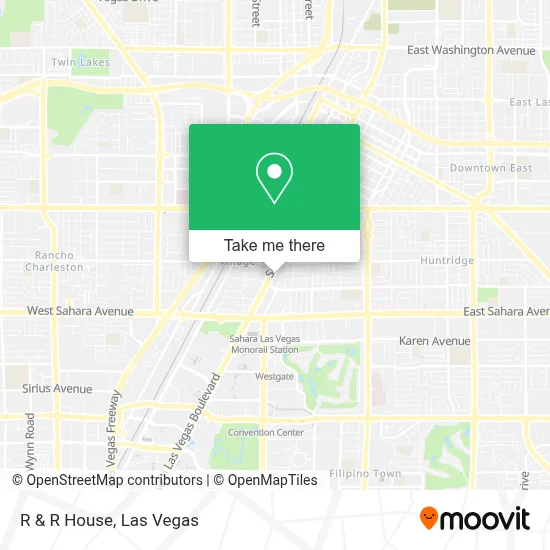
See R & R House, Las Vegas, on the map
Public Transit to R & R House in Las Vegas
Wondering how to get to R & R House in Las Vegas? Moovit helps you find the best way to get to R & R House with step-by-step directions from the nearest public transit station.
Moovit provides free maps and live directions to help you navigate through your city. View schedules, routes, timetables, and find out how long does it take to get to R & R House in real time.
Looking for the nearest stop or station to R & R House? Check out this list of stops closest to your destination: Nb Las Vegas at the Strat; Eb St Louis After Las Vegas; Harrah'S/The Linq Station.
Bus: 108, DEUCE.Monorail: LVM.
Want to see if there’s another route that gets you there at an earlier time? Moovit helps you find alternative routes or times. Get directions from and directions to R & R House easily from the Moovit App or Website.
We make riding to R & R House easy, which is why over 1.7 million users, including users in Las Vegas, trust Moovit as the best app for public transit. You don’t need to download an individual bus app or train app, Moovit is your all-in-one transit app that helps you find the best bus time or train time available.
For information on prices of bus, costs and ride fares to R & R House, please check the Moovit app.
Use the app to navigate to popular places including to the airport, hospital, stadium, grocery store, mall, coffee shop, school, college, and university.
R & R House Address: 13504 Skypark Industrial Ave street in Las Vegas
- Las Vegas World Market Shuttle Bus,
- Chapel of the Flowers,
- Stratosphere I NB (Bus Stop),
- Las Vegas Blvd S / E St Louis Ave,
- S Las Vegas Blvd / E Oakey Blvd,
- Las Vegas Strip,
- RTC Bus Stop 2596 - Stratosphere I SB,
- Bryce Canyon National Park,
- Nuleaf Dispensary Las Vegas Strip,
- NV-604,
- Dv Love Boutique Stratosphere,
- Strat Cafe & Wok,
- E Wyoming Ave / Las Vegas Blvd S,
- High Roller Stratosphere,
- The Strat,
- Stratosphere Tower,
- Stratosphere Casino, Hotel & Tower,
- Tap N Ash Social Club,
- Lamarre Theater,
- The STRAT Hotel Casino and Skypod Las Vegas
Places Near R & R House (Las Vegas)
- Town Square, Enterprise,
- Welcome To Fabulous Las Vegas Sign, Paradise,
- The Palms Casino Resort, Paradise,
- Las Vegas Premium Outlets-North, Enterprise,
- Omega Mart, Las Vegas,
- The Deuce Bus Stop at Fremont St, Las Vegas,
- Area15, Las Vegas,
- The Neon Museum, Las Vegas,
- Trump International Hotel Las Vegas, Paradise,
- Las Vegas South Premium Outlets, Enterprise,
- Las Vegas North Premium Outlets, Las Vegas,
- Koolsville Tattoos, Las Vegas,
- Allegiant Stadium, Paradise,
- Zak Bagans Haunted Museum, Las Vegas,
- Walmart, Las Vegas,
- Meow Wolf - Las Vegas (Meow Wolf's Omega Mart), Las Vegas,
- Lee Canyon, Las Vegas,
- Arte Museum Las Vegas, Paradise,
- Gold & Silver Pawn Shop, Las Vegas,
- Walmart Supercenter, Las Vegas
How to get to popular places in Las Vegas with public transit
Get around Las Vegas by public transit!
Traveling around Las Vegas has never been so easy. See step by step directions as you travel to any attraction, street or major public transit station. View bus and train schedules, arrival times, service alerts and detailed routes on a map, so you know exactly how to get to anywhere in Las Vegas.
When traveling to any destination around Las Vegas use Moovit's Live Directions with Get Off Notifications to know exactly where and how far to walk, how long to wait for your line, and how many stops are left. Moovit will alert you when it's time to get off — no need to constantly re-check whether yours is the next stop.
Wondering how to use public transit in Las Vegas or how to pay for public transit in Las Vegas? Moovit public transit app can help you navigate your way with public transit easily, and at minimum cost. It includes public transit fees, ticket prices, and costs. Looking for a map of Las Vegas public transit lines? Moovit public transit app shows all public transit maps in Las Vegas with all Bus and Monorail routes and stops on an interactive map.
Las Vegas has 2 transit type(s), including: Bus and Monorail, operated by several transit agencies, including RTCSNV, City of Las Vegas, Alvand Transportation, Vegas Airporter, Las Vegas Monorail, FlixBus-us and Greyhound-us