R. Rego Freitas, 475 stop - Wednesday schedule
| Line | Direction | Time |
|---|---|---|
| N840-11 | Sta. Cecília | 3:20 AM |
| N840-11 | Sta. Cecília | 4:20 AM |
| 475M-10 | Term. Amaral Gurgel | 5:19 AM |
| 178L-10 | Lauzane Paulista | 5:26 AM |
| 875A-10 | Perdizes | 5:40 AM |
| 178L-10 | Lauzane Paulista | 5:46 AM |
| 475M-10 | Term. Amaral Gurgel | 5:52 AM |
| 875A-10 | Perdizes | 5:56 AM |
| 178L-10 | Lauzane Paulista | 6:06 AM |
| 875A-10 | Perdizes | 6:12 AM |
| 178L-10 | Lauzane Paulista | 6:26 AM |
| 875A-10 | Perdizes | 6:27 AM |
| 967A-10 | Imirim | 6:29 AM |
| 475M-10 | Term. Amaral Gurgel | 6:32 AM |
| 178L-10 | Lauzane Paulista | 6:41 AM |
| 875A-10 | Perdizes | 6:42 AM |
| 967A-10 | Imirim | 6:54 AM |
| 178L-10 | Lauzane Paulista | 6:56 AM |
| 875A-10 | Perdizes | 6:57 AM |
| 178L-10 | Lauzane Paulista | 7:15 AM |
| 875A-10 | Perdizes | 7:15 AM |
| 475M-10 | Term. Amaral Gurgel | 7:21 AM |
| 967A-10 | Imirim | 7:24 AM |
| 875A-10 | Perdizes | 7:31 AM |
| 178L-10 | Lauzane Paulista | 7:31 AM |
Directions to R. Rego Freitas, 475 stop (República) with public transit
The following transit lines have routes that pass near R. Rego Freitas, 475
 Bus: 178L-10, 701A-10, 702C-10, 7545-10, 8707-10.
- Train: LINHA 11, LINHA 8.
- Metro: LINHA 3, LINHA 4, LINHA 1.
How to get to R. Rego Freitas, 475 stop by bus?
Click on the bus route to see step by step directions with maps, line arrival times and updated time schedules.
How to get to R. Rego Freitas, 475 stop by train?
Click on the train route to see step by step directions with maps, line arrival times and updated time schedules.
How to get to R. Rego Freitas, 475 stop by metro?
Click on the metro route to see step by step directions with maps, line arrival times and updated time schedules.
Metro stations near R. Rego Freitas, 475 station in República
- São Bento, 2 min walk,
- Anhangabaú, 12 min walk,
- República, 14 min walk,
Bus stops near R. Rego Freitas, 475 stop in República
- Av. Ipiranga, 102, 3 min walk,
- Av. Ipiranga, 103, 3 min walk,
- R. Mj. Sertório, 295, 4 min walk,
- R. da Consolação, 322 - Consolação, São Paulo, 4 min walk,
- Rua Da Consolação 336, 4 min walk,
- R. Mq. de Itu, 284, 5 min walk,
- R. Amaral Gurgel, 470, 5 min walk,
- Araújo, 6 min walk,
- R. Amaral Gurgel, 287, 7 min walk,
- Av. S. Luís, 192, 7 min walk,
Bus lines to R. Rego Freitas, 475 stop in República
- 909T-1, Terminal Pinheiros - Terminal Parque Dom Pedro Ii,
- 178L-10, Lauzane Paulista - Hospital Das Clínicas,
- 669A-10, Terminal Santo Amaro - Terminal Princesa Isabel,
- 701A-10, Parque Edu Chaves - Metrô Vila Madalena,
- 701U-10, Metrô Santana - Cidade Universitária,
- 702C-10, Jardim Bonfiglioli - Metrô Belém,
- 702U-10, Cidade Universitária - Terminal Parque Dom Pedro Ii,
- 702U-22, Metrô Butantã - Terminal Parque Dom Pedro Ii,
- 778R-10, Cohab Raposo Tavares - Terminal Princesa Isabel,
- N801-11, Metrô Butantã - Terminal Parque Dom Pedro Ii,
- 8700-1, Terminal Campo Limpo - Praça Ramos De Azevedo,
- 875A-10, Aeroporto - Perdizes,
- 909T-10, Terminal Pinheiros - Terminal Parque Dom Pedro Ii,
- 7267-10, Apiacás - Praça Ramos De Azevedo (Circular),
- 7272-10, Mercado Da Lapa - Praça Ramos De Azevedo (Circular),
- 7281-10, Lapa - Praça Ramos De Azevedo (Circular),
- 7282-10, Parque Continental - Praça Ramos De Azevedo (Circular),
- 7411-10, Cidade Universitária - Praça Da Sé (Circular),
- 7545-10, Jardim João Xxiii - Praça Ramos De Azevedo,
- 7545-21, Cdhu Butantã - Praça Ramos De Azevedo,
What are the closest stations to R. Rego Freitas, 475?
The closest stations to R. Rego Freitas, 475 are:
- São Bento station is 104 meters away, 2 min walk.
- Av. Ipiranga, 102 stop is 158 meters away, 3 min walk.
- Av. Ipiranga, 103 stop is 198 meters away, 3 min walk.
- R. Mj. Sertório, 295 stop is 262 meters away, 4 min walk.
- R. da Consolação, 322 - Consolação, São Paulo stop is 278 meters away, 4 min walk.
- Rua Da Consolação 336 stop is 300 meters away, 4 min walk.
- R. Mq. de Itu, 284 stop is 318 meters away, 5 min walk.
- R. Amaral Gurgel, 470 stop is 331 meters away, 5 min walk.
- Araújo stop is 459 meters away, 6 min walk.
- R. Amaral Gurgel, 287 stop is 517 meters away, 7 min walk.
- Av. S. Luís, 192 stop is 535 meters away, 7 min walk.
- Anhangabaú station is 906 meters away, 12 min walk.
- República station is 1052 meters away, 14 min walk.
Which bus lines stop near R. Rego Freitas, 475?
These bus lines stop near R. Rego Freitas, 475: 178L-10, 701A-10, 702C-10, 7545-10, 8707-10, 967A-10.
Which train lines stop near R. Rego Freitas, 475?
These train lines stop near R. Rego Freitas, 475: LINHA 11, LINHA 8.
Which metro lines stop near R. Rego Freitas, 475?
These metro lines stop near R. Rego Freitas, 475: LINHA 3, LINHA 4.
What’s the nearest metro station to R. Rego Freitas, 475 in República?
The nearest metro station to R. Rego Freitas, 475 in República is São Bento. It’s a 2 min walk away.
What’s the nearest bus station to R. Rego Freitas, 475 in República?
The nearest bus stations to R. Rego Freitas, 475 in República are Av. Ipiranga, 102 and Av. Ipiranga, 103. The closest one is a 3 min walk away.
What time is the first metro to R. Rego Freitas, 475 in República?
The LINHA 4 is the first metro that goes to R. Rego Freitas, 475 in República. It stops nearby at 4:41 AM.
What time is the last metro to R. Rego Freitas, 475 in República?
The LINHA 3 is the last metro that goes to R. Rego Freitas, 475 in República. It stops nearby at 12:45 AM.
What time is the first bus to R. Rego Freitas, 475 in República?
The N801-11 is the first bus that goes to R. Rego Freitas, 475 in República. It stops nearby at 3:05 AM.
What time is the last bus to R. Rego Freitas, 475 in República?
The N801-11 is the last bus that goes to R. Rego Freitas, 475 in República. It stops nearby at 3:22 AM.
R. Rego Freitas, 475 station
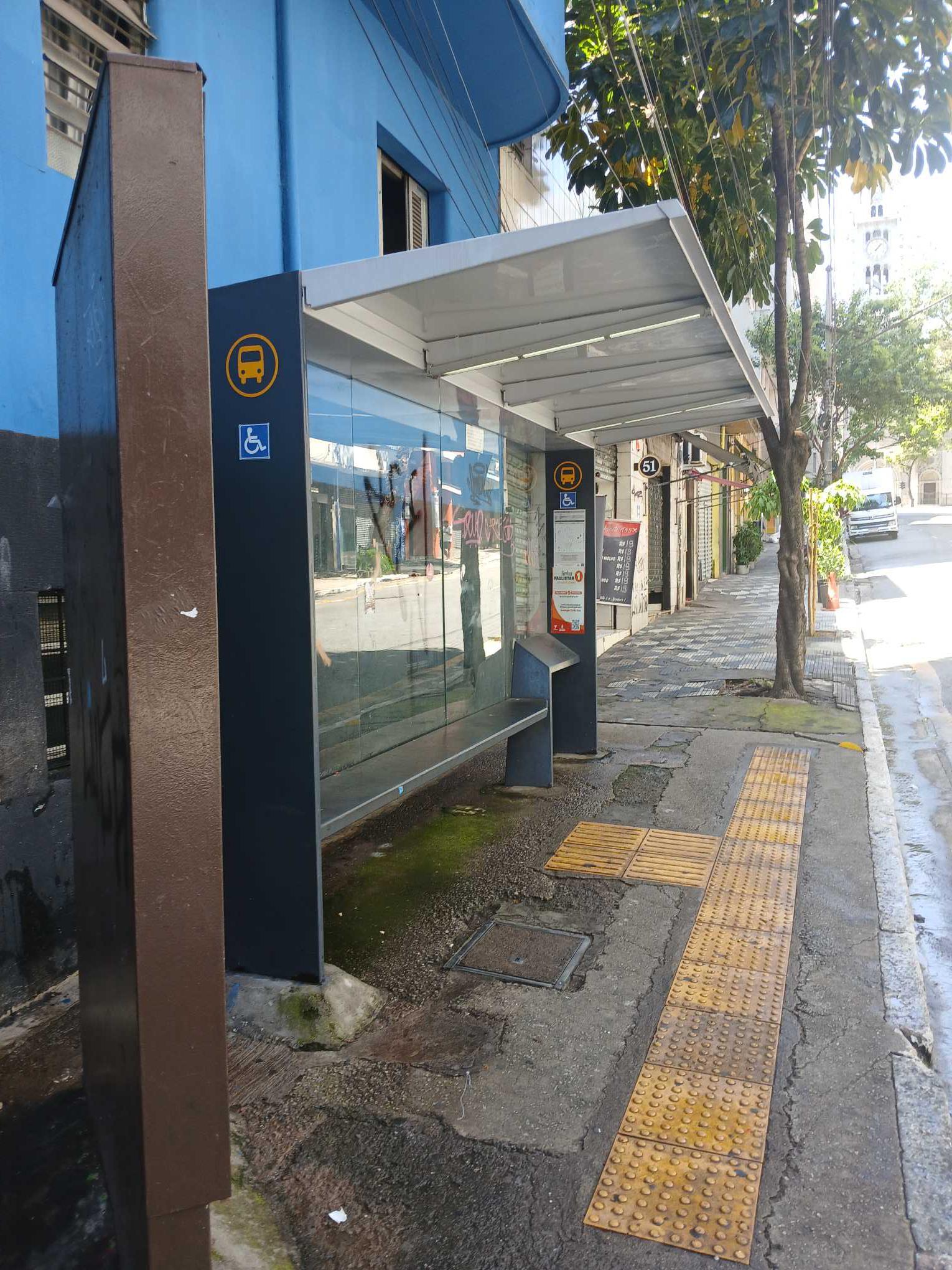 Taken by Anonymous
See R. Rego Freitas, 475 stop, República, on the map
Public transit to R. Rego Freitas, 475 stop in República
Looking for directions to R. Rego Freitas, 475 in República, Brazil?
Download the Moovit App to find the current schedule and step-by-step directions for Bus, Metro or Train routes that pass through R. Rego Freitas, 475.
Looking for the nearest stops closest to R. Rego Freitas, 475 ? Check out this list of closest stops to your destination: São Bento; Av. Ipiranga; Av. Ipiranga; R. Mj. Sertório; R. da Consolação; Rua Da Consolação 336; R. Mq. de Itu; R. Amaral Gurgel; Araújo; R. Amaral Gurgel; Av. S. Luís; Anhangabaú; República.
Bus: 178L-10, 701A-10, 702C-10, 7545-10, 8707-10, 967A-10, 909T-1, 669A-10, 701U-10, 920P-10, 408A-10.Train: LINHA 11, LINHA 8.Metro: LINHA 3, LINHA 4, LINHA 1.
We make riding on public transit to R. Rego Freitas, 475 easy, which is why over 1.7 billion users, including users in República trust Moovit as the best app for public transit.
Use the app to navigate to popular places including to the airport, hospital, stadium, grocery store, mall, coffee shop, school, college, and university.
The first line to this stop is N840-11, at 3:20 AM, and the last line is N840-11 at 2:20 AM.
483 Rua Rego Freitas, São Paulo, Brazil
This stop serves SPTrans’s lines
- São Bento,
- Anhangabaú,
- República
Metro stations near R. Rego Freitas, 475 station
- Av. Ipiranga, 102,
- Av. Ipiranga, 103,
- R. Mj. Sertório, 295,
- R. da Consolação, 322 - Consolação, São Paulo,
- Rua Da Consolação 336,
- R. Mq. de Itu, 284,
- R. Amaral Gurgel, 470,
- Araújo,
- R. Amaral Gurgel, 287,
- Av. S. Luís, 192
Bus stops near R. Rego Freitas, 475 stop
- Av. Washington Luiz, 300,
- Rua Aurélia, 39,
- Júlio Prestes,
- Terminal Diadema,
- Rua Pedra Azul, 314,
- Av. Pres. Juscelino Kubitschek, 180,
- Av. José Manoel Camisa Nova, 116,
- Av. do Anastácio, 1485,
- Parada 1 - Getúlio Vargas C/B,
- Via de Acesso João de Góes, 2041-2065 - Jardim Alvorada - Jardim Alvorada, Jandira,
- Av. Indianópolis, 3096,
- Av. Ultramarino,
- Cidade Jardim,
- Av. Zaki Narchi, 357,
- Engenheiro Goulart,
- Parque Da Água Branca B/C,
- Avenida Guapira 2674,
- R. Otávio Tarquínio de Souza, 377,
- Rua Heitor Penteado 1529,
- Av. Inconfidência Mineira, 1422
Popular public transit stations in República
Get around República by public transit!
Traveling around República has never been so easy. See step by step directions as you travel to any attraction, street or major public transit station. View bus and train schedules, arrival times, service alerts and detailed routes on a map, so you know exactly how to get to anywhere in República.
When traveling to any destination around República use Moovit's Live Directions with Get Off Notifications to know exactly where and how far to walk, how long to wait for your line, and how many stops are left. Moovit will alert you when it's time to get off — no need to constantly re-check whether yours is the next stop.
Wondering how to use public transit in República or how to pay for public transit in República? Moovit public transit app can help you navigate your way with public transit easily, and at minimum cost. It includes public transit fees, ticket prices, and costs. Looking for a map of República public transit lines? Moovit public transit app shows all public transit maps in República with all Bus, Train, Metro, Light Rail, Ferry, Gondola, Cable Car and Funicular routes and stops on an interactive map.
Sao Paulo Region has 8 transit type(s), including: Bus, Train, Metro, Light Rail, Ferry, Gondola, Cable Car and Funicular, operated by several transit agencies, including SPTrans, CPTM, ViaMobilidade, Aquático SP, SPTRANS, EMTU, ViaQuatro, Auto Ônibus Moratense, GRU Airport (Aeroporto de Guarulhos), Auto Viação Urubupungá (Cajamar), Viação Cometa, Auto Viação Urubupungá (Osasco), Viação Ultra / Rápido Brasil, Auto Viação Urubupungá (Santana de Parnaíba) and Expresso Luxo