R. Roma, 312 stop - Tuesday schedule
| Line | Direction | Time |
|---|---|---|
| 938V-10 | Jd. Vista Alegre | 4:48 AM |
| 978T-10 | Jd. Guarani | 4:58 AM |
| 938V-10 | Jd. Vista Alegre | 5:03 AM |
| 978T-10 | Jd. Guarani | 5:12 AM |
| 938V-10 | Jd. Vista Alegre | 5:14 AM |
| 938P-10 | Jd. Tereza | 5:19 AM |
| 978T-10 | Jd. Guarani | 5:20 AM |
| 938V-10 | Jd. Vista Alegre | 5:24 AM |
| 978T-10 | Jd. Guarani | 5:28 AM |
| 938V-10 | Jd. Vista Alegre | 5:34 AM |
| 938P-10 | Jd. Tereza | 5:34 AM |
| 978T-10 | Jd. Guarani | 5:36 AM |
| 978T-10 | Jd. Guarani | 5:44 AM |
| 938V-10 | Jd. Vista Alegre | 5:47 AM |
| 938P-10 | Jd. Tereza | 5:49 AM |
| 978T-10 | Jd. Guarani | 5:53 AM |
| 938V-10 | Jd. Vista Alegre | 6:00 AM |
| 978T-10 | Jd. Guarani | 6:01 AM |
| 978T-10 | Jd. Guarani | 6:09 AM |
| 938P-10 | Jd. Tereza | 6:09 AM |
| 938V-10 | Jd. Vista Alegre | 6:13 AM |
| 978T-10 | Jd. Guarani | 6:17 AM |
| 938P-10 | Jd. Tereza | 6:19 AM |
| 938V-10 | Jd. Vista Alegre | 6:24 AM |
| 978T-10 | Jd. Guarani | 6:25 AM |
Directions to R. Roma, 312 stop (Lapa) with public transit
The following transit lines have routes that pass near R. Roma, 312
 Bus: 361, 7272-10, 817C-10, 8615-10, 875C-10.
- Train: LINHA 8, LINHA 7.
- Metro: LINHA 2, LINHA 3.
How to get to R. Roma, 312 stop by bus?
Click on the bus route to see step by step directions with maps, line arrival times and updated time schedules.
How to get to R. Roma, 312 stop by train?
Click on the train route to see step by step directions with maps, line arrival times and updated time schedules.
How to get to R. Roma, 312 stop by metro?
Click on the metro route to see step by step directions with maps, line arrival times and updated time schedules.
Bus stops near R. Roma, 312 stop in Lapa
- R. Joaquim Machado, 99, 1 min walk,
- Rua Joaquim Machado 19, 2 min walk,
- R. Faustolo, 1284, 2 min walk,
- R. Scipião, 67, 2 min walk,
- Rua Faustolo (Oposto Ao Nº 1286), 3 min walk,
- Parada Catão B/C, 3 min walk,
- Rua Aurélia, 160, 3 min walk,
- Rua Aurélia, 150, 3 min walk,
- Parada Estação Ciência C/B, 4 min walk,
- Rua Scipião, 343, 4 min walk,
Train stations near R. Roma, 312 station in Lapa
- Lapa, 13 min walk,
Bus lines to R. Roma, 312 stop in Lapa
- 9051-10, Lapa,
- 817C-10, Hosp. das Clínicas,
- 178A-10, Metrô Santana - Lapa,
- 809N-10, Vila Dalva - Lapa,
- 856R-10, Lapa - Socorro,
- 874T-10, Ipiranga - Lapa,
- 875H-10, Terminal Lapa - Metrô Vila Mariana,
- 877T-10, Vila Anastácio - Metrô Paraíso,
- 938P-10, Jardim Tereza - Metrô Barra Funda,
- 938V-10, Jardim Vista Alegre - Metrô Barra Funda,
- 978J-10, Voith - Terminal Princesa Isabel,
- 978T-10, Jardim Guarani - Metrô Barra Funda,
- 7272-10, Mercado Da Lapa - Praça Ramos De Azevedo (Circular),
- 8545-10, Penteado - Metrô Barra Funda,
- 875C-1, Term. Lapa,
- N831-11, Pq. da Lapa,
- N834-11, Term. Pinheiros,
- 875C-10, Term. Lapa,
- 8252-10, Lapa,
- 8686-21, Mangalot,
What are the closest stations to R. Roma, 312?
The closest stations to R. Roma, 312 are:
- R. Joaquim Machado, 99 stop is 14 meters away, 1 min walk.
- Rua Joaquim Machado 19 stop is 93 meters away, 2 min walk.
- R. Faustolo, 1284 stop is 132 meters away, 2 min walk.
- R. Scipião, 67 stop is 146 meters away, 2 min walk.
- Rua Faustolo (Oposto Ao Nº 1286) stop is 151 meters away, 3 min walk.
- Parada Catão B/C stop is 166 meters away, 3 min walk.
- Rua Aurélia, 160 stop is 181 meters away, 3 min walk.
- Rua Aurélia, 150 stop is 202 meters away, 3 min walk.
- Parada Estação Ciência C/B stop is 236 meters away, 4 min walk.
- Rua Scipião, 343 stop is 246 meters away, 4 min walk.
- Lapa station is 993 meters away, 13 min walk.
Which bus lines stop near R. Roma, 312?
These bus lines stop near R. Roma, 312: 361, 7272-10, 817C-10, 8615-10, 875C-10, 938V-10, 978T-10.
Which train line stops near R. Roma, 312?
LINHA 8 (Itapevi)
Which metro lines stop near R. Roma, 312?
These metro lines stop near R. Roma, 312: LINHA 2, LINHA 3.
What’s the nearest train station to R. Roma, 312 in Lapa?
The nearest train station to R. Roma, 312 in Lapa is Lapa. It’s a 13 min walk away.
What’s the nearest bus station to R. Roma, 312 in Lapa?
The nearest bus station to R. Roma, 312 in Lapa is R. Joaquim Machado, 99. It’s a 1 min walk away.
What time is the first train to R. Roma, 312 in Lapa?
The LINHA 7 is the first train that goes to R. Roma, 312 in Lapa. It stops nearby at 4:02 AM.
What time is the last train to R. Roma, 312 in Lapa?
The LINHA 7 is the last train that goes to R. Roma, 312 in Lapa. It stops nearby at 1:01 AM.
What time is the first bus to R. Roma, 312 in Lapa?
The N102-11 is the first bus that goes to R. Roma, 312 in Lapa. It stops nearby at 3:01 AM.
What time is the last bus to R. Roma, 312 in Lapa?
The N831-11 is the last bus that goes to R. Roma, 312 in Lapa. It stops nearby at 3:16 AM.
R. Roma, 312 station
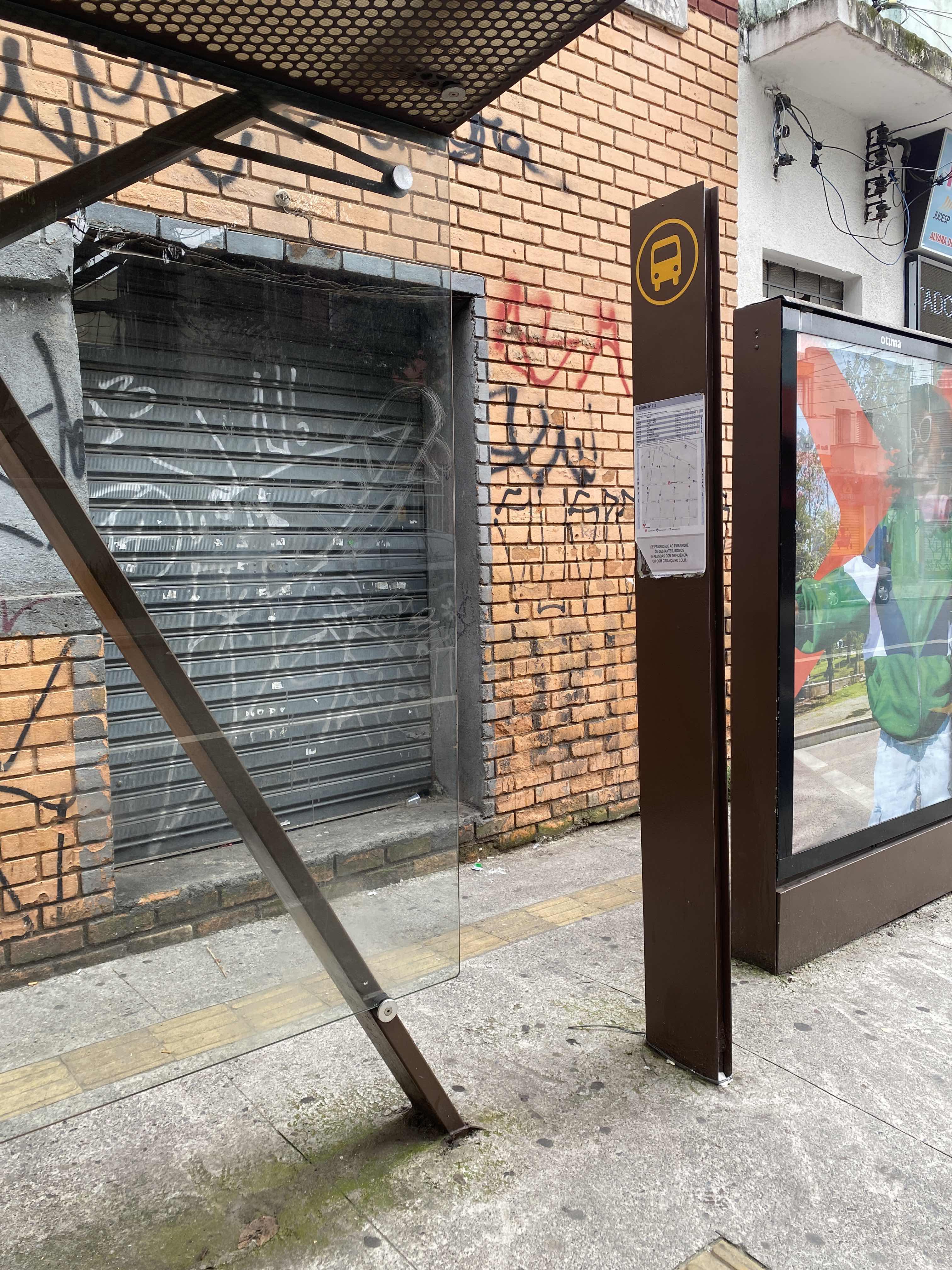 Taken by Anonymous
See R. Roma, 312 stop, Lapa, on the map
Public transit to R. Roma, 312 stop in Lapa
Looking for directions to R. Roma, 312 in Lapa, Brazil?
Download the Moovit App to find the current schedule and step-by-step directions for Bus, Metro or Train routes that pass through R. Roma, 312.
Looking for the nearest stops closest to R. Roma, 312 ? Check out this list of closest stops to your destination: R. Joaquim Machado; Rua Joaquim Machado 19; R. Faustolo; R. Scipião; Rua Faustolo (Oposto Ao Nº 1286); Parada Catão B/C; Rua Aurélia; Rua Aurélia; Parada Estação Ciência C/B; Rua Scipião; Lapa.
Bus: 361, 7272-10, 817C-10, 8615-10, 875C-10, 938V-10, 978T-10, 9051-10, 178A-10, 809N-10, 856R-10, 874T-10, 875H-10, 875C-1, N831-11, N834-11, 8252-10.Train: LINHA 8, LINHA 7.Metro: LINHA 2, LINHA 3.
We make riding on public transit to R. Roma, 312 easy, which is why over 1.7 billion users, including users in Lapa trust Moovit as the best app for public transit.
Use the app to navigate to popular places including to the airport, hospital, stadium, grocery store, mall, coffee shop, school, college, and university.
The first line to this stop is 938V-10, at 4:48 AM, and the last line is 978T-10 at 12:43 AM.
286 Rua Roma, São Paulo, Brazil
This stop serves SPTrans’s lines
- R. Joaquim Machado, 99,
- Rua Joaquim Machado 19,
- R. Faustolo, 1284,
- R. Scipião, 67,
- Rua Faustolo (Oposto Ao Nº 1286),
- Parada Catão B/C,
- Rua Aurélia, 160,
- Rua Aurélia, 150,
- Parada Estação Ciência C/B,
- Rua Scipião, 343
Bus stops near R. Roma, 312 stop
- Lapa
Train station near R. Roma, 312 station
- Rua da Saudade,
- Belem Metro,
- Estrada Antiga De Itu, 437-459,
- Avenida Marechal Tito,
- Av. Prestes Maia- 811,
- Itapevi,
- Terminal A. E. Carvalho,
- Pista Central,
- Av. Eng. Armando de Arruda Pereira,
- Av. Dos Eucaliptos, 740 • Metrô Eucaliptos,
- R. Leopoldo Couto de Magalhães Júnior, 758,
- Francisco Morato,
- Av. Ultramarino,
- Alto da Boa Vista,
- Terminal Metrô Carrão Sul,
- Av. Brasil, 762,
- Avenida Amador Bueno da Veiga 195,
- Parada 1/2/3 - Concórdia,
- Av. Moema, 81,
- Av. Washington Luiz, 4859
Popular public transit stations in Lapa
Get around Lapa by public transit!
Traveling around Lapa has never been so easy. See step by step directions as you travel to any attraction, street or major public transit station. View bus and train schedules, arrival times, service alerts and detailed routes on a map, so you know exactly how to get to anywhere in Lapa.
When traveling to any destination around Lapa use Moovit's Live Directions with Get Off Notifications to know exactly where and how far to walk, how long to wait for your line, and how many stops are left. Moovit will alert you when it's time to get off — no need to constantly re-check whether yours is the next stop.
Wondering how to use public transit in Lapa or how to pay for public transit in Lapa? Moovit public transit app can help you navigate your way with public transit easily, and at minimum cost. It includes public transit fees, ticket prices, and costs. Looking for a map of Lapa public transit lines? Moovit public transit app shows all public transit maps in Lapa with all Bus, Train, Metro, Light Rail, Ferry, Gondola, Cable Car and Funicular routes and stops on an interactive map.
Sao Paulo Region has 8 transit type(s), including: Bus, Train, Metro, Light Rail, Ferry, Gondola, Cable Car and Funicular, operated by several transit agencies, including SPTrans, CPTM, ViaMobilidade, Aquático SP, SPTRANS, EMTU, ViaQuatro, Auto Ônibus Moratense, GRU Airport (Aeroporto de Guarulhos), Auto Viação Urubupungá (Cajamar), Viação Cometa, Auto Viação Urubupungá (Osasco), Viação Ultra / Rápido Brasil, Auto Viação Urubupungá (Santana de Parnaíba) and Expresso Luxo