R. Rui Barbosa, 47 stop - Wednesday schedule
| Line | Direction | Time |
|---|---|---|
| 967A-10 | Imirim | 6:23 AM |
| 967A-10 | Imirim | 6:48 AM |
| 967A-10 | Imirim | 7:17 AM |
| 967A-10 | Imirim | 7:43 AM |
| 967A-10 | Imirim | 7:58 AM |
| 967A-10 | Imirim | 8:18 AM |
| 967A-10 | Imirim | 8:38 AM |
| 967A-10 | Imirim | 8:58 AM |
| 967A-10 | Imirim | 9:18 AM |
| 967A-10 | Imirim | 9:38 AM |
| 967A-10 | Imirim | 9:58 AM |
| 967A-10 | Imirim | 10:15 AM |
| 967A-10 | Imirim | 10:32 AM |
| 967A-10 | Imirim | 10:46 AM |
| 967A-10 | Imirim | 11:01 AM |
| 967A-10 | Imirim | 11:16 AM |
| 967A-10 | Imirim | 11:36 AM |
| 967A-10 | Imirim | 11:56 AM |
| 967A-10 | Imirim | 12:16 PM |
| 967A-10 | Imirim | 12:36 PM |
| 967A-10 | Imirim | 1:01 PM |
| 967A-10 | Imirim | 1:26 PM |
| 967A-10 | Imirim | 1:46 PM |
| 967A-10 | Imirim | 2:06 PM |
| 967A-10 | Imirim | 2:26 PM |
Directions to R. Rui Barbosa, 47 stop (Bela Vista) with public transit
The following transit lines have routes that pass near R. Rui Barbosa, 47
 Bus: 106A-10, 475M-10, 6200-10, 6451-10, 967A-10.
- Train: LINHA 11, LINHA 8.
- Metro: LINHA 1, LINHA 4, LINHA 2, LINHA 3.
How to get to R. Rui Barbosa, 47 stop by bus?
Click on the bus route to see step by step directions with maps, line arrival times and updated time schedules.
How to get to R. Rui Barbosa, 47 stop by train?
Click on the train route to see step by step directions with maps, line arrival times and updated time schedules.
How to get to R. Rui Barbosa, 47 stop by metro?
Click on the metro route to see step by step directions with maps, line arrival times and updated time schedules.
Bus stops near R. Rui Barbosa, 47 stop in Bela Vista
- R. Jaceguai, 548, 3 min walk,
- R. Rui Barbosa, 28, 5 min walk,
- R. João Passalacqua, 5 min walk,
- Avenida Brigadeiro Luís Antônio 878, 6 min walk,
- Av. Brig. Luís Antônio, 931, 6 min walk,
- 14 Bis B/C, 8 min walk,
Metro stations near R. Rui Barbosa, 47 station in Bela Vista
- Trianon-Masp, 7 min walk,
- Anhangabaú, 9 min walk,
- Japão-Liberdade, 10 min walk,
- Higienópolis-Mackenzie, 21 min walk,
Bus lines to R. Rui Barbosa, 47 stop in Bela Vista
- 475M-10, Term. Amaral Gurgel,
- N841-11, Sta. Cecília,
- 967A-10, Pinheiros,
- N840-11, Sta. Cecília,
- 475R-10, Jardim São Savério - Terminal Parque Dom Pedro Ii,
- 715M-10, Jardim Maria Luiza - Largo Da Pólvora,
- N802-11, Terminal Pinheiros - Terminal Parque Dom Pedro Ii,
- 5100-10, Terminal Pinheiros - Terminal Parque Dom Pedro Ii,
- 5106-10, Mar Paulista - Largo São Francisco,
- 5111-10, Terminal Santo Amaro - Terminal Parque Dom Pedro Ii,
- 5119-10, Terminal Capelinha - Largo São Francisco,
- 5119-22, Terminal João Dias - Largo São Francisco,
- 5131-10, Cidade Ademar - Parque Dom Pedro Ii,
- 5154-10, Terminal Santo Amaro - Terminal Princesa Isabel,
- 5175-10, Balneário São Francisco - Praça Da Sé,
- 5178-10, Jardim Miriam - Praça João Mendes,
- 5185-10, Terminal Guarapiranga - Terminal Parque Dom Pedro Ii,
- 7550-10, Terminal Santo Amaro - Metrô Santa Cecília,
- 920P-10, Pinacoteca,
- 106A-10, Metrô Santana - Itaim Bibi,
What are the closest stations to R. Rui Barbosa, 47?
The closest stations to R. Rui Barbosa, 47 are:
- R. Jaceguai, 548 stop is 217 meters away, 3 min walk.
- R. Rui Barbosa, 28 stop is 328 meters away, 5 min walk.
- R. João Passalacqua stop is 385 meters away, 5 min walk.
- Avenida Brigadeiro Luís Antônio 878 stop is 404 meters away, 6 min walk.
- Av. Brig. Luís Antônio, 931 stop is 449 meters away, 6 min walk.
- Trianon-Masp station is 511 meters away, 7 min walk.
- 14 Bis B/C stop is 570 meters away, 8 min walk.
- Anhangabaú station is 656 meters away, 9 min walk.
- Japão-Liberdade station is 721 meters away, 10 min walk.
- Higienópolis-Mackenzie station is 1582 meters away, 21 min walk.
Which bus lines stop near R. Rui Barbosa, 47?
These bus lines stop near R. Rui Barbosa, 47: 106A-10, 475M-10, 6200-10, 6451-10, 967A-10.
Which train lines stop near R. Rui Barbosa, 47?
These train lines stop near R. Rui Barbosa, 47: LINHA 11, LINHA 8.
Which metro lines stop near R. Rui Barbosa, 47?
These metro lines stop near R. Rui Barbosa, 47: LINHA 1, LINHA 4.
What’s the nearest metro station to R. Rui Barbosa, 47 in Bela Vista?
The nearest metro station to R. Rui Barbosa, 47 in Bela Vista is Trianon-Masp. It’s a 7 min walk away.
What’s the nearest bus station to R. Rui Barbosa, 47 in Bela Vista?
The nearest bus station to R. Rui Barbosa, 47 in Bela Vista is R. Jaceguai, 548. It’s a 3 min walk away.
What time is the first metro to R. Rui Barbosa, 47 in Bela Vista?
The LINHA 4 is the first metro that goes to R. Rui Barbosa, 47 in Bela Vista. It stops nearby at 4:43 AM.
What time is the last metro to R. Rui Barbosa, 47 in Bela Vista?
The LINHA 3 is the last metro that goes to R. Rui Barbosa, 47 in Bela Vista. It stops nearby at 12:42 AM.
What time is the first bus to R. Rui Barbosa, 47 in Bela Vista?
The N802-11 is the first bus that goes to R. Rui Barbosa, 47 in Bela Vista. It stops nearby at 3:06 AM.
What time is the last bus to R. Rui Barbosa, 47 in Bela Vista?
The N701-11 is the last bus that goes to R. Rui Barbosa, 47 in Bela Vista. It stops nearby at 3:26 AM.
R. Rui Barbosa, 47 station
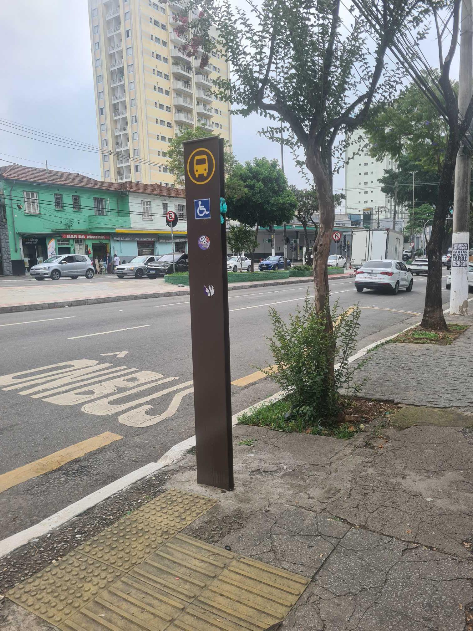 Taken by Anonymous
See R. Rui Barbosa, 47 stop, Bela Vista, on the map
Public transit to R. Rui Barbosa, 47 stop in Bela Vista
Looking for directions to R. Rui Barbosa, 47 in Bela Vista, Brazil?
Download the Moovit App to find the current schedule and step-by-step directions for Bus, Train or Metro routes that pass through R. Rui Barbosa, 47.
Looking for the nearest stops closest to R. Rui Barbosa, 47 ? Check out this list of closest stops to your destination: R. Jaceguai; R. Rui Barbosa; R. João Passalacqua; Avenida Brigadeiro Luís Antônio 878; Av. Brig. Luís Antônio; Trianon-Masp; 14 Bis B/C; Anhangabaú; Japão-Liberdade; Higienópolis-Mackenzie.
Bus: 106A-10, 475M-10, 6200-10, 6451-10, 967A-10, N841-11.Train: LINHA 11, LINHA 8.Metro: LINHA 1, LINHA 4, LINHA 2, LINHA 3.
We make riding on public transit to R. Rui Barbosa, 47 easy, which is why over 1.7 billion users, including users in Bela Vista trust Moovit as the best app for public transit.
Use the app to navigate to popular places including to the airport, hospital, stadium, grocery store, mall, coffee shop, school, college, and university.
The first line to this stop is 967A-10, at 6:23 AM, and the last line is 967A-10 at 1:01 AM.
This stop serves SPTrans’s lines
Popular routes from R. Rui Barbosa, 47 stop, Bela Vista
- R. Jaceguai, 548,
- R. Rui Barbosa, 28,
- R. João Passalacqua,
- Avenida Brigadeiro Luís Antônio 878,
- Av. Brig. Luís Antônio, 931,
- 14 Bis B/C
Bus stops near R. Rui Barbosa, 47 stop
- Trianon-Masp,
- Anhangabaú,
- Japão-Liberdade,
- Higienópolis-Mackenzie
Metro stations near R. Rui Barbosa, 47 station
- Av. Manuel Bandeira, 360 - Vila Leopoldina, São Paulo,
- Ac. Ao Viaduto Dona Paulina,
- Av. Clavasio Alves da Silva, 683,
- Joaquim Nabuco B/C,
- Estrada Marechal Tomoki Hiramoto (Sitio Tirulim),
- R. Erva Andorinha, 192,
- R. Cerro Cora, 613,
- Av. Carlos Caldeira Filho,
- Vila Matilde,
- Terminal Lapa,
- Butantã,
- R. Afonso Braz, 525,
- Rua Serra da Bocaina, 126,
- Av. Alexios Jafet, 560,
- Av. Onze de Junho, 772,
- Av. Alexios Jafet,
- Viad. Nove de Julho, 160,
- Avenida Marechal Tito 6037,
- Osasco,
- R. Francisco Fanganiello, 127
Popular public transit stations in Bela Vista
Get around Bela Vista by public transit!
Traveling around Bela Vista has never been so easy. See step by step directions as you travel to any attraction, street or major public transit station. View bus and train schedules, arrival times, service alerts and detailed routes on a map, so you know exactly how to get to anywhere in Bela Vista.
When traveling to any destination around Bela Vista use Moovit's Live Directions with Get Off Notifications to know exactly where and how far to walk, how long to wait for your line, and how many stops are left. Moovit will alert you when it's time to get off — no need to constantly re-check whether yours is the next stop.
Wondering how to use public transit in Bela Vista or how to pay for public transit in Bela Vista? Moovit public transit app can help you navigate your way with public transit easily, and at minimum cost. It includes public transit fees, ticket prices, and costs. Looking for a map of Bela Vista public transit lines? Moovit public transit app shows all public transit maps in Bela Vista with all Bus, Train, Metro, Light Rail, Ferry, Gondola, Cable Car and Funicular routes and stops on an interactive map.
Sao Paulo Region has 8 transit type(s), including: Bus, Train, Metro, Light Rail, Ferry, Gondola, Cable Car and Funicular, operated by several transit agencies, including SPTrans, CPTM, ViaMobilidade, Aquático SP, SPTRANS, EMTU, ViaQuatro, Auto Ônibus Moratense, GRU Airport (Aeroporto de Guarulhos), Auto Viação Urubupungá (Cajamar), Viação Cometa, Auto Viação Urubupungá (Osasco), Viação Ultra / Rápido Brasil, Auto Viação Urubupungá (Santana de Parnaíba) and Expresso Luxo