Directions to R S Bike (Água Fria) with public transportation
The following transit lines have routes that pass near R S Bike
How to get to R S Bike by bus?
Click on the bus route to see step by step directions with maps, line arrival times and updated time schedules.
From Hospital Tricentenario, Olinda
38 minFrom Ferreira Costa, Imbiribeira
47 minFrom Rua Pereira da Costa 230, Pina
47 minFrom Rua São Miguel, Afogados
28 minFrom Praça do diário, Joana Bezerra
35 minFrom Hospital Otávio de Freitas-PS, Tejipió
56 minFrom Hospital Geral Otávio de Freitas, Sancho
57 minFrom Ipsep, Ipsep
57 minFrom Cabaré da Laurinha, Boa Viagem
50 minFrom Abdias de Carvalho, San Martin
31 min
Bus stops near R S Bike in Água Fria
Bus lines to R S Bike in Água Fria
- 710 BEBERIBE / DERBY (JOANA BEZERRA), Via Aacd,VIEW
- 711 ALTO DO PASCOAL, Alto do Pascoal,VIEW
- 712 ALTO SANTA TEREZINHA, Alto Santa Terezinha,VIEW
- 713 BOMBA DO HEMETÉRIO, Bomba Do Hemetério,VIEW
- 714 ALTO JOSÉ BONIFÁCIO (AV. NORTE), Atende À Pcr,VIEW
- 715 ALTO SANTA TEREZINHA (BACURAU), Alto Santa Terezinha (Bacurau),VIEW
- 717 JOSÉ AMARINO DOS REIS, José Amarino Dos Reis,VIEW
- 721 ÁGUA FRIA (CIRCULAR), Água Fria (Circular),VIEW
- 742 LINHA DO TIRO, Linha Do Tiro,VIEW
- 800 DOIS UNIDOS / AFOGADOS, Dois Unidos / Afogados,VIEW
- 870 TI XAMBÁ / TI LARGO DA PAZ, Ti Xambá / Ti Largo Da Paz,VIEW
- 914 TI PE-15 / TI AFOGADOS, TI PE-15 / TI Afogados,VIEW
- C110 CAMPO GRANDE / AFOGADOS, Via Shopping Tacaruna,VIEW
- C112 CASA AMARELA / BOMBA DO HEMETÉRIO / SHOPPING TACARUNA, Casa Amarela / Bomba do Hemetério / Shopping Tacaruna,VIEW
- 700 BEBERIBE / AFOGADOS, Beberibe / Afogados,VIEW
- 723 CAJUEIRO, Via Cajueiro Alto,VIEW
- 724 CHÃO DE ESTRELAS, Chão de Estrelas,VIEW
- 741 DOIS UNIDOS, Via Prefeitura,VIEW
- 743 ALTO JOSÉ BONIFÁCIO (JOÃO DE BARROS), Via Prefeitura Do Recife,VIEW
- 744 DOIS UNIDOS (BACURAU), Dois Unidos (Bacurau),VIEW
What are the closest stations to R S Bike?
The closest stations to R S Bike are:
- Estrada Velha De Água Fria 1463 | Maracatu Nação Raízes De Pai Adão is 111 meters away, 3 min walk.
- Av. Beberibe, 1657 is 370 meters away, 6 min walk.
- 120028 - Rua Bomba Do Hemetério 505 is 397 meters away, 6 min walk.
- 110243 - Rua Jacob 47 is 449 meters away, 7 min walk.
Which bus lines stop near R S Bike?
These bus lines stop near R S Bike: 710 BEBERIBE / DERBY (JOANA BEZERRA), 713 BOMBA DO HEMETÉRIO, 800 DOIS UNIDOS / AFOGADOS, 870 TI XAMBÁ / TI LARGO DA PAZ, C110 CAMPO GRANDE / AFOGADOS.
What’s the nearest bus station to R S Bike in Água Fria?
The nearest bus station to R S Bike in Água Fria is Estrada Velha De Água Fria 1463 | Maracatu Nação Raízes De Pai Adão. It’s a 3 min walk away.
What time is the first bus to R S Bike in Água Fria?
The 745 ALTO JOSÉ BONIFÁCIO (BACURAU) is the first bus that goes to R S Bike in Água Fria. It stops nearby at 3:14 AM.
What time is the last bus to R S Bike in Água Fria?
The 744 DOIS UNIDOS (BACURAU) is the last bus that goes to R S Bike in Água Fria. It stops nearby at 3:22 AM.
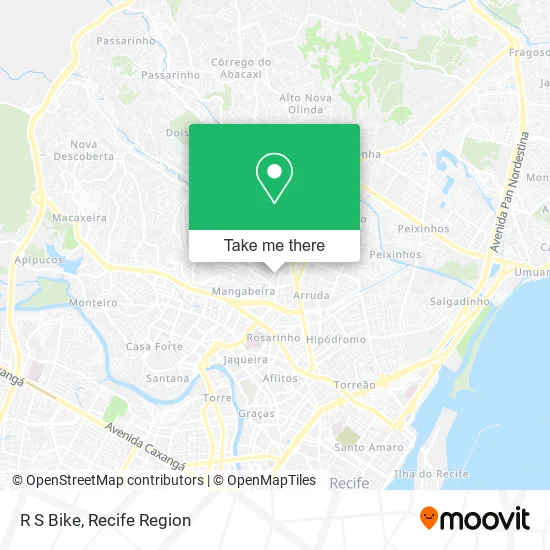
See R S Bike, Água Fria, on the map
Public Transit to R S Bike in Água Fria
Wondering how to get to R S Bike in Água Fria? Moovit helps you find the best way to get to R S Bike with step-by-step directions from the nearest public transit station.
Moovit provides free maps and live directions to help you navigate through your city. View schedules, routes, timetables, and find out how long does it take to get to R S Bike in real time.
Looking for the nearest stop or station to R S Bike? Check out this list of stops closest to your destination: Estrada Velha De Água Fria 1463 | Maracatu Nação Raízes De Pai Adão; Av. Beberibe; 120028 - Rua Bomba Do Hemetério 505; 110243 - Rua Jacob 47.
Bus: 710 BEBERIBE / DERBY (JOANA BEZERRA), 713 BOMBA DO HEMETÉRIO, 800 DOIS UNIDOS / AFOGADOS, 870 TI XAMBÁ / TI LARGO DA PAZ, C110 CAMPO GRANDE / AFOGADOS, 711 ALTO DO PASCOAL, 712 ALTO SANTA TEREZINHA, 714 ALTO JOSÉ BONIFÁCIO (AV. NORTE), 700 BEBERIBE / AFOGADOS, 723 CAJUEIRO, 724 CHÃO DE ESTRELAS, 741 DOIS UNIDOS, 743 ALTO JOSÉ BONIFÁCIO (JOÃO DE BARROS), 780 ALTO SANTA TEREZINHA / DERBY, 611 ALTO JOSÉ DO PINHO (CAIS DE SANTA RITA).
Want to see if there’s another route that gets you there at an earlier time? Moovit helps you find alternative routes or times. Get directions from and directions to R S Bike easily from the Moovit App or Website.
We make riding to R S Bike easy, which is why over 1.5 million users, including users in Água Fria, trust Moovit as the best app for public transit. You don’t need to download an individual bus app or train app, Moovit is your all-in-one transit app that helps you find the best bus time or train time available.
For information on prices of bus, costs and ride fares to R S Bike, please check the Moovit app.
Use the app to navigate to popular places including to the airport, hospital, stadium, grocery store, mall, coffee shop, school, college, and university.
R S Bike Address: Rua Riolândia, 70 Água Fria Recife-PE 52111-220 street in Água Fria
- Rua São Sebastião 352,
- Rua Riolândia,
- Desafrio,
- Clube Internacional Derby,
- Clínicardio,
- Rua Baixa José Ribeiro,
- Chaveiro do Gordinho,
- Cefapp,
- Sabor do Bolo,
- NB SOCIETY CLUB,
- Areia Quente Moda Praia,
- Policlínica Salomão Kelner,
- Persolare Bronze,
- 2a Travess Sao Sebastiao 182,
- Edifício Santa Inês,
- Gs Papelaria,
- Lb Pneus,
- Wagner Looks,
- Feira de Água Fria,
- Escoka São Franscisco de Assis
Places Near R S Bike (Água Fria)
- SHOPPING TACARUNA, Santo Amaro,
- tuuuuu, Olinda,
- Centro de Convenções de Pernambuco, Olinda,
- Shopping Recife, Boa Viagem,
- Arena de Pernambuco, São Lourenço Da Mata,
- Hospital Altino Ventura, Iputinga,
- Marco Zero, Bairro Do Recife,
- Hospital Universitário Oswaldo Cruz, Santo Amaro,
- Imbiribeira, Imbiribeira,
- Imip (Instituto Materno-Infantil De Pernambuco), Coelhos,
- Parque da Jaqueira, Jaqueira,
- Hospital Geral De Areias, Areias,
- Hospital Eduardo Campus Da Pessoa Idosa, Areias,
- Shopping Patteo Olinda, Olinda,
- Hospital Agamenon Magalhães, Tamarineira,
- Shopping RioMar Recife, Pina,
- SHOPPING GUARARAPES, Jaboatão Dos Guararapes,
- Hospital Maria Lucinda, Parnamirim,
- hospital otavio de freitas - UTI, Tejipió,
- llll, Fundão
How to get to popular places in Recife Region with public transit
Get around Água Fria by public transit!
Traveling around Água Fria has never been so easy. See step by step directions as you travel to any attraction, street or major public transit station. View bus and train schedules, arrival times, service alerts and detailed routes on a map, so you know exactly how to get to anywhere in Água Fria.
When traveling to any destination around Água Fria use Moovit's Live Directions with Get Off Notifications to know exactly where and how far to walk, how long to wait for your line, and how many stops are left. Moovit will alert you when it's time to get off — no need to constantly re-check whether yours is the next stop.
Wondering how to use public transit in Água Fria or how to pay for public transit in Água Fria? Moovit public transit app can help you navigate your way with public transit easily, and at minimum cost. It includes public transit fees, ticket prices, and costs. Looking for a map of Água Fria public transit lines? Moovit public transit app shows all public transit maps in Água Fria with all Bus, Train, Subway and Ferry routes and stops on an interactive map.
Recife Region has 4 transit type(s), including: Bus, Train, Subway and Ferry, operated by several transit agencies, including CBTU (Metrorec), BRT (Via Livre), Grande Recife, BORBOREMA IMPERIAL (TIP), BORBOREMA IMPERIAL (B.V), RODOVIÁRIA POTENGY, EMPRESA METROPOLITANA, CONSÓRCIO RECIFE, SÃO JUDAS TADEU, Expresso 1002, Rodotur Turismo, Complementar Recife, Sistema Municipal - Jaboatão, Sistema Municipal - Cabo and Sistema Municipal - Ipojuca