How to get to R.S.H.E.C.C. by bus?
Click on the bus route to see step by step directions with maps, line arrival times and updated time schedules.
From Avenida de la Industria, Alcobendas
42 minFrom Centro Médico Sanitas Valdebebas, Área Metropolitana De Madrid Y Corredor Del Henares
76 minFrom Campus de Cantoblanco, Madrid
68 minFrom La Moraleja, Área Metropolitana De Madrid Y Corredor Del Henares
63 minFrom Universidad Europea de Madrid, Alcobendas
35 minFrom Universidad Europea Campus Alcobendas, Alcobendas
40 minFrom Hospital Enfermera Isabel Zendal, Madrid
83 minFrom Hospital De Cantoblanco., Área Metropolitana De Madrid Y Corredor Del Henares
68 minFrom Valdebebas, Madrid
86 minFrom Hestia Alliance Hospital Hestia Madrid, Madrid
58 min
How to get to R.S.H.E.C.C. by metro?
Click on the metro route to see step by step directions with maps, line arrival times and updated time schedules.
Bus stops near R.S.H.E.C.C. in San Sebastián De Los Reyes
Metro station near R.S.H.E.C.C. in San Sebastián De Los Reyes
- Hospital Infanta Sofía, 44 min walk,VIEW
Bus lines to R.S.H.E.C.C. in San Sebastián De Los Reyes
- 166, San Sebastián de los Reyes - Urbanización Valdelagua,VIEW
- 171, Madrid (Plaza de Castilla) - Urb. Santo Domingo,VIEW
- 191, Madrid (Plaza de Castilla) - Buitrago,VIEW
- 193, Madrid (Plaza de Castilla) - Pedrezuela - El Vellón,VIEW
- 194, Madrid (Plaza de Castilla) - Rascafria,VIEW
- 195, Madrid (Plaza de Castilla) - Braojos,VIEW
- 196, Madrid (Plaza de Castilla) - La Acebeda,VIEW
- N104, Madrid (Plaza de Castilla) - El Molar,VIEW
- 161, Senda Ardal - Caseta Control,VIEW
- 180, Alcobendas - Algete,VIEW
- 181, Madrid (Plaza de Castilla) - Algete,VIEW
- 182, Madrid (Plaza de Castilla) - Algete - Valdeolmos,VIEW
- 183, Madrid (Plaza de Castilla) - Cobeña - Algete,VIEW
- 184, Madrid (Plaza de Castilla) - El Casar,VIEW
- 185, Madrid (Plaza de Castilla) - Nuevo Algete,VIEW
- N103, Madrid (Plaza de Castilla) - Algete,VIEW
- 197, Av. España - Est. Alcobendas S. Seb. Reyes,VIEW
- 210, P.º Europa - Hospital Infanta Sofía,VIEW
What are the closest stations to R.S.H.E.C.C.?
The closest stations to R.S.H.E.C.C. are:
- Ctra. A-1 - Urb. Fuente El Fresno is 853 meters away, 11 min walk.
- Senda Ardal - Caseta Control is 896 meters away, 12 min walk.
- Ctra. Antigua De Burgos - Granja Escuela is 921 meters away, 12 min walk.
- Ctra. M-100 - La Hacienda is 1034 meters away, 14 min walk.
- Ctra. M-100 - C.º Viejo De Barajas is 1595 meters away, 21 min walk.
- Hospital Infanta Sofía is 3395 meters away, 44 min walk.
Which bus lines stop near R.S.H.E.C.C.?
These bus lines stop near R.S.H.E.C.C.: 161, 171, 180, 181, 193, 196.
Which metro line stops near R.S.H.E.C.C.?
M-10 (Hospital Infanta Sofía)
What’s the nearest bus station to R.S.H.E.C.C. in San Sebastián De Los Reyes?
The nearest bus station to R.S.H.E.C.C. in San Sebastián De Los Reyes is Ctra. A-1 - Urb. Fuente El Fresno. It’s a 11 min walk away.
What time is the first metro to R.S.H.E.C.C. in San Sebastián De Los Reyes?
The M-10 is the first metro that goes to R.S.H.E.C.C. in San Sebastián De Los Reyes. It stops nearby at 6:05 AM.
What time is the last metro to R.S.H.E.C.C. in San Sebastián De Los Reyes?
The M-10 is the last metro that goes to R.S.H.E.C.C. in San Sebastián De Los Reyes. It stops nearby at 1:54 AM.
What time is the first bus to R.S.H.E.C.C. in San Sebastián De Los Reyes?
The 183 is the first bus that goes to R.S.H.E.C.C. in San Sebastián De Los Reyes. It stops nearby at 3:01 AM.
What time is the last bus to R.S.H.E.C.C. in San Sebastián De Los Reyes?
The N104 is the last bus that goes to R.S.H.E.C.C. in San Sebastián De Los Reyes. It stops nearby at 2:43 AM.
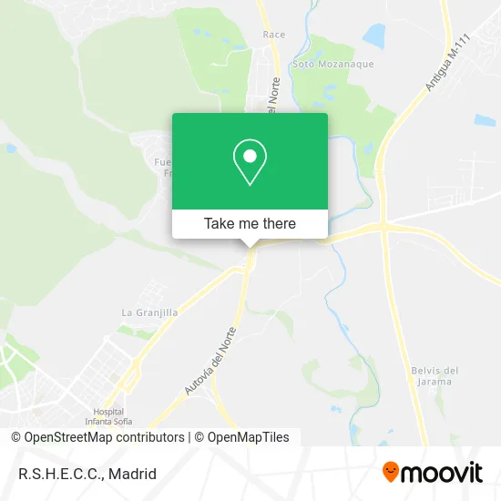
See R.S.H.E.C.C., San Sebastián De Los Reyes, on the map
Public Transit to R.S.H.E.C.C. in San Sebastián De Los Reyes
Wondering how to get to R.S.H.E.C.C. in San Sebastián De Los Reyes? Moovit helps you find the best way to get to R.S.H.E.C.C. with step-by-step directions from the nearest public transit station.
Moovit provides free maps and live directions to help you navigate through your city. View schedules, routes, timetables, and find out how long does it take to get to R.S.H.E.C.C. in real time.
Looking for the nearest stop or station to R.S.H.E.C.C.? Check out this list of stops closest to your destination: Ctra. A-1 - Urb. Fuente El Fresno; Senda Ardal - Caseta Control; Ctra. Antigua De Burgos - Granja Escuela; Ctra. M-100 - La Hacienda; Ctra. M-100 - C.º Viejo De Barajas; Hospital Infanta Sofía.
Bus: 161, 171, 180, 181, 193, 196, 166, 191, 194, 182, 183, 184, 197, 210.Metro: M-10.
Want to see if there’s another route that gets you there at an earlier time? Moovit helps you find alternative routes or times. Get directions from and directions to R.S.H.E.C.C. easily from the Moovit App or Website.
We make riding to R.S.H.E.C.C. easy, which is why over 1.5 million users, including users in San Sebastián De Los Reyes, trust Moovit as the best app for public transit. You don’t need to download an individual bus app or train app, Moovit is your all-in-one transit app that helps you find the best bus time or train time available.
For information on prices of bus, metro and train, costs and ride fares to R.S.H.E.C.C., please check the Moovit app.
Use the app to navigate to popular places including to the airport, hospital, stadium, grocery store, mall, coffee shop, school, college, and university.
R.S.H.E.C.C. Address: N-I, 28709 San Sebastián de los Reyes street in San Sebastián De Los Reyes
- La Alpargatería,
- Hacienda Campoamor,
- La Hacienda De Campoamor,
- Casa Emiliana,
- Villa Laureana,
- Heineken España,
- Fronda,
- Paracuellos del Jarama,
- 5 Pádel,
- BANCO POPULAR,
- Calle Abedul,
- Autovía A1 Km 23.500,
- Parroquia Nuestra Señora De Fuente Del Fresno,
- Ciudad Deportiva Jarama,
- La Terraza Del Jarama,
- 28708,
- Casa Emiliana,
- Las Arroyadas,
- Solycan,
- Mec Mec Cafe
Places Near R.S.H.E.C.C. (San Sebastián De Los Reyes)
- Centro Comercial Islazul, Área Metropolitana De Madrid Y Corredor Del Henares,
- Hospital Clínico Universitario San Carlos, Madrid,
- Centro Comercial La Gavia, Área Metropolitana De Madrid Y Corredor Del Henares,
- Hospital Universitario Ramón y Cajal, Madrid,
- Mendez Alvaro, Madrid,
- Centro Comercial Oasiz Madrid, Área Metropolitana De Madrid Y Corredor Del Henares,
- Tres Aguas, Alcorcón,
- Nassica, Área Metropolitana De Madrid Y Corredor Del Henares,
- Calle de López de Hoyos 169, Madrid,
- Wizink Center, Madrid,
- Centro Comercial La Vaguada, Área Metropolitana De Madrid Y Corredor Del Henares,
- Mercadillo de Majadahonda, Majadahonda,
- Sala La Riviera, Madrid,
- Hospital Universitario La Paz, Madrid,
- Plenilunio, Área Metropolitana De Madrid Y Corredor Del Henares,
- Estadio Wanda Metropolitano, Área Metropolitana De Madrid Y Corredor Del Henares,
- Rastro De Madrid, Área Metropolitana De Madrid Y Corredor Del Henares,
- Plaza Mayor, Madrid,
- Estacion de Chamartin, Madrid,
- Palacio De Vistalegre, Área Metropolitana De Madrid Y Corredor Del Henares
How to get to popular places in Madrid with public transit
Get around San Sebastián De Los Reyes by public transit!
Traveling around San Sebastián De Los Reyes has never been so easy. See step by step directions as you travel to any attraction, street or major public transit station. View bus and train schedules, arrival times, service alerts and detailed routes on a map, so you know exactly how to get to anywhere in San Sebastián De Los Reyes.
When traveling to any destination around San Sebastián De Los Reyes use Moovit's Live Directions with Get Off Notifications to know exactly where and how far to walk, how long to wait for your line, and how many stops are left. Moovit will alert you when it's time to get off — no need to constantly re-check whether yours is the next stop.
Wondering how to use public transit in San Sebastián De Los Reyes or how to pay for public transit in San Sebastián De Los Reyes? Moovit public transit app can help you navigate your way with public transit easily, and at minimum cost. It includes public transit fees, ticket prices, and costs. Looking for a map of San Sebastián De Los Reyes public transit lines? Moovit public transit app shows all public transit maps in San Sebastián De Los Reyes with all Bus, Train, Metro and Light Rail routes and stops on an interactive map.
Madrid has 4 transit type(s), including: Bus, Train, Metro and Light Rail, operated by several transit agencies, including Metro de Madrid, Metro Ligero, Tranvía de Parla, Renfe Cercanías - Servicios de Autobús especiales, Renfe Cercanias, Renfe Cercanías, EMT, Interurbanos, Urbanos de Alcalá de Henares, Urbanos de Alcobendas, Urbanos de Alcorcón, Urbanos de Algete, Urbanos de Aranjuez, Urbanos de Arganda del Rey and Urbanos de Arroyomolinos