Directions to R'Spiro Café (Miraflores De La Sierra) with public transportation
The following transit lines have routes that pass near R'Spiro Café
 Bus: 725.
How to get to R'Spiro Café by bus?
Click on the bus route to see step by step directions with maps, line arrival times and updated time schedules.
From Tanatorio La Paz, Alcobendas
59 minFrom Manzanares el Real, Manzanares El Real
45 minFrom Outlet Factory, San Sebastián De Los Reyes
140 minFrom Piscinas Naturales Las Berceas, Cercedilla
154 minFrom Cantoblanco, Área Metropolitana De Madrid Y Corredor Del Henares
76 minFrom Autovía A-1 (Madrid-Burgos) km 24, San Sebastián De Los Reyes
155 minFrom Hospital Público de Collado Villalba, Collado Villalba
94 minFrom Las Presillas, Rascafría
340 minFrom Centro Penitenciario Madrid V - Soto Del Real, Cuenca Alta Del Manzanares
65 min
Bus stop near R'Spiro Café in Miraflores De La Sierra
- Miraflores De La Sierra - Guardia Civil, 7 min walk,VIEW
Bus lines to R'Spiro Café in Miraflores De La Sierra
- 725, Intercambiador De Plaza De Castilla (Nivel -3, Islas 1 Y 2),VIEW
What are the closest stations to R'Spiro Café?
The closest stations to R'Spiro Café are:
- Miraflores De La Sierra - Guardia Civil is 502 meters away, 7 min walk.
Which bus line stops near R'Spiro Café?
725 (Valdemanco - Av. Desvío)
What’s the nearest bus station to R'Spiro Café in Miraflores De La Sierra?
The nearest bus station to R'Spiro Café in Miraflores De La Sierra is Miraflores De La Sierra - Guardia Civil. It’s a 7 min walk away.
What time is the first bus to R'Spiro Café in Miraflores De La Sierra?
The 725 is the first bus that goes to R'Spiro Café in Miraflores De La Sierra. It stops nearby at 4:29 AM.
What time is the last bus to R'Spiro Café in Miraflores De La Sierra?
The 725 is the last bus that goes to R'Spiro Café in Miraflores De La Sierra. It stops nearby at 12:38 AM.
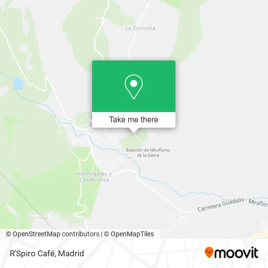
See R'Spiro Café, Miraflores De La Sierra, on the map
Public Transit to R'Spiro Café in Miraflores De La Sierra
Wondering how to get to R'Spiro Café in Miraflores De La Sierra? Moovit helps you find the best way to get to R'Spiro Café with step-by-step directions from the nearest public transit station.
Moovit provides free maps and live directions to help you navigate through your city. View schedules, routes, timetables, and find out how long does it take to get to R'Spiro Café in real time.
Looking for the nearest stop or station to R'Spiro Café? Check out this list of stops closest to your destination: Miraflores De La Sierra - Guardia Civil.
Bus: 725.
Want to see if there’s another route that gets you there at an earlier time? Moovit helps you find alternative routes or times. Get directions from and directions to R'Spiro Café easily from the Moovit App or Website.
We make riding to R'Spiro Café easy, which is why over 1.5 million users, including users in Miraflores De La Sierra, trust Moovit as the best app for public transit. You don’t need to download an individual bus app or train app, Moovit is your all-in-one transit app that helps you find the best bus time or train time available.
For information on prices of bus and train, costs and ride fares to R'Spiro Café, please check the Moovit app.
Use the app to navigate to popular places including to the airport, hospital, stadium, grocery store, mall, coffee shop, school, college, and university.
R'Spiro Café Address: Calle de la Estación, 28792 Miraflores de la Sierra street in Miraflores De La Sierra
- Estación de Tren de Miraflores de la Sierra,
- Agropecuaria La Estancia,
- Calle Padre Rivero,
- Farmacia Carolina Fern,
- Comunidad Autónoma de Madrid-Centros de Educación,
- Plaza De Toros De Miraflores De La Sierra,
- Restaurante Solycampo (Sol Y Campo),
- Ayuntamiento de Miraflores de la Sierra,
- Cementerio de Miraflores de la Sierra,
- Mora Ochando,
- Estación De Miraflores De La Sierra,
- Avenida Sol y Campo,
- Aguado Vallejo,
- Cimera Estudios Aplicados,
- Villalejos,
- Calle Prados de la Cañada,
- Alimentos de Miraflores,
- Valmasa,
- Pm Servicios,
- Calle San Pablo / Calle San Lucas
Places Near R'Spiro Café (Miraflores De La Sierra)
- Centro Comercial La Gavia, Área Metropolitana De Madrid Y Corredor Del Henares,
- Mendez Alvaro, Madrid,
- Centro Comercial Islazul, Área Metropolitana De Madrid Y Corredor Del Henares,
- Wizink Center, Madrid,
- Centro Comercial Oasiz Madrid, Área Metropolitana De Madrid Y Corredor Del Henares,
- Sala La Riviera, Madrid,
- Estacion de Chamartin, Madrid,
- Hospital Clínico Universitario San Carlos, Madrid,
- Plenilunio, Área Metropolitana De Madrid Y Corredor Del Henares,
- Palacio De Vistalegre, Área Metropolitana De Madrid Y Corredor Del Henares,
- Hospital Universitario Ramón y Cajal, Madrid,
- Mercadillo de Majadahonda, Majadahonda,
- Rastro De Madrid, Área Metropolitana De Madrid Y Corredor Del Henares,
- Nassica, Área Metropolitana De Madrid Y Corredor Del Henares,
- Tres Aguas, Alcorcón,
- Centro Comercial La Vaguada, Área Metropolitana De Madrid Y Corredor Del Henares,
- Calle de López de Hoyos 169, Madrid,
- Hospital Universitario La Paz, Madrid,
- Estadio Wanda Metropolitano, Área Metropolitana De Madrid Y Corredor Del Henares,
- Plaza Mayor, Madrid
How to get to popular places in Madrid with public transit
Get around Miraflores De La Sierra by public transit!
Traveling around Miraflores De La Sierra has never been so easy. See step by step directions as you travel to any attraction, street or major public transit station. View bus and train schedules, arrival times, service alerts and detailed routes on a map, so you know exactly how to get to anywhere in Miraflores De La Sierra.
When traveling to any destination around Miraflores De La Sierra use Moovit's Live Directions with Get Off Notifications to know exactly where and how far to walk, how long to wait for your line, and how many stops are left. Moovit will alert you when it's time to get off — no need to constantly re-check whether yours is the next stop.
Wondering how to use public transit in Miraflores De La Sierra or how to pay for public transit in Miraflores De La Sierra? Moovit public transit app can help you navigate your way with public transit easily, and at minimum cost. It includes public transit fees, ticket prices, and costs. Looking for a map of Miraflores De La Sierra public transit lines? Moovit public transit app shows all public transit maps in Miraflores De La Sierra with all Bus, Train, Metro and Light Rail routes and stops on an interactive map.
Madrid has 4 transit type(s), including: Bus, Train, Metro and Light Rail, operated by several transit agencies, including Metro de Madrid, Metro Ligero, Tranvía de Parla, Renfe Cercanías - Servicios de Autobús especiales, Renfe Cercanias, Renfe Cercanías, EMT, Interurbanos, Urbanos de Alcalá de Henares, Urbanos de Alcobendas, Urbanos de Alcorcón, Urbanos de Algete, Urbanos de Aranjuez, Urbanos de Arganda del Rey and Urbanos de Arroyomolinos