Directions to R. T. Playground (Fairfax County) with public transportation
The following transit lines have routes that pass near R. T. Playground
 Bus: 803.
How to get to R. T. Playground by bus?
Click on the bus route to see step by step directions with maps, line arrival times and updated time schedules.
From Arlington, VA, Arlington County
50 minFrom Days Inn by Wyndham Arlington Pentagon, Arlington County
49 minFrom Fort Myer, Arlington County
55 minFrom Arlington County Courthouse, Arlington County
53 minFrom Liberty Crossing, Fairfax County
60 minFrom FSI, Arlington County
51 minFrom Shirlington, Arlington County
61 minFrom Kaiser Permanente Tysons Corner Medical Center, Fairfax County
59 minFrom Fort Myer, Arlington County
64 minFrom Hilton Garden Inn Arlington/Courthouse Plaza, Arlington County
55 min
Bus stop near R. T. Playground in Fairfax County
- Annandale Rd @ Dauphine Dr, 2 min walk,VIEW
Bus lines to R. T. Playground in Fairfax County
- 803, 803 Annandale,VIEW
What are the closest stations to R. T. Playground?
The closest stations to R. T. Playground are:
- Annandale Rd @ Dauphine Dr is 90 yards away, 2 min walk.
Which bus line stops near R. T. Playground?
803 (803 Annandale)
What’s the nearest bus station to R. T. Playground in Fairfax County?
The nearest bus station to R. T. Playground in Fairfax County is Annandale Rd @ Dauphine Dr. It’s a 2 min walk away.
What time is the first bus to R. T. Playground in Fairfax County?
The 803 is the first bus that goes to R. T. Playground in Fairfax County. It stops nearby at 5:45 AM.
What time is the last bus to R. T. Playground in Fairfax County?
The 803 is the last bus that goes to R. T. Playground in Fairfax County. It stops nearby at 9:30 PM.
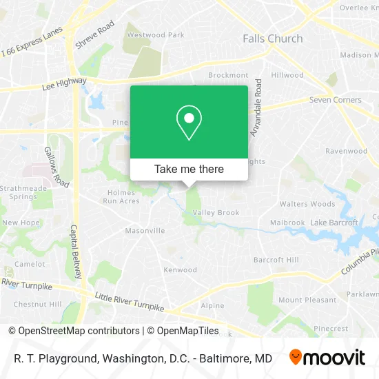
See R. T. Playground, Fairfax County, on the map
Public Transit to R. T. Playground in Fairfax County
Wondering how to get to R. T. Playground in Fairfax County? Moovit helps you find the best way to get to R. T. Playground with step-by-step directions from the nearest public transit station.
Moovit provides free maps and live directions to help you navigate through your city. View schedules, routes, timetables, and find out how long does it take to get to R. T. Playground in real time.
Looking for the nearest stop or station to R. T. Playground? Check out this list of stops closest to your destination: Annandale Rd @ Dauphine Dr.
Bus: 803.
Want to see if there’s another route that gets you there at an earlier time? Moovit helps you find alternative routes or times. Get directions from and directions to R. T. Playground easily from the Moovit App or Website.
We make riding to R. T. Playground easy, which is why over 1.5 million users, including users in Fairfax County, trust Moovit as the best app for public transit. You don’t need to download an individual bus app or train app, Moovit is your all-in-one transit app that helps you find the best bus time or train time available.
For information on prices of bus and metro, costs and ride fares to R. T. Playground, please check the Moovit app.
Use the app to navigate to popular places including to the airport, hospital, stadium, grocery store, mall, coffee shop, school, college, and university.
Location: Fairfax County, Washington, D.C. - Baltimore, MD
- VA-649 (Highway 649),
- VA-649 (SH-649),
- Annandale Rd (annandale rd and Roundtree Estates Ct),
- Doxzen Chris & Assoc,
- Capitol Resources,
- Annandale Rd & Casilear Rd,
- Dauphine VA-649,
- Saigon Gourmet Restaurant,
- HJ Appliances Repair,
- Clarence E Gatton Realtor,
- Gatton Clarence E Realtor,
- Montessori School Of Holmes Run-Children's House,
- Pavilion,
- Roundtree Park (Holmes Run Stream Valley Park),
- Meetings Plus Inc,
- Web To Market,
- Graham Rd (graham rd & annandale),
- Annandale Hickory,
- Graham Rd Annandale Rd,
- Tran Home Remodel & D Cor
Places Near R. T. Playground (Fairfax County)
- Sibley Memorial Hospital, Washington,
- Westfield Montgomery Mall, Montgomery County,
- Basilica of the National Shrine, Washington,
- The Anthem, Washington,
- M&T Bank Stadium, Baltimore,
- Warner Theatre, Washington,
- Amazon Hq2, Arlington County,
- Camden Yards, Baltimore,
- National Zoo, Washington,
- PG Mall, Prince George's County,
- National Mall, Washington,
- Museum Of The Bible, Washington,
- Washington National Cathedral, Washington,
- Capital One Arena, Washington,
- National Museum of African American History and Culture, Washington,
- Georgetown, Washington,
- Marriott Marquis Washington, DC, Washington,
- Pennsylvania Ave NW (3rd st and pennsylvania), Washington,
- Washington DC VA Medical Center, Washington,
- Rock Creek Tennis Center, Washington
How to get to popular places in Washington, D.C. - Baltimore, MD with public transit
Get around Fairfax County by public transit!
Traveling around Fairfax County has never been so easy. See step by step directions as you travel to any attraction, street or major public transit station. View bus and train schedules, arrival times, service alerts and detailed routes on a map, so you know exactly how to get to anywhere in Fairfax County.
When traveling to any destination around Fairfax County use Moovit's Live Directions with Get Off Notifications to know exactly where and how far to walk, how long to wait for your line, and how many stops are left. Moovit will alert you when it's time to get off — no need to constantly re-check whether yours is the next stop.
Wondering how to use public transit in Fairfax County or how to pay for public transit in Fairfax County? Moovit public transit app can help you navigate your way with public transit easily, and at minimum cost. It includes public transit fees, ticket prices, and costs. Looking for a map of Fairfax County public transit lines? Moovit public transit app shows all public transit maps in Fairfax County with all Bus, Train, Metro, Light Rail and Ferry routes and stops on an interactive map.
Washington, D.C. - Baltimore, MD has 5 transit type(s), including: Bus, Train, Metro, Light Rail and Ferry, operated by several transit agencies, including WMATA, Montgomery County Ride On, Fairfax Connector, TheBus, PRTC, DASH - Alexandria, Arlington Transit (ART), RTA of Central Maryland, MDOT MTA, MDOT MTA Light RailLink, MDOT MTA Commuter Bus, MDOT MTA Local Bus, FXBGO!, Virginia Railway Express (VRE) and MARC