How to get to R. V. Bike Point by bus?
Click on the bus route to see step by step directions with maps, line arrival times and updated time schedules.
From Triveni Circle, Mysuru
45 minFrom Suvarna, Mysuru
59 minFrom Kerala Samajam Community Hall, Mysuru
61 minFrom De Paul Public School, Mysuru
50 minFrom Columbia Asia Hospital, Mysuru
54 minFrom Loyal World - Bannimantap, Mysuru
48 minFrom Mysore Race Club, Mysuru
32 minFrom Rane Madras Factory Road, Mysuru
65 minFrom Jevargi - Chamarajanagar Road, Mysuru
53 minFrom Kittur Rani Chennamma Circle, Mysuru
33 min
Bus stops near R. V. Bike Point in Mysuru
Train station near R. V. Bike Point in Mysuru
- Chamarajapuram, 42 min walk,VIEW
Bus lines to R. V. Bike Point in Mysuru
- 2, → Sri Rampura (ಶ್ರೀ ರಾಮ್ಪುರ),VIEW
- 220, → Hullahalli (ಹುಳ್ಳಹಳ್ಳಿ),VIEW
- 221, → Doddakatur Temple (ದೊಡ್ಡಕಾತೂರು ದೇವಸ್ಥಾನ),VIEW
- 227, → Udbur (ಉದ್ಬೂರು),VIEW
- 230, → Arasinakere (ಅರಸಿನಕೆರೆ),VIEW
- 234, → Ahalya (ಅಹಲ್ಯ),VIEW
- 235, → Mavinahalli (ಮಾವಿನಹಳ್ಳಿ),VIEW
- 237, → Kergalli (ಕೇರ್ಗಳ್ಳಿ),VIEW
- 240, → Kallihundi (ಕಲ್ಲಿಹುಂಡಿ),VIEW
- 255, → Gumchahalli (ಗುಂಚಹಳ್ಳಿ),VIEW
- 220A, → Hullahalli (ಹುಳ್ಳಹಳ್ಳಿ),VIEW
- 227A, → Taloor (ತಳೂರು),VIEW
- 235A, → Mavinahalli (ಮಾವಿನಹಳ್ಳಿ),VIEW
- 327A, → Tibbaiana Hundi (ತಿಬ್ಬಯ್ಯನಹುಂಡಿ),VIEW
- 227B, → Doora (ದೂರ),VIEW
- 235B, → Badagala Hundi (ಬಾಡಗಲ ಹುಂಡಿ),VIEW
- 227C, → Marballi (ಮರ್ಬಳ್ಳಿ),VIEW
- 235C, → Gopalapura (ಗೋಪಾಲಪುರ),VIEW
- 2D, → City Bus Station (ನಗರ ಬಸ್ ನಿಲ್ದಾಣ),VIEW
- 227D, → Marballi Hundi (ಮರ್ಬಳ್ಳಿ ಹುಂಡಿ),VIEW
What are the closest stations to R. V. Bike Point?
The closest stations to R. V. Bike Point are:
- Toll Gate (ಟೋಲ್ ಗೇಟ್) is 249 meters away, 4 min walk.
- Devaiahna Hundi Gate (ದೇವಯ್ಯನ ಹುಂಡಿ ಗೇಟ್) is 570 meters away, 8 min walk.
- Naidu Stores (ನಾಯ್ಡು ಸ್ಟೋರ್ಸ್) is 912 meters away, 12 min walk.
- J.P Nagar (ಜೆ.ಪಿ ನಗರ) is 1125 meters away, 15 min walk.
- Chamarajapuram is 3272 meters away, 42 min walk.
Which bus lines stop near R. V. Bike Point?
These bus lines stop near R. V. Bike Point: 220, 235B, 235S, 237.
What’s the nearest bus station to R. V. Bike Point in Mysuru?
The nearest bus station to R. V. Bike Point in Mysuru is Toll Gate (ಟೋಲ್ ಗೇಟ್). It’s a 4 min walk away.
What time is the first train to R. V. Bike Point in Mysuru?
The SWR is the first train that goes to R. V. Bike Point in Mysuru. It stops nearby at 9:15 AM.
What time is the last train to R. V. Bike Point in Mysuru?
The SWR is the last train that goes to R. V. Bike Point in Mysuru. It stops nearby at 11:21 AM.
What time is the first bus to R. V. Bike Point in Mysuru?
The 13R is the first bus that goes to R. V. Bike Point in Mysuru. It stops nearby at 4:50 AM.
What time is the last bus to R. V. Bike Point in Mysuru?
The 13A is the last bus that goes to R. V. Bike Point in Mysuru. It stops nearby at 11:25 PM.
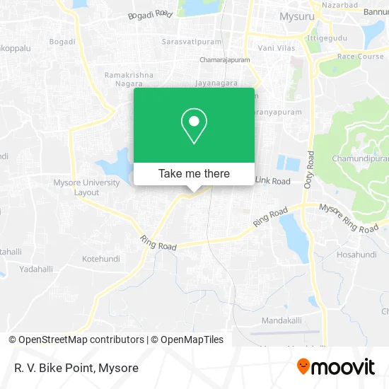
See R. V. Bike Point, Mysuru, on the map
Public Transit to R. V. Bike Point in Mysuru
Wondering how to get to R. V. Bike Point in Mysuru? Moovit helps you find the best way to get to R. V. Bike Point with step-by-step directions from the nearest public transit station.
Moovit provides free maps and live directions to help you navigate through your city. View schedules, routes, timetables, and find out how long does it take to get to R. V. Bike Point in real time.
Looking for the nearest stop or station to R. V. Bike Point? Check out this list of stops closest to your destination: Toll Gate (ಟೋಲ್ ಗೇಟ್); Devaiahna Hundi Gate (ದೇವಯ್ಯನ ಹುಂಡಿ ಗೇಟ್); Naidu Stores (ನಾಯ್ಡು ಸ್ಟೋರ್ಸ್); J.P Nagar (ಜೆ.ಪಿ ನಗರ); Chamarajapuram.
Bus: 220, 235B, 235S, 237, 2, 221, 227, 230, 2A, 237K, 60, 60A, 60R, 94C, 11, 13, 15, 155, 160.Train: SWR.
Want to see if there’s another route that gets you there at an earlier time? Moovit helps you find alternative routes or times. Get directions from and directions to R. V. Bike Point easily from the Moovit App or Website.
We make riding to R. V. Bike Point easy, which is why over 1.5 million users, including users in Mysuru, trust Moovit as the best app for public transit. You don’t need to download an individual bus app or train app, Moovit is your all-in-one transit app that helps you find the best bus time or train time available.
For information on prices of bus, costs and ride fares to R. V. Bike Point, please check the Moovit app.
Use the app to navigate to popular places including to the airport, hospital, stadium, grocery store, mall, coffee shop, school, college, and university.
R. V. Bike Point Address: H D Kote Main Road Mysuru 570023 KA street in Mysuru
- Devamma Nanjegowda Tower,
- Amma Mane Charitable Trust,
- Laptop Service Center,
- Cane Pub,
- Puncture Care,
- Provision Store,
- Sri Shaneshwara Swamy Temple,
- Balaji Enterprises,
- Appu Coffee Bar,
- Arbatt Enterprises,
- G. L Pure Drinking Water,
- Vaishnavi Footwear,
- Prajvee Impex,
- Shuddha Kudiyuva Neeru,
- Gokul Cafe,
- H D Kote Road,
- Abhaya Health Care,
- Dress Metro,
- Hotelbharathi,
- Kabab Corner
Places Near R. V. Bike Point (Mysuru)
- Chamundi Hill, Mysuru,
- Dattagalli, Mysuru,
- Jayadeva Hospital, Mysuru,
- Red Light area, Mysuru,
- KRS Dam, Pandavapura,
- Nimishamba Temple, Shrirangapattana,
- Sri Chamundeshwari Temple, Mysuru,
- Hebbal Industrial Area, Mysuru,
- Ion Digital Zone, Mysuru,
- Payana Car Museum, Shrirangapattana,
- Iskcon Mysore, Mysuru,
- Venugopal Swamy Temple, Mysuru,
- Vijayanagar 4th Stage, Mysuru,
- Venugopala Swamy Temple (Shri Venugopala Swamy Temple-Kannambady), Pandavapura,
- Bharat Cancer Hospital Bus Stop, Mysuru,
- Ranganathittu Bird Sanctuary, Shrirangapattana,
- Brindavan Garden KRS Mysore, Mysuru,
- Brindavan Garden KRS Mysore, Pandavapura,
- Vidya Vardhaka College Of Engineering, Mysuru,
- Kallahalli, Mysuru
How to get to popular places in Mysore with public transit
Get around Mysuru by public transit!
Traveling around Mysuru has never been so easy. See step by step directions as you travel to any attraction, street or major public transit station. View bus and train schedules, arrival times, service alerts and detailed routes on a map, so you know exactly how to get to anywhere in Mysuru.
When traveling to any destination around Mysuru use Moovit's Live Directions with Get Off Notifications to know exactly where and how far to walk, how long to wait for your line, and how many stops are left. Moovit will alert you when it's time to get off — no need to constantly re-check whether yours is the next stop.
Wondering how to use public transit in Mysuru or how to pay for public transit in Mysuru? Moovit public transit app can help you navigate your way with public transit easily, and at minimum cost. It includes public transit fees, ticket prices, and costs. Looking for a map of Mysuru public transit lines? Moovit public transit app shows all public transit maps in Mysuru with all Bus and Train routes and stops on an interactive map.
Mysore has 2 transit type(s), including: Bus and Train, operated by several transit agencies, including KSRTC AC Volvo Bus Services, KSRTC Ordinary Bus Services and South-Western Railways
Public transit lines with stations closest to R. V. Bike Point in Mysuru
Train lines with stations closest to R. V. Bike Point in Mysuru
Bus lines with stations closest to R. V. Bike Point in Mysuru
Toll Gate (ಟೋಲ್ ಗೇಟ್)
 2City Bus Station ⇄ Sri Rampura (ನಗರ ಬಸ್ ನಿಲ್ದಾಣ ⇄ ಶ್ರೀ ರಾಮ್ಪುರ)
- 220City Bus Station ⇄ Hullahalli (ನಗರ ಬಸ್ ನಿಲ್ದಾಣ ⇄ ಹುಳ್ಳಹಳ್ಳಿ)
- 221City Bus Station ⇄ Doddakatur Temple (ನಗರ ಬಸ್ ನಿಲ್ದಾಣ ⇄ ದೊಡ್ಡಕಾತೂರು ದೇವಸ್ಥಾನ)
- 227City Bus Station ⇄ Udbur (ನಗರ ಬಸ್ ನಿಲ್ದಾಣ ⇄ ಉದ್ಬೂರು)
- 230City Bus Station ⇄ ArasinaKere (ನಗರ ಬಸ್ ನಿಲ್ದಾಣ ⇄ ಅರಸಿನಕೆರೆ)