R. Willis Roberto Banks, 34 stop - Wednesday schedule
| Line | Direction | Time |
|---|---|---|
| N132-11 | Pq. São Domingos | 3:12 AM |
| N132-11 | Pq. São Domingos | 3:52 AM |
| N132-11 | Pq. São Domingos | 4:32 AM |
| 8002-10 | Term. Pirituba | 6:03 AM |
| 8002-10 | Term. Pirituba | 6:33 AM |
| 958P-10 | Jd. Nardini | 6:49 AM |
| 8002-10 | Term. Pirituba | 7:04 AM |
| 8002-10 | Term. Pirituba | 7:41 AM |
| 958P-10 | Jd. Nardini | 7:44 AM |
| 8002-10 | Term. Pirituba | 8:06 AM |
| 958P-10 | Jd. Nardini | 8:36 AM |
| 8002-10 | Term. Pirituba | 8:41 AM |
| 8002-10 | Term. Pirituba | 9:11 AM |
| 958P-10 | Jd. Nardini | 9:23 AM |
| 8002-10 | Term. Pirituba | 9:41 AM |
| 958P-10 | Jd. Nardini | 10:07 AM |
| 8002-10 | Term. Pirituba | 10:14 AM |
| 958P-10 | Jd. Nardini | 10:44 AM |
| 8002-10 | Term. Pirituba | 10:55 AM |
| 958P-10 | Jd. Nardini | 11:22 AM |
| 8002-10 | Term. Pirituba | 11:40 AM |
| 958P-10 | Jd. Nardini | 11:51 AM |
| 958P-10 | Jd. Nardini | 12:21 PM |
| 8002-10 | Term. Pirituba | 12:25 PM |
| 958P-10 | Jd. Nardini | 12:56 PM |
Directions to R. Willis Roberto Banks, 34 stop (São Domingos) with public transit
The following transit lines have routes that pass near R. Willis Roberto Banks, 34
 Bus: 8002-10, 958P-10, N132-11, N103-11, 948A-10.
- Train: LINHA 7, LINHA 8.
How to get to R. Willis Roberto Banks, 34 stop by bus?
Click on the bus route to see step by step directions with maps, line arrival times and updated time schedules.
How to get to R. Willis Roberto Banks, 34 stop by train?
Click on the train route to see step by step directions with maps, line arrival times and updated time schedules.
Bus stops near R. Willis Roberto Banks, 34 stop in São Domingos
- R. Willis Roberto Banks, 33, 1 min walk,
- Av. do Anastácio, 1485, 4 min walk,
- Avenida Raimundo Pereira de Magalhães 4058, 26 min walk,
Train stations near R. Willis Roberto Banks, 34 station in São Domingos
- Domingos De Moraes, 44 min walk,
- Vila Clarice, 48 min walk,
Bus lines to R. Willis Roberto Banks, 34 stop in São Domingos
- 958P-10, Vl. Olímpia,
- 8002-10, Term. Pirituba,
- N132-11, Pq. São Domingos,
- N103-11, Term. Lapa,
- 948A-10, Metrô Barra Funda,
- 1896-10, Pça. Ramos de Azevedo,
- 8100-10, Term. Lapa,
- 361, Sao Paulo (Terminal Rodoviario Barra Funda),
What are the closest stations to R. Willis Roberto Banks, 34?
The closest stations to R. Willis Roberto Banks, 34 are:
- R. Willis Roberto Banks, 33 stop is 3 meters away, 1 min walk.
- Av. do Anastácio, 1485 stop is 247 meters away, 4 min walk.
- Avenida Raimundo Pereira de Magalhães 4058 stop is 1980 meters away, 26 min walk.
- Domingos De Moraes station is 3427 meters away, 44 min walk.
- Vila Clarice station is 3737 meters away, 48 min walk.
Which bus lines stop near R. Willis Roberto Banks, 34?
These bus lines stop near R. Willis Roberto Banks, 34: 8002-10, 958P-10.
Which train line stops near R. Willis Roberto Banks, 34?
LINHA 7 (Jundiaí)
What’s the nearest bus station to R. Willis Roberto Banks, 34 in São Domingos?
The nearest bus station to R. Willis Roberto Banks, 34 in São Domingos is R. Willis Roberto Banks, 33. It’s a 1 min walk away.
What time is the first train to R. Willis Roberto Banks, 34 in São Domingos?
The LINHA 8 is the first train that goes to R. Willis Roberto Banks, 34 in São Domingos. It stops nearby at 4:09 AM.
What time is the last train to R. Willis Roberto Banks, 34 in São Domingos?
The LINHA 7 is the last train that goes to R. Willis Roberto Banks, 34 in São Domingos. It stops nearby at 12:53 AM.
What time is the first bus to R. Willis Roberto Banks, 34 in São Domingos?
The N103-11 is the first bus that goes to R. Willis Roberto Banks, 34 in São Domingos. It stops nearby at 3:03 AM.
What time is the last bus to R. Willis Roberto Banks, 34 in São Domingos?
The N132-11 is the last bus that goes to R. Willis Roberto Banks, 34 in São Domingos. It stops nearby at 3:16 AM.
R. Willis Roberto Banks, 34 station
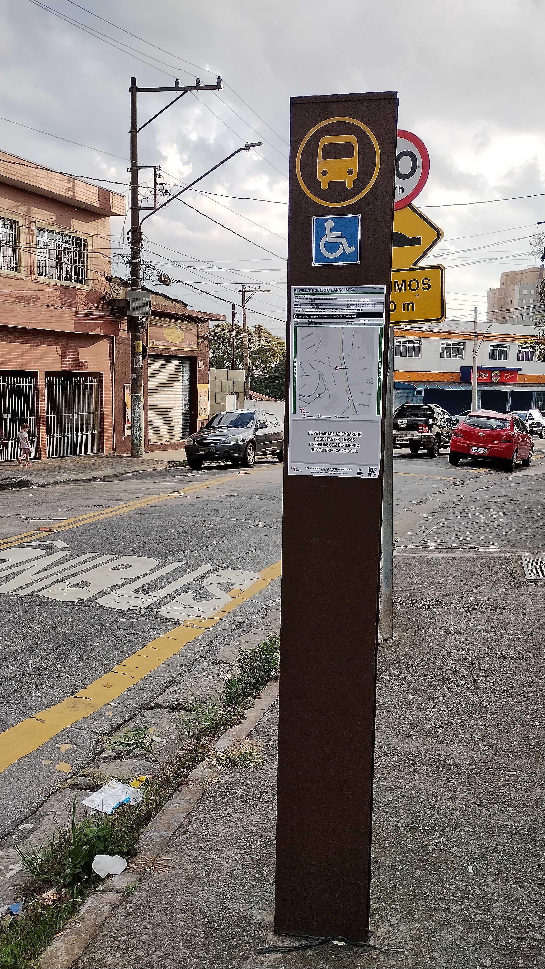 Taken by Cassandra L.
See R. Willis Roberto Banks, 34 stop, São Domingos, on the map
Public transit to R. Willis Roberto Banks, 34 stop in São Domingos
Looking for directions to R. Willis Roberto Banks, 34 in São Domingos, Brazil?
Download the Moovit App to find the current schedule and step-by-step directions for Bus or Train routes that pass through R. Willis Roberto Banks, 34.
Looking for the nearest stops closest to R. Willis Roberto Banks, 34 ? Check out this list of closest stops to your destination: R. Willis Roberto Banks; Av. do Anastácio; Avenida Raimundo Pereira de Magalhães 4058; Domingos De Moraes; Vila Clarice.
Bus: 8002-10, 958P-10, N132-11, N103-11, 948A-10, 1896-10, 8100-10, 361.Train: LINHA 7, LINHA 8.
We make riding on public transit to R. Willis Roberto Banks, 34 easy, which is why over 1.7 billion users, including users in São Domingos trust Moovit as the best app for public transit.
Use the app to navigate to popular places including to the airport, hospital, stadium, grocery store, mall, coffee shop, school, college, and university.
The first line to this stop is N132-11, at 3:12 AM, and the last line is N132-11 at 2:32 AM.
46 Rua Willis Roberto Banks, São Paulo, Brazil
This stop serves SPTrans’s lines
- R. Willis Roberto Banks, 33,
- Av. do Anastácio, 1485,
- Avenida Raimundo Pereira de Magalhães 4058
Bus stops near R. Willis Roberto Banks, 34 stop
- Domingos De Moraes,
- Vila Clarice
Train stations near R. Willis Roberto Banks, 34 station
- R. Gomes de Carvalho, 1507,
- Avenida Agenor Couto de Magalhães 125,
- Av. Nordestina, 43,
- Avenida 23 De Maio 412,
- R. João Teodoro, 1331,
- Rua Brigadeiro Tobias - Ministerio Da Fazienda,
- Rua Narciso Sturlini 320,
- Av. Arruda Botelho 255,
- Borba Gato,
- Rodovia Pedro Eroles Km 48,
- Av. das Nações Unidas, 17955,
- Avenida Tomás De Sousa,
- Estrada João Rodrigues de Morães, 660 - Lagoa, Itapecerica da Serra,
- Avenida Arnolfo Azevedo, 231,
- Terminal Santo Amaro,
- Rua Treze de Maio 1685,
- Av. Agenor Couto de Magalhães, 310,
- Avenida Celso dos Santos 1225,
- Av. Mandaqui, 197,
- Av. Ragueb Chohfi, 6300
Popular public transit stations in São Domingos
Get around São Domingos by public transit!
Traveling around São Domingos has never been so easy. See step by step directions as you travel to any attraction, street or major public transit station. View bus and train schedules, arrival times, service alerts and detailed routes on a map, so you know exactly how to get to anywhere in São Domingos.
When traveling to any destination around São Domingos use Moovit's Live Directions with Get Off Notifications to know exactly where and how far to walk, how long to wait for your line, and how many stops are left. Moovit will alert you when it's time to get off — no need to constantly re-check whether yours is the next stop.
Wondering how to use public transit in São Domingos or how to pay for public transit in São Domingos? Moovit public transit app can help you navigate your way with public transit easily, and at minimum cost. It includes public transit fees, ticket prices, and costs. Looking for a map of São Domingos public transit lines? Moovit public transit app shows all public transit maps in São Domingos with all Bus, Train, Metro, Light Rail, Ferry, Gondola, Cable Car and Funicular routes and stops on an interactive map.
Sao Paulo Region has 8 transit type(s), including: Bus, Train, Metro, Light Rail, Ferry, Gondola, Cable Car and Funicular, operated by several transit agencies, including SPTrans, CPTM, ViaMobilidade, Aquático SP, SPTRANS, EMTU, ViaQuatro, Auto Ônibus Moratense, GRU Airport (Aeroporto de Guarulhos), Auto Viação Urubupungá (Cajamar), Viação Cometa, Auto Viação Urubupungá (Osasco), Viação Ultra / Rápido Brasil, Auto Viação Urubupungá (Santana de Parnaíba) and Expresso Luxo