R. do Oratório, 1954 stop - Friday schedule
| Line | Direction | Time |
|---|---|---|
| 573H-10 | Hosp. Sapopemba | 4:29 AM |
| 573H-10 | Hosp. Sapopemba | 4:42 AM |
| 573H-10 | Hosp. Sapopemba | 4:54 AM |
| 172U-10 | Mooca | 5:04 AM |
| 573H-10 | Hosp. Sapopemba | 5:06 AM |
| 573H-10 | Hosp. Sapopemba | 5:20 AM |
| 172U-10 | Mooca | 5:25 AM |
| 573H-10 | Hosp. Sapopemba | 5:32 AM |
| 3161-10 | Jd. Colorado | 5:34 AM |
| 172U-10 | Mooca | 5:36 AM |
| 573H-10 | Hosp. Sapopemba | 5:44 AM |
| 172U-10 | Mooca | 5:47 AM |
| 573H-10 | Hosp. Sapopemba | 5:56 AM |
| 172U-10 | Mooca | 5:58 AM |
| 3161-10 | Jd. Colorado | 5:59 AM |
| 573H-10 | Hosp. Sapopemba | 6:08 AM |
| 172U-10 | Mooca | 6:08 AM |
| 3161-10 | Jd. Colorado | 6:14 AM |
| 172U-10 | Mooca | 6:19 AM |
| 573H-10 | Hosp. Sapopemba | 6:20 AM |
| 573H-10 | Hosp. Sapopemba | 6:27 AM |
| 172U-10 | Mooca | 6:30 AM |
| 3161-10 | Jd. Colorado | 6:34 AM |
| 573H-10 | Hosp. Sapopemba | 6:34 AM |
| 172U-10 | Mooca | 6:38 AM |
Directions to R. do Oratório, 1954 stop (Água Rasa) with public transit
The following transit lines have routes that pass near R. do Oratório, 1954
 Bus: 172U-10, 3161-10, 373T-10, 573H-10, 4726-10.
- Metro: LINHA 2, LINHA 3, LINHA 15.
- Train: LINHA 10, LINHA 2.
How to get to R. do Oratório, 1954 stop by bus?
Click on the bus route to see step by step directions with maps, line arrival times and updated time schedules.
How to get to R. do Oratório, 1954 stop by train?
Click on the train route to see step by step directions with maps, line arrival times and updated time schedules.
How to get to R. do Oratório, 1954 stop by metro?
Click on the metro route to see step by step directions with maps, line arrival times and updated time schedules.
Bus stops near R. do Oratório, 1954 stop in Água Rasa
- R. do Oratório, 1911, 1 min walk,
- R. Campo Largo, 37, 4 min walk,
- Parada São Cristovao B/C, 5 min walk,
- Parada São Cristóvão C/B, 6 min walk,
Metro stations near R. do Oratório, 1954 station in Água Rasa
- Belém, 20 min walk,
- Vila Prudente, 39 min walk,
Train stations near R. do Oratório, 1954 station in Água Rasa
- Juventus-Mooca, 20 min walk,
- Tamanduateí, 23 min walk,
Bus lines to R. do Oratório, 1954 stop in Água Rasa
- 172U-10, Cem. Pq. dos Pinheiros,
- 573H-10, Hosp. Sapopemba,
- 3161-10, Term. Pq. D. Pedro II,
- 4726-10, Metrô Tatuapé,
- 311C-10, Bom Retiro,
- 373M-10, Shop. Metrô Tatuapé,
- 373T-10, Metrô Bresser,
- N504-11, Term. Pq. D. Pedro II,
- 573A-10, Vl. Alpina,
- 3112-10, Vl. Industrial,
- 3160-10, Term. Vl. Prudente,
What are the closest stations to R. do Oratório, 1954?
The closest stations to R. do Oratório, 1954 are:
- R. do Oratório, 1911 stop is 38 meters away, 1 min walk.
- R. Campo Largo, 37 stop is 284 meters away, 4 min walk.
- Parada São Cristovao B/C stop is 389 meters away, 5 min walk.
- Parada São Cristóvão C/B stop is 446 meters away, 6 min walk.
- Belém station is 1421 meters away, 20 min walk.
- Juventus-Mooca station is 1559 meters away, 20 min walk.
- Tamanduateí station is 1790 meters away, 23 min walk.
- Vila Prudente station is 3019 meters away, 39 min walk.
Which bus lines stop near R. do Oratório, 1954?
These bus lines stop near R. do Oratório, 1954: 172U-10, 3161-10, 373T-10, 573H-10.
Which metro line stops near R. do Oratório, 1954?
LINHA 2 (Vila Prudente)
Which train line stops near R. do Oratório, 1954?
LINHA 10 (Rio Grande da Serra)
What’s the nearest metro station to R. do Oratório, 1954 in Água Rasa?
The nearest metro station to R. do Oratório, 1954 in Água Rasa is Belém. It’s a 20 min walk away.
What’s the nearest train station to R. do Oratório, 1954 in Água Rasa?
The nearest train station to R. do Oratório, 1954 in Água Rasa is Juventus-Mooca. It’s a 20 min walk away.
What’s the nearest bus station to R. do Oratório, 1954 in Água Rasa?
The nearest bus station to R. do Oratório, 1954 in Água Rasa is R. do Oratório, 1911. It’s a 1 min walk away.
What time is the first metro to R. do Oratório, 1954 in Água Rasa?
The LINHA 2 is the first metro that goes to R. do Oratório, 1954 in Água Rasa. It stops nearby at 4:40 AM.
What time is the last metro to R. do Oratório, 1954 in Água Rasa?
The LINHA 3 is the last metro that goes to R. do Oratório, 1954 in Água Rasa. It stops nearby at 12:29 AM.
What time is the first train to R. do Oratório, 1954 in Água Rasa?
The LINHA 10 is the first train that goes to R. do Oratório, 1954 in Água Rasa. It stops nearby at 4:10 AM.
What time is the last train to R. do Oratório, 1954 in Água Rasa?
The LINHA 10 is the last train that goes to R. do Oratório, 1954 in Água Rasa. It stops nearby at 12:41 AM.
What time is the first bus to R. do Oratório, 1954 in Água Rasa?
The N504-11 is the first bus that goes to R. do Oratório, 1954 in Água Rasa. It stops nearby at 3:06 AM.
What time is the last bus to R. do Oratório, 1954 in Água Rasa?
The N504-11 is the last bus that goes to R. do Oratório, 1954 in Água Rasa. It stops nearby at 2:57 AM.
R. do Oratório, 1954 station
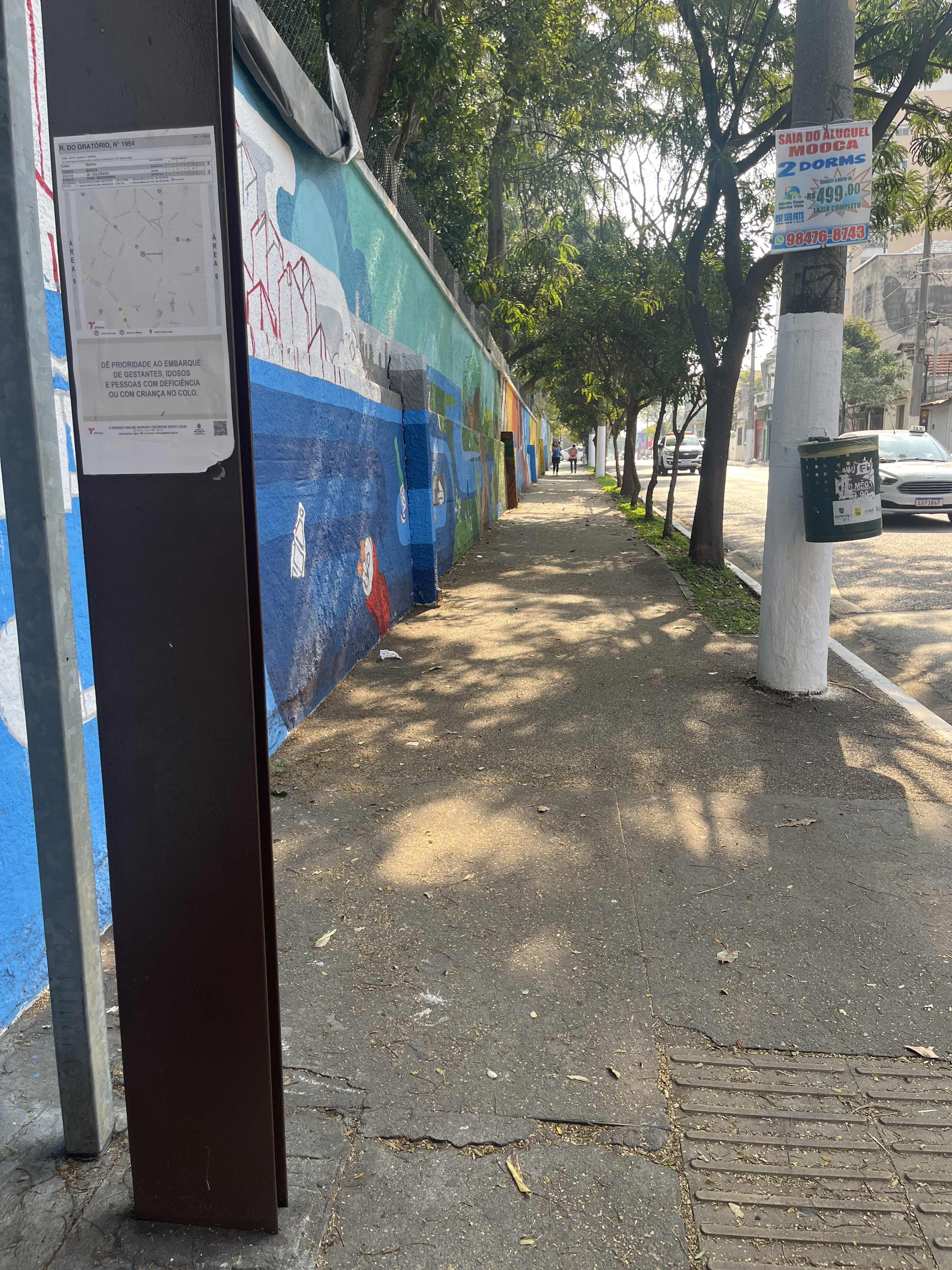 Taken by Anonymous
See R. do Oratório, 1954 stop, Água Rasa, on the map
Public transit to R. do Oratório, 1954 stop in Água Rasa
Looking for directions to R. do Oratório, 1954 in Água Rasa, Brazil?
Download the Moovit App to find the current schedule and step-by-step directions for Bus, Metro or Train routes that pass through R. do Oratório, 1954.
Looking for the nearest stops closest to R. do Oratório, 1954 ? Check out this list of closest stops to your destination: R. do Oratório; R. Campo Largo; Parada São Cristovao B/C; Parada São Cristóvão C/B; Belém; Juventus-Mooca; Tamanduateí; Vila Prudente.
Bus: 172U-10, 3161-10, 373T-10, 573H-10, 4726-10.Metro: LINHA 2, LINHA 3, LINHA 15.Train: LINHA 10, LINHA 2.
We make riding on public transit to R. do Oratório, 1954 easy, which is why over 1.7 billion users, including users in Água Rasa trust Moovit as the best app for public transit.
Use the app to navigate to popular places including to the airport, hospital, stadium, grocery store, mall, coffee shop, school, college, and university.
The first line to this stop is 573H-10, at 4:29 AM, and the last line is 573H-10 at 12:59 AM.
2017 Rua Do Oratorio, São Paulo, Brazil
This stop serves SPTrans’s lines
- R. do Oratório, 1911,
- R. Campo Largo, 37,
- Parada São Cristovao B/C,
- Parada São Cristóvão C/B
Bus stops near R. do Oratório, 1954 stop
- Belém,
- Vila Prudente
Metro stations near R. do Oratório, 1954 station
- Juventus-Mooca,
- Tamanduateí
Train stations near R. do Oratório, 1954 station
- Carandiru,
- Av. José Higino Neves,
- Rodovia Régis Bittencourt - Br 116, Km 305,1,
- General Miguel Costa,
- Avenida Prestes Maia, 297,
- R. Abílio Soares, 1160,
- Rua Brigadeiro Gavião Peixoto 213,
- Rua Boa Vista, 364,
- Av. Carlos Caldeira Filho,
- Terminal Novo Osasco,
- Praça da Árvore,
- Av. José Higino Neves,
- Rodovia Engenheiro Candido Do Rego Chaves (Sp-39) (Km 62-5 Sitio Pereira),
- Terminal Ferraz,
- Antonio João,
- Avenida Ariston Azevedo 75,
- Av. Yervant Kissajikian, 2699,
- Avenida Agenor Couto de Magalhães 125,
- Estrada Marechal Tomoki Hiramoto (Sitio Tirulim),
- Jardim São Paulo-Ayrton Senna
Popular public transit stations in Água Rasa
Get around Água Rasa by public transit!
Traveling around Água Rasa has never been so easy. See step by step directions as you travel to any attraction, street or major public transit station. View bus and train schedules, arrival times, service alerts and detailed routes on a map, so you know exactly how to get to anywhere in Água Rasa.
When traveling to any destination around Água Rasa use Moovit's Live Directions with Get Off Notifications to know exactly where and how far to walk, how long to wait for your line, and how many stops are left. Moovit will alert you when it's time to get off — no need to constantly re-check whether yours is the next stop.
Wondering how to use public transit in Água Rasa or how to pay for public transit in Água Rasa? Moovit public transit app can help you navigate your way with public transit easily, and at minimum cost. It includes public transit fees, ticket prices, and costs. Looking for a map of Água Rasa public transit lines? Moovit public transit app shows all public transit maps in Água Rasa with all Bus, Train, Metro, Light Rail, Ferry, Gondola, Cable Car and Funicular routes and stops on an interactive map.
Sao Paulo Region has 8 transit type(s), including: Bus, Train, Metro, Light Rail, Ferry, Gondola, Cable Car and Funicular, operated by several transit agencies, including SPTrans, CPTM, ViaMobilidade, Aquático SP, SPTRANS, EMTU, ViaQuatro, Auto Ônibus Moratense, GRU Airport (Aeroporto de Guarulhos), Auto Viação Urubupungá (Cajamar), Viação Cometa, Auto Viação Urubupungá (Osasco), Viação Ultra / Rápido Brasil, Auto Viação Urubupungá (Santana de Parnaíba) and Expresso Luxo