Directions to Rab do Denise (Campo) with public transportation
The following transit lines have routes that pass near Rab do Denise
How to get to Rab do Denise by bus?
Click on the bus route to see step by step directions with maps, line arrival times and updated time schedules.
From Volvo do Brasil, Cic
105 minFrom Capela Velha, Araucária
162 minFrom Ligeirinho Curitiba - Campo Largo, Campo
45 minFrom Boqueirão/Araucária, Araucária
204 minFrom Colônia Cristina, Araucária
265 minFrom City Center Shopping & Outlet, Campo
74 minFrom Araucária Acqua Park, Araucária
195 minFrom Risotolândia, Araucária
164 minFrom Avenida Juscelino Kubitschek de Oliveira 2600, Cic
109 minFrom Campo Magro, Campo Magro
110 min
Bus stops near Rab do Denise in Campo
Bus lines to Rab do Denise in Campo
- 100 PARTENOPE, Partenope → Terminal Campo Largo,VIEW
- 102 VILA DE LOURDES / POPULARES, Terminal Urbano Campo Largo ↺ Vila de Lourdes / Populares (Circular),VIEW
- 111 OUTLET CITY CENTER, Linha 02 - Outlet → Bom Jesus / Esmeralda / Águas Claras / São Vicente / Partênope,VIEW
- 300 NOTURNA, Terminal → Bairros (Circular),VIEW
What are the closest stations to Rab do Denise?
The closest stations to Rab do Denise are:
- Rua José Gavlak, 185 is 295 meters away, 4 min walk.
- Rua José Gavlak, 191 is 295 meters away, 4 min walk.
- Estrada Colônia Cristina, 1010 - Residencial Denise is 594 meters away, 8 min walk.
Which bus lines stop near Rab do Denise?
These bus lines stop near Rab do Denise: 100 PARTENOPE, 102 VILA DE LOURDES / POPULARES, J62 CAMPO LARGO / GUADALUPE.
What’s the nearest bus station to Rab do Denise in Campo?
The nearest bus stations to Rab do Denise in Campo are Rua José Gavlak, 185 and Rua José Gavlak, 191. The closest one is a 4 min walk away.
What time is the first bus to Rab do Denise in Campo?
The 100 PARTENOPE is the first bus that goes to Rab do Denise in Campo. It stops nearby at 4:52 AM.
What time is the last bus to Rab do Denise in Campo?
The 300 NOTURNA is the last bus that goes to Rab do Denise in Campo. It stops nearby at 1:19 AM.
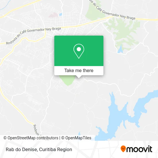
See Rab do Denise, Campo, on the map
Public Transit to Rab do Denise in Campo
Wondering how to get to Rab do Denise in Campo? Moovit helps you find the best way to get to Rab do Denise with step-by-step directions from the nearest public transit station.
Moovit provides free maps and live directions to help you navigate through your city. View schedules, routes, timetables, and find out how long does it take to get to Rab do Denise in real time.
Looking for the nearest stop or station to Rab do Denise? Check out this list of stops closest to your destination: Rua José Gavlak; Rua José Gavlak; Estrada Colônia Cristina.
Bus: 100 PARTENOPE, 102 VILA DE LOURDES / POPULARES, J62 CAMPO LARGO / GUADALUPE, 111 OUTLET CITY CENTER, 300 NOTURNA.
Want to see if there’s another route that gets you there at an earlier time? Moovit helps you find alternative routes or times. Get directions from and directions to Rab do Denise easily from the Moovit App or Website.
We make riding to Rab do Denise easy, which is why over 1.5 million users, including users in Campo, trust Moovit as the best app for public transit. You don’t need to download an individual bus app or train app, Moovit is your all-in-one transit app that helps you find the best bus time or train time available.
For information on prices of bus, costs and ride fares to Rab do Denise, please check the Moovit app.
Use the app to navigate to popular places including to the airport, hospital, stadium, grocery store, mall, coffee shop, school, college, and university.
Rab do Denise Address: Acesso Público, Jardim Florestal Campo Largo-PR 83602-340 street in Campo
- Vila Olímpica,
- Sombra & Água Fresca,
- Condomínio Residencial Denise,
- Associação dos Moradores do Partenope e Jardim Florestal,
- Rua Francisco Antunes Zanin,
- Rafael Marques Elias,
- Epg - Paulinho Guarezi Eletricista,
- Izabelcristinada,
- Paraíso Animal Cl,
- Sviluppanda Apps,
- Jardim Florestal,
- Nadma Machado,
- Rm Transportes,
- Jorgeaugustocarol,
- Parque Cambuí,
- Equipe Lb Silva Serviços,
- Tarantula Acessorios,
- Lcl Consultoria e Equipamentos,
- Bonfim Supermercados - Loja 03 - Campo Largo.,
- Companhia da Beleza
Places Near Rab do Denise (Campo)
- Jockey Plaza Shopping Center, Tarumã,
- Hospital Madalena Sofia, Bairro Alto,
- Park Shopping Barigüi, Mossunguê,
- Rua General Mário Tourinho, Campina Do Siqueira,
- Hospital de Clínicas (HC - UFPR), Centro,
- Rua Martim Afonso 558, Mercês,
- Hospital Da Cruz Vermelha, Batel,
- Jardim Botânico de Curitiba PR, Centro,
- Hospital Erasto Gaertner, Jardim Das Américas,
- Campo Largo, Campo,
- Hospital Angelina Caron, Campina Grande Do Sul,
- Shopping Palladium, Portão,
- Shopping Estação, Rebouças,
- Hhhhh, Fazendinha,
- Hospital Nossa Senhora Das Graças, Mercês,
- Hospital Universitário Evangélico de Curitiba, Bigorrilho,
- Pontifícia Universidade Católica do Paraná (PUCPR), Prado Velho,
- Arena Da Baixada - Curitiba,
- Parque Barigui, Mercês,
- Hospital do Rocio, Campo
How to get to popular places in Curitiba Region with public transit
Get around Campo by public transit!
Traveling around Campo has never been so easy. See step by step directions as you travel to any attraction, street or major public transit station. View bus and train schedules, arrival times, service alerts and detailed routes on a map, so you know exactly how to get to anywhere in Campo.
When traveling to any destination around Campo use Moovit's Live Directions with Get Off Notifications to know exactly where and how far to walk, how long to wait for your line, and how many stops are left. Moovit will alert you when it's time to get off — no need to constantly re-check whether yours is the next stop.
Wondering how to use public transit in Campo or how to pay for public transit in Campo? Moovit public transit app can help you navigate your way with public transit easily, and at minimum cost. It includes public transit fees, ticket prices, and costs. Looking for a map of Campo public transit lines? Moovit public transit app shows all public transit maps in Campo with all Bus and Cable Car routes and stops on an interactive map.
Curitiba Region has 2 transit type(s), including: Bus and Cable Car, operated by several transit agencies, including Sistema Integrado de Mobilidade (URBS), Sistema Integrado de Mobilidade (AMEP), URBS (Cartões bancários e Dinheiro), URBS (Cartões bancários / Cartão URBS), AMEP (Cartões bancários / Cartão MetroCard), AMEP (Cartões bancários / Cartão MetroCard / Dinheiro), Viação Colombo (Dinheiro), TRIAR (Cartão TRIAR / Dinheiro), Empresa Curitiba Cerro Azul (Dinheiro), Expresso Nossa Senhora da Penha (Dinheiro), Empresa Campo Alto Tijucas (Dinheiro), Auto Viação São José (Cartão VEM / Dinheiro), BRT S/A (Cartão VEM / Dinheiro), TransPiedade (Cartão Cidadão / Dinheiro) and Oceânica Sul (Cartão Transporte / Dinheiro)