How to get to Rabuíde by bus?
Click on the bus route to see step by step directions with maps, line arrival times and updated time schedules.
From Central de Camionagem de Braga, Maximinos, Sé e Cividade
66 minFrom Braga Parque, São Vítor
122 minFrom Os Zés das Caldas da Rainha (Bifanas), São José de São Lázaro e São João do Souto
76 minFrom Palmeira, Braga
105 minFrom Centro Distrital de Segurança Social de Braga, São Vítor
79 minFrom Universidade do Minho, Braga
91 minFrom IPCA - Instituto Politécnico do Cávado e do Ave - Pólo de Braga, São José de São Lázaro e São João do Souto
79 minFrom Aldeia dos Macacos, São José de São Lázaro e São João do Souto
78 minFrom Sameiro, Braga
123 minFrom Parque de Estacionamento da Central de Camionagem de Braga, São Vicente
59 min
Bus stops near Rabuíde in Águas Santas e Moure
Bus lines to Rabuíde in Águas Santas e Moure
What are the closest stations to Rabuíde?
The closest stations to Rabuíde are:
- Rabuíde (Cruzamento) is 437 meters away, 6 min walk.
- Ponte do Porto is 1007 meters away, 13 min walk.
- Tanquinhos is 1531 meters away, 20 min walk.
Which bus line stops near Rabuíde?
73 (Central Iv→Matinho)
What’s the nearest bus station to Rabuíde in Águas Santas e Moure?
The nearest bus station to Rabuíde in Águas Santas e Moure is Rabuíde (Cruzamento). It’s a 6 min walk away.
What time is the first bus to Rabuíde in Águas Santas e Moure?
The 73 is the first bus that goes to Rabuíde in Águas Santas e Moure. It stops nearby at 6:58 AM.
What time is the last bus to Rabuíde in Águas Santas e Moure?
The 73 is the last bus that goes to Rabuíde in Águas Santas e Moure. It stops nearby at 8:47 PM.
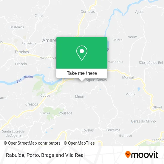
See Rabuíde, Águas Santas e Moure, on the map
Public Transit to Rabuíde in Águas Santas e Moure
Wondering how to get to Rabuíde in Águas Santas e Moure? Moovit helps you find the best way to get to Rabuíde with step-by-step directions from the nearest public transit station.
Moovit provides free maps and live directions to help you navigate through your city. View schedules, routes, timetables, and find out how long does it take to get to Rabuíde in real time.
Looking for the nearest stop or station to Rabuíde? Check out this list of stops closest to your destination: Rabuíde (Cruzamento); Ponte do Porto; Tanquinhos.
Bus: 73, 5501, 5686, 9503, 204.
Want to see if there’s another route that gets you there at an earlier time? Moovit helps you find alternative routes or times. Get directions from and directions to Rabuíde easily from the Moovit App or Website.
We make riding to Rabuíde easy, which is why over 1.5 million users, including users in Águas Santas e Moure, trust Moovit as the best app for public transit. You don’t need to download an individual bus app or train app, Moovit is your all-in-one transit app that helps you find the best bus time or train time available.
For information on prices of bus, costs and ride fares to Rabuíde, please check the Moovit app.
Use the app to navigate to popular places including to the airport, hospital, stadium, grocery store, mall, coffee shop, school, college, and university.
Rabuíde Address: Póvoa de Lanhoso, street in Águas Santas e Moure
- Construções Alfredo Cunha,
- Águas Santas,
- Alfredo Jesus Bastos Cunha,
- Quinta do Fernando,
- Restaurante O Fernando,
- Banco,
- Igreja Paroquial de Águas Santas,
- Restaurante Tipo Tradicional,
- Tipo Tradicional,
- Igreja moure,
- Cemitério de Águas Santas,
- Oratório da Senhora da Lapa,
- Green-Utopia,
- Ponte do Porto / Ponte de Prozelo,
- Ponte do Porto,
- Quinta Lago dos Cisnes Turismo Lda,
- Cruzeiro de Nossa Senhora dos Desamparados,
- quinta do galgo,
- Monte De Nossa Senhora Da Paz,
- Casa d'Amares
Places Near Rabuíde (Águas Santas e Moure)
- Estádio do Dragão, Campanhã,
- Avintes, Vila Nova De Gaia,
- Hospital Santos Silva, Vila Nova De Gaia,
- Leça da Palmeira, Matosinhos e Leça da Palmeira,
- Parque Aquatico Amarante - Aqua Aventura, Amarante,
- Palácio de Cristal, Lordelo do Ouro e Massarelos,
- Zoo Santo Inácio, Vila Nova De Gaia,
- Valongo, Valongo,
- Hospital da Prelada, Ramalde,
- Rua Calouste Gulbenkian, Lordelo do Ouro e Massarelos,
- Hospital de Santo António, Cedofeita, Santo Ildefonso, Sé, Miragaia, São Nicolau e Vitória,
- Arrábida Shopping, Santa Marinha e São Pedro da Afurada,
- El Corte Inglés de Gaia, Mafamude e Vilar do Paraíso,
- Canidelo, Vila Nova De Gaia,
- Acesso ao Shopping Parque Nascente, Campanhã,
- VILA do CONDE PORTO FASHION OUTLET, Modivas,
- Maia, Maia,
- Senhor de Matosinhos, Matosinhos e Leça da Palmeira,
- Espinho, Espinho,
- MAR Shopping, Matosinhos e Leça da Palmeira
How to get to popular places in Porto, Braga and Vila Real with public transit
Get around Águas Santas e Moure by public transit!
Traveling around Águas Santas e Moure has never been so easy. See step by step directions as you travel to any attraction, street or major public transit station. View bus and train schedules, arrival times, service alerts and detailed routes on a map, so you know exactly how to get to anywhere in Águas Santas e Moure.
When traveling to any destination around Águas Santas e Moure use Moovit's Live Directions with Get Off Notifications to know exactly where and how far to walk, how long to wait for your line, and how many stops are left. Moovit will alert you when it's time to get off — no need to constantly re-check whether yours is the next stop.
Wondering how to use public transit in Águas Santas e Moure or how to pay for public transit in Águas Santas e Moure? Moovit public transit app can help you navigate your way with public transit easily, and at minimum cost. It includes public transit fees, ticket prices, and costs. Looking for a map of Águas Santas e Moure public transit lines? Moovit public transit app shows all public transit maps in Águas Santas e Moure with all Bus, Train, Metro, Ferry, Funicular and Gondola routes and stops on an interactive map.
Porto, Braga and Vila Real has 6 transit type(s), including: Bus, Train, Metro, Ferry, Funicular and Gondola, operated by several transit agencies, including Metro do Porto, Metro do Porto - Metrobus, CP - Comboios de Portugal, STCP, UNIR Mobilidade da Area Metropolitana do Porto, Getbus - Aerobus, Mobiave, Valpibus, TUB - Transportes Urbanos de Braga, TuViana, Guimabus, Ave Mobilidade, Cávado Mobilidade, Transdev and Câmara Municipal de Santo Tirso